The best traffic-free bike rides around Flörsheim
3.9
(107)
1,149
riders
5
rides
No traffic road cycling routes around Flörsheim offer diverse terrain along the Main River and through rolling hills. The region features scenic riverside paths, particularly along the Mainradweg, and areas characterized by vineyards and open meadows. Cyclists can explore varied landscapes, from the flat riverbanks to the gentle ascents through the "Flörsheimer Switzerland" area.
Best no traffic road cycling routes around Flörsheim
- The most popular no traffic road cycling route is The Main River at Kostheim – View of Mainz…
Last updated: July 11, 2026
4.7
(56)
497
riders
Moderate road ride. Great for any fitness level. Some segments of this route may be unpaved and difficult to ride.
15
riders
Moderate road ride. Great for any fitness level. Some segments of this route may be unpaved and difficult to ride.

Sign up for free
3.0
(1)
15
riders
21.0km
00:58
110m
110m
Easy road ride. Great for any fitness level. Mostly well-paved surfaces and easy to ride.
4
riders
Moderate road ride. Great for any fitness level. Some segments of this route may be unpaved and difficult to ride.
3
riders
Moderate road ride. Great for any fitness level. Some segments of this route may be unpaved and difficult to ride.
Our route recommendations are based on thousands of hikes, rides, and runs completed by other people on komoot.
Start today with a free account
Your next adventure awaits.
Login or Signup




Tips from the Community

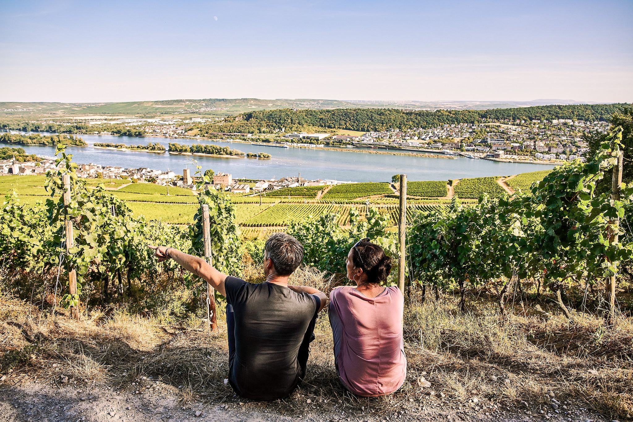
It's always nice to let your gaze wander over the vineyards.
2
0
The „König Wilhelmsberg Säule“ is a real „eye-catcher“.
3
0

Purpose of the conversion: The distinctive three-legged steel tower, built in 2011, forms the interface of two important regional park routes. The immediate surroundings at the foot of the tower are now being fundamentally renovated for around 610,000 euros to make access to the Main river more spectacular and to create a high-quality area for staying and resting. What is being built: The construction measures include a terraced terrain structure and a newly paved square area. Modern relaxation zones with benches, loungers, and cozy wooden platforms are being created. For families, a wooden climbing structure will be integrated as a play offer for children. Green integration and paths: To visually connect the area harmoniously with the adjacent Flößerpark, nine new trees, willow bushes, and meadow areas will be planted. At the same time, new, clear sightlines to the river will be opened up and the path guidance will be made clearer. Schedule: Construction work began in April and the project is scheduled for completion in June.
11
0

The path on the (northern) bank of the Main estuary is already beautiful, but those who like it a bit nicer will find the detour to the Mainspitze (southern bank) even better.
0
0
Historical Age: The bridge was built around 1877 (twelve years after the harbor opened) and is today considered one of the oldest still preserved swing bridges in all of Germany. For this reason, the steel truss construction is an important cultural monument under strict heritage protection. Technical Dimensions & Function: The structure has a length of 37.50 meters, a width of 4.50 meters, and weighs around 54 tons. The original mechanical rotation mechanism ensured for decades that the bridge could be swung to the side at any water level to allow larger ships to pass into the harbor basin. Modernization: After the historical rotation mechanism was irreparably damaged and jammed in 1996, the bridge was fundamentally reconstructed in 2009. The historical appearance of the top chords was preserved, while the outdated mechanics were replaced by a state-of-the-art hydraulic rotation system. Location & Significance: It connects the Stresemann-Ufer (Old Town side near the Hyatt Hotel) directly with the Victor-Hugo-Ufer on the upstream mole. Today, it serves exclusively as an important, highly frequented connection for pedestrians and cyclists and is an integral part of recreational routes such as the popular Mainzer Drei-Brücken-Weg.
7
0
With a total length of around 1,233 kilometers, the Rhine is one of the longest, most historically significant, and economically important rivers in Europe. The river originates in the Swiss Alps, where it is formed from the two headwaters, the Vorder- and Hinterrhein. After flowing through Lake Constance, it plunges down at the Rhine Falls near Schaffhausen and then, as the High Rhine, forms the border between Switzerland and Germany. Further on, as the Upper Rhine, it flows through the Upper Rhine Plain past major cities such as Karlsruhe and Ludwigshafen, as well as directly past the region of Mainz and Wiesbaden. In this area, the river makes a sharp turn west at the so-called "Rhine Knee" (Rheinknie) before reaching the spectacular Middle Rhine. This section between Bingen and Koblenz – known as the Upper Middle Rhine Valley (Obere Mittelrheintal) – has been protected as a UNESCO World Heritage site since 2002 due to its density of castles, historic vineyards, and the legend of the Loreley rock. Via the Lower Rhine (Niederrhein) and the metropolitan regions of Cologne and Düsseldorf, the Rhine finally continues into the Netherlands. There it divides into a widely branched delta and finally flows into the North Sea near Rotterdam. As an international waterway, the Rhine is the logistical backbone of Western Europe. It connects major industrial centers and seaports directly with the hinterland, and is used annually by tens of thousands of cargo ships for the transport of coal, ores, containers, and chemical goods. In addition to its industrial function, the Rhine Valley serves as a lifeline for tourism, as a rich source of energy through hydropower plants, and as a valuable natural and recreational area for millions of people.
8
0
The observation tower at Mainz-Kostheim harbor is a striking 20-meter-high steel monument that serves as an important experiential point of the RheinMain Regional Park. The three-legged structure, erected in 2011, consciously recalls the industrial history of the site in its aesthetics, particularly the inland navigation cranes and the neighboring cellulose factory. From the platform, visitors are offered a wide panoramic view over the Kostheim lock, the mouth of the Main river, and the silhouette of Mainz and Wiesbaden, all the way to the Taunus mountains. The tower stands at a strategic intersection between the Main Cycle Path and the Regional Park Circular Route, making it a popular stop for cyclists and hikers. The immediate surroundings of the tower are currently being extensively redesigned as part of the "Entrance to the Regional Park" project, in order to further enhance the quality of stay on the banks of the Main river through new resting areas and climbing elements. The ascent via the steel grate steps is free of charge and possible at any time, but requires a certain degree of freedom from vertigo due to the open construction.
9
0
The historic lime kilns in Flörsheim am Main form a significant industrial monument that vividly illustrates the pre-industrial working world of Hesse. Located on the country road towards Hochheim, the facility marks a place with centuries of tradition: while the roots of lime extraction here could date back to Roman times, the distinctive circular structures preserved today originate from the 18th century. For generations, the kilns were fired by family businesses in hard shift work to produce quicklime for the region's construction industry. Operations were only finally ceased in 1921. After the facility was left to decay for a long time, it was extensively excavated and preserved by Regionalpark RheinMain GmbH at the end of the 1990s. Today, the kilns are a popular destination for hikers and cyclists on the Regionalpark-Rundroute and serve as a publicly accessible testament to regional economic history.
9
0
Frequently Asked Questions
How many no-traffic road cycling routes are available around Flörsheim?
There are currently 6 dedicated no-traffic road cycling routes around Flörsheim, offering a variety of distances and difficulty levels for a peaceful ride.
What kind of terrain can I expect on these no-traffic road cycling routes?
You'll find a diverse landscape, from flat, scenic paths along the Main River to rolling hills and vineyards in areas known as "Flörsheimer Switzerland." Routes like the Flörsheimer Watchtower – Hochheim Vineyards loop offer a mix of riverside views and vineyard climbs.
Are there routes suitable for beginners or families looking for easy, traffic-free rides?
Yes, there is 1 easy route designed for a relaxed experience. The Flörsheimer Watchtower – Hochheim Vineyards loop is a great option, offering gentle gradients and beautiful scenery without significant traffic.
What is the best time of year to enjoy traffic-free road cycling in Flörsheim?
The region is particularly beautiful in spring when meadows are flowering and leaves are fresh, and in autumn with its vibrant foliage. Summer also offers pleasant conditions, especially along the shaded riverside paths.
Are there any more challenging no-traffic road cycling routes for experienced riders?
Yes, 5 of the routes are rated as moderate, providing more significant distances and elevation gains. For example, the Stangenpyramide Dreieich – Works Bridge West loop is a longer ride with more climbing, perfect for those seeking a greater challenge.
What scenic viewpoints or landmarks can I discover along these routes?
Many routes offer views of the Main River and its picturesque banks. You might also pass by highlights such as the Großer Mannstein (Staufenschwur Lookout) or the Weilbacher Gravel Pits Observation Tower. The "Flörsheimer Switzerland" area provides magnificent views over vineyards and rolling hills.
Can I combine my ride with a visit to local wineries or cultural sites?
Absolutely. The region is known for its vineyards, and some routes lead past local wineries like Kessler-Meyer, where you can enjoy tastings. Flörsheim's proximity to cultural sites such as the Alte Malzfabrik museum also allows for combined exploration.
Are all the no-traffic road cycling routes circular?
Yes, all the routes listed in this guide are designed as loops, allowing you to start and finish at the same point without needing to retrace your steps.
Where can I find parking for these no-traffic road cycling routes?
Parking is generally available in and around Flörsheim, particularly near the Main River or at the starting points of popular routes. Specific parking information can often be found on the individual route pages.
Is it possible to reach the starting points of these routes using public transport?
Flörsheim is well-connected by public transport, including train services. Many routes are accessible from the town center or nearby stations, making it convenient to start your ride without a car.
Are there cafes or places to stop for refreshments along the no-traffic routes?
Yes, especially along the Main River and in the towns and villages you'll pass through. You'll find various cafes, restaurants, and traditional taverns (Straußwirtschaften) in the vineyard areas to refuel and relax.
What do other cyclists say about the no-traffic road cycling routes in Flörsheim?
The komoot community rates the routes in Flörsheim highly, with an average score of 3.96 stars. Reviewers often praise the peacefulness of the traffic-free paths, the beautiful riverside scenery, and the charming vineyard landscapes.
Are there any routes that offer extensive views of the Main River?
Many routes closely follow the Main River, providing continuous scenic views. The Main River at Kostheim – View of Mainz loop is an excellent example, offering expansive river vistas and even views towards Mainz.
Most popular routes around Flörsheim
Most popular attractions around Flörsheim

Get inspired with the komoot mobile app


Explore more
Browse the best Road cycling routes in other regions.
