The best dog-friendly hikes and walks around Würselen
4.4
(1435)
7,814
hikers
25
hikes
Dog friendly hiking trails around Würselen are characterized by diverse landscapes within the Städteregion Aachen, Germany. The region features the Wurm Valley, known for its meandering river, woods, meadows, and wetlands. Hikers can explore rolling hills, dense forests, and historical sites, with terrain generally suitable for various activity levels. The area's natural features include river courses and orchards, providing varied environments for exploration.
Best dog friendly hiking trails around Würselen
- The most popular dog friendly hiking route is Wurm River…
Last updated: July 10, 2026
4.8
(322)
1,420
hikers
5.13km
01:22
60m
60m
Easy hike. Great for any fitness level. Easily-accessible paths. Suitable for all skill levels.
4.7
(85)
411
hikers
9.18km
02:30
140m
140m
Moderate hike. Good fitness required. Easily-accessible paths. Suitable for all skill levels.

Sign up for free
4.6
(52)
207
hikers
Easy hike. Great for any fitness level. Easily-accessible paths. Suitable for all skill levels.
4.3
(15)
71
hikers
9.61km
02:40
180m
180m
Moderate hike. Good fitness required. Easily-accessible paths. Suitable for all skill levels.
4.3
(6)
34
hikers
3.22km
00:53
50m
50m
Easy hike. Great for any fitness level. Easily-accessible paths. Suitable for all skill levels.
Get access to more routes and recommendations from other explorers.
Sign up for free
Already have an account?
Our route recommendations are based on thousands of hikes, rides, and runs completed by other people on komoot.
Start today with a free account
Your next adventure awaits.
Login or Signup
Popular around Würselen
Other adventures around Würselen

Tips from the Community

Remains of the former Gouley mine, including the old railway viaduct. Have you been there before?
1
0

"The roots of the Stolberg – Kohlscheid line reach back to the early days of Aachen's railway history, but its decline also began very early. And the history of this railway is closely linked to coal mining in the Wurm region. ..." FURTHER INFORMATION: https://www.eisenbahn-stolberg.de/0-inhaltsverzeichnis/stolbergs-eisenbahnstrecken/stolberg-hbf-wurselen-kohlscheid/
0
0

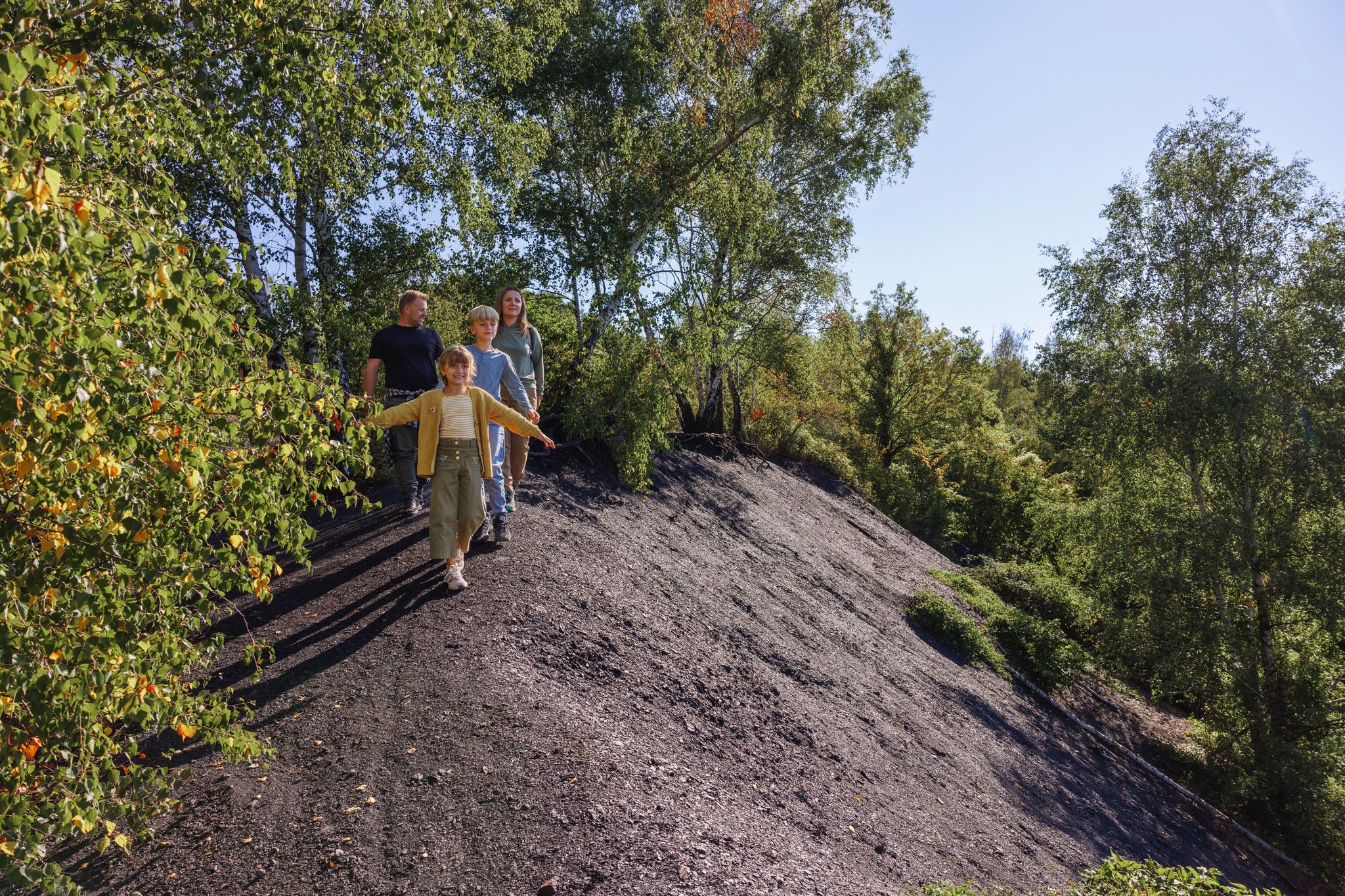
The Kalkhalde Teuterhof is a unique artificial hill in the Wurmtal valley near Würselen in North Rhine-Westphalia (Germany). It originated as an industrial waste product from chemical production in the region around the beginning of the 20th century. Unlike many other limestone mounds in the Euregion, which are the result of mining, this limestone mound consists of carboniferous limestone (lime-rich residues) from a former soda ash factory, originally established as the Honigmann factory and later part of the Solvaywerke, which ceased production in 1929. In the past, the waste material from the production process was transported via a conduit into the Wurmtal valley and stored there on the slope near the Teuterhof area. The site covers approximately several hectares and forms a characteristic white hill in the landscape, with steep wall fragments up to approximately 10 meters high, which testify to the way in which the limestone was deposited and later partially eroded or reclaimed. Today, the Kalkhalde is a protected area as part of the cultural and natural heritage of the Upper Wurmtal Valley. Although the area itself is generally not open to the public for reasons of protection and safety, it can be experienced along hiking trails as a spectacular, contrasting natural feature, the white Kalkhalde contrasting with the surrounding forests and the dark soil layers of the valley. Ecologically, the Kalkhalde, with its unique composition, supports a characteristic flora that thrives in dry, calcareous soil. Species such as Braunrote Sumpfwurz (Brown Orchid), Rundblättriges Wintergrün (Round-leaved Wintergreen), and Großes Zweiblatt can be found here, as can rare mosses such as Preissia rotundifolia, which are relatively scarce elsewhere in North Rhine-Westphalia. Combined with the surrounding Wurmtal natural landscape, the Kalkhalde Teuterhof forms an interesting landscape and geological monument that demonstrates the intertwining of human industrial history and natural development, and bears silent witness to the 19th- and 20th-century chemical industries in the region.
1
0

The viewpoint on the former limestone spoil heap near Würselen-Teuterhof offers views primarily of the immediate surroundings: adjacent fields, wooded areas, the districts of Würselen, and the former Teuterhof industrial site. The elevated position provides a good impression of the landscape's structure, without offering a distant view. The spoil heap originates from the former limestone quarrying that took place here for decades and shaped the region's economy. The deposited material is a remnant of this industrial activity. After operations ceased, the spoil heap was gradually secured and renaturalized. Today, it is part of the local recreation area and an example of the transformation from an industrially dominated site to a landscape integrated into the surrounding countryside.
1
0
The so-called "dinosaur eggs" on the former limestone spoil heap near Würselen-Teuterhof are not actual fossils, but rather deliberately placed art and design elements. They playfully address the geological significance of limestone mining: Limestone is formed from deposits of prehistoric marine organisms and thus points to periods in which dinosaurs also lived. The objects are intended to attract attention, foster curiosity, and, in particular, provide children with easy access to the geological and industrial history of the site. At the same time, they mark the spoil heap as a learning and experiential space and vividly connect nature, history, and recultivation.
1
0
The spoil heap originates from the former limestone quarrying that took place here for decades and shaped the region's economy. The deposited material is a remnant of this industrial use. After operations ceased, the spoil heap was gradually secured and renaturalized. Today, it is part of the local recreation area and an example of the transformation from an industrially dominated site to a landscape integrated into the surrounding countryside.
1
0
Beautiful view of fields and meadows along the Wurm river
0
0
South of Herzogenrath, in the green and relatively quiet Wurmtal valley, lies a unique landscape feature: the old railway embankment and its accompanying bridge, a tangible reminder of the region's industrial and infrastructure past. This former railway line partially follows the Worm (Wurm) valley and was built to serve the mining and industrial sectors in the border region between Germany and the Netherlands.
1
0
Frequently Asked Questions
How many dog-friendly hiking trails are there in Würselen?
Würselen offers a great selection of routes for you and your dog, with over 25 dog-friendly hiking trails available. These range from easy strolls to more moderate adventures, ensuring there's something for every dog and owner.
What do other hikers enjoy most about dog-friendly trails in Würselen?
The komoot community highly rates the dog-friendly trails in Würselen, with an average score of 4.4 stars from over 1300 ratings. Hikers often praise the serene natural beauty of the Wurm Valley, the well-maintained paths, and the blend of scenic landscapes with interesting historical sites, making it a perfect outing for dogs and their owners.
What kind of terrain can I expect on dog-friendly hikes in Würselen?
You can expect diverse terrain in Würselen. Many trails follow the meandering Wurm River through its valley, offering riverside paths, meadows, and wetlands. Other routes lead through picturesque hills, dense forests like Brander and Atscher Forest, and even orchards. The terrain is generally gentle, making it accessible for various activity levels.
Are there any easy dog-friendly routes suitable for beginners or older dogs?
Yes, Würselen has plenty of easy dog-friendly options. For instance, the Wurm River near Würselen – Teuterhof loop is an easy 5 km path that follows the Wurm River, offering beautiful views without significant elevation. Another great choice is the Teuterhof – Granite Eggs in the Wurmtal loop, which is just over 3 km and also easy.
Are there any circular dog-friendly hikes in Würselen?
Many of the dog-friendly trails in Würselen are circular, allowing you to start and end at the same point. For example, the View of the Wurm Valley – Wurm River near Würselen loop is a moderate 9 km circular route offering scenic vistas. The Wurm River near Würselen – View of the Wurm Valley loop is another excellent moderate circular option, just under 10 km.
What are the best times of year to hike with my dog in Würselen?
Würselen is enjoyable for hiking with your dog throughout much of the year. Spring brings blooming flora, while autumn showcases vibrant foliage, making these seasons particularly scenic. The generally gentle terrain also means trails are accessible in most conditions, though checking local weather is always recommended.
Are there any historical sites or natural landmarks to see on dog-friendly trails?
Absolutely! Many trails intertwine with the region's rich history and natural beauty. You might encounter remnants of old tunnels, former railway lines, or even castles. The Wurm Valley itself is a protected natural area. Highlights like the Schlangenberg Nature Reserve or the Iterbach Valley Near Kornelimünster offer unique natural experiences. The Gouley mine tunnel entrance (Stollenmundloch) is also a historic feature in the Wurmtal.
Can I find scenic viewpoints along dog-friendly routes in Würselen?
Yes, several dog-friendly routes offer scenic viewpoints, particularly those that traverse the hills surrounding the Wurm Valley. Trails like the View of the Wurm Valley – Wurm River near Würselen loop provide excellent vistas of the meandering river and its green surroundings. The Aachen Summit Trail, which passes through the area, also includes climbing the Haarberg (239 m) for elevated views.
Where can I park when hiking with my dog in Würselen?
Many trailheads in and around Würselen offer designated parking areas, especially for popular routes. It's advisable to check the specific route details on komoot for parking information, as options can vary. Generally, you'll find convenient parking near the starting points of most trails, particularly those leading into the Wurm Valley or surrounding forests.
Are there specific rules or permits for dogs on trails in Würselen?
While specific permits are generally not required for dogs on public hiking trails in Würselen, it's always important to keep your dog under control, either on a leash or with reliable voice command, especially in nature reserves or areas with wildlife. Always clean up after your dog to help keep the trails enjoyable for everyone.
How long are the dog-friendly trails in Würselen typically?
The dog-friendly trails in Würselen vary in length to suit different preferences. You can find shorter, easy walks around 3-5 km, such as the Wurm River near Würselen – Teuterhof loop (approx. 5 km). There are also longer, moderate routes, like the View of the Wurm Valley – Wurm River near Würselen loop, which is around 9 km, offering more extended adventures.
How can I avoid muddy conditions on dog-friendly trails in Würselen?
To minimize muddy conditions, especially after heavy rain, consider trails that are well-maintained or have a more gravelly or paved surface. Routes that stick to higher ground or forest paths might also be less prone to mud than those directly alongside the river in the Wurm Valley. Checking recent trail conditions or reviews on komoot before heading out can also be very helpful.
Most popular routes around Würselen
Most popular attractions around Würselen

Get inspired with the komoot mobile app


Explore more
Browse the best Hikes in other regions.
