The best hikes from bus stations around Sinzig
4.4
(4388)
16,268
hikers
56
hikes
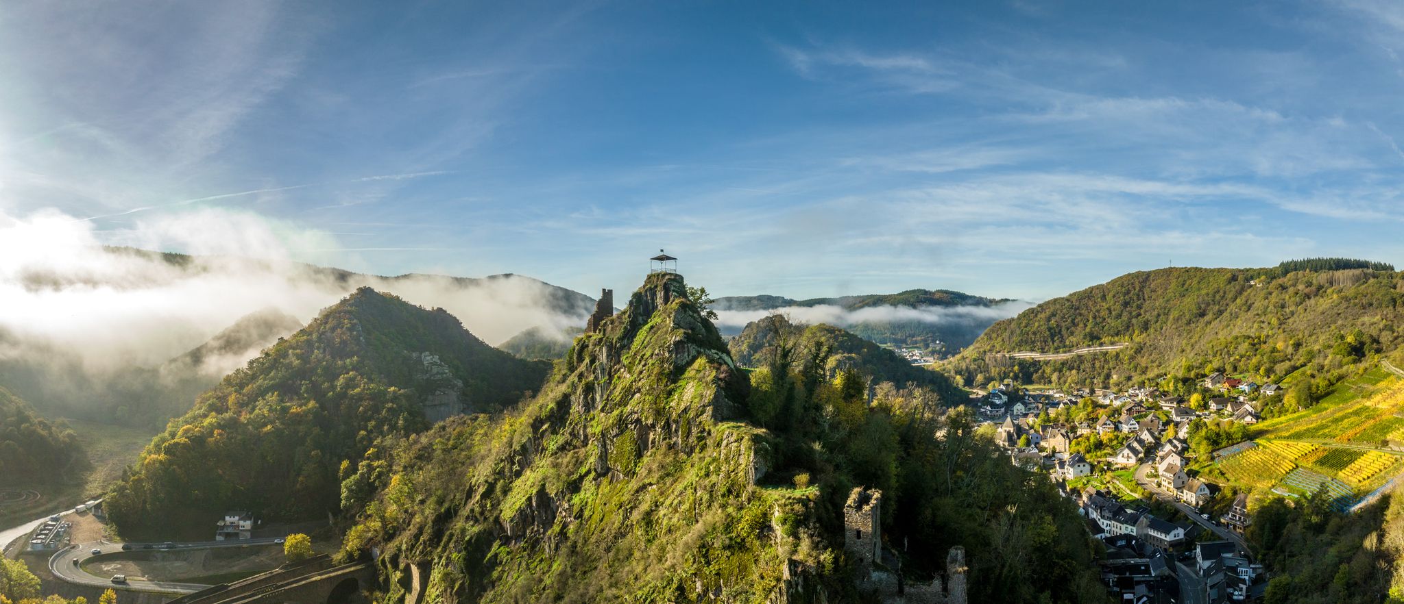
Bus station hiking trails around Sinzig offer access to a diverse landscape at the confluence of the Ahr and Rhine valleys. The region is characterized by rolling hills, meandering rivers, and extensive vineyards, set against the backdrop of the Rhenish Slate Mountains. Hikers can explore dense forests, open terrain, and riverine landscapes, with many routes providing panoramic views over the valleys and towards the distant Eifel Mountains. This varied topography provides a range of hiking experiences for different preferences.
Best…
Last updated: August 20, 2026
4.1
(41)
135
hikers
18.8km
05:06
260m
260m
Hard hike. Very good fitness required. Easily-accessible paths. Suitable for all skill levels.
4.3
(11)
47
hikers
21.9km
05:54
270m
270m
Hike the difficult 13.6-mile Sinziger Höhenweg through the Ahr Valley, featuring vineyards, forests, and views from Ehlinger Ley.

Sign up for free
4.3
(9)
33
hikers
12.7km
03:32
240m
240m
Moderate hike. Good fitness required. Easily-accessible paths. Suitable for all skill levels.
4.3
(4)
48
hikers
9.00km
02:28
140m
140m
Moderate hike. Good fitness required. Easily-accessible paths. Suitable for all skill levels.
4.3
(3)
17
hikers
9.12km
02:38
230m
230m
Moderate hike. Good fitness required. Easily-accessible paths. Suitable for all skill levels.
Get access to more routes and recommendations from other explorers.
Sign up for free
Already have an account?
Our route recommendations are based on thousands of hikes, rides, and runs completed by other people on komoot.
Start today with a free account
Your next adventure awaits.
Login or Signup
Popular around Sinzig
Other adventures around Sinzig

Tips from the Community

Historic, small place before Sinzig. But it also includes a bakery with a café, a pizzeria, a KSK branch, a florist, physiotherapy, a kindergarten, and a post office. https://www-vervecard.com
1
0

Besides the open picnic hut (the lack of side walls is an argument against resting here in the cold winter), the hiker will encounter a very old wayside cross as well as a significantly younger wayside shrine with a figure representing Saint Jodocus, to whom the small shrine is also dedicated.
9
0
Löhndorf itself is a village, with one notable location being in the municipality of Sinzig, Rhineland-Palatinate, which is known for its surrounding hiking trails and beautiful landscape https://www.e-zpassKY.com
0
0


A fantastic spot to gaze out over the expansive Ahr Valley and take in everything. It's truly a true highlight.
0
0

One of the few spots on this stage of the Rhine Castle Trail with a view of the Eifel Mountains and the volcanic cones. A glider airfield is located at the edge of the forest opposite.
1
0

The Ehlinger Ley, also known as the Ehlinger Köpfchen, lies above the village of Ehlingen and offers a sweeping view over the lower Ahr Valley, including the villages of Lohrsdorf, Ehlingen, and Heimersheim, all the way to the striking volcanic peak of the Landskrone. The 7th stage of the AhrSteig Trail leads directly over this viewpoint, which is surrounded by picturesque vineyards. The Ehlinger Ley invites you to linger and picnic and is a perfect place to fully enjoy the nature and landscape of the Ahr Valley. https://www.ahrtal.com/de/adenau/sehenswuerdigkeiten/ehlinger-ley/poi.html
1
0
The Landskrone forms a widely visible rocky peak in the lower Ahr Valley near Heppingen, about 1 km east of the district town of Bad Neuenahr, and is now a nature reserve. An ancient Germanic cult site and the ruins of the Staufenburg Castle (1205) are located on the plateau. The peak is almost entirely forested. Adjacent to the forest belt, intensively cultivated vineyards lie outside the nature reserve to the south, southeast, and southwest.
0
1
Frequently Asked Questions
How many bus station hiking trails are available around Sinzig?
There are over 50 bus-accessible hiking trails around Sinzig, offering a wide range of options for all skill levels. The region boasts a total of 58 routes, with 36 considered easy, 20 moderate, and 2 difficult.
Are there easy, family-friendly hiking routes accessible by bus from Sinzig?
Yes, Sinzig offers several easy and family-friendly routes accessible by bus. The region is known for its diverse trails suitable for all ages. For example, the 'Explorer Family Route Sinzig' is specifically designed for families, ensuring variety for everyone. Many routes also feature picnic spots and relatively flat sections.
Can I find circular hiking routes that start directly from a bus station in Sinzig?
Absolutely. Many of the trails around Sinzig are designed as circular routes, making them ideal for starting and ending at a public transport stop. An example is the moderate Avenue to Gutshof Mönchsheide – Swing chair loop from Sinzig, which offers a pleasant loop experience.
What kind of terrain can I expect on bus-accessible hikes around Sinzig?
The terrain around Sinzig is incredibly varied, thanks to its location at the confluence of the Ahr and Rhine valleys and at the base of the Rhenish Slate Mountains. You can expect everything from meandering riverine landscapes along the Ahr, dense forests, and open fields, to scenic vineyards and rolling hills. Many routes, like the Sinzig Heights Trail, offer a mix of these diverse landscapes.
Are there bus-accessible hikes in Sinzig with impressive panoramic views?
Yes, many bus-accessible hikes in Sinzig offer stunning panoramic views. The region is famous for vistas over the Ahr and Rhine valleys, and even distant views of the Eifel Mountains and the Landskrone. Viewpoints like Ehlinger Ley are often incorporated into trails, providing memorable scenic spots. The Barbarossaloop Sinzig blue - Ahr valley hike, for instance, offers extensive views through the Ahr valley.
What natural features or landmarks can I see on bus-accessible hikes near Sinzig?
Bus-accessible hikes near Sinzig lead to a wealth of natural features and landmarks. You can explore the unique Ahr River estuary, walk through picturesque vineyards, and discover dense forests. Notable attractions in the wider vicinity include the Wolf Gorge Waterfall and the Trass Caves Brohltal. You might also encounter highlights such as the Krausberg Tower or enjoy the View from the Landskrone summit.
What is the best time of year to enjoy bus-accessible hikes in Sinzig?
Spring and autumn are generally considered the best times for hiking in Sinzig. Spring brings blooming landscapes and fresh greenery, while autumn offers vibrant colorful foliage and a mild climate, perfect for exploring the vineyards. The region's high ratings from hiking communities often highlight these seasons for their beauty and comfortable conditions.
What do other hikers enjoy most about the bus-accessible trails in Sinzig?
The bus-accessible trails in Sinzig are highly rated by the komoot community, with an average score of 4.48 stars. Hikers frequently praise the diverse and picturesque landscapes, the well-maintained paths, and the impressive panoramic views over the Ahr and Rhine valleys. The convenience of public transport access to these varied routes is also a significant draw.
Are there longer, more challenging bus-accessible hikes for experienced hikers?
Yes, for experienced hikers seeking a challenge, there are longer and more demanding bus-accessible routes. The Barbarossaloop Sinzig blue - Ahr valley hike, at 18.8 km, and the Sinzig Heights Trail, at 21.9 km, are both rated as difficult and offer extensive exploration of the region's varied terrain and views. For an even greater challenge, the approximately 100 km long Ahrsteig, accessible at various points, offers a demanding experience from the source of the Ahr to its mouth near Sinzig.
Are there places to eat or picnic spots along the bus-accessible hiking routes?
Many bus-accessible hiking routes around Sinzig pass through or near charming villages and towns where you can find cafes and pubs. Additionally, the scenic nature of the Ahr and Rhine valleys means there are numerous idyllic spots perfect for a picnic, often with benches or viewpoints. It's always a good idea to check specific route details for amenities along the way.
Which bus connections can I use to reach trailheads from Sinzig train station?
Sinzig train station serves as a central hub for bus connections to various trailheads. Local bus lines connect the station to different parts of Sinzig and surrounding villages, providing access to routes like the Barbarossaschleife trails, the Sinzig Heights Trail, and the Explorer Family Route. You can consult local bus schedules for specific routes and timings to plan your hike.
Are there specific trails that offer good public transport access to the Ahr Valley vineyards?
Yes, the Ahr Valley is renowned for its vineyards, and several trails offer excellent public transport access to these scenic areas. The Red Wine Hiking Trail, for instance, winds through the vineyards and is well-served by bus connections, allowing you to enjoy the landscape and learn about local wine production without needing a car.
Most popular routes around Sinzig
Most popular attractions around Sinzig

Get inspired with the komoot mobile app


Explore more
Browse the best Hikes in other regions.
