The best traffic-free bike rides in Ring Mountain Open Space Preserve
4.6
(494)
8,543
riders
36
rides
Touring cycling in Ring Mountain Open Space Preserve offers routes through diverse terrain, characterized by grassy slopes, oak woodlands, and accessible fire roads. The preserve is known for its unique geology, including serpentine soils, and provides panoramic views of the Bay Area, Mount Tamalpais, and the San Francisco Bay. While single-track trails are generally not permitted for bikes, the fire roads provide opportunities for rides with varying terrain and rewarding vistas. Petroglyph Rock, featuring Native American carvings, adds a cultural…
Last updated: October 13, 2026
5.0
(3)
96
riders
47.2km
03:52
1,320m
1,320m
This difficult 29.3-mile touring cycling loop in Mount Tamalpais State Park offers challenging climbs and panoramic views of the Bay Area.
112
riders
31.4km
03:00
750m
750m
Hard bike ride. Very good fitness required. Mostly paved surfaces. Suitable for all skill levels.

5.0
(2)
59
riders
33.3km
02:37
430m
430m
Cycle a moderate 20.7-mile loop around Phoenix and Bon Tempe Lakes, enjoying diverse terrain, scenic views, and wildlife spotting.
5.0
(2)
25
riders
18.4km
01:19
150m
150m
Cycle 11.4 miles (18.4 km) to Tennessee Beach via Sausalito-Mill Valley Trail, a moderate route with ocean views in Marin Headlands.
5.0
(1)
86
riders
41.9km
03:48
1,010m
1,010m
Hard bike ride. Very good fitness required. Mostly paved surfaces. Suitable for all skill levels.
Get access to more routes and recommendations from other explorers.
Already have an account?
Our route recommendations are based on thousands of hikes, rides, and runs completed by other people on komoot.
Start today with a free account
Your next adventure awaits.
Popular around Ring Mountain Open Space Preserve
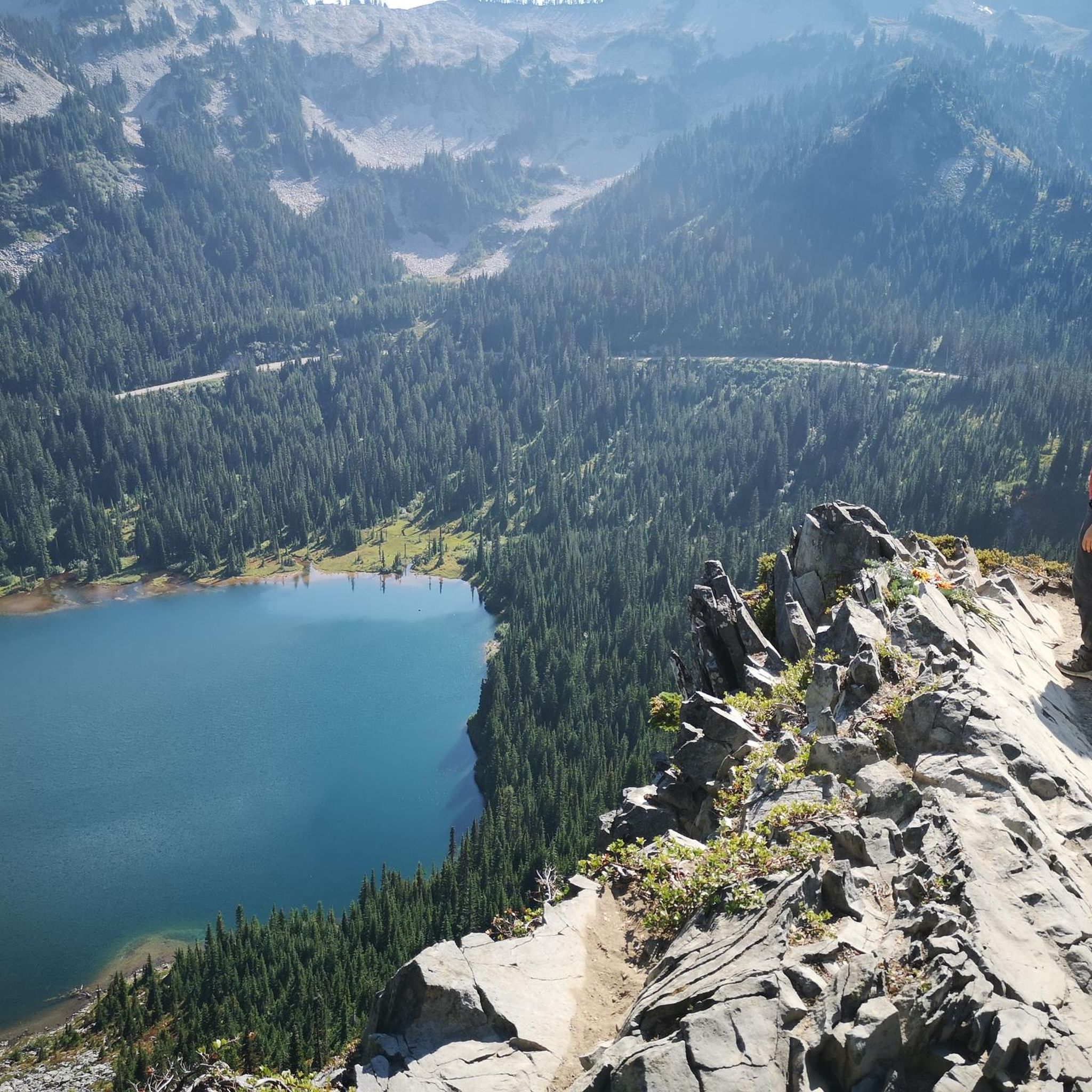

Tips from the Community


At the end of the gradual Tennessee Valley Road, the last mile or so unpaved but smooth gravel, awaits the natural sandy wide beach cove. The steep coastal trails climbing on either side are hiking only.
0
0

Mount Tam East Peak offers some of the most majestic views north of the bay. From this vantage point, you can see all of Marin, along with Point Reyes to the north and Oakland and San Francisco to the south. The stunning panoramic vistas make the journey well worth the effort. There are restrooms and picnic tables, ideal for a snack or lunch while you capture some incredible photos.
0
0

Often busy on weekends, this is a great spot to take moment before/after summiting Mt Tam. There are spigots to fill up water and bathrooms that are open during park hours. The parking lot is very close for those that drive up. There is access to MANY trails for those on foot/bike.
0
0

West of Lake Lagunitas, Bon Tempe Lake is a reservoir managed by Marin Municipal Water District. It features striking scenery, with lush trees, clear water, and a peaceful atmosphere.
0
0
Mount Tamalpais State Park is a majestic area in the heart of Marin County, with sweeping hillsides covered in fantastic redwood forest, open grasslands, sturdy chaparral, and wooded oaklands. The views from Mount Tampais boast breathtaking vistas of the Pacific Ocean, San Francisco Bay and City, the Marin County Hills, Mount Diablo, and the East Bay. You can even see the Farallon Islands, 25 miles out to sea. If you're lucky, you can catch an occasional glimpse of the snow-capped Sierra Nevada Mountain Range, nearly 150 miles away. The Park is a haven for cyclists, hikers, wildlife watchers, or those who wish to find a beautiful spot for an afternoon picnic.
0
0
This tidal sanctuary runs along the Mill Valley-Sausalito Pathway and the Charles F. McGlashan Pathway. More than 400 species of migratory birds rest here after their long flights, and if you pass through in the early morning or late evening, the sunrises and sunsets reflect beautifully on the surface of this 106-acre marsh.
0
0
Frequently Asked Questions
How many no-traffic touring cycling routes are available in Ring Mountain Open Space Preserve?
There are over 40 dedicated no-traffic touring cycling routes within Ring Mountain Open Space Preserve, offering a variety of experiences from easy to difficult. This includes 5 easy, 19 moderate, and 19 difficult routes, ensuring options for all skill levels.
What are the best times of year to go touring cycling in Ring Mountain Open Space Preserve?
The spring (March-May) is particularly beautiful, with wildflowers blooming and the rare Tiburon mariposa lily making an appearance, typically in May. Autumn also offers pleasant riding conditions with colorful foliage from toyon and poison oak. While trails can be muddy during the rainy season, the preserve generally offers enjoyable cycling year-round, with panoramic views as a constant highlight.
Are there any family-friendly no-traffic touring cycling routes in the preserve?
Yes, there are several easier routes suitable for families. While specific 'family-friendly' designations aren't always clear-cut, routes with less elevation gain and smoother surfaces are generally preferred. The preserve's fire roads offer accessible options, though some sections can be steep or have loose gravel. Always check individual route details for suitability.
What kind of views can I expect on a touring cycling route in Ring Mountain Open Space Preserve?
Ring Mountain Open Space Preserve is renowned for its breathtaking 360-degree panoramic views. Cyclists can expect to see Mount Tamalpais, the San Francisco Bay, the city of San Francisco, Mount Diablo, and the Richmond-San Rafael Bridge from various vantage points along the routes.
Are there any notable landmarks or attractions to see along the cycling routes?
Beyond the stunning natural beauty, you can discover unique geological formations and cultural sites. Keep an eye out for Petroglyph Rock, which features ancient Native American rock carvings. The preserve is also home to unique serpentine soils supporting rare plant species, especially vibrant during spring wildflower season.
What is the difficulty level of touring cycling routes in Ring Mountain Open Space Preserve?
The routes vary significantly in difficulty. You'll find 5 easy routes, 19 moderate routes, and 19 difficult routes. Some fire roads can be steep with loose gravel, providing a moderate to challenging experience. It's advisable to check the elevation profile and surface type for each route before you set out.
Can I find any loop routes for touring cycling in the preserve?
Yes, there are several loop options available. For example, the Paradise Beach County Park – Tiburon Linear Park Bike Trail loop from Paradise Cay offers a moderate touring cycling experience. Another option is the Phoenix Lake to Bon Tempe Lake loop, which is also rated as moderate.
How do other touring cyclists rate their experience in Ring Mountain Open Space Preserve?
The komoot community highly rates touring cycling in Ring Mountain Open Space Preserve, with an average score of 4.75 out of 5 stars from nearly 400 reviews. Cyclists frequently praise the incredible panoramic views, the unique natural features, and the sense of tranquility on the no-traffic fire roads.
Are there any long-distance touring cycling routes that avoid traffic?
For those seeking a longer, more challenging ride with minimal traffic, consider routes that extend beyond the immediate preserve boundaries while still utilizing dedicated paths. The Stinson Beach Overlook & Mount Tamalpais loop via Panoramic Highway is a difficult, longer option that offers extensive views and a significant challenge.
What should I know about parking and public transport access for touring cycling?
While specific parking details for every trailhead vary, Ring Mountain Open Space Preserve generally offers designated parking areas. For detailed information on parking facilities and potential public transport connections to the preserve, it's recommended to consult the official visitor resources for Marin County, such as Visit Marin.
What kind of wildlife might I encounter while cycling?
The preserve is home to various wildlife. You might spot raptors circling overhead, especially around the mountainsides. Rock wrens are present year-round, and scrub jays and red-winged blackbirds are also common. Remember to observe wildlife from a distance and respect their natural habitat.
Are there any specific rules or permits required for biking in Ring Mountain Open Space Preserve?
Cyclists are generally permitted on designated fire roads within the preserve. Single-track trails are typically not open to bikes. It's important to be courteous and safety-conscious, sharing the roads with hikers and horseback riders. Always check for current regulations and any permit requirements on the official preserve website before your visit.
Most popular routes in Ring Mountain Open Space Preserve

Get inspired with the komoot mobile app


Explore more
Browse the best Cycling routes in other regions.
