The best traffic-free bike rides in Espacio Natural De Las Tuerces
4.3
(14)
154
riders
23
rides
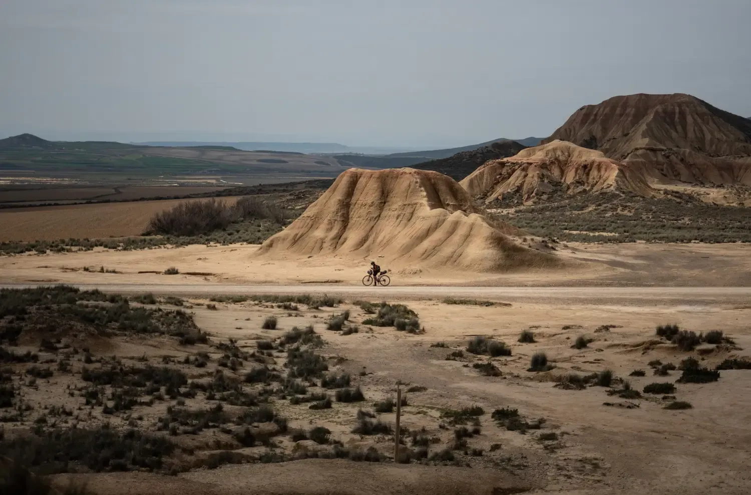
No traffic touring cycling routes in Espacio Natural De Las Tuerces traverse a distinctive karst landscape, shaped by the Pisuerga River. The region features unique rock formations, often described as an "enchanted city," alongside the impressive Cañón de La Horadada. Cyclists can explore a mix of open plateaus, such as the Meseta de Las Tuerces, and areas with diverse flora including holm oaks and junipers. The terrain includes both gentle paths and more challenging sections with elevation changes, offering varied experiences for touring cyclists.
Best no traffic touring cycling routes in Espacio Natural De Las Tuerces
- The most popular no traffic touring cycling route is Sunset view at Castrecias loop from Mave, a 16.9 miles (27.2 km) trail that takes 1 hour 42 minutes to complete. This moderate route offers views of the surrounding natural rock formations and the Castrecias area.
- Another top favourite among local touring cyclists is Collegiate Church of San Miguel – Pisuerga River loop from Aguilar de Campoo, a difficult 35.8 miles (57.6 km) path. This route includes significant elevation gain and follows the Pisuerga River, passing historical sites.
- Local touring cyclists also love the Collegiate Church of San Miguel – Santa María la Real Monastery loop from Restaurante Monte Royal, a 6.8 miles (10.9 km) trail leading through the local countryside, often completed in about 49 minutes.
- Touring cycling in Espacio Natural De Las Tuerces is defined by karst rock formations, river valleys, and open plateaus. The network offers options for different ability levels, from easy loops to more challenging routes with notable climbs.
- The routes in Espacio Natural De Las Tuerces are highly rated by the komoot community with an average score of 4.3 stars from over 8 reviews. More than 80 touring cyclists have used komoot to explore Espacio Natural De Las Tuerces's varied terrain.
Last updated: October 12, 2026
5
riders
26.9km
01:38
200m
200m
Moderate bike ride. Good fitness required. Mostly paved surfaces. Suitable for all skill levels.
4
riders
56.2km
04:56
710m
710m
Hard bike ride. Very good fitness required. You may need to push your bike for some segments of this route.

5.0
(1)
12
riders
Moderate bike ride. Good fitness required. Mostly paved surfaces. Suitable for all skill levels.
4.5
(2)
10
riders
Hard bike ride. Very good fitness required. You may need to push your bike for some segments of this route.
8
riders
7.59km
00:30
110m
110m
Easy bike ride. Great for any fitness level. Mostly paved surfaces. Suitable for all skill levels.
Get access to more routes and recommendations from other explorers.
Already have an account?
Our route recommendations are based on thousands of hikes, rides, and runs completed by other people on komoot.
Start today with a free account
Your next adventure awaits.
Popular around Espacio Natural De Las Tuerces


Other adventures in Espacio Natural De Las Tuerces

Tips from the Community

In the Plaza de España, the nerve centre of the town.
1
0
The amount of water this river carries is always surprising.
1
0

The visit to the neighborhoods of San Pedro and Santa María is worth it for the heritage and landscapes but it has a price on the legs, you have to climb Monte de la Ruya again to connect with the main itinerary and overcome the infernal slope that We saw before the detour, which also has a trap because after a short descent there is another similar section to a hill, the prize is fantastic views of the Palentina Mountain. The road enters the meadows and mountains of La Ojeda again and there is a fun stretch, climbing the GPS average for several kilometers until Dehesa de Montejo, where the detour for the Perazancas variant comes out on the left. The route continues to the right, crosses the Cervera de Pisuerga road and climbs the slope of Peña Umoma to a hill that finally marks the entrance to the Pisuerga valley through the beautiful valley of Valdeados. The descent ends in Vado, it is noon, time for a snack but there is no bar or grocery store. Cervera is three kilometers away but it is the place where we plan to finish the stage and we decided to continue and spend the afternoon with the energy bars. The path continues along the charming bank of the Pisuerga River, favorable terrain, river landscape, good climate and change of environment. On the route there are yellow arrows of the Camino Olvidado or Camino de la Montaña, a Camino de Santiago very popular in the 12th and 13th centuries, starting from Bilbao, running along the southern slope of the Cantabrian Mountains and connecting with the Camino Francés in El Bierzo. In Barcenilla de Pisuerga, the milestones of the Natural Trail cross the Pisuerga River via a pedestrian walkway and change course, beginning the climb through the Mudá valley until the connection with the GR-1. The climb begins in Rueda de Pisuerga, the route passes by the church of San Cristóbal, which preserves the Romanesque doorway from the 12th century, and continues through Vallespinoso de Cervera to San Cebrián de Mudá, a town with a mining tradition and the last town on the Natural Trail of the Palentine Romanesque. In the square there are some wagons from the mining era, when the Cok Coal Route was the main economic channel of the valley. The church of San Cornelio and San Cipriano is on a hill, is Romanesque from the 13th century and was declared a Site of Cultural Interest in 1993. The climb to the Historical Trail passes through the European Bison Interpretation Center, runs through a mountain oak grove and ends at a small hill below the imposing Valdecebollas (2,143 m), entrance to the La Pernía valley and the upper Pisuerga. The views are stunning. The end of the stage is Cervera de Pisuerga, with accommodation, camping and complete services. The final stretch to complete a great day of gravel cycling continues through the Castillería valley and at the Estalaya crossroads, where the climb to the Verdeña Fossil Forest is, a path leaves on the left that leads to Vañes off the road. In this section it is important to have the track downloaded because there are no milestones on the route. You must continue along the road for about 500 meters towards Cervera and at the fork of the road take a detour to the left towards Rabanal de los Caballeros and Valdasornín. The rest of the way follows the road that goes down to the urban complex of Cervera de Pisuerga.
0
0

Puente Mayor over the Pisuerga River is of medieval origin. We can see the small islands in the river and the castle hill.
2
0

The next town is Vallespinoso de Aguilar. The hermitage of Santa Cecilia, immediately standing out on a castle hill, is dated to the 12th century and was declared a historical-artistic monument in 1951. The portico has well-carved capitals and the location conveys the atmosphere of a fortress sanctuary.
0
0

Temple built at the end of the 12th century and beginning of the 13th, it is located on a beautiful hillock, on the outskirts of Barrio de Santa María, near the Aguilar de Campoo reservoir.
2
0
The Church of the Assumption, located in Barrio de Santa María, is an outstanding example of the Romanesque in the Palencia Mountain. Built in the 16th century on the remains of a 12th-century Romanesque church, it preserves elements such as the apse and the nave of the Gospel.
2
0
Nice railway bridge that crosses the Pisuerga river on the outskirts of Salinas de Pisuerga.
1
0
Frequently Asked Questions
How many no-traffic touring cycling routes are available in Espacio Natural De Las Tuerces?
There are 13 dedicated no-traffic touring cycling routes in Espacio Natural De Las Tuerces, offering a variety of distances and difficulties to explore the region's unique landscapes.
What makes touring cycling in Espacio Natural De Las Tuerces unique?
The region is renowned for its distinctive karst topography, featuring an 'enchanted city' of intricate rock formations, natural bridges, and canyons carved by the Pisuerga River. Cycling here offers a chance to immerse yourself in an otherworldly landscape, often described as a 'lunar landscape', away from vehicle traffic.
Are there any easy no-traffic touring cycling routes suitable for beginners or families?
Yes, there are 2 easy routes perfect for beginners or families looking for a relaxed ride. One such route is the Collegiate Church of San Miguel – Santa María la Real Monastery loop from Restaurante Monte Royal, which is just under 11 km long and features minimal elevation gain.
What kind of attractions can I see along the no-traffic touring cycling routes?
The routes often pass by fascinating natural and historical landmarks. You can explore the dramatic rock formations like Peña Mesa and the Peña Mesa Rock Formation (Las Tuerces), or discover historical sites such as Gama Castle and the Church of San Juan Bautista, Villaescusa de las Torres. The Horadada Tunnel is another notable natural feature.
Are there any circular no-traffic touring routes available?
Yes, many of the routes are circular, allowing you to start and end at the same point. For example, the Sunset view at Castrecias loop from Mave offers a moderate 27 km ride with scenic views.
What is the best time of year to go touring cycling in Espacio Natural De Las Tuerces?
The region is generally pleasant for cycling throughout the year, but spring and autumn offer the most comfortable temperatures and vibrant scenery. Summer can be warm, while winter might bring cooler weather, though the unique rock formations take on a different charm in every season.
Where can I find parking for my touring bike near the routes?
Many of the routes start from villages or towns like Mave or Aguilar de Campoo, where public parking is typically available. It's advisable to check specific starting points for designated parking areas, often near local amenities.
What do other touring cyclists enjoy most about the no-traffic routes here?
The komoot community rates the routes highly, with an average of 4.3 stars. Cyclists often praise the unique karst landscapes, the tranquility of the no-traffic paths, and the opportunity to discover hidden natural and historical gems away from busy roads.
Are there any routes that offer views of the Aguilar Reservoir?
Yes, several routes incorporate views of the Aguilar Reservoir. A challenging option is the Aguilar Reservoir – Aguilar Reservoir loop from Aguilar de Campoo, a 43 km ride that circles the reservoir, offering expansive water views.
How do the no-traffic touring cycling routes compare to mountain biking trails in the area?
While Espacio Natural De Las Tuerces is also known for mountain biking, the no-traffic touring cycling routes are generally designed for a smoother experience on paved or well-maintained gravel paths, focusing on scenic exploration rather than technical off-road challenges. They allow you to enjoy the unique geology without needing a specialized mountain bike.
Are there any longer, more challenging no-traffic touring routes?
For experienced touring cyclists seeking a longer challenge, the region offers routes up to 57 km. The Collegiate Church of San Miguel – Pisuerga River loop from Aguilar de Campoo is a difficult 57.5 km route with significant elevation gain, providing a comprehensive tour of the area's natural beauty and historical sites.
Most popular routes in Espacio Natural De Las Tuerces
Most popular attractions in Espacio Natural De Las Tuerces

Get inspired with the komoot mobile app


Explore more
Browse the best Cycling routes in other regions.
