The best hikes from bus stations in Λευκά Όρη Ανατολικού Σελίνου Και Σφακίων
4.5
(4444)
24,219
hikers
10
hikes
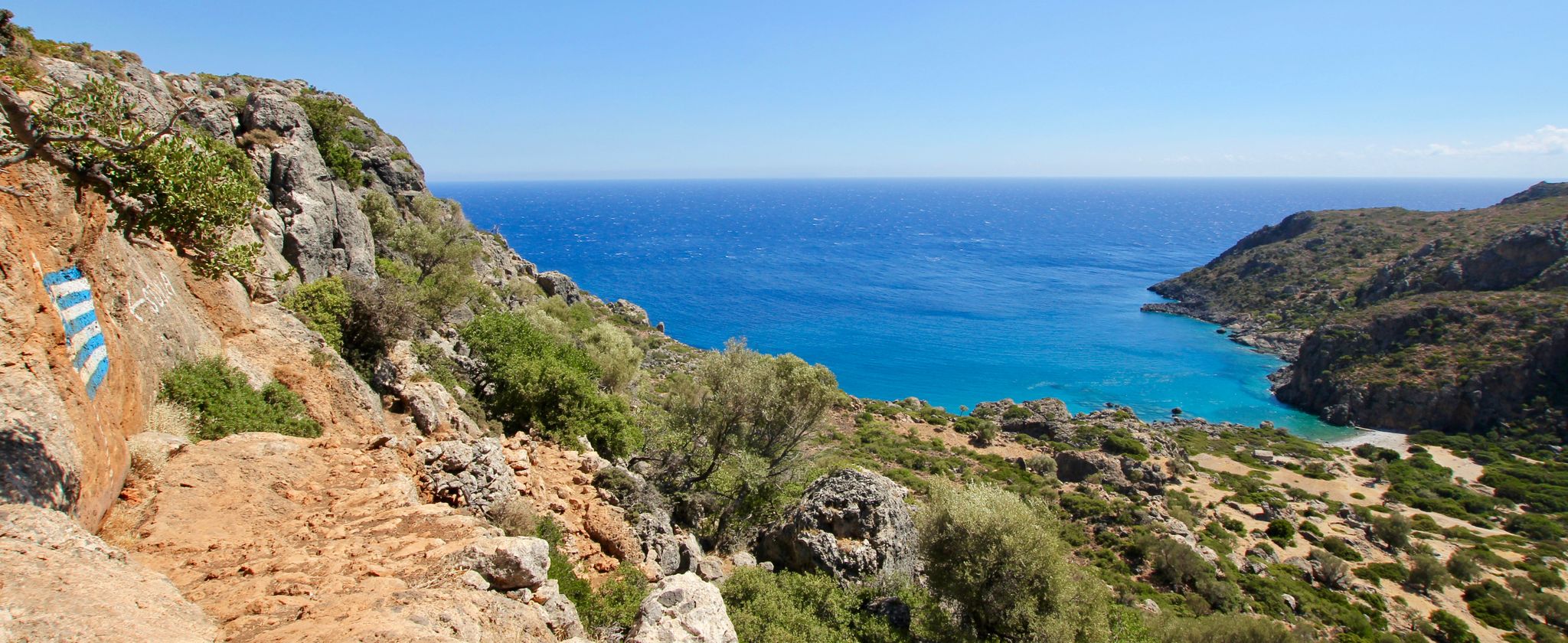
Bus station hiking trails in Λευκά Όρη Ανατολικού Σελίνου Και Σφακίων traverse a diverse and dramatic landscape in western Crete. This mountain range features over fifty peaks exceeding 2,000 meters, including Pachnes at 2,454 meters, offering panoramic views. The region is characterized by deep ravines, gorges like Samaria and Agia Irini, and extensive karstic formations including dolines and chasms. While higher altitudes present a barren "moon landscape," inland areas support forests of chestnut, oak, and cypress.
Best bus station hiking trails in Λευκά Όρη Ανατολικού Σελίνου Και Σφακίων
- The most popular bus station hiking route is Samaria Gorge – Iron Gates (Samaria Gorge) loop from ΞΥΛΟΣΚΑΛΟ, a difficult 15.3 miles (24.7 km) trail that takes 8 hours 20 minutes to complete. This route explores the renowned Samaria Gorge, known for its dramatic cliffs.
- Another top favourite among local hikers is Samaria Gorge – Ruins of Samaria Village loop from ΞΥΛΟΣΚΑΛΟ, a moderate 8.0 miles (12.9 km) path. This trail offers a journey through the lower sections of the Samaria Gorge, passing historical ruins.
- Local hikers also love the Rescue mules in the Samaria Gorge – Samaria Gorge loop from ΞΥΛΟΣΚΑΛΟ, a 7.1 miles (11.5 km) trail leading through the Samaria Gorge, often completed in about 4 hours 25 minutes.
- Hiking in Λευκά Όρη Ανατολικού Σελίνου Και Σφακίων is defined by towering peaks, deep gorges, and unique karstic formations. The network offers options for different ability levels, from moderate paths to challenging mountain ascents.
- The routes in Λευκά Όρη Ανατολικού Σελίνου Και Σφακίων are highly rated by the komoot community with an average score of 4.5 stars from more than 3,900 reviews. More than 22,000 hikers have used komoot to explore Λευκά Όρη Ανατολικού Σελίνου Και Σφακίων's varied terrain.
Last updated: October 12, 2026
4.9
(1588)
9,695
hikers
24.7km
08:21
1,200m
1,200m
Hard hike. Very good fitness required. Easily-accessible paths. Suitable for all skill levels.
4.5
(17)
278
hikers
12.9km
04:54
880m
880m
Moderate hike. Good fitness required. Easily-accessible paths. Suitable for all skill levels.

4.5
(18)
270
hikers
Moderate hike. Good fitness required. Easily-accessible paths. Suitable for all skill levels.
4.5
(48)
185
hikers
12.0km
04:06
570m
580m
Moderate hike. Good fitness required. Easily-accessible paths. Suitable for all skill levels.
4.5
(14)
64
hikers
21.2km
07:28
1,160m
1,150m
Hard hike. Very good fitness required. Mostly accessible paths. Sure-footedness required.
Get access to more routes and recommendations from other explorers.
Already have an account?
Our route recommendations are based on thousands of hikes, rides, and runs completed by other people on komoot.
Start today with a free account
Your next adventure awaits.
Popular around Λευκά Όρη Ανατολικού Σελίνου Και Σφακίων
Other adventures in Λευκά Όρη Ανατολικού Σελίνου Και Σφακίων

Tips from the Community

beautiful path through the Samaria Gorge
1
0
in this area the Samaria Gorge gets narrower and narrower
2
1
We were lucky and there was quite a lot of water flowing down the Samaria Gorge
3
1
here you have to cross the stream
2
0
Funny idea with the fake supports
2
1
With the mules, people who can no longer make it through the Samaria Gorge can be rescued
2
1
First station for refilling water in the Samaria Gorge
2
1
Steep descent into the Samaria Gorge
2
1
Frequently Asked Questions
How many bus-accessible hiking trails are available in Λευκά Όρη Ανατολικού Σελίνου Και Σφακίων?
There are 10 curated hiking routes in Λευκά Όρη Ανατολικού Σελίνου Και Σφακίων that are easily accessible from bus stations. These routes offer a range of experiences, from moderate to difficult, allowing you to explore the region's stunning landscapes without needing a car.
What kind of terrain can I expect on bus-accessible hikes in the White Mountains?
The terrain on bus-accessible hikes in the White Mountains is incredibly diverse. You'll encounter everything from the dramatic, barren 'moon landscape' at higher altitudes to lush forests of chestnut, oak, and cypress in inland areas. Many trails traverse deep gorges and karstic formations, offering a challenging yet rewarding experience.
Are there any family-friendly hiking options accessible by bus?
While many trails in the White Mountains are challenging, there are options suitable for families depending on their experience level. For example, the route Samaria Gorge – Ruins of Samaria Village loop from ΞΥΛΟΣΚΑΛΟ is a moderate 12.8 km hike that offers a taste of the famous gorge without committing to the full, difficult descent. Always check the specific route details for elevation and duration to ensure it suits your family's capabilities.
What are some notable natural features or landmarks I can see on these bus-accessible trails?
Many bus-accessible trails offer access to the region's most iconic features. You can explore parts of the famous Samaria Gorge, known for its dramatic cliffs and unique ecosystem. Highlights include the Kallergi Hut, offering stunning views, and various viewpoints like the Kallergi Shelter View of Samaria Gorge and Gigilos. The region is also home to majestic peaks like Gingilos Peak, accessible on more challenging routes.
What is the best time of year to hike these bus-accessible trails?
The best time to hike in Λευκά Όρη Ανατολικού Σελίνου Και Σφακίων is generally spring, summer, and autumn. During these seasons, water levels in gorges are typically low, and the weather is more favorable. Spring brings blooming wildflowers, while autumn offers pleasant temperatures. Summer can be hot, especially in the gorges, so early starts are recommended.
Are there any circular routes available from bus stations?
Yes, several circular routes are available from bus stations, allowing for convenient day trips. For instance, the challenging Samaria Gorge – Iron Gates (Samaria Gorge) loop from ΞΥΛΟΣΚΑΛΟ is a demanding 24.6 km circular hike. For a moderate option, consider the Koukoulé Peak (Koukoulé) – Kallergi Hut loop from ΞΥΛΟΣΚΑΛΟ.
What are the difficulty levels of the bus-accessible hikes?
The bus-accessible hikes in Λευκά Όρη Ανατολικού Σελίνου Και Σφακίων cater to various skill levels. You'll find 3 easy routes, 4 moderate routes, and 3 difficult routes. This range ensures that both casual hikers and experienced trekkers can find a suitable adventure. Always check the specific route details for distance, elevation gain, and estimated duration.
Are permits required for any of the bus-accessible hiking trails, especially for Samaria Gorge?
Yes, permits are required for hiking through the Samaria Gorge, which is a National Park. It's crucial to check the official regulations and secure your permit in advance, especially during peak season, as visitor numbers are often limited. Information regarding permits can usually be found at the park entrances or through local tourism offices.
Can I bring my dog on these bus-accessible trails?
While many outdoor areas in Greece are generally dog-friendly, specific regulations apply to National Parks and protected areas like the Samaria Gorge. Dogs are typically not allowed inside the Samaria Gorge National Park itself. It's best to verify local rules for other trails and always keep your dog on a leash and clean up after them.
What do other hikers enjoy most about hiking in Λευκά Όρη Ανατολικού Σελίνου Και Σφακίων?
The area is highly rated by the komoot community, with an average score of 4.5 stars. Reviewers often praise the dramatic and diverse landscapes, the challenge of the gorges and peaks, and the breathtaking panoramic views of both the Cretan and Libyan Seas. The extensive network of trails and the unique karstic formations are frequently highlighted as memorable aspects of the hiking experience.
Are there mountain huts or shelters along the bus-accessible routes?
Yes, mountain huts serve as important attractions and rest points for hikers in the region. The Kallergi Hut is a well-known example, accessible on several routes, including the Gigilos Peak – Kallergi Hut loop from ΞΥΛΟΣΚΑΛΟ. These huts can provide shelter, and sometimes refreshments or overnight stays, depending on their facilities and operating season.
Most popular routes in Λευκά Όρη Ανατολικού Σελίνου Και Σφακίων
Most popular attractions in Λευκά Όρη Ανατολικού Σελίνου Και Σφακίων

Get inspired with the komoot mobile app


Explore more
Browse the best Hikes in other regions.
