The best hikes from bus stations around Kilmuir
4.5
(3507)
18,916
hikers
14
hikes
Bus station hiking trails around Kilmuir offer access to the dramatic landscapes of the Isle of Skye. The region is characterized by its unique geological formations, including massive cliffs and distinctive rock structures of the Quiraing, part of the Trotternish Ridge. Hikers can explore varied terrain, from challenging ridge traverses to moderate coastal paths with views towards the Outer Hebrides. The area's natural features provide a diverse environment for outdoor activities.
Best bus station hiking trails around Kilmuir
- The most…
Last updated: July 7, 2026
4.4
(38)
188
hikers
7.61km
02:12
170m
170m
Hard hike. Good fitness required. Sure-footedness, sturdy shoes and alpine experience required.
4.5
(30)
123
hikers
Easy hike. Great for any fitness level. Easily-accessible paths. Suitable for all skill levels.
5.0
(3)
11
hikers
23.4km
07:24
610m
610m
Hard hike. Very good fitness required. Sure-footedness, sturdy shoes and alpine experience required.
Get access to more routes and recommendations from other explorers.
Sign up for free
Already have an account?
Our route recommendations are based on thousands of hikes, rides, and runs completed by other people on komoot.
Start today with a free account
Your next adventure awaits.
Login or Signup
Other adventures around Kilmuir


Tips from the Community

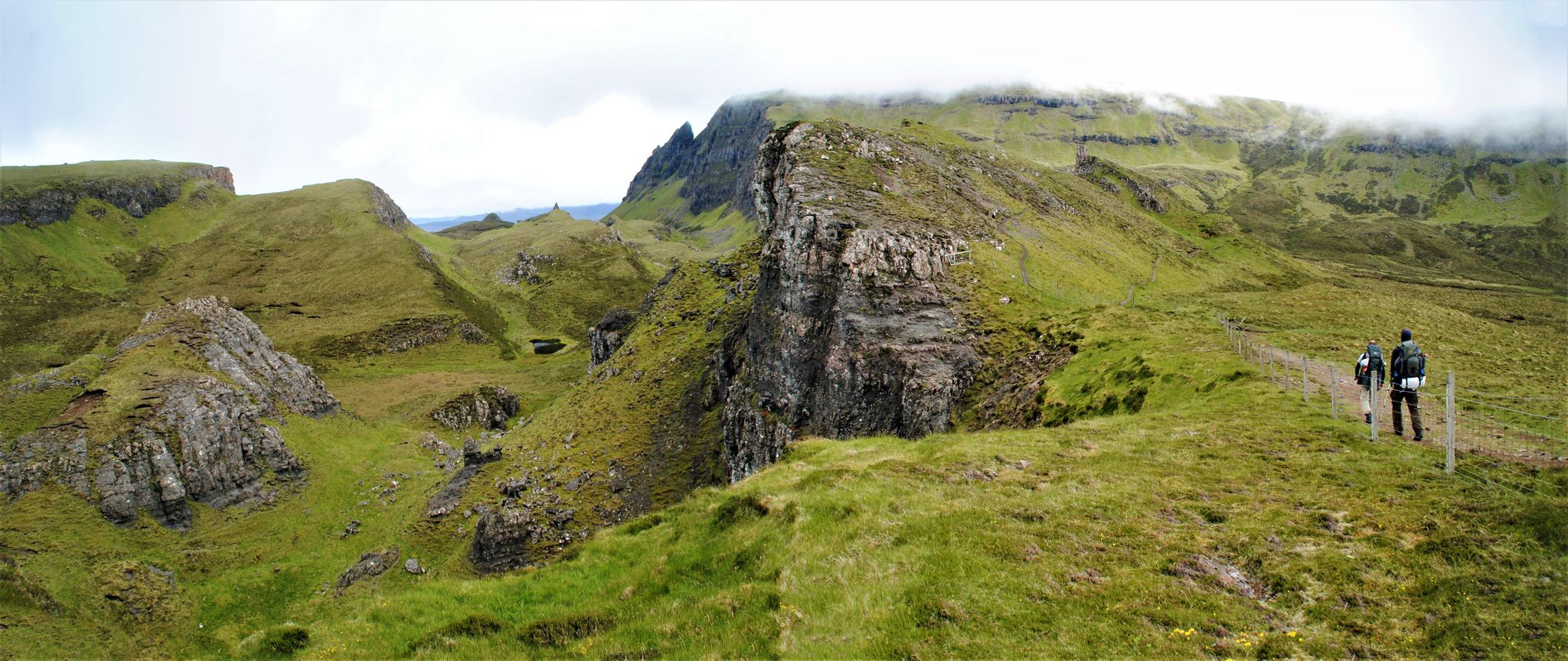
The Quiraing on the Isle of Skye is a spectacular landscape of rugged rocks, steep slopes, and green plateaus on the Trotternish Peninsula. It was formed by massive landslips, which are still active today and constantly changing the shape of the landscape. The area is known for distinctive formations such as The Needle, The Prison, and The Table. The Quiraing offers some of Scotland's most impressive views and is a popular destination for hikers and photographers. Its dramatic scenery gives it an almost mystical atmosphere.
0
0
The Quiraing on the Isle of Skye is a spectacular landscape of rugged rocks, steep slopes, and green plateaus on the Trotternish Peninsula. It was formed by massive landslides that are still active today, constantly changing the shape of the landscape. The area is known for distinctive formations such as The Needle, The Prison, and The Table. The Quiraing offers some of Scotland's most impressive views and is a popular destination for hikers and photographers. Its dramatic scenery gives it an almost mystical atmosphere.
0
0
The Quiraing on the Isle of Skye is a spectacular landscape of rugged cliffs, steep slopes, and green plateaus on the Trotternish Peninsula. It was formed by massive landslides that are still active today, constantly changing the shape of the landscape. The area is known for distinctive formations such as The Needle, The Prison, and The Table. The Quiraing offers some of Scotland's most impressive views and is a popular destination for hikers and photographers. Its dramatic scenery gives it an almost mystical atmosphere.
0
0
The Quiraing on the Isle of Skye is a spectacular landscape of rugged rocks, steep slopes, and green plateaus on the Trotternish Peninsula. It was formed by massive landslides, which are still active today and constantly changing the shape of the landscape. The area is known for distinctive formations such as The Needle, The Prison, and The Table. The Quiraing offers some of Scotland's most impressive views and is a popular destination for hikers and photographers. Its dramatic scenery gives it an almost mystical atmosphere.
0
0
The Needle at the Quiraing on the Isle of Skye is a slender, steeply rising rock column that stands out from the landscape like a natural needle. It was formed by massive landslide movements that continue to shape the area today. Erosion exposed the rock and sculpted it into this distinctive form. The Needle is one of the most famous sights in the Quiraing and a popular photo motif. Together with formations like The Prison, it shapes the dramatic, almost unreal landscape of the Trotternish Peninsula.
0
0
The Quiraing on the Isle of Skye is a spectacular landscape of rugged rocks, steep slopes, and green plateaus on the Trotternish Peninsula. It was formed by massive landslides that are still active today, constantly changing the shape of the landscape. The area is known for distinctive formations such as The Needle, The Prison, and The Table. The Quiraing offers some of Scotland's most impressive views and is a popular destination for hikers and photographers. Its dramatic scenery gives it an almost mystical atmosphere.
0
0
The Prison am Quiraing on the Isle of Skye is a striking rock formation with steep, almost vertical walls, reminiscent of a natural fortress or prison – hence the name. It was formed by ancient landslides that shaped the terrain of the Trotternish Peninsula and continue to change it slightly to this day. The Prison is one of the most famous geological landmarks of the Quiraing and is particularly popular with hikers and photographers. From here, you can enjoy impressive views of the island's rugged, dramatic landscape.
0
0

This turnoff is very steep and dangerous. You emerge between the rocks but can't go any further, and you have to turn back. So there's no continuous path to the top.
0
0
Frequently Asked Questions
How many bus station hiking trails are available in Kilmuir?
There are 15 hiking trails around Kilmuir that are easily accessible from bus stops, offering a variety of experiences for different skill levels.
Are there easy hiking trails accessible by bus in Kilmuir?
Yes, Kilmuir offers 6 easy hiking trails that start directly from bus stops. A great option is the Deserted Village of Erisco – View of Duntulm Castle loop from Duntulm Castle, which is an easy 5.5 km walk with minimal elevation gain, perfect for a relaxed outing.
What are the most popular natural attractions accessible from bus station hikes in Kilmuir?
Many iconic natural attractions are within reach of bus-accessible trails. You can explore the dramatic landscapes of The Quiraing, including formations like The Prison, or discover the Staffin Beach Dinosaur Footprints. The summit of Fir Bhreugach also offers stunning panoramic views.
Can I find circular hiking routes from bus stops in Kilmuir?
Absolutely. Many of the bus-accessible routes in Kilmuir are circular, allowing you to return to your starting point without retracing your steps. An excellent example is the Rubha Hunish Cliffs – Rubha Hunish Lookout Bothy loop from Duntulm Castle, which provides breathtaking coastal views.
Are there dog-friendly trails accessible by bus in Kilmuir?
The Isle of Skye is generally very dog-friendly, and many of the trails around Kilmuir are suitable for dogs. However, always keep your dog on a lead, especially near livestock, and be mindful of local signage. Ensure your dog is well-behaved around other hikers and wildlife.
What is the best time of year to hike from bus stations in Kilmuir?
The best time to hike in Kilmuir is typically from late spring to early autumn (May to September). During these months, you'll experience longer daylight hours, milder weather, and a higher chance of clear skies, which are ideal for enjoying the dramatic landscapes. Be prepared for changeable weather at any time of year.
Are there any family-friendly bus-accessible hikes in Kilmuir?
Yes, Kilmuir offers several family-friendly options. The 6 easy trails are generally suitable for families. While not directly in Kilmuir, the enchanting Fairy Glen, a short drive away, is known for its unique landscapes and is ideal for a family hike, and can be reached via local bus services to nearby villages.
What kind of terrain can I expect on bus-accessible trails in Kilmuir?
The terrain varies significantly. You can expect everything from well-trodden paths and coastal walks to more rugged, uneven ground, especially on trails leading to formations like The Quiraing. Some routes, particularly the difficult ones, may involve steep ascents and descents over rocky or boggy sections. Always wear appropriate footwear.
What do other hikers enjoy most about hiking in Kilmuir?
The area is highly rated by the komoot community, with an average score of 4.56 stars from over 2900 ratings. Reviewers often praise the otherworldly landscapes, the dramatic coastal views, and the unique geological formations like The Quiraing. The accessibility via public transport is also a frequently highlighted benefit.
Are there any challenging bus-accessible hikes in Kilmuir?
Yes, for experienced hikers, there are 5 difficult trails accessible by bus. The Quiraing Viewpoint – Quiraing Hiking Trail loop from Kilmuir is a challenging 23.4 km route with over 600m of elevation gain, offering an immersive experience of the Trotternish Ridge's dramatic scenery.
Are there places to eat or stay near the bus stops in Kilmuir?
While Kilmuir itself is a small, rural area, there are a few local amenities. You'll find some cafes, pubs, and accommodation options in the wider Trotternish peninsula, particularly in larger villages like Staffin or Uig, which are served by local bus routes. It's advisable to check opening times and book accommodation in advance, especially during peak season.
How long do the bus station hiking routes in Kilmuir typically take?
The duration of the hikes varies greatly depending on the route's distance and difficulty. Easy trails like the Deserted Village of Erisco loop might take around 1.5 to 2 hours. More difficult and longer routes, such as the Quiraing loop, can take 7 hours or more. Always check the estimated duration for your chosen route and factor in breaks and photo stops.
Most popular attractions around Kilmuir

Get inspired with the komoot mobile app


Explore more
Browse the best Hikes in other regions.
