The best MTB trails around Downieville-Lawson-Dumont
4.2
(5)
447
riders
4
rides
Mountain biking around Downieville-Lawson-Dumont offers diverse terrain within the Sierra Nevada mountains, characterized by dense forests, significant elevation changes, and river valleys. The region features a mix of loamy dirt, alpine singletrack, and technical downhill runs, catering to intermediate and advanced riders. Riders can expect varied paths, from fast and flowy sections to rocky and rugged trails. This area provides a challenging and scenic environment for mountain biking.
Best mountain bike trails around Downieville-Lawson-Dumont
- The most popular mountain bike trail…
Last updated: July 9, 2026
10.9km
01:39
570m
0m
Moderate mountain bike ride. Good fitness required. Suitable for all skill levels.
4.0
(2)
261
riders
23.1km
02:29
620m
620m
Hard mountain bike ride. Good fitness required. Advanced riding skills necessary. Some portions of the route may require you to push your bike.

Sign up for free
4.5
(2)
153
riders
16.7km
01:46
470m
470m
Hard mountain bike ride. Good fitness required. Advanced riding skills necessary. Some portions of the route may require you to push your bike.
4.0
(1)
21
riders
9.37km
00:54
230m
230m
Hard mountain bike ride. Great for any fitness level. Advanced riding skills necessary. Some portions of the route may require you to push your bike.
12
riders
29.9km
03:02
1,010m
1,010m
Hard mountain bike ride. Very good fitness required. Advanced riding skills necessary.
Our route recommendations are based on thousands of hikes, rides, and runs completed by other people on komoot.
Start today with a free account
Your next adventure awaits.
Login or Signup
Tips from the Community

Has been a good ride through some of the winter weeks but cold in places.
0
0

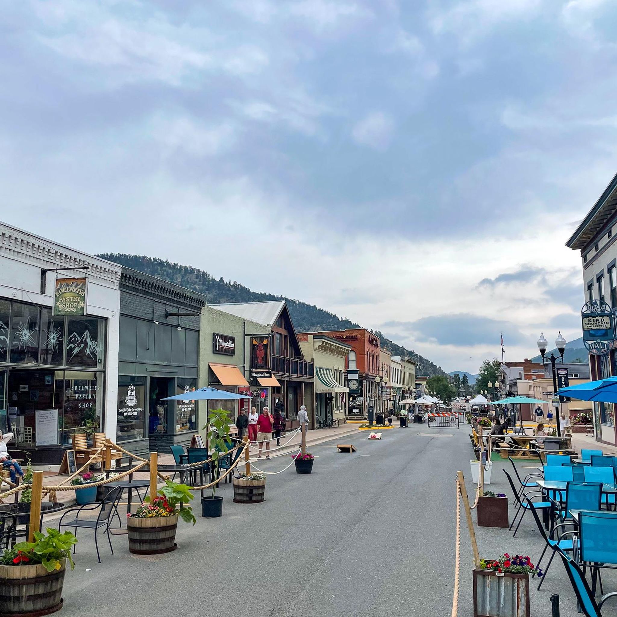
Idaho Springs, Colorado, is a small former mining town just off of I-70. This is a great place for hikers, cyclists, and trail runners to start or end an outdoor adventure; with its blend of history, local shops and restaurants, and natural beauty this is a must-stop for anyone visiting Colorado.
0
0

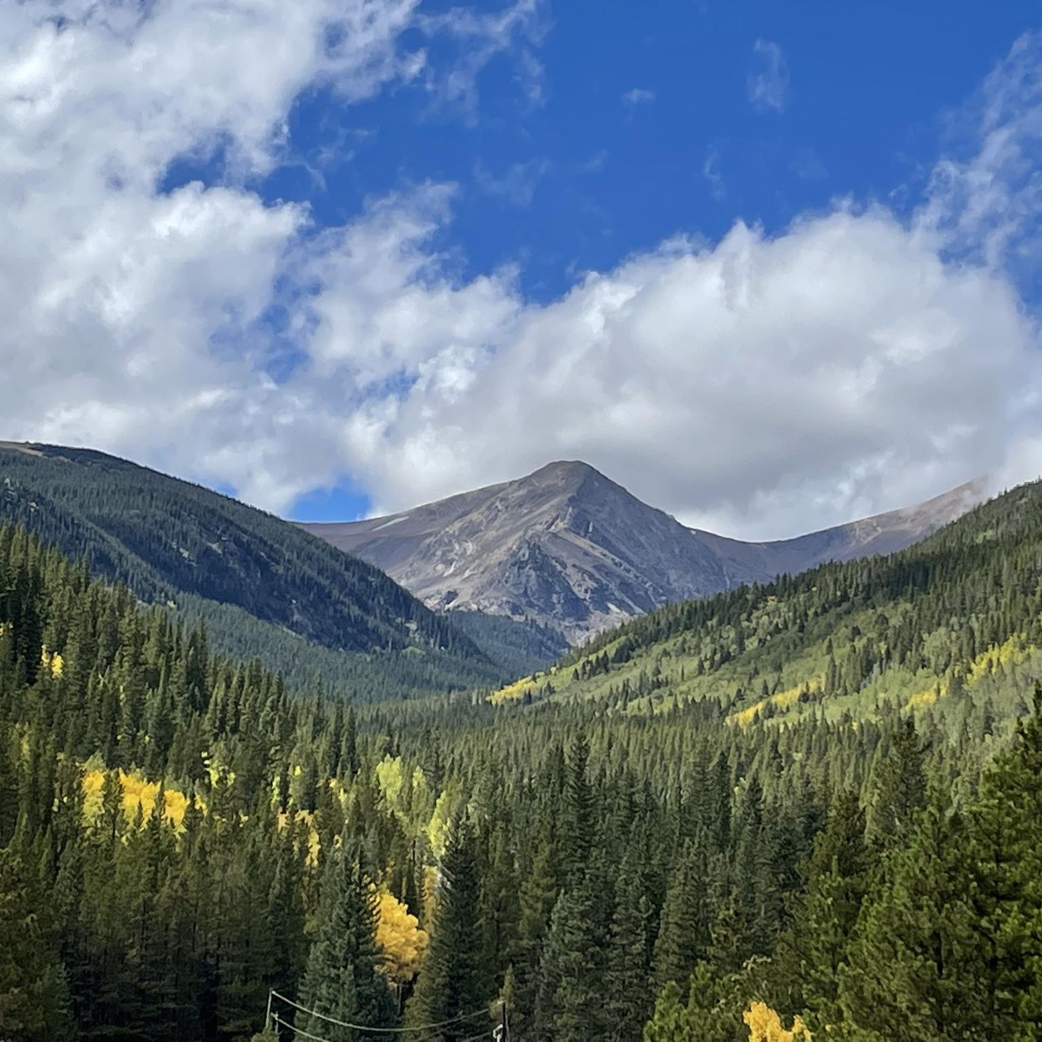
Mestaa'Ėhehe Pass (formerally Squ*w Pass) Summit is located at just over 9,800 feet. This is a popular area for cyclists in the summer time as the temperatures are significantly cooler than in Denver. This also marks the spot where most typically finish the bulk of their climbing. If you are heading back to Idaho Springs or Denver, it's mostly downhill with some great descending.
0
0

Maryland Mountain is a popular spot for running, hiking and mountain biking near Central City. There are several miles of trails for visitors to choose from. Some trails are bikes only and others are foot traffic only, so make sure you keep your eye out for signs if you are unsure who can be on the trail.
0
0

With Bridal Veil Falls in the background, the Charlie Taylor Waterwheel is a spectacle in off the side of the main paved bike path in Idaho Springs, Colorado. It's easy to find parking less than half a mile from the wheel, and there are informational signs at the viewing area.
0
0
There is a cool, older steam engine that used to work on the nearby Narrow Gauge Railroad. The engine first ran in the 1880s and helped supply the canyon with supplies and helping hands during the mining boom.
0
0
The Mestaa'Ėhehe Pass (formerly Squ*w Pass) Summit is located at just over 9,800 feet. This is a popular area for cyclists in the summer time as the temperatures are significantly cooler than in Denver. This also marks the spot where most typically finish the bulk of their climbing. If you are heading back to Idaho Springs or Denver, it's mostly downhill with some great descending.
0
0
Maryland Mountain is the 9,200-foot summit in the middle of Central City, Colorado. There are several miles of maintained singletrack biking and hiking trails that intertwine while climbing to the viewpoint at the top of the mountain. Some of the trails are designated as "foot traffic only" and other trails as "bikes only". These trails are well-marked and easy to follow.
0
0
Frequently Asked Questions
What kind of mountain bike trails can I expect in the Downieville-Lawson-Dumont area?
The Downieville-Lawson-Dumont area, located in Clear Creek County, Colorado, offers mountain bike trails that often feature significant elevation changes and varied terrain. You'll find routes that traverse historical mining areas and provide access to natural features within the Arapaho National Forest.
Are there any difficult mountain bike routes for experienced riders?
Yes, the area is well-suited for experienced mountain bikers. Most of the routes in this guide are rated as difficult, offering challenging climbs and descents. For example, consider the Winnebago Hill – Bates Hill loop from Nevadaville or the Idaho Springs – Mestaa'Ėhehe Pass Summit loop from Idaho Springs, both providing substantial challenges.
What are the best times of year for mountain biking in Downieville-Lawson-Dumont?
The best time for mountain biking in this Colorado region is typically during the warmer months, from late spring through early autumn. This avoids heavy snow cover and ensures more favorable trail conditions. Always check local weather and trail reports before heading out, as conditions can change rapidly in the mountains.
Are there any circular mountain bike routes in the area?
Yes, several routes in the Downieville-Lawson-Dumont area are designed as loops, allowing you to start and finish in the same location. Examples include the challenging Winnebago Hill – Bates Hill loop from Nevadaville and the Idaho Springs – Historical engines loop from Idaho Springs.
What kind of natural features or landmarks can I see along the mountain bike trails?
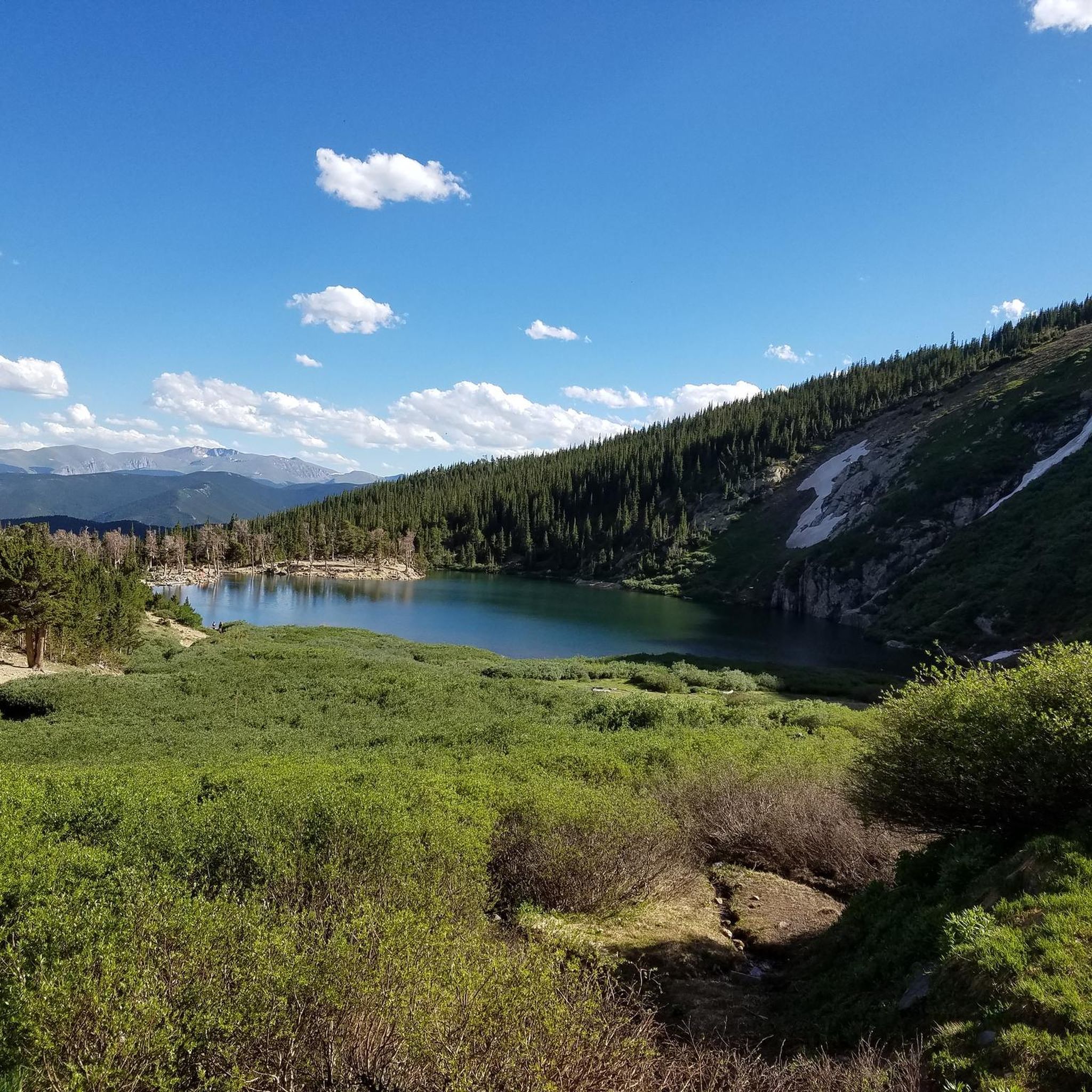
The trails in this region offer access to various natural and historical points of interest. You might encounter features like Saint Mary's Lake, explore former mining towns, or enjoy views within the Arapaho National Forest. Notable attractions include Saint Mary's Snowfield and the historic town of Idaho Springs.
Are there any family-friendly mountain bike trails in Downieville-Lawson-Dumont?
While many routes in this guide are rated as difficult, the broader Clear Creek County area offers diverse outdoor recreation. For family-friendly options, it's best to look for trails specifically designated as easy or moderate, which may be found outside the most challenging routes highlighted here. Always check the difficulty rating and elevation profile before setting out with family.
What do other mountain bikers enjoy most about the Downieville-Lawson-Dumont area?
The area is highly rated by the komoot community, with an average score of 4.7 stars. Riders often praise the challenging terrain, the scenic views of the Colorado mountains, and the sense of adventure found on trails that traverse historical landscapes.
Is public transport available to reach the trailheads?
Public transport options directly to specific mountain bike trailheads in the Downieville-Lawson-Dumont area can be limited. It is generally recommended to use a personal vehicle for convenient access to most starting points, especially for routes that begin further from towns like Idaho Springs.
Where can I find parking for mountain bike trails?
Parking is typically available at or near the designated trailheads in the Downieville-Lawson-Dumont area. For routes starting from towns like Idaho Springs, you can usually find parking within the town or at specific access points for the trails. Always observe local parking regulations and signage.
Are dogs allowed on the mountain bike trails?
Many trails in the Arapaho National Forest and surrounding areas generally permit dogs, often requiring them to be on a leash. However, specific regulations can vary by trail and land management agency. It's always best to check the current rules for the particular trail you plan to ride to ensure it is dog-friendly.
What is the longest mountain bike route in this guide?
The longest route featured in this guide is the Idaho Springs – Mestaa'Ėhehe Pass Summit loop from Idaho Springs, covering approximately 29.9 kilometers (18.6 miles) with over 1000 meters of elevation gain.
Most popular attractions around Downieville-Lawson-Dumont

Get inspired with the komoot mobile app


Explore more
Browse the best MTB trails in other regions.
