The best walks and hikes in Shannon County
13
hikers
6
hikes
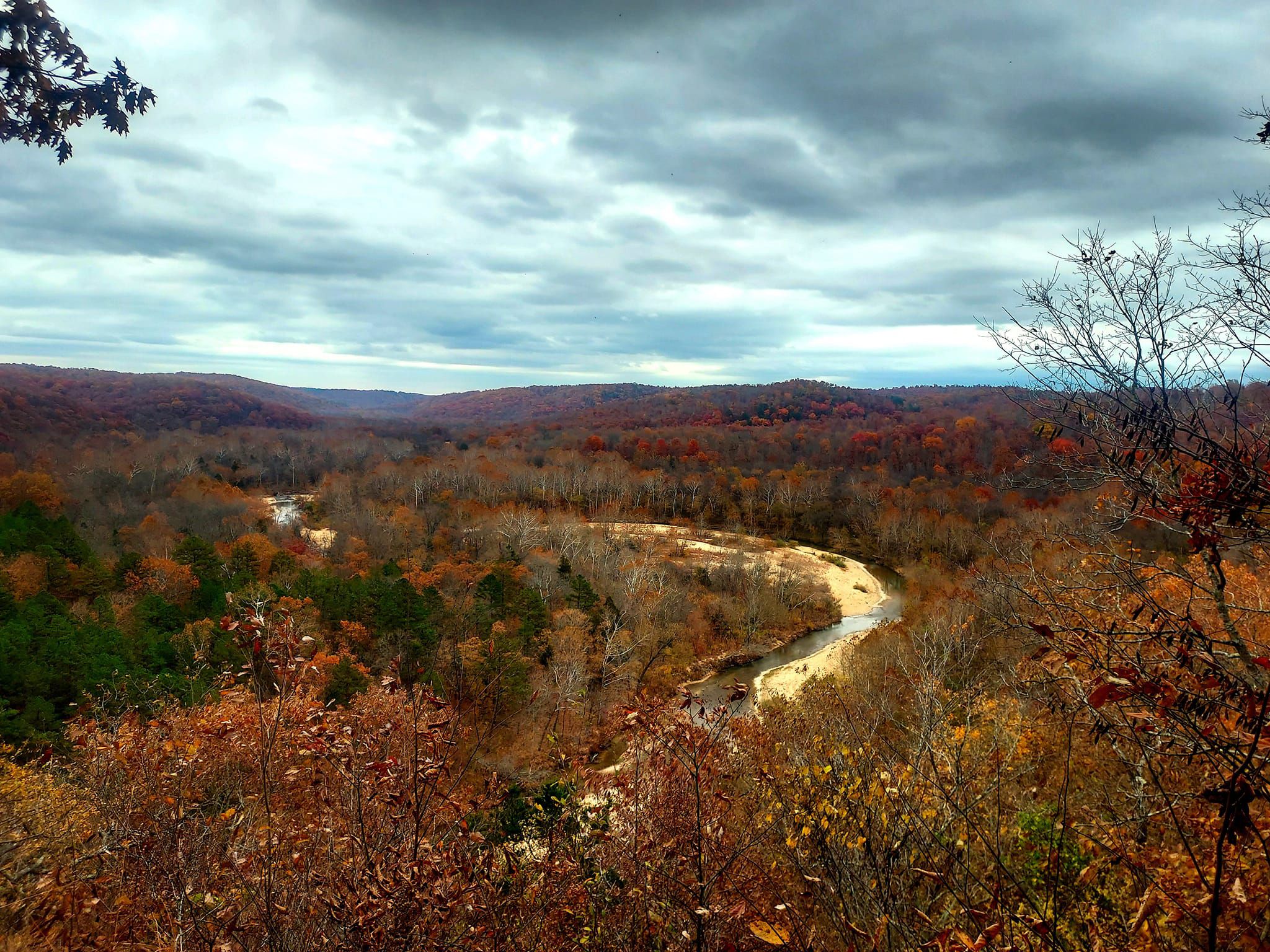
Popular hiking trails in Shannon County, Missouri, traverse the heart of the Ozark Mountains, offering diverse natural landscapes. The region is characterized by spring-fed rivers like the Current River, limestone bluffs, and dense oak-hickory forests. Hikers can explore areas within the Ozark National Scenic Riverways, which protects significant river systems and their surrounding terrain. This environment provides varied terrain for outdoor activities.
Best hiking trails in Shannon County
- The most popular hiking route is Powder Mills to Rocky Falls,…
Last updated: August 18, 2026
1
hikers
5.03km
01:21
50m
80m
Embark on an easy hike along the Rocky Falls and Klepzig Mill Trail, a 3.1-mile (5.0 km) route that guides you through diverse woodlands and open fields. You will gain…
1
hikers
16.8km
04:34
260m
210m
Embark on a moderate hiking adventure from Powder Mills to Rocky Falls, a journey spanning 10.5 miles (16.8 km) with an elevation gain of 844 feet (257 metres). This route…

Sign up for free
121km
33:11
1,870m
1,920m
The Current River Paddle Route: Cedar Grove to Round Spring offers a challenging hiking experience through varied landscapes. You will cover a significant 75.3 miles (121.3 km) with an elevation…
516m
00:08
10m
0m
Embark on an easy hike along the Blue Spring Trail, a short 0.3-mile (0.5 km) path that guides you through a lush bottomland riparian forest. You will gain a gentle…
8
hikers
7.80km
02:10
150m
150m
Embark on the Cave Spring Trail, a moderate hike spanning 4.8 miles (7.8 km) with an elevation gain of 478 feet (146 metres). You can expect to complete this loop…
3
hikers
10.00km
02:41
120m
120m
Embark on a moderate hike along the Ozark Trail: Current River Section, a 6.2-mile (10.0 km) route that takes about 2 hours and 40 minutes to complete. You will gain…
Our route recommendations are based on thousands of hikes, rides, and runs completed by other people on komoot.
Start today with a free account
Your next adventure awaits.
Login or Signup
Popular around Shannon County
Other adventures in Shannon County

Tips from the Community

A natural cascading waterfall that flows over molten rock that erupted to the surface 1.5 billion years ago. The falls expeience a heavy flow after it rains. The site is very popular and has bathrooms, picnic tables, and fire grills.
0
0
This is a small turbine mill built in 1928 by Walter Klepzig. The mill is located in a beautiful setting on Rocky Creek that is surrounded by a shut-in canyon that is formed by the rock in the creek.
0
0
This trails leads down to the Current River and the Cave Spring Cave. The spring rises into a large cave opening that goes to a vertical shaft 140 feet deep. Water from the Devils Well up the trail is a sourcce of the spring.
0
0
The Devil's Well is a sinkhole that opens into a large underground lake. There is a viewing platform located here where visitors can view the lake from a viewing platform. Water from here goes to Cave Spring which is down the trail from this location.
0
0
Frequently Asked Questions
What types of terrain can I expect on hiking trails in Shannon County?
Shannon County, nestled in the Missouri Ozark Mountains, offers diverse terrain. You'll find trails winding through lush oak-hickory forests, along crystal-clear spring-fed rivers like the Current and Jack's Fork, and ascending steep bluffs that provide dramatic vistas. Expect a mix of piney ridges, rocky hollows, and riverside paths, often showcasing karst features and natural springs.
Are there any easy, family-friendly hiking options in Shannon County?
Yes, Shannon County has several easy trails suitable for families. For instance, the Rocky Falls and Klepzig Mill Trail is an easy 5 km route that takes you to a beautiful cascading waterfall. Another very short and easy option is the Blue Spring Trail, a 500-meter path leading to the stunning Blue Spring. Many areas, like Echo Bluff State Park, also offer trails designed for various skill levels, often with amenities like picnic tables nearby.
Can I bring my dog on the hiking trails in Shannon County?
Many trails within Shannon County, especially those in the Ozark National Scenic Riverways and state parks, are dog-friendly. However, it's always best to check specific park or trail regulations before you go. Generally, dogs are welcome on leash, allowing you to explore the beautiful natural landscapes with your canine companion.
What are the best seasons for hiking in Shannon County?
Each season offers a unique experience in Shannon County. Spring brings vibrant wildflowers and comfortable temperatures. Fall is spectacular for foliage, with the oak and hickory forests turning brilliant colors. Summer is popular for combining hiking with river activities, though trails can be warm. Winter offers quiet, serene landscapes, often with fewer crowds, but be prepared for colder conditions.
Are there any trails that feature waterfalls in Shannon County?
Absolutely! Shannon County is home to beautiful waterfalls. The Rocky Falls and Klepzig Mill Trail leads to Rocky Falls, a natural cascading waterfall over ancient molten rock, which is particularly impressive after rain. You can also explore the area around Alley Spring, where the spring's outflow powers a historic grist mill, creating picturesque water features.
What interesting natural attractions or landmarks can I see along the trails?
Shannon County is rich in natural wonders. You can explore the famous Current River, known for its clear, spring-fed waters. Discover geological marvels like Round Spring and Alley Spring, or the unique Devil's Well sinkhole. The Cave Spring Trail leads to Cave Spring Cave, offering a glimpse into the region's karst topography. The Rocky Creek Conservation Area also provides immersive experiences in dense forests and rocky hollows.
Are there any long-distance or challenging hikes available?
Yes, for those seeking a challenge, Shannon County offers sections of the renowned Ozark Trail. The Ozark Trail: Current River Section is a moderate 10 km hike. The Ozark Trail: Blair Creek Section, though not directly in our guide, is a moderately challenging 27-mile stretch winding through the remote Roger Pryor Backcountry, offering stunning river views and old home sites. For a truly extensive adventure, the Current River Paddle Route: Cedar Grove to Round Spring is a difficult, multi-day route that combines hiking with paddling.
What kind of wildlife might I encounter while hiking?
Shannon County is rich in wildlife. Hikers often spot diverse flora and fauna in the dense oak-hickory and shortleaf pine forests. Keep an eye out for wild horses that roam near the Jack's Fork and Current Rivers within the Ozark National Scenic Riverways. Peck Ranch Conservation Area, a large preserve, is also home to wild turkey and reintroduced elk, offering unique viewing opportunities.
Is public transportation available to reach hiking trailheads in Shannon County?
Public transportation options to reach specific hiking trailheads within Shannon County are generally limited. Most visitors travel by private vehicle. It's advisable to plan your trip with a car to access the various state parks, conservation areas, and remote trail sections effectively.
Where can I find parking for hiking trails in Shannon County?
Parking is typically available at the trailheads of most designated hiking areas, including state parks like Current River State Park and Echo Bluff State Park, as well as conservation areas such as Rocky Creek Conservation Area. Always check specific park or trail information for detailed parking instructions and any potential fees before your visit.
What is the longest hiking trail featured in this guide?
The longest route in this guide is the Current River Paddle Route: Cedar Grove to Round Spring, which spans over 121 kilometers. While primarily a paddle route, it offers extensive hiking opportunities along its course and is classified as difficult due to its length and elevation changes.
Are there any moderate difficulty trails for a good day hike?
Yes, there are several moderate trails perfect for a day hike. The Powder Mills to Rocky Falls route is a moderate 16.8 km hike. Another excellent option is the Cave Spring Trail, a 7.8 km moderate loop, or the Ozark Trail: Current River Section, which is a 10 km moderate hike.
Most popular routes in Shannon County
Most popular attractions in Shannon County

Get inspired with the komoot mobile app


Explore more
Browse the best Hikes in other regions.
