Top 20 Bike Parks around Wattendorf
Best bike parks around Wattendorf are characterized by natural mountain biking trails rather than constructed features. The region, located in Oberfranken, Germany, offers diverse landscapes with forests and valleys, providing varied terrain for cyclists. Many Wattendorf mountain bike routes feature natural singletracks with technical difficulty ratings ranging from S0 to S2, with some longer routes including more challenging S3-S6 sections. This area is suitable for those seeking to explore natural environments on two wheels.
Best bike parks around Wattendorf
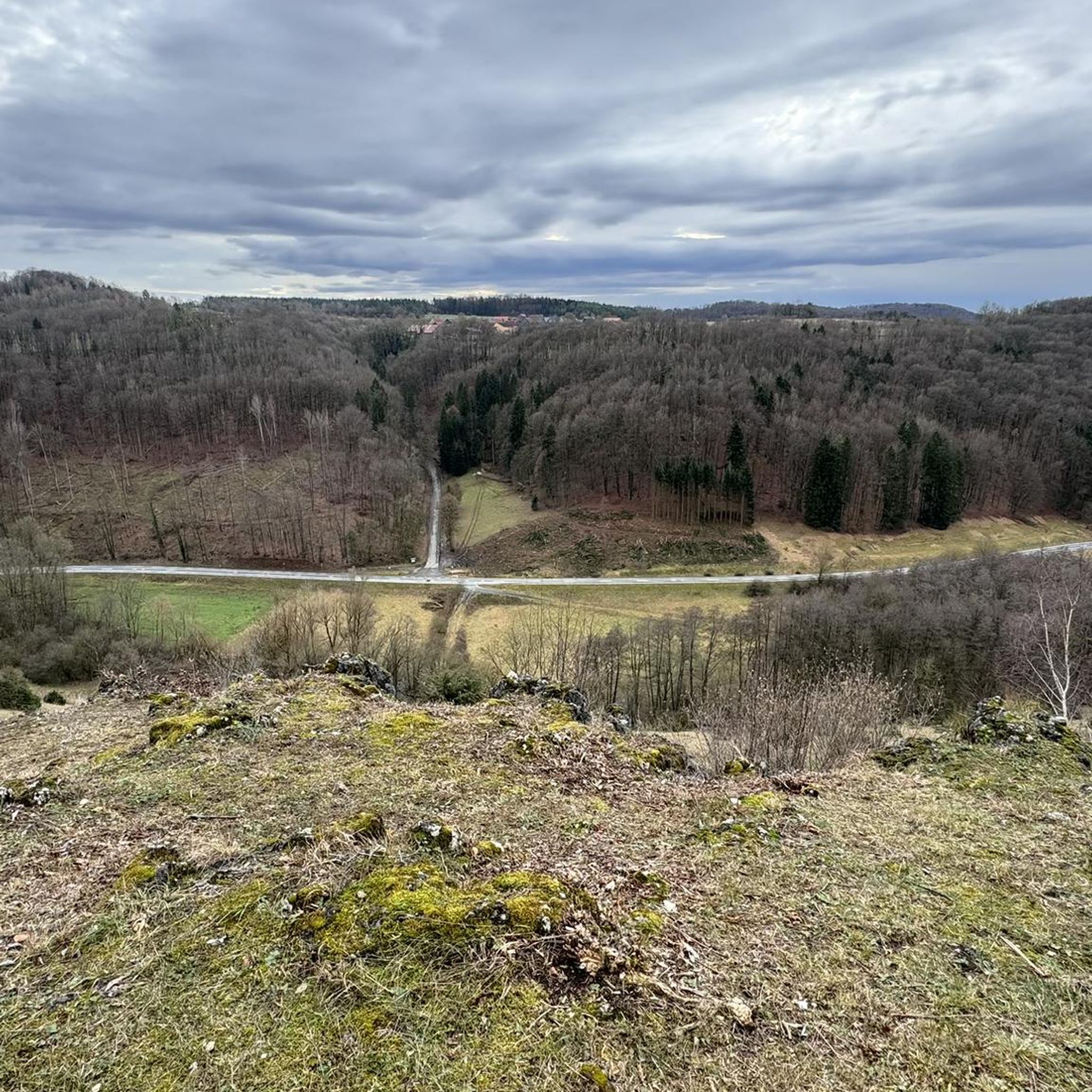
- The most popular bike parks is Klosterlangheim Forest Singletrail, a trail that offers a great singletrack experience. This nearly 2 km long downhill trail has a difficulty of S1.
- Another must-see spot is Lichtenfels All-Mountain Trail, a downhill trail. Visitors can expect a 2 km long downhill trail to Lichtenfels, where the difficulty is manageable.
- Visitors also love Z-Line Schwabtal Trail, an mtb_park. This trail can be ridden in both directions and is rated S0 to S1 due to some hairpin bends.
- Wattendorf is known for natural trails and singletracks. The area provides a variety of mountain biking experiences, from easy paths to more demanding routes with varying technical difficulties.
- The bike parks around Wattendorf are appreciated by the komoot community, with more than 170 upvotes and over 50 photos shared by users.
Last updated: July 8, 2026
Klosterlangheim Forest Singletrail
Highlight (Segment) • Trail
Translated by Google •
Tip by

Singletrack to Oberlangheim
Highlight (Segment) • Trail
The difficulty is S0, with moisture / rain increases the difficulty as several roots cross and the soil is irregularly occupied by small stones.
Translated by Google •
Tip by

Sign up now to discover places like this
Get recommendations on the best single tracks, peaks, & plenty of other exciting outdoor places.
Sign up for free
Z-Line Schwabtal Trail
Highlight (Segment) • MTB Park
Actually S0. Only by some hairpin bends he gets the S0,5 to S1 designation.
As a fast downhill he conjures the driver a smile in the face. The switchbacks are very good with footrest drift. Here should not be exaggerated. Watch out for strollers and do not aggravate them. Of course, every curve can also be driven slowly. Keep your balance and look into the curve. Where you watch, you go too! ;O)
As an uphill, the trail runs with a moderate but power-consuming slope. Goes well as a Kondi workout.
Translated by Google •
Tip by

Stammberg Flow Trail
Highlight (Segment) • MTB Park
Translated by Google •
Tip by

Zillertal
Highlight (Segment) • Gorge
Translated by Google •
Tip by
Sign up for free to discover even more bike parks around Wattendorf.
Sign up for free
Already have an account?
Start today with a free account
Your next adventure awaits.
Login or Signup

Tips from the Community


non-technical section.
0
0

Always nice to drive in wet and dry conditions, uphill as well as downhill. Few rooty sections where you have to be careful when wet.
0
0


This trail is perfect for switchback exercises. It's a lot of fun no matter how you drive it.
0
0
Frequently Asked Questions
What kind of mountain biking trails can I expect around Wattendorf?
The Wattendorf area is known for its natural mountain biking trails and singletracks, rather than constructed bike park features. You'll find diverse landscapes with forests and valleys, offering a variety of terrain for cyclists. Many routes feature natural singletracks with technical difficulty ratings from S0 to S2, with some longer routes including more challenging S3-S6 sections.
What are some recommended mountain biking trails for different skill levels?
For those seeking a great singletrack experience, the Klosterlangheim Forest Singletrail is a nearly 2 km long downhill trail rated S1. The Lichtenfels All-Mountain Trail offers a 2 km downhill ride with manageable difficulty. For practicing curves and hairpin bends, the Z-Line Schwabtal Trail is rated S0 to S1 and can be ridden in both directions.
Are there trails suitable for beginners or those looking for an easier ride?
Yes, trails like the Z-Line Schwabtal Trail are generally rated S0, making them suitable for beginners, though some hairpin bends might elevate sections to S1. The Singletrack to Oberlangheim is also rated S0, offering a liquid singletrack experience, though moisture can increase its difficulty due to roots.
What about more challenging or advanced mountain biking options?
While many trails are S0-S2, some longer mountain bike routes in the region can include more challenging sections rated S3-S6 on the Single Track Scale. These sections may require advanced riding skills or even pushing your bike over obstacles. The Kuhleutner Cliff – Kaiserbach Valley loop, for instance, offers sections that require advanced skills.
What do visitors enjoy most about the mountain biking trails around Wattendorf?
Visitors appreciate the natural singletrack experiences and the flow of the trails. Many highlight the fun, manageable difficulty, and the opportunity to pick up speed. Trails like the Z-Line Schwabtal Trail are praised for being great for practicing curves and hairpin bends, while others enjoy the scenic forest settings.
Are there any specific viewpoints or scenic spots along the bike trails?
While specific viewpoints aren't detailed for every trail, the region's diverse landscapes with forests and valleys inherently offer scenic beauty. The Kuhleutner Cliff – Kaiserbach Valley loop is noted for its scenic mountain bike ride. The Z-Line Schwabtal Trail also features a weather protection and break pavilion in its upper third, offering a spot to rest and enjoy the surroundings.
What other outdoor activities can I do near the bike parks around Wattendorf?
Beyond mountain biking, the Wattendorf area offers a variety of outdoor activities. You can explore numerous cycling routes, such as the challenging "View of Kloster Banz – Old Town Bamberg loop from Bojendorf" or the moderate "Krögelhof Self-Service Hut – Hohler Stein rock formation loop from Kümmersreuth". There are also many hiking opportunities, including the "Wayside shrine at Kemitzenstein – Kemitzenstein loop from Wattendorf" or the "Water Cascades Near Burglesau – Burglesauer Wand climbing crag loop from Gräfenhäusling". For more details, check out the Cycling around Wattendorf and Hiking around Wattendorf guides.
Are there dedicated hiking trails near the mountain biking areas?
Yes, there are several hiking trails available. For example, you can find moderate hikes like the "Wayside shrine at Kemitzenstein – Kemitzenstein loop from Wattendorf" (9.07 km) or the "Dremel Brewery & Inn – Brewery Hübner loop from Wattendorf" (9.44 km). An easier option is the "Wattendorf hiking car park – Wayside Cross loop from Wattendorf" (5.75 km). You can find more hiking options in the Hiking around Wattendorf guide.
Can I find gravel biking routes in the Wattendorf region?
Yes, the area around Wattendorf also offers gravel biking opportunities. Routes like the "Weißer Lahma Dry Grassland – Küpser Linde loop from Kleukheim" and the "Burglesauer Valley – Längerstein rock formation loop from Kleinziegenfeld" are available, often featuring challenging terrain. More information can be found in the Gravel biking around Wattendorf guide.
What is the best time to visit Wattendorf for mountain biking?
While specific seasonal recommendations aren't provided, mountain biking in natural trail areas like Wattendorf is generally best during spring, summer, and autumn months when the weather is milder and trails are less likely to be muddy or covered in snow. Always check local weather conditions before heading out, especially since wet conditions can increase the difficulty of some trails due to roots and soil.
Are there any circular mountain bike routes in the area?
Yes, the region offers various loops for mountain biking. Examples from the broader area include the "Kuhleutner Cliff – Kaiserbach Valley loop from Bojendorf" and the "Source of the Wiesent – Aufseß Spring loop from Gräfenhäusling," which provide diverse terrain and varying lengths for a complete ride.
Is there a trail that is good for practicing specific biking techniques?
The Z-Line Schwabtal Trail is highly recommended for practicing curves and hairpin bends. Its S0-S1 rating makes it accessible, and riders can choose to tackle the switchbacks slowly or with a footrest drift, making it versatile for skill development.
Most popular routes around Wattendorf
Most popular attractions around Wattendorf

Get inspired with the komoot mobile app


Explore more
Still looking for your perfect bike park? Check out our guides in these places:
