Top 20 Natural Monuments in El Dorado County
Best natural monuments in El Dorado County are found within California's Sierra Nevada, featuring diverse landscapes from high alpine wilderness to forested canyons. This region offers numerous opportunities for outdoor adventure and connection with nature. The county encompasses federally protected areas like Desolation Wilderness and parts of El Dorado National Forest, providing varied ecosystems and geological formations. These sites are worth visiting for their scenic beauty and recreational activities.
Best natural monuments in El Dorado County
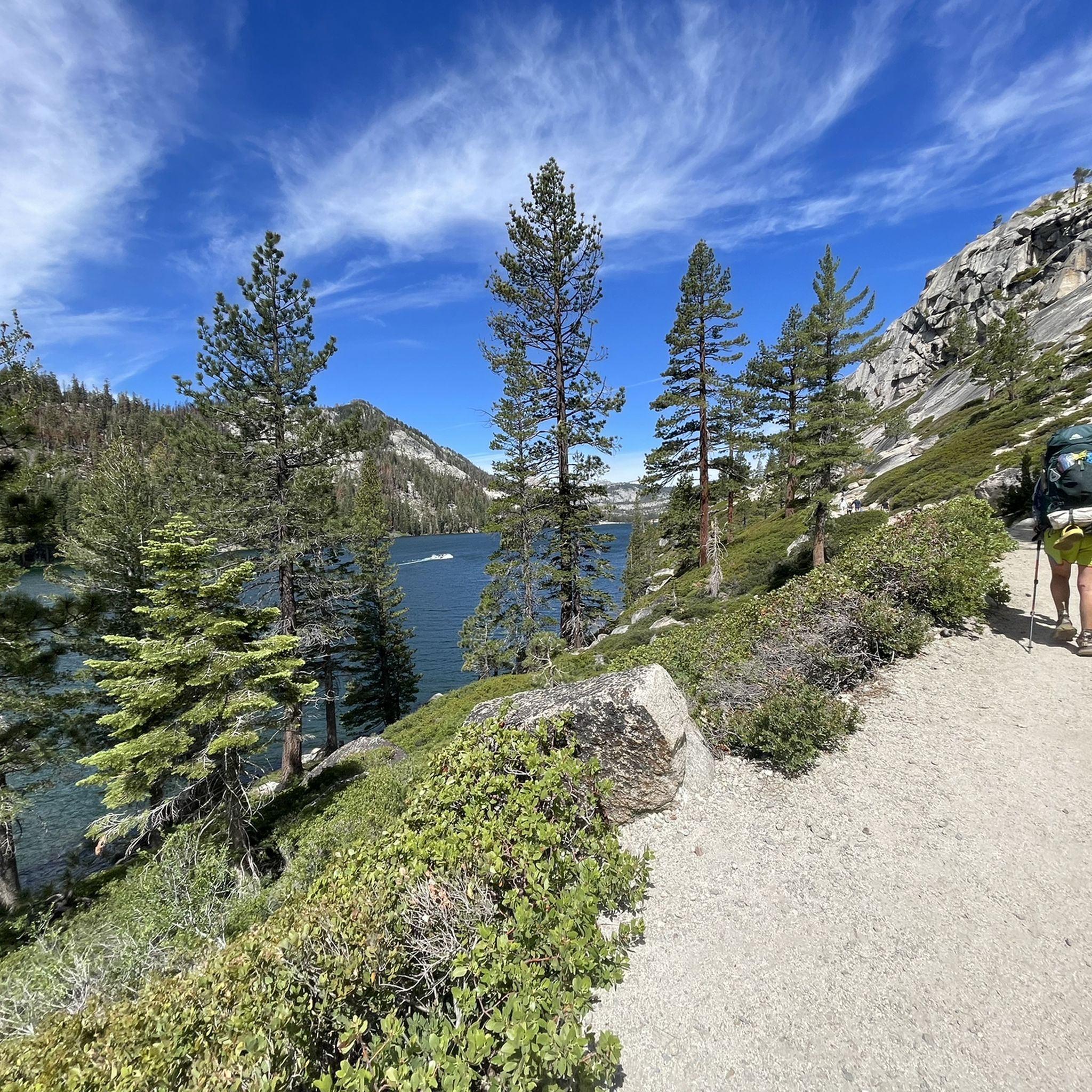
- The most popular natural monuments is Eagle Lake (Desolation Wilderness), a lake that is about 5 miles into Desolation Wilderness from the Eagle Falls trailhead. It offers forested shorelines with secluded campsites and fishing opportunities.
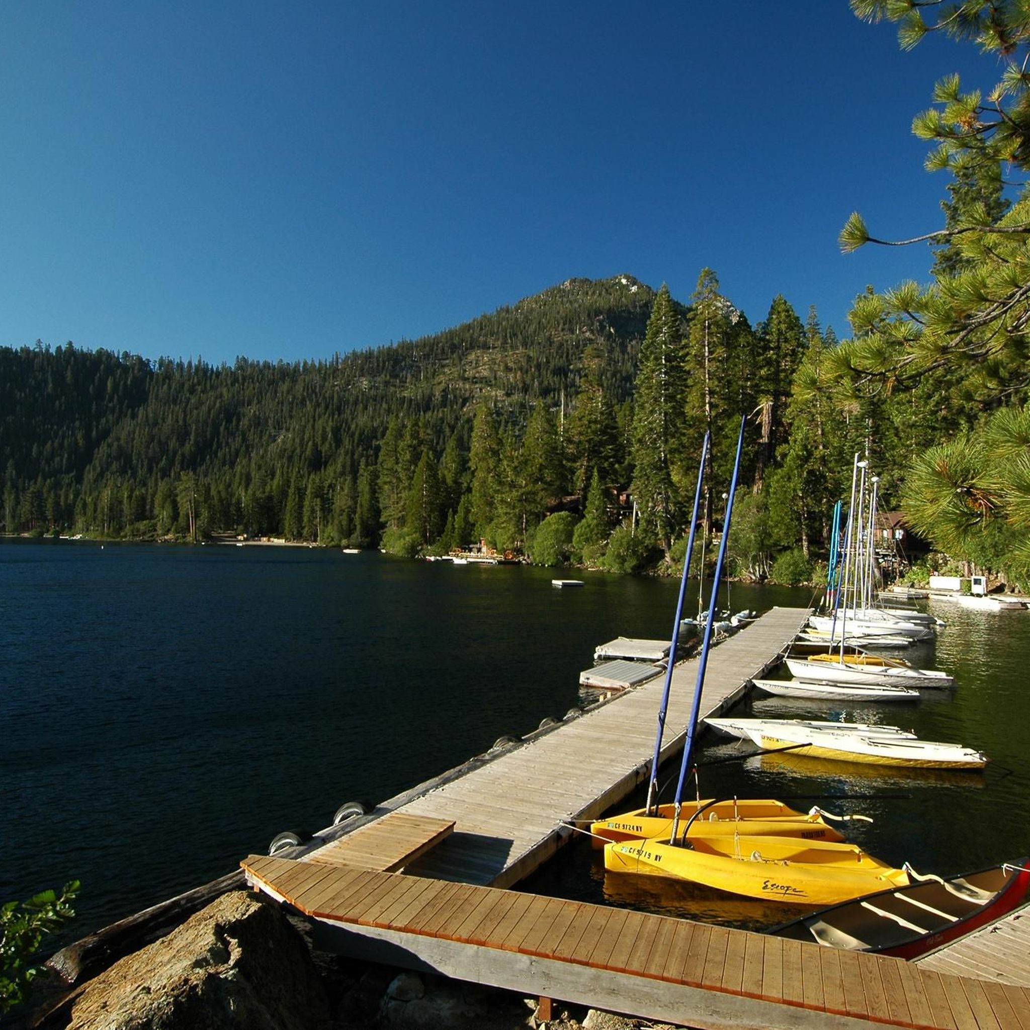
- Another must-see spot is Emerald Bay, a lake renowned for its vibrant emerald-green waters and Fannette Island. Visitors can explore the island, tour Vikingsholm Castle, and hike the Rubicon Trail along the bay's edge.
- Visitors also love Granite Lake, a lake located at the base of Maggies Peaks. It offers beautiful views and is a popular spot for a swim after a hike.
- El Dorado County is known for its lakes, waterfalls, and summits. The region offers a variety of natural monuments to see and explore, from alpine lakes to prominent peaks and cascading waterfalls.
- The natural monuments in El Dorado County are appreciated by the komoot community, with over 35 upvotes and 27 photos shared across the highlights.
Last updated: October 11, 2026
Eagle Lake (Desolation Wilderness)
Highlight • Lake
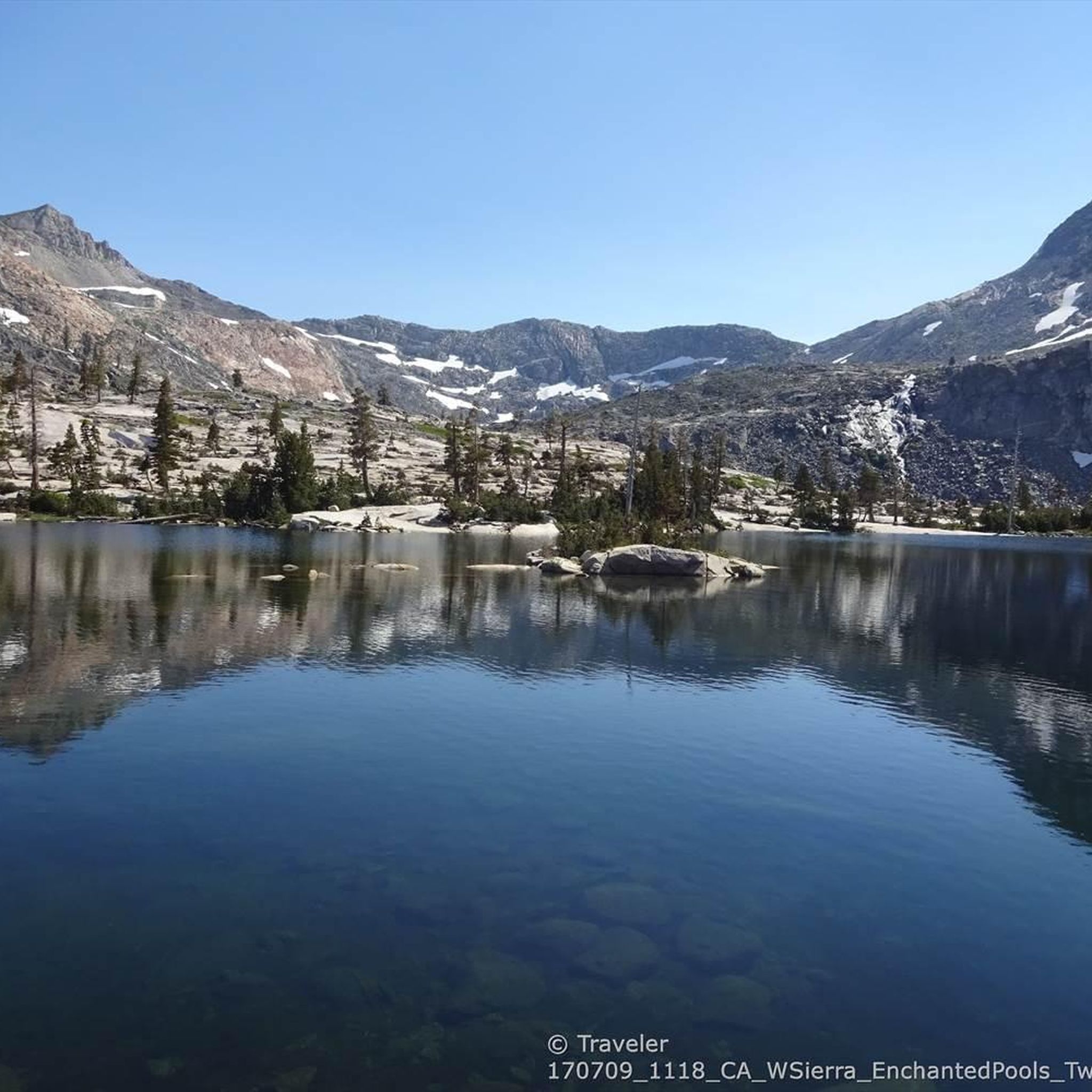
Dicks and Fontanillis lakes are separated by only about a third of a mile. Both lakes press up against 9,374-foot Dicks Peak. Nearby are the Velma Lakes, a cluster of 3 great fishing lakes that draw the majority of campers who come up the trail from Tahoe.
Eagle Falls Trailhead to Bayview Trail Junction, 2.7 miles
From the Eagle Falls trailhead the hike up to and across a bridge and then begin a steady climb. Stop half way up to catch a view of Emerald Bay. In less than a mile, a side trail splits off to Eagle Lake. Take the Velma Lakes trail.
Despite occasional dips and level spots, most of the hike is uphill, many parts of it with steps. After 2.7 miles arrive at a ridge top and an intersection with the Bayview trail.
Velma Lakes
Bayview Trail to Dicks Lake or Fontanillis Lake,
1.75 miles or 2.5 miles
Continue toward Velma Lakes for 0.7 miles until you spot a trail sign which points you toward Dicks Lake. The trail soon climbs again with switchbacks. Look for views of Velma Lakes to the north. After a mile you strike the Pacific Crest Trail. There, turn right, heading southwest. Very soon, where the trail loops back to the north, you will spy Dicks Lake off through the trees. Follow a short side trail to the lake. By continuing north on the main hiking trail for 0.75 miles you arrive at half-mile-long Fontanillis Lake. Both make excellent places to camp.
highsierratrails.com/fontanillis_dicks_lakes/trail.html
en.wikipedia.org/wiki/Desolation_Wilderness
Tip by

Granite Lake
Highlight • Lake
From the Bayview Trailhead (about 2100 m) head northwest from the trailhead sign board. The trail will climb steeply the entire way. You will pass a great viewpoint for views of Emerald Bay before reaching Granite Lake. The trail continues to climb after Granite Lake before reaching the ridge crest giving you a view of Eagle lake off the back side. To summit South Maggies Peak continue on the trail a short 100 yards after reaching the ridge and then turn off trail and scramble up the back side of the peak. There is a faint trail but its hard to find from the trail and can be found for the return trip off the summit.
You can create a loop hike by combining this hike with Eagle Falls and Eagle Lake. Once you reach the ridge just below South Maggies peak. Continue up the trail along the ridge. At the next trail junction turn right onto the Eagle Falls Trail.
A wilderness permit is needed to hike to both Granite Lake and Maggies Peaks. Wilderness permits are available for free at the trailhead.
How to get there:
From South Lake Tahoe: head north on highway 89 for 7.5 miles. Turn left into Bayview Campground opposite Inspiration Point which is the scenic overlook located one mile before you get to Emerald Bay. A wooden sign points right to the trailhead on the backside of the campground.
From Tahoe City: head south on highway 89 for 19.5 miles. Turn right into Bayview Campground opposite Inspiration Point which is the scenic overlook located one mile before you get to Emerald Bay. A wooden sign points right to the trailhead on the backside of the campground.
trailwiki.org/wiki/Granite_Lake_and_Maggies_Peaks
Tip by
Sign up now to discover places like this
Get recommendations on the best single tracks, peaks, & plenty of other exciting outdoor places.
Cascade Falls Trailhead
Highlight • Waterfall
Tip by

Emerald Bay
Highlight • Lake
Tip by

Upper Eagle Falls
Highlight • Waterfall
Tip by

Mount Tallac Summit
Highlight • Summit
Tip by
Stunning Mountain Scenery
Highlight • Viewpoint
Tip by

Star Lake
Highlight • Lake
To experience the breathtaking sunset from here with a view of Lake Tahoe to the North-West either camp near Star Lake's shore or bring a strong light for the mountain bike ride back down Freel Peak Use Trail and Fountain Place Road.
Tip by
Bassi Falls
Highlight • Waterfall
From Hwy 50 about 20 miles east of Placerville, near Pollock Pines turn left (north) onto Ice House Rd (Forest Road 3). Drive 15.9 miles on Ice House Rd. to Union Valley Reservoir. Turn right onto an unmarked dirt road (Road 12N32A), just after crossing the bridge over Big Silver Creek (opposite Big Silver group camp). Drive 0.2 miles to a junction and turn left. Then drive either about half a mile to the Towering Rocks Trailhead, from where it is about 1.4 miles to the bottom of the falls, or continue driving the dirt road 1.5 miles to the trailhead at the end of the road (total 1.7 miles along the dirt road). From there a shorter trail is about 0.5 miles to the falls.
Tip by
Desolation Wilderness Entrance
Highlight • Trail
Worth it when the snow melts.
Translated by Google •
Tip by

Sign up for free to discover even more natural monuments in El Dorado County.
Already have an account?
Start today with a free account
Your next adventure awaits.
Popular around El Dorado County

Pacific Crest Trail from Mexico to Canada – 4,200 kilometres of wilderness

Tahoe Rim Trail — Hiking along the Jewel of the Sierra

California to Nevada – hiking between Volcanoes, Water & Forest

Circumnavigating Lake Tahoe in the Sierra Nevada – Tahoe Rim Trail

Unforgettable MTB Adventures – IMBA Epic Trails in USA and Canada
Hiking in El Dorado County
MTB Trails in El Dorado County
Road Cycling Routes in El Dorado County
Cycling in El Dorado County
Running Trails in El Dorado County
Other adventures in El Dorado County


Tips from the Community

During our hike in mid October, we couldn’t see the waterfall as it was almost dried up. Considering the height of the bridge it must look stunning after the raining season.
0
0

Hiking around Lake Tahoe's Emerald Bay offers amazing views of the bay's vibrant emerald-green waters, more vibrant than other parts of the lake due to its shallow depth. Visitors can explore Fannette Island, home to the remains of a teahouse, and tour the old 1929 Scandinavian-style Vikingsholm Castle. The Eagle Falls Trail provides a scenic 2-mile hike to Eagle Lake, while the Rubicon Trail hugs the bay’s edge with stunning lake views. Emerald Bay also has California's first maritime heritage trail, showcasing sunken ships and barges. Nearby, the Tallac Historic Site offers a glimpse into Lake Tahoe’s early 1900s history. This area has a ton to do, and hikers can easily spend the whole day exploring.
0
0

A stunning alpine lake surrounded by granite peaks, offering breathtaking scenery and a serene atmosphere. Enjoy the clarity of the lake, ideal for fishing, or simply admiring its beauty.
1
0

This backcountry gem is right on the path to and from Maggie's Peaks — a great opportunity to take a relaxing dip or just enjoy the beauty if you want to keep running past.
0
0

It is a very pretty alpine lake, nestled at the base of the three towering peaks of Freel Peak (3,305 meters), Jobs Sister (3,299 meters) and Jobs Peak (3,233 meters). If there is not too much wind, the rocks and trees that surround it are almost perfectly reflected in its waters. A nice spot!
0
0

Upper Eagle Falls is a 50-foot waterfall in Lake Tahoe Basin Management Unit. The falls are only a short distance to a parking lot, so it is very accessible. This also means that during high season, the falls can be very busy.
0
0

The powerful water cascading over the granite slabs is beautiful, creating many photo opportunities, especially in the afternoon when the sun hits the falls. You may even catch a rainbow if you're lucky. It is a fantastic place to take the whole family in the summer after the snow melts for the season. There are several deep, refreshing pools of water, making it a perfect spot for cooling off on a hot day.
1
1
This pretty, 50-foot waterfall is just a 5-minute walk or so from the Eagle Lake Trailhead — but as you might imagine, that gets pretty busy. If that trailhead is full, you can often find parking at the Vikingsholm Trailhead a little farther up the road.
0
0
Frequently Asked Questions
What are some lesser-known natural monuments in El Dorado County worth exploring?
Beyond the most popular spots, El Dorado County offers unique natural monuments like Bassi Falls, a magnificent 120-foot waterfall best visited during snowmelt in May. Another unique site is Grass Lake, which holds the distinction of being California's largest Sphagnum bog, offering diverse habitats for those interested in botany and wetland ecosystems. For a challenging high Sierra experience, consider Round Top, a prominent 10,380-foot granite spire known for its distinctive summit.
Are there family-friendly natural monuments in El Dorado County?
Yes, several natural monuments are suitable for families. Upper Eagle Falls is a very accessible 50-foot waterfall, just a short walk from the Eagle Lake Trailhead. Bassi Falls also offers a leisurely hike through a mixed-conifer forest, making it enjoyable for various ages. Emerald Bay, while not solely a natural monument, offers a combination of natural beauty and historical intrigue with opportunities for hiking and exploring its unique features, which can be engaging for families.
What kind of hiking trails can I find near El Dorado County's natural monuments?
El Dorado County offers a wide range of hiking experiences. For waterfall enthusiasts, you can explore routes like the Bayview and Eagle Lake Trail Loop or the shorter Eagle Trail Loop, both found in the waterfall hikes guide. If you're looking for easier options, the easy hikes guide includes trails like the Echo Lakes Trail and Taylor Creek Loop. More challenging routes, such as those leading to Mount Tallac Summit or Pyramid Peak, offer rewarding views for experienced hikers.
What are the best natural monuments for panoramic views in El Dorado County?
For expansive vistas, consider the hike to Granite Lake. More ambitious hikers can continue to the ridge along Maggies Peak for 260-degree views of Lake Tahoe, Emerald Bay, Cascade Lake, and the Desolation Wilderness. Mount Tallac Summit and Pyramid Peak also offer challenging climbs with breathtaking high Sierra views.
Are permits required to visit certain natural monuments in El Dorado County?
Yes, permits are required for some areas, particularly within federally protected wilderness. For instance, day and overnight permits are necessary for exploring the Desolation Wilderness, which includes areas around Eagle Lake and Granite Lake. These permits are often available for free at trailheads, but it's always advisable to check specific requirements before your visit, especially for overnight stays.
What is the best time of year to visit the natural monuments in El Dorado County?
The best time to visit largely depends on the activity. Late spring through early fall (May to October) generally offers the most favorable weather for hiking and exploring high-elevation areas like the Desolation Wilderness. Waterfalls like Bassi Falls are most impressive during snowmelt in May. Winter brings opportunities for cross-country skiing in areas like Desolation Wilderness, but many trails may be snow-covered and require specialized gear.
What other outdoor activities can I do near the natural monuments in El Dorado County?
Beyond hiking, El Dorado County offers diverse outdoor activities. You can find excellent gravel biking opportunities, with routes like the Marlette Flume and Tahoe Rim Trail Loop, as detailed in the gravel biking guide. The region's numerous lakes, including Eagle Lake and Star Lake, are popular for fishing and swimming. The Rubicon Trail, while famous for off-roading, also winds through beautiful natural landscapes, offering a unique way to experience the wilderness.
Are there any natural monuments in El Dorado County with historical significance?
While primarily natural, Emerald Bay stands out for its combination of natural beauty and historical intrigue. It features Fannette Island, which hosts the remains of a teahouse, and the Scandinavian-style Vikingsholm Castle. The area also boasts California's first maritime heritage trail with sunken ships, offering a glimpse into the region's past alongside its stunning natural features.
What do visitors enjoy most about the natural monuments in El Dorado County?
Visitors frequently praise the unparalleled scenic beauty, particularly the clarity of alpine lakes like Eagle Lake and the breathtaking views from high points like Maggies Peaks near Granite Lake. The opportunity for a refreshing swim after a long hike is also a common highlight. Many appreciate the serene atmosphere and the chance to connect with the raw and majestic wilderness of the Sierra Nevada.
Which natural monuments offer impressive waterfalls in El Dorado County?
El Dorado County is home to several beautiful waterfalls. Cascade Falls Trailhead leads to an impressive waterfall with beautiful scenery and rock outcroppings, a rewarding short hike. Upper Eagle Falls is another popular spot, known for its accessibility and picturesque 50-foot drop. For a grander scale, Bassi Falls offers a magnificent 120-foot cascade, particularly stunning during the spring snowmelt.
Can I find natural monuments that are suitable for beginner hikers?
Yes, there are options for beginner hikers. The trail to Upper Eagle Falls is a very short and accessible walk. The easy hikes guide for El Dorado County features trails like the Eagle Trail Loop and Echo Lakes Trail, which are generally less strenuous and suitable for those new to hiking or looking for a relaxed outing.
Most popular routes in El Dorado County
Most popular attractions in El Dorado County

Get inspired with the komoot mobile app


Didn’t find what you were looking for?
Find even more amazing natural monuments in El Dorado County by checking out the top Highlights region by region:
Explore more
Extend your search for the best caves by checking out these guides of the top ones in El Dorado County:
