Top 20 Natural Monuments around Lladorre
Best natural monuments around Lladorre are found within the Alt Pirineu Natural Park, a high-mountain landscape shaped by glacial activity. The region features a variety of natural monuments, including glacial lakes, towering peaks, and expansive plains. These natural features contribute to the area's diverse terrain, offering opportunities for exploration and outdoor activities. Lladorre's natural heritage is characterized by its pristine environment and significant geological formations.
Best natural monuments around Lladorre
- The most popular natural monuments is Agnès Pass, a…
Last updated: October 18, 2026
Col d'Agnes
Highlight • Mountain Pass
Translated by Google •
Tip by

Tristaina Solar Viewpoint
Highlight • Viewpoint
Translated by Google •
Tip by

Sign up now to discover places like this
Get recommendations on the best single tracks, peaks, & plenty of other exciting outdoor places.
Coma Pedrosa Summit
Highlight • Summit
Showing Translation
Tip by

Pica d'Estats
Highlight • Summit
Showing Translation
Tip by

Montcalm Peak
Highlight • Summit
Translated by Google •
Tip by
Sign up for free to discover even more natural monuments around Lladorre.
Already have an account?
Start today with a free account
Your next adventure awaits.
Popular around Lladorre

Haute Route Pyrénéenne – Pyrenees Crossing

On wild ridges: Catalonia to Ariège – Hexatrek, Eastern Pyrenees

Catalonia and Andorra on the Pyrenean Trail – GR 11
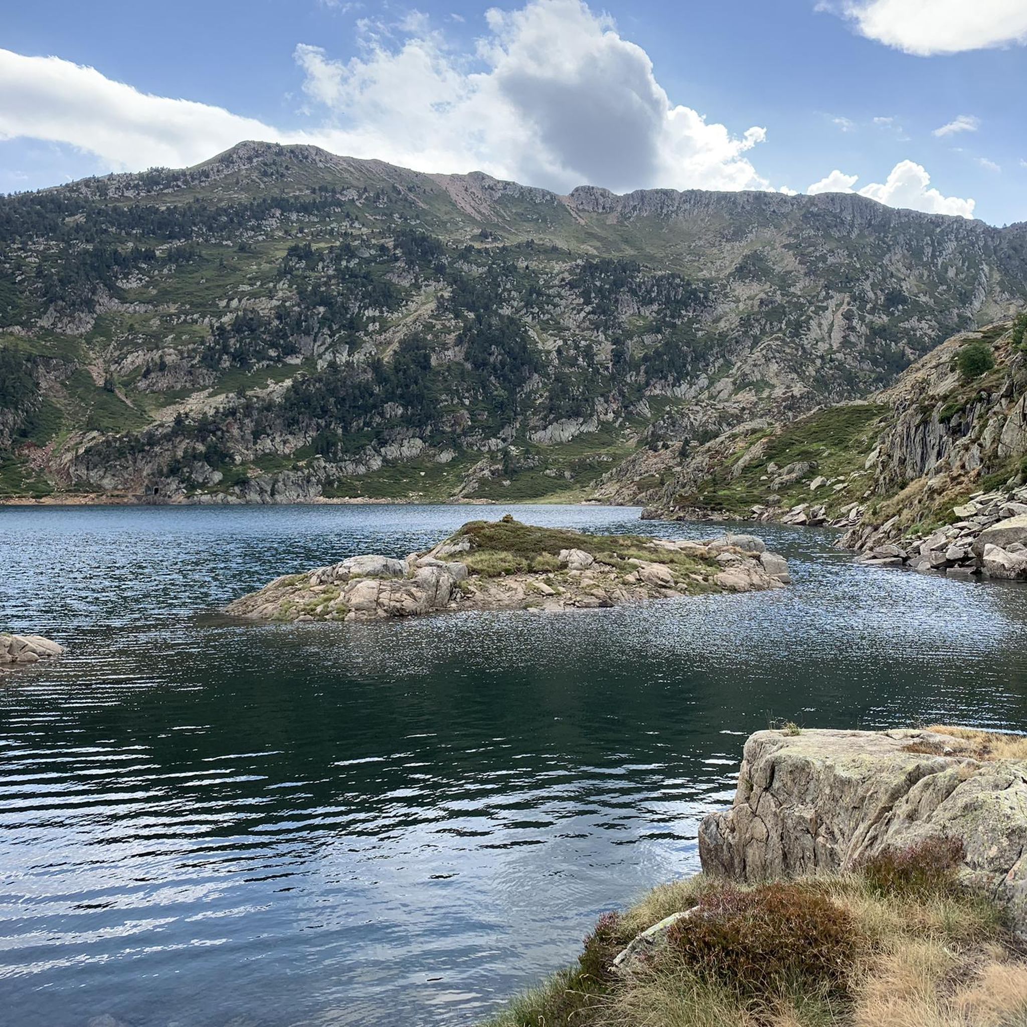
Hiking around Lladorre
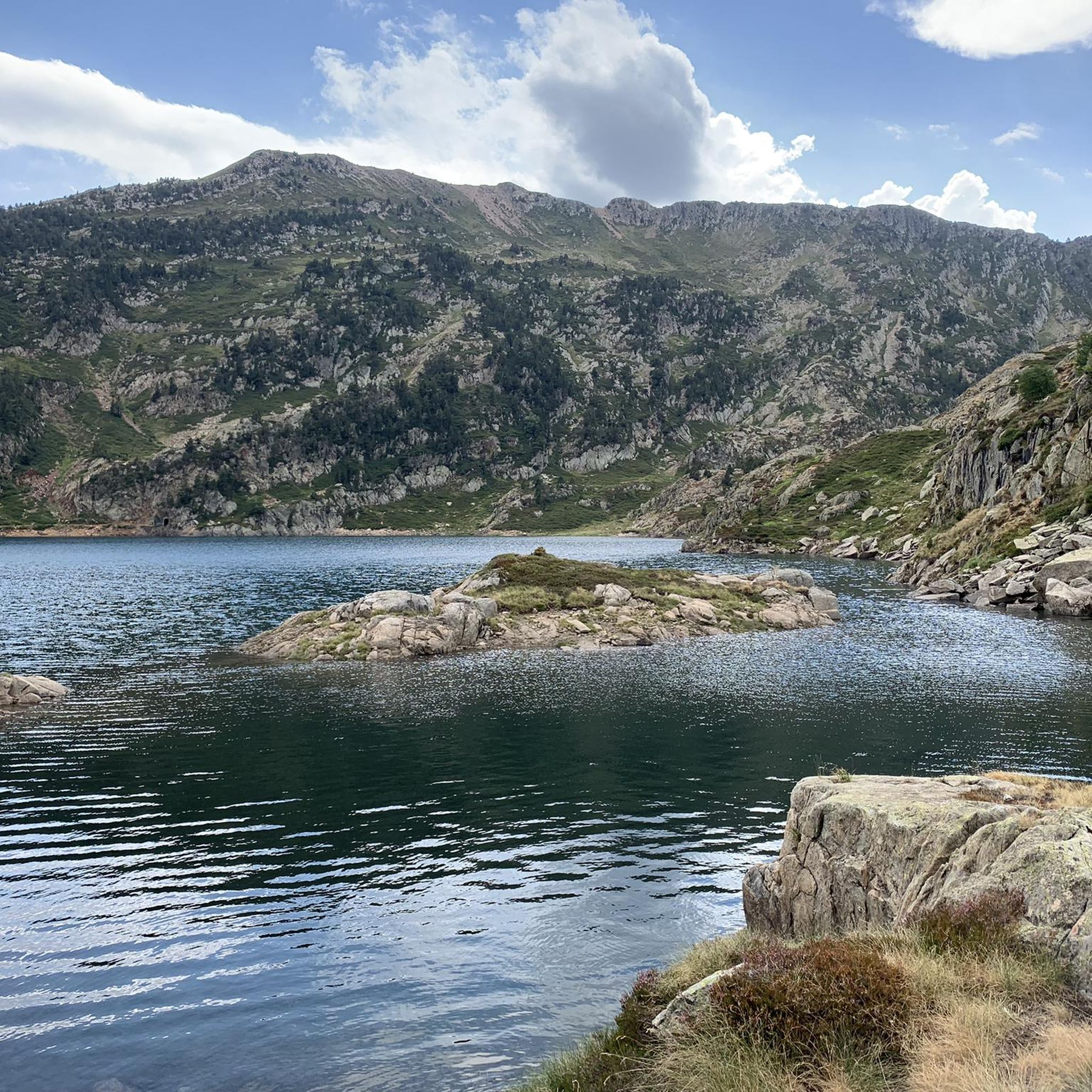
MTB Trails around Lladorre
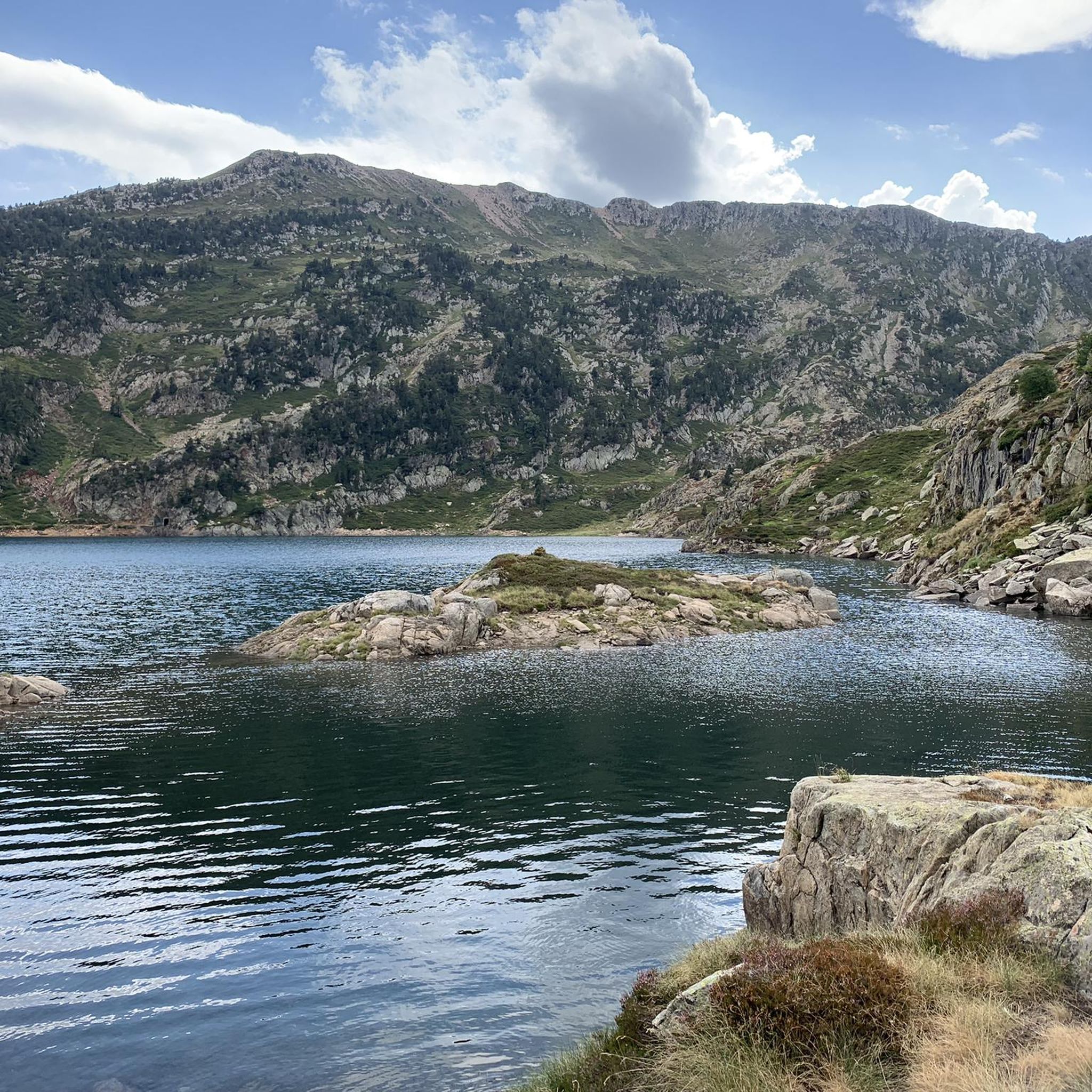
Road Cycling Routes around Lladorre
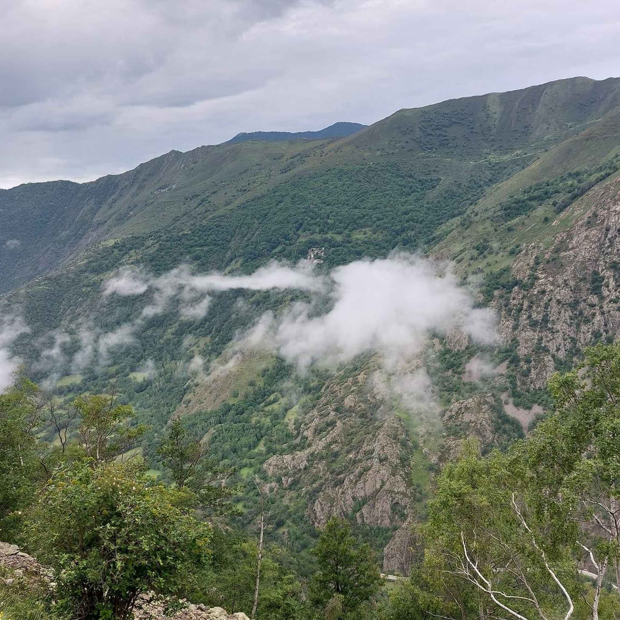
Running Trails around Lladorre
Cycling around Lladorre
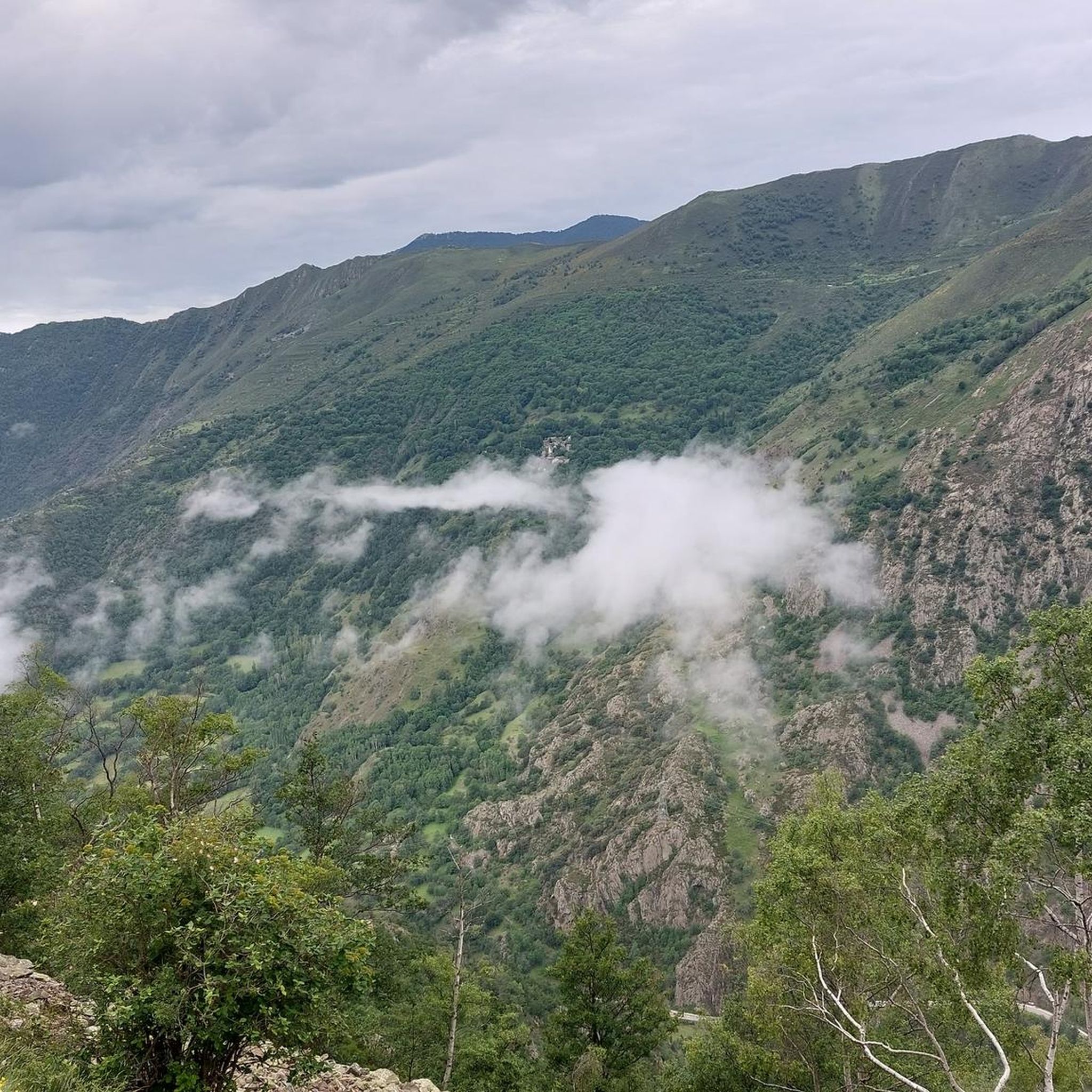
Mountain Hikes around Lladorre

Gravel biking around Lladorre


Tips from the Community

The highest peak in the Catalan Pyrenees is well worth the visit, although you have to earn it as it is a long route with considerable elevation gain to overcome.
0
1

Fantastic panoramic view all around, this summit is worth it, see my two panorama photos. Ascent from Estany de Sotllo via Pass. Took the partly exposed scrambling/climbing ridge via Pic Verdaguer. Nice scrambling, you just have to be careful to stay on the right track. Descent all around the summit, then to the same pass and down along the same beautiful mountain lakes and via Valferrera hut into the valley. The length and roughness of this path really surprised me. Luckily I didn't ascend from the hut. Especially the path along the mountainside, some way above the hut, was challenging. Again and again there are small counter-ascents over rocky tops and at some point I was on a side path below the main path, which then ended in bushes. After a short climb, everything went well again.
1
0

Solar viewpoint on the Peyraguils pass or summit, a metal structure that allows a 360° view of the valleys of the Andorran Pyrenees and the Aran Valley, with views of Aneto.
2
0

I think making this peak a highlight of my run is quite a challenge. Taking the easiest route via the Refuge de Pinet would be at least challenging mountain trail running. Inexperienced runners should definitely be aware of the altitude and terrain.
1
0
Here again: Someone is rating ALL photos of highlights in this region (Northwest Pyrenees) "not accurate," even though they accurately depict the location? Why does anyone need to do that? Is it jealousy? Does someone want to drag down others' "expert" ratings? How pathetic.
1
1
A well-known 3000-meter peak entirely on the French side, with a flat summit (and bivouac stone walls). There are four ascent routes: -from the east from the Étang de Soulcem (T4) -from the north via the Refuge du Pinet (T3+) -from the northeast (steep T4+ gully, dangerous in icy conditions) -from the Spanish side (south) with an easy intermediate descent (T3+) Designed as a "mountain hiking" highlight, as some tours go beyond simple "hiking." I combined the tour with the Sotllo (T4+).
3
0
I created the summit myself as a "highlight" for mountain hiking, as my chosen long loop, including the Pic de Sotllo, was a bit more challenging. The "normal route" via the Refuge de Pinet is technically easier and lacks any real climbing. However, I find the mountain hiking category more appropriate due to the altitude and terrain. Unfortunately, Komoot makes my highlight invisible to others on the map. As has happened with several of my previous highlights in other regions, where I marked the only point.
1
0
This 3000-meter peak on the French side of the Pyrenees' main ridge is relatively easy to reach via the Refuge de Pinet, but requires a significant elevation gain from the parking lot. Therefore, using the hut is recommended; it also has a room open in winter (€8 unattended). Another ascent from the northeast allows for a "crossing," but it has a steep gully (which, when icy, almost caused me a nasty fall in October 2014). A third ascent option leads from the east, from the reservoir, over the shared pass with the Pica d'Estats. Needless to say, there's a fantastic view from the summit. Only the view to the south is limited by the slightly higher Pica d'Estats, which is why hikers with good fitness and surefootedness are recommended to climb the latter from the shared pass.
2
0
Frequently Asked Questions
What are the most popular natural monuments to visit around Lladorre?
Visitors to Lladorre particularly enjoy the high-altitude experiences. Among the most popular natural monuments are Agnès Pass, known for its scenic beauty and views of the Etang de Lers, and the Tristaina Solar Viewpoint, which offers impressive panoramic views of the Arcalís Valley and the Pyrenees. For those seeking a challenge, Coma Pedrosa Summit, the highest peak in Andorra, provides expansive views in all directions.
What kind of natural features can I expect to see in Lladorre's natural monuments?
Lladorre's natural monuments are primarily characterized by a stunning high-mountain landscape shaped by glacial activity. You'll encounter majestic glacial lakes like Certascan Lake, the largest in the Pyrenees, and others such as Estanys de Mariola, Naorte, and Romedo. Towering peaks like Pica d'Estats and Montcalm Peak offer dramatic vistas, while the Boavi Plains provide expansive, gentler landscapes. The Tavascan and Noguera de Lladorre Rivers also add to the region's pristine natural beauty.
Are there challenging hiking opportunities among the natural monuments?
Yes, Lladorre offers numerous challenging hiking opportunities, especially to its high-altitude natural monuments. Summits like Coma Pedrosa Summit, Pica d'Estats, and Montcalm Peak require good physical resistance and expertise, often involving technical sections with sharp or loose rocks. The views from these peaks, however, are incredibly rewarding.
What is the best time of year to visit the natural monuments in Lladorre?
While the natural environment of Lladorre is suitable for visits throughout the year, spring and summer are generally recommended. During these seasons, the high-altitude areas are more accessible, and the weather conditions are more favorable for hiking and exploring the glacial lakes and mountain passes. Winter offers a different experience, with snow-covered landscapes, but requires specific gear and experience for winter hikes.
Are there any family-friendly natural monuments or activities in Lladorre?
While many of Lladorre's natural monuments involve challenging terrain, the region also offers options for families. The Boavi Plains (Pla de Boavi) are ideal for easier walks and enjoying the expansive natural beauty. Many of the glacial lakes, such as Estanys de Mariola, Naorte, and Romedo, can be accessed via less strenuous routes, offering serene beauty and opportunities for tranquil walks suitable for families.
Can I find viewpoints with panoramic scenery in Lladorre?
Absolutely. Lladorre is rich in viewpoints offering spectacular panoramic scenery. The Tristaina Solar Viewpoint is a prime example, providing extensive views of the Arcalís Valley and the surrounding Pyrenees. Additionally, mountain passes like Agnès Pass and the summits of Coma Pedrosa, Pica d'Estats, and Montcalm Peak all boast breathtaking vistas in every direction.
What outdoor activities can I do near the natural monuments in Lladorre?
The area around Lladorre's natural monuments is perfect for various outdoor activities. You can find extensive MTB trails, including difficult routes like 'Tavascán - Lago de Romedo - Pla de Boaví'. For road cyclists, there are scenic road cycling routes such as 'Valle de Àneu - Pyrenean villages'. Runners can explore challenging running trails, including 'Le Pic de Montcalm' or the 'Estany del Diable' loops.
Are there any natural monuments suitable for dog-friendly hikes?
Many areas within the Alt Pirineu Natural Park, where Lladorre's natural monuments are located, are generally dog-friendly. While specific restrictions might apply in certain protected zones or during specific seasons (e.g., nesting periods), you can typically find trails around glacial lakes and through the Boavi Plains that are suitable for hiking with dogs. Always ensure your dog is on a leash and check local regulations before heading out.
What are the unique geological features of the Lladorre region?
The Lladorre region is a testament to significant geological processes, primarily glacial activity. Its unique features include numerous glacial cirques, U-shaped valleys, and a multitude of pristine glacial lakes, with Certascan Lake being the largest in the Pyrenees. The towering peaks like Pica d'Estats and Montcalm Peak are part of the Montcalm massif, showcasing the rugged, high-altitude terrain characteristic of the Pyrenees.
Are there any permits required to hike to the natural monuments in Alt Pirineu Natural Park?
Generally, hiking within the Alt Pirineu Natural Park, which encompasses many of Lladorre's natural monuments, does not require specific permits for day hikes. However, for certain activities like overnight stays in designated areas, fishing, or accessing highly sensitive zones, permits might be necessary. It's always advisable to check with the park's official information center for the most current regulations before your visit, especially for multi-day treks or specific activities.
What do visitors enjoy most about the natural monuments around Lladorre?
Visitors consistently praise the breathtaking natural beauty and the sense of accomplishment offered by Lladorre's natural monuments. Many highlight the dramatic, almost alpine scenery around Certascan Lake, the expansive panoramic views from summits like Coma Pedrosa, and the serene beauty of the numerous glacial lakes. The challenging yet rewarding hikes and the pristine, untouched environment are frequently mentioned as major draws.
Can I find any waterfalls or rivers among the natural monuments?
Yes, the region is home to the Tavascan and Noguera de Lladorre Rivers, which are vital arteries flowing through the landscape. These rivers are known for their clear, cold waters and provide excellent opportunities for riverside walks and trout fishing. While specific named waterfalls are not highlighted, the high-mountain terrain and glacial activity mean that numerous cascades and smaller waterfalls can be encountered along river courses and hiking trails, especially during spring melt.
Most popular routes around Lladorre
Most popular attractions around Lladorre

Get inspired with the komoot mobile app


Explore more
Extend your search for the best caves by checking out these guides of the top ones around Lladorre:
