Top 5 Mountain Passes around Figueroles
Best mountain passes around Figueroles are found in a region characterized by its mountainous and Mediterranean landscape, with an average elevation of 360-370 meters above sea level. The area provides opportunities for exploring various heights and natural routes, making it suitable for hiking and nature enthusiasts. Numerous trails for walking and cycling allow visitors to appreciate the natural surroundings.
Best mountain passes around Figueroles
- The most popular mountain passes is Coll de la Bassa (Atzeneta Side), a mountain pass…
Last updated: July 1, 2026
Xodos / Chodos Pass (Atzeneta Side)
Highlight (Segment) • Mountain Pass
The port that goes up to Xodos/Chodos is one of the great colossi of the province of Castellón, with its more than 16 kilometers in length and almost 700 …
Translated by Google •
Tip by

Puerto El Remolcador
Highlight • Mountain Pass
Showing Translation
Tip by

Sign up now to discover places like this
Get recommendations on the best single tracks, peaks, & plenty of other exciting outdoor places.
Sign up for free
Coll de la Bassa (Atzeneta Side)
Highlight (Segment) • Mountain Pass
Leaving from Atzeneta in the direction of La Pelejaneta we find the Coll de la Bassa, a tack of only 2 km that culminates in the parched pond at …
Translated by Google •
Tip by
Coll de les Coronetes
Highlight • Mountain Pass
Translated by Google •
Tip by
Alto Mas de la Costa
Highlight (Segment) • Mountain Pass
Translated by Google •
Tip by

Start today with a free account
Your next adventure awaits.
Login or Signup

Tips from the Community

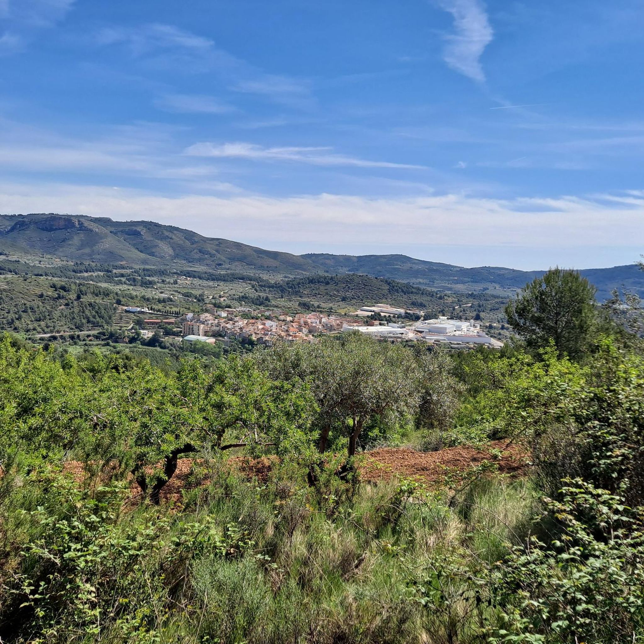
El Puerto El Remolcador is located deep in the mountains of Castellón. The ascent takes place with views of a spectacular landscape of limestone cliffs and with a marked rural character among dry orchards.
1
0

With an average slope of 12.4% to reach an altitude of 942 meters above sea level, it has undoubtedly earned the title of the hardest mountain pass in the province of Castellón. The surface from the road detour is concrete and can be quite rough in sections with a saw, so it is better to be careful, especially going down. Climbing to the Alto del Mas de la Costa is a tough and demanding challenge with the reward of spectacular views throughout the journey.
1
0

https://www.dandolotodo09.com/2018/07/puertos-la-bassa-por-atzeneta-apm-15.html Leaving from Atzeneta in the direction of La Pelejaneta we find the Coll de la Bassa, a tack of only 2 km that culminates in the parched pond at the top that gives the port its name. The road is fairly firm but with little shoulder for cyclists. With a single powerful ramp at 9% maximum slope. A classic on the way back from the Vistabella stage.
1
0
https://www.dandolotodo09.com/2021/09/puertos-xodos-chodos-por-atzeneta-apm.html The port that goes up to Xodos/Chodos is one of the great colossi of the province of Castellón, with its more than 16 kilometers in length and almost 700 meters of accumulated ascent. We have waited a long time to visit it, but the ascent was worth it. Our journey begins in the town of Atzeneta del Maestrat. Very wide asphalt road in perfect condition, a paradise for bikers who trace the curves as if they were on a circuit. Shadows there is not one. It is the port of the 5 peaks, which gives an idea of what breaks we do have during its ascent. Between peaks 2 and 3 we have 5 very constant kilometers, where the slope rarely drops below 6%. Speaking of slopes, the maximum is around 10-11% and is reached at various points in the port. Arriving at the town of Xodos, the landscape opens up and we can contemplate one of the most beautiful pictures of the province, with the town perched on a cliff and the Gegant de Pedra el Penyagolosa to its left. To reach the highest point (1,103 meters above sea level) you have to cross the town and climb almost 1 kilometer more along a narrower and somewhat rougher road. The other side of the port runs along the aforementioned road and ends at the beginning of the Port of Vistabella, which is now called Coll del Vidre on the plates.
0
0
Small ascent of 1.40 kms at the end of the CV-193 road that connects Argelita with Lucena del Cid. Full article: https://www.dandolotodo09.com/2018/09/puertos-coronetes-por-argelita-apm-17.html
0
0
altimetry of the Tugboat from Lucena, although this port starts earlier if you come from Alcora and Figueroles. From Lucena it is almost 9 kilometers, good asphalt and a fairly gentle slope. The hardest is at the exit of Lucena. On the weekend there are many motorcyclists. As you ascend there are good views of the Penyagolosa. Full port article: https://www.dandolotodo09.com/2018/10/puertos-el-remolcador-por-lucena-del.html
0
0

Go up for the view or to feel the pain in your legs. Gradients between 12% to 22% ensure you will enjoy both.
0
1
Frequently Asked Questions
What types of mountain passes can I find around Figueroles?
The region around Figueroles offers a variety of mountain passes, catering to different skill levels. You'll find challenging climbs like Xodos / Chodos Pass (Atzeneta Side) and Alto Mas de la Costa, as well as intermediate options such as Coll de les Coronetes and El Remolcador Pass. There are also cycle-friendly passes like Coll de la Bassa (Atzeneta Side).
Are there challenging mountain passes for experienced cyclists or hikers?
Yes, for those seeking a challenge, the Xodos / Chodos Pass (Atzeneta Side) is a demanding climb spanning over 16 kilometers with almost 700 meters of accumulated ascent. Another formidable option is the Alto Mas de la Costa, known for its average slope of 12.4% and sections reaching up to 22%.
Which mountain passes offer the best scenic viewpoints?
Many passes in the region provide excellent views. The Xodos / Chodos Pass (Atzeneta Side) offers stunning vistas of Penyagolosa, especially as you approach the town of Xodos. Similarly, El Remolcador Pass provides good views of Penyagolosa as you ascend. The Alto Mas de la Costa is also noted for its spectacular views throughout the journey.
What kind of terrain can I expect on the mountain passes near Figueroles?
The terrain around Figueroles is mountainous and typically Mediterranean. Passes often feature well-maintained asphalt roads, ideal for cycling, though some, like the Alto Mas de la Costa, can have concrete surfaces that are rough in sections. You'll encounter significant elevation changes and winding roads through natural landscapes.
What outdoor activities can I do near these mountain passes?
Beyond exploring the passes themselves, the Figueroles area is excellent for various outdoor activities. You can find numerous hiking trails, such as the 'Heritage Trail of L'Alcora' or the 'Molí del Ros – El Salt Waterfall loop'. For cyclists, there are extensive routes like the 'View of Vilafamés – Vilafamés loop' or gravel biking options including the 'Font de la Parra – Coll de les Coronetes loop'. You can explore more options in the Hiking around Figueroles, Cycling around Figueroles, and Gravel biking around Figueroles guides.
Are there any easy or intermediate mountain passes suitable for less experienced adventurers?
Yes, for those looking for less strenuous options, Coll de les Coronetes is an intermediate pass with a short ascent of 1.40 kilometers. El Remolcador Pass, when approached from Lucena, is also considered intermediate with a fairly gentle slope over its almost 9 kilometers. Coll de la Bassa (Atzeneta Side) is an intermediate cycle way with a single powerful ramp.
What is the best time of year to visit the mountain passes around Figueroles?
Given the Mediterranean climate, spring (April-May) and autumn (September-October) are generally the most pleasant times to visit. During these seasons, temperatures are milder, making outdoor activities like cycling and hiking more enjoyable. Summer can be quite hot, especially at lower elevations, while winters are generally mild but can bring cooler temperatures to the higher passes.
What natural features are prominent in the Figueroles area?
The Figueroles region is characterized by its mountainous and Mediterranean landscape. You'll find impressive natural surroundings, including various heights and natural routes. The area is rich in trails for walking and cycling, allowing visitors to appreciate the general natural beauty. While specific named 'mountain passes' are not always within the immediate municipality, the broader region offers diverse natural environments.
Are there hiking trails near the mountain passes around Figueroles?
Absolutely. The area around Figueroles is well-suited for hiking. You can find trails like the 'Heritage Trail of L'Alcora' (14 km, moderate difficulty) or the 'Molí del Ros – El Salt Waterfall loop' (13.7 km, moderate difficulty). These trails allow you to explore the natural beauty and varied terrain of the region. For more details, refer to the Hiking around Figueroles guide.
What do visitors particularly enjoy about the mountain passes in this region?
Visitors appreciate the variety of mountain passes available, catering to different skill levels from challenging climbs to intermediate routes. The spectacular views, especially of landmarks like Penyagolosa from passes like Xodos / Chodos Pass (Atzeneta Side) and Alto Mas de la Costa, are frequently highlighted. The well-maintained roads for cycling and the overall natural beauty of the Mediterranean landscape also contribute to a positive experience.
Is there public transport access to the mountain passes near Figueroles?
While Figueroles itself is a municipality, direct public transport to the specific mountain passes can be limited. It's generally recommended to use a personal vehicle or bicycle to access the starting points of these passes and trails. Some passes connect towns, like Coll de les Coronetes connecting Argelita with Lucena del Cid, which might have local bus services, but direct routes to the passes themselves are uncommon.
Most popular attractions around Figueroles

Get inspired with the komoot mobile app


Explore more
See even more epic mountain passes by checking out these guides around Figueroles:
