Top 20 Natural Monuments around Vallirana
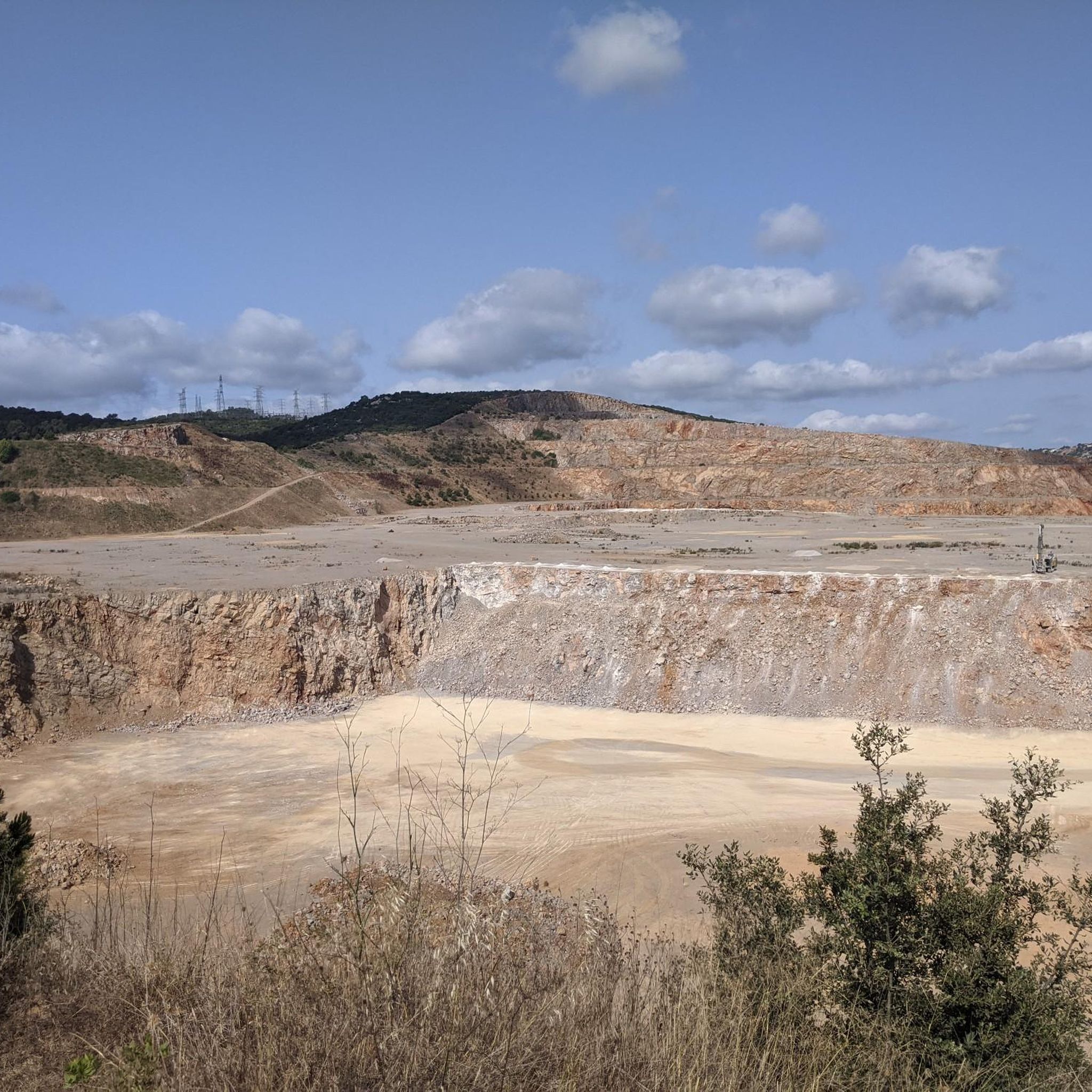
Best natural monuments around Vallirana are found in a region nestled between the Ordal mountains and the Garraf massif. This area is characterized by diverse geological formations, including potholes and caves. The landscape is capricious, abrupt, and picturesque, offering varied natural features. These elements contribute to a unique environment for exploration.
Best natural monuments around Vallirana
- The most popular natural monument is La Morella Summit, a summit that is the second highest peak in the Garraf Massif. It offers…
Last updated: July 1, 2026
Gorg de la Mola
Highlight • Gorge
Translated by Google •
Tip by

Salt de l'Aigua Waterfall
Highlight • Waterfall
Translated by Google •
Tip by

Sign up now to discover places like this
Get recommendations on the best single tracks, peaks, & plenty of other exciting outdoor places.
Sign up for free
La Morella Summit
Highlight • Summit
Translated by Google •
Tip by

Vallvidrera Stream
Highlight • River
Aware of
Edit
The Vallvidrera stream, also known as the Rierada, is a tributary along the left bank of the river Llobregat and the only permanent watercourse in the Collserola Park.
Translated by Google •
Tip by
Puig Madrona Summit
Highlight • Summit
Translated by Google •
Tip by
Sign up for free to discover even more natural monuments around Vallirana.
Sign up for free
Already have an account?
Start today with a free account
Your next adventure awaits.
Login or Signup
Tips from the Community

Hape Kerkeling, a well-known entertainer in the German-speaking world, wrote down some thoughts about a mystical experience (encounter with God) while traveling through Spain, which I would also like to offer to the viewer of this small sacred monument: "To encounter God, one must first extend an invitation to him, for he will not come uninvited. It is also a form of good manners. We have free choice. He builds an individual relationship with each person. Only someone who truly loves is capable of this." (Hape Kerkeling in "Ich bin dann mal weg")
1
0

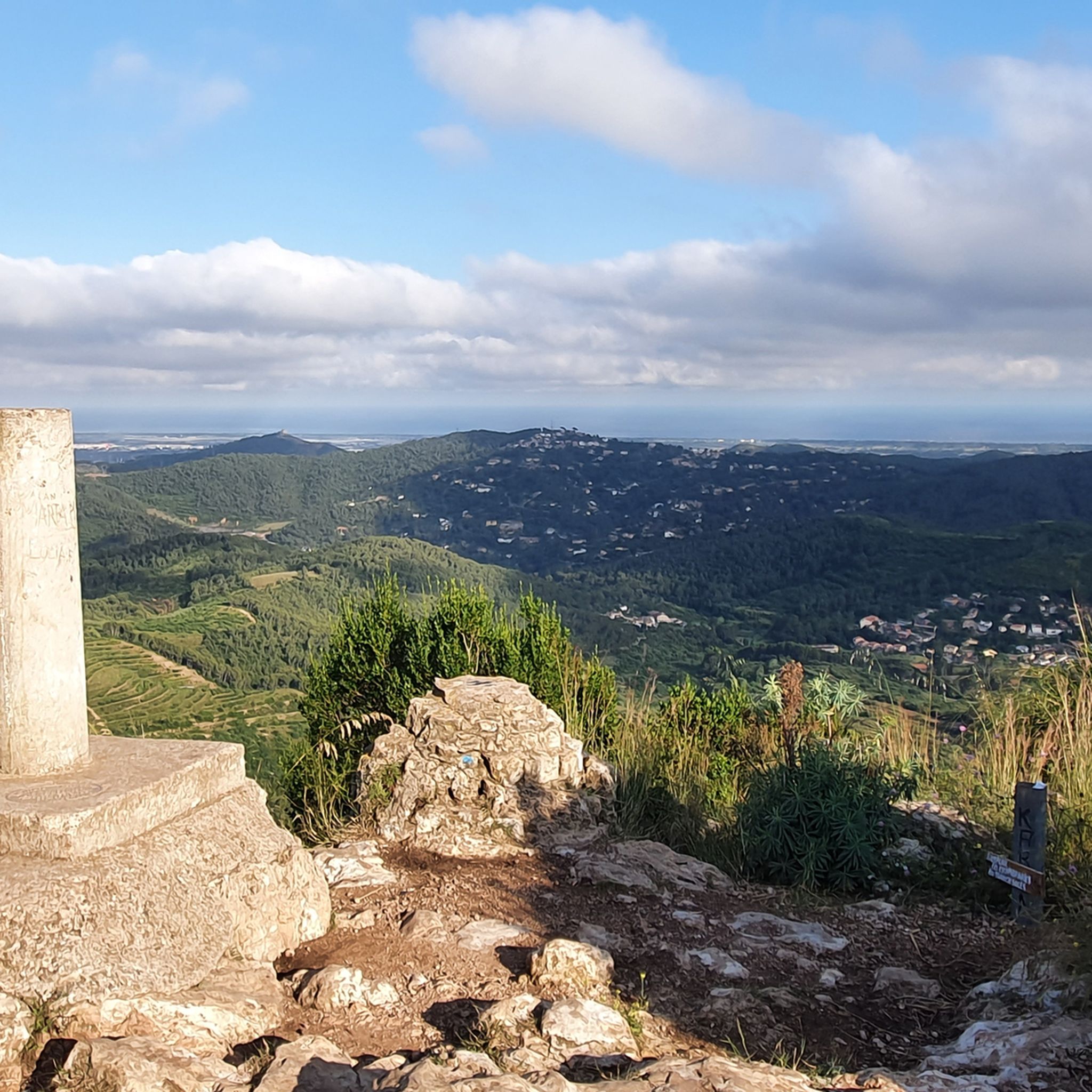
La Morella is the second highest peak in the Garraf Massif after Montau (658 m), at 593.6 meters. It is located in the municipality of Begues, in the Baix Llobregat region. Its surroundings contain several chasms. There is also the tail of the old Garraf landfill, currently being restored. At the summit, we can find a geodesic vertex. The peak is included in the FEEC's list of the 100 peaks. A long-distance trail (GR 92 Mediterranean Trail) passes through this mountain peak, on its 21st stage from Bruguers to Garraf. It meets the local short-distance trail (SL-C 99), which is 6.1 km long, running from the Cal Ganxo Environmental Activities Center (Castelldefels) to La Morella. If we follow the GR 92 towards the town of Garraf, 3.5 km away we reach the La Pleta Information Centre in Garraf Park.
11
0


To get to the top, I went along the Ratpenat road until a detour that goes there. The entire route is accessible by bike except for going up to the peak of the mountain, where you have to go downhill and push it along a complicated path, especially at the highest part. The views are worth it!!
5
0

Puig de la Morella (594 m) is the highest point of the massif and we can see both the coastal side and the interior, the Llobregat deltaic plain, Collserola and the Marina mountain range. If you're lucky and it's a good day, let's see if you can identify the distant peaks of Pica d'Estats or Canigó. You have an interpretive panel to help you. You are still in the term of Begues. The GR that you have probably been following is the 92-del Mediterrani. Stage 21 from Bruguers to Garraf. If you follow the direction of Garraf, you will arrive in 40 minutes at La Pleta where there is the modernist farmhouse, the offices and the information center of the park. You are in one of the most important karst areas in Catalonia. Its appearance, in contrast with nearby mountain ranges on the other side of the Llobregat, has nothing to do with the climate but with the edaphic and geological characteristics. For the same reasons we will find unique specimens, both flora and fauna. From the margallo to the population of bats that live in the more than 400 cavities found. In 1992, the Garraf was included in the Areas of Natural Interest Plan (PEIN) of the Generalitat. The park is currently part of the Natural Spaces Network promoted and managed by the Barcelona Provincial Council and covers an area of nearly 12,400 hectares. At the top is a monstrous white geodesic vertex of all sorts of gallifardeus. Peak included in the list of 100 peaks of the F.E.E.C. https://www.feec.cat/activitats/100-cims/cim/la-morella/
1
0
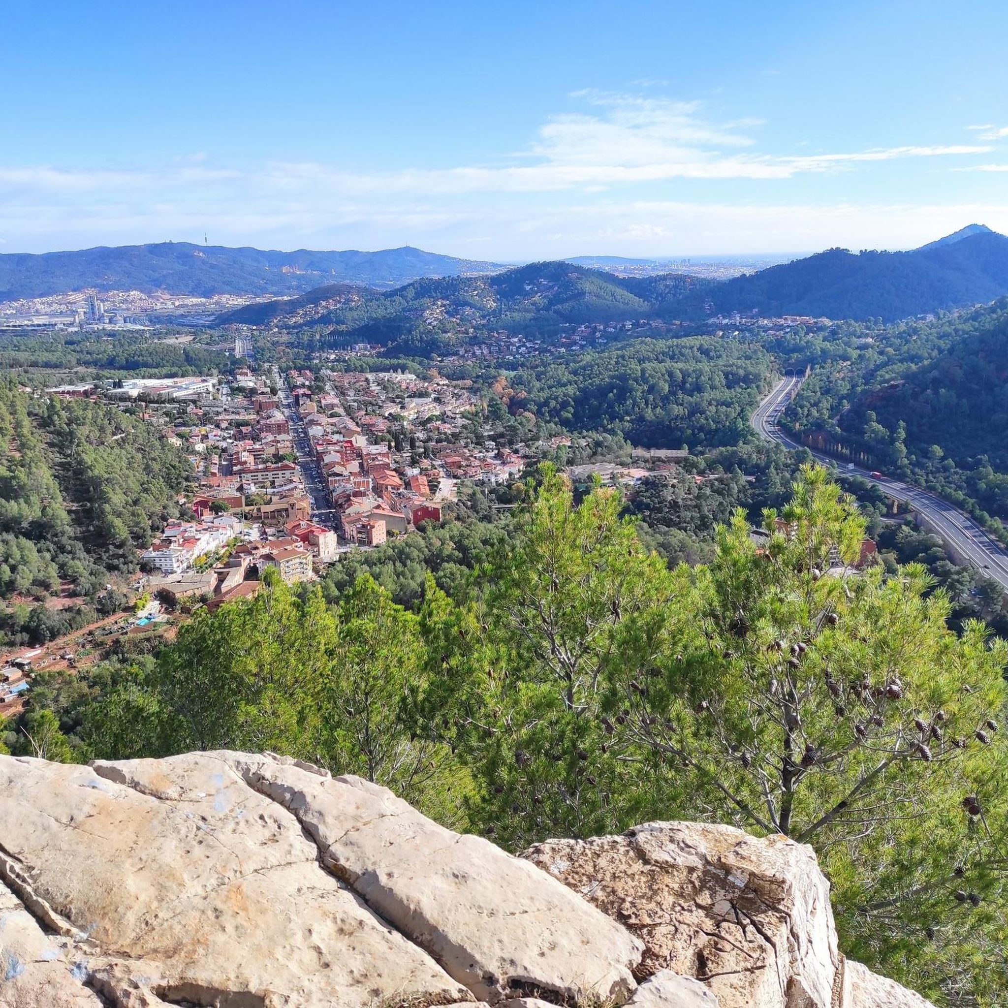
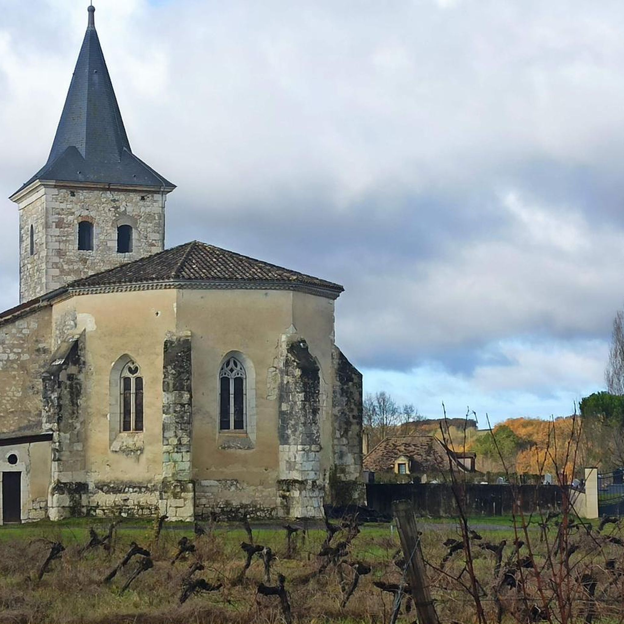
Peak of 341 m. altitude, located between the municipalities of Papiol and Sant Cugat del Vallès, in the Collserola mountain range. At the highest part there is a 16 meter high fire watch tower, and at its foot there is the Hermitage of Health and the geodesic vertex 286123001. It is also known of the existence of a Iberian town on top of the hill. The place is a splendid viewpoint of the Baix Llobregat, the ridge of Collserola, the mountains of Montserrat, Sant Llorenç del Munt and Vallès beyond to Montseny. The importance of this natural space is evidenced in recent studies, such as the one that indicates the presence of interesting lichens. In particular, it is important, due to its uniqueness, the first appointment for Catalonia, in terms of cryptogamic flora, of the species "Porina byssophila". This was detected in the lichen surveys in the Escletxes de Papiol and Puigmadrona, and 38 saxicolous and terrestrial lichens have been catalogued, of which 32 are new taxa for the flora of the Collserola Park, such as the one mentioned (Bolea, et al .: 2010: 354). It is the highest point that dominates the entire municipality. This peak is included in the list of the 100 peaks of the FEEC. https://www.feec.cat/activitats/100-cims/cim/puig-madrona/
0
0
Exuberant and shady corner where we will definitely forget that we are close to Barcelona. We are in one of those spaces that alone justify a trip. The stream forms a small jump thanks to an artificial lock built in the s. XIX that brought water from the stream through a pipe, which we can still see on one side of the jump, to the Can Planes mill. We can go down to the small pond that forms the caient, where, in the summer, the little ones can still take a bath. El Salt is surrounded by lush and shady vegetation, with bananas, oaks and oaks that bring freshness in the summer. It is one of the most crowded places in Collserola due to its proximity and ease of access.
2
1

With the 🚴♂️ going up rat penat and going down through begues behind the ball, I only got off at the morella and bike on my back, then lowered it but it is the highest point of the garraf (in buegues the mountain that does not belong if it would not be higher ) Spectacular views from La Morella
1
2
Frequently Asked Questions
What unique natural features can I explore around Vallirana?
Vallirana is known for its diverse geological formations, including numerous caves and impressive gorges. You can explore sites like the Gorg de la Mola, a testament to the region's natural beauty, or the Vallvidrera Stream, the only permanent watercourse in Collserola Park, maintaining a lush riparian forest.
Are there any historical or cultural natural monuments in the Vallirana area?
Yes, the region offers a blend of natural beauty and history. The Puig Madrona Summit, for example, is not only a viewpoint but also has historical significance with knowledge of an ancient Iberian town. Additionally, Cova Bonica is notable as an ancient Neolithic settlement, offering a glimpse into prehistoric human activity.
What kind of outdoor activities can I do near Vallirana's natural monuments?
The area around Vallirana is excellent for various outdoor activities. You can find numerous routes for running, cycling, and road cycling, often passing by or offering views of these natural sites. The mountainous surroundings provide scenic routes for exploration.
Are there family-friendly natural monuments to visit in Vallirana?
Yes, the Salt de l'Aigua Waterfall is categorized as family-friendly, offering a spectacular natural sight that is worth a visit for all ages. The general landscape with its diverse features also provides engaging experiences for families.
What is the best time to visit the natural monuments around Vallirana?
While specific seasonal recommendations are not provided, visiting during milder weather conditions would generally be ideal for exploring the geological formations and enjoying outdoor activities. Be aware that some areas like the Gorg de la Mola can have mosquitos in summer.
What do visitors enjoy most about the natural monuments in Vallirana?
Visitors frequently praise the stunning views and unique natural formations. The La Morella Summit offers beautiful 360-degree views into Barcelona from Parc del Garraf, while the Salt de l'Aigua Waterfall is described as spectacular. The Gorg de la Mola is considered an impressive and unique location.
Are there any caves I can explore in the Vallirana region?
Yes, Vallirana is rich in speleological landscapes due to its unique geological makeup. Notable caves include Cova Bonica, significant for its Neolithic settlement, and Cova de les Casetes in the Ordal mountains, which features a main hall, galleries, and a pit for experienced cavers. Other caves like Fou de Montaner, Cova del Lladre, and Cova del Turonet also contribute to the region's natural heritage.
Can I find hiking trails that lead to these natural monuments?
Many natural monuments are accessible via hiking trails. For instance, a long-distance trail (GR 92 Mediterranean Trail) passes through La Morella Summit, and a local short-distance trail (SL-C 99) also leads to it. The mountainous surroundings of Vallirana offer numerous scenic routes for exploring these natural landscapes.
What is the highest point I can reach among Vallirana's natural monuments?
The La Morella Summit is the second highest peak in the Garraf Massif, reaching 593.6 meters. It provides expansive views and is a popular destination for hikers.
Is the <a href="https://www.komoot.com/highlight/1423555" target="_blank" rel="noopener">Gorg de la Mola</a> worth visiting?
Absolutely. The Gorg de la Mola is described as an 'impressive' natural monument, standing out despite the region not being known for high mountains or abundant rainfall. Its unique characteristics make it a noteworthy natural attraction and a favorite among visitors.
Are there any natural monuments with significant water features?
Yes, the region features several water-related natural monuments. The Salt de l'Aigua Waterfall is a spectacular sight in the Collserola area. Additionally, the Vallvidrera Stream is the only permanent watercourse in Collserola Park, supporting a rich riparian forest environment.
What should I know about visiting the <a href="https://www.komoot.com/highlight/2724790" target="_blank" rel="noopener">La Morella Summit</a>?
La Morella Summit offers beautiful 360-degree views from the Parc del Garraf into Barcelona. It's the second highest peak in the Garraf Massif. While much of the route is accessible, the final ascent to the peak can be challenging, especially if cycling, requiring some pushing on a complicated path. The views from the geodesic vertex at the top are highly rewarding.
Most popular routes around Vallirana
Most popular attractions around Vallirana

Get inspired with the komoot mobile app


Explore more
Extend your search for the best caves by checking out these guides of the top ones around Vallirana:
