Top 5 Natural Monuments around Lower Harpton
Best natural monuments around Lower Harpton are found in this civil parish in Herefordshire, England, located approximately 2.5 miles from Knighton. Despite its small population, the area features notable natural monuments offering impressive landscapes and historical interest. The region's geography includes distinctive summits, ancient hillforts, and a notable waterfall. These sites provide opportunities to explore natural features and archaeological elements.
Best natural monuments around Lower Harpton
- The most popular natural monuments is Water-Break-Its-Neck Waterfall, a waterfall known for the…
Last updated: July 1, 2026
The Whimble
Highlight • Viewpoint
To the …
Tip by

Water-Break-Its-Neck Waterfall
Highlight • Waterfall
There's a high and low path so you can enjoy both viewpoints.
Tip by
Sign up now to discover places like this
Get recommendations on the best single tracks, peaks, & plenty of other exciting outdoor places.
Sign up for free
Black Mixen Summit
Highlight • Structure
Tip by

Bache Hill Summit
Highlight • Viewpoint
Tip by
Wapley Hillfort
Highlight • Historical Site
Tip by

Sign up for free to discover even more natural monuments around Lower Harpton.
Sign up for free
Already have an account?
Start today with a free account
Your next adventure awaits.
Login or Signup


Tips from the Community

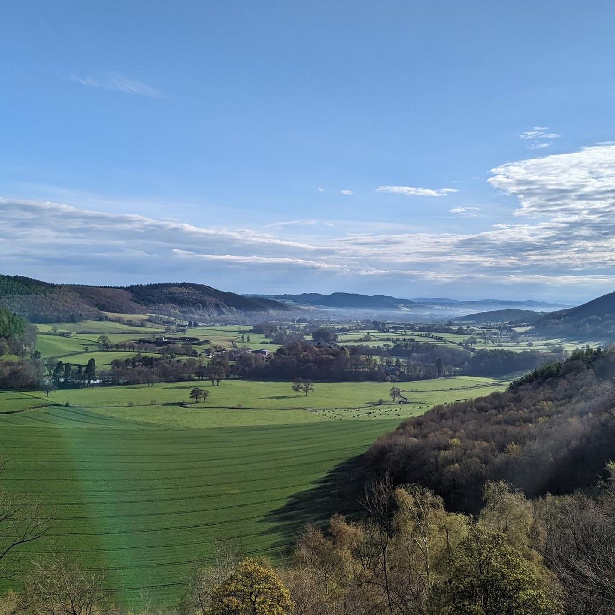
The Whimble has a striking conical shape. The summit is 599m and on a clear day offers great voews with the hill dropping away steeply on all sides. To the southeast, Hergest Ridge and the Black Mountains visible to the south. To the west and north the higher, flat-topped summits of the Radnor Range. To the northeast, Bache Hill.
3
0
The fine rainbow mist surrounding the unusually named Water-break-its-neck waterfall creates a humid micro-climate in this lush green gorge. There's a high and low path so you can enjoy both viewpoints.
3
0

Black Mixen is a subsidiary summit of Rhos Fawr or Great Rhos in the Radnor Forest. The summit is large peat bog plateau. The summit is marked with a cairn, and is next to a radio transmitter and its building. Black Mixen is the only UK registered Nuttall to have a communications mast on its summit.
3
0
Bache Hill is a subsidiary summit of Rhos Fawr or Great Rhos, in the Radnor Forest in Wales. It is located to the east of Black Mixen. The summit is marked by a trig point built on an ancient burial mound, probably of Bronze Age date, like most of the summit cairns and round barrows in Wales. It is a UK registered Nuttall.
3
0

Atop Wapley Hill at 1,050 feet (320 m) the remains of this Iron Age hill fort can be found among mixed woodland. The total site is spread over 6 hectares, with an entrance to the south and defences at a height over 5 metres. There's also a 33 metre deep ritual shaft believed to date back from the late Bronze Age.
1
0
Frequently Asked Questions
What natural features can I explore around Lower Harpton?
The Lower Harpton area offers a variety of natural features, including distinctive summits like The Whimble and Bache Hill Summit, ancient hillforts such as Wapley Hillfort, and the scenic Water-Break-Its-Neck Waterfall. You can also find unique landscapes like the peat bog plateau at Black Mixen Summit.
Are there any historical natural monuments in the Lower Harpton area?
Yes, the region features significant historical natural monuments. Wapley Hillfort is an Iron Age hillfort with defensive structures and a 33-meter deep ritual shaft believed to date back to the late Bronze Age. Additionally, Bache Hill Summit is marked by a trig point built upon an ancient Bronze Age burial mound.
Which natural monuments are suitable for families near Lower Harpton?
The Water-Break-Its-Neck Waterfall is a family-friendly natural monument. Its fine rainbow mist and lush green gorge create a beautiful setting, and visitors can enjoy different perspectives from both high and low paths.
What kind of views can I expect from the summits around Lower Harpton?
From The Whimble, you can enjoy extensive panoramic vistas on clear days, including Hergest Ridge, the Black Mountains, and the higher, flat-topped summits of the Radnor Range. Bache Hill Summit also offers broad views of the surrounding Radnor Forest.
Can I find hiking trails near the natural monuments in Lower Harpton?
Yes, there are numerous hiking opportunities. You can explore trails like 'Hergest Ridge Summit – Monkey-puzzle trees and bench loop from Kington' or 'St Mary's Church – Remains of Offa’s Dyke loop from Lower Harpton'. For more options, refer to the Hiking around Lower Harpton guide.
Are there options for cycling near Lower Harpton's natural monuments?
Absolutely. The area provides cycling routes such as 'Rhulen and Paincastle loop from Kington' or 'St Mary's Church – Monkey-puzzle trees and bench loop from Kington'. Discover more routes in the Cycling around Lower Harpton guide.
What makes Water-Break-Its-Neck Waterfall a unique place to visit?
Water-Break-Its-Neck Waterfall is known for the fine rainbow mist it creates, which contributes to a humid micro-climate within its lush green gorge. This unique atmosphere makes it a very scenic and refreshing spot.
What is special about Bache Hill Summit?
Bache Hill Summit is notable for its trig point, which is built upon an ancient burial mound, likely dating back to the Bronze Age. This adds a significant historical layer to its natural landscape. It is also recognized as a 'Nuttall' in the UK's hill classification system.
What is Wapley Hillfort, and what can I see there?
Wapley Hillfort is an Iron Age hillfort situated atop Wapley Hill. Visitors can explore the remains of its defensive structures, which reach over 5 meters in height, and a 33-meter deep ritual shaft believed to be from the late Bronze Age, all set within mixed woodland.
Is there a natural monument with a unique modern feature in Lower Harpton?
Yes, Black Mixen Summit, a subsidiary summit of Rhos Fawr, is unique for having a radio transmitter and its building adjacent to the summit. It is the only 'Nuttall' in the UK with a communications mast on its summit, offering a blend of natural landscape and modern infrastructure.
Are there any easy walking trails to natural monuments in Lower Harpton?
Yes, you can find easy walking trails in the vicinity. For example, the 'Highland – Wapley Hillfort loop from Staunton on Arrow' is an easy hike. More options are available in the Easy hikes around Lower Harpton guide.
What do visitors appreciate most about the natural monuments in Lower Harpton?
Visitors frequently appreciate the diverse natural features, from distinctive summits offering panoramic views to ancient historical sites like hillforts and burial mounds. The scenic beauty of places like Water-Break-Its-Neck Waterfall and the opportunities for outdoor activities are also highly valued by the komoot community.
Most popular attractions around Lower Harpton

Get inspired with the komoot mobile app


Explore more
Extend your search for the best caves by checking out these guides of the top ones around Lower Harpton:
