The 8 Most Amazing Peaks around Frenkendorf
Best mountain peaks around Frenkendorf are characterized by elevated hills, rock faces, and scenic viewpoints within the Jura Mountains and the Basel-Landschaft Tafeljura. This region offers opportunities for hiking and enjoying panoramic vistas. The area features well-maintained hiking trails suitable for various fitness levels. These elevated points provide clear perspectives of the surrounding landscape.
Best mountain peaks around Frenkendorf
- The most popular mountain peaks is Eigenturm Observation Tower, a viewpoint that offers a fantastic view over the Rhine plain…
Last updated: July 7, 2026
Schartenflue
Highlight • Viewpoint
Translated by Google •
Tip by

Eigenturm Observation Tower
Highlight • Viewpoint
Translated by Google •
Tip by

Sign up now to discover places like this
Get recommendations on the best single tracks, peaks, & plenty of other exciting outdoor places.
Sign up for free
Schleifenberg Tower
Highlight • Viewpoint
Translated by Google •
Tip by

Spalentor City Gate
Highlight • Monument
The Spalentor is a former city gate of the city of Basel and, as a successor to the Spalenschwibbogen, which was demolished in 1838, is a former part …
Translated by Google •
Tip by

Tinguely Museum
Highlight • Monument
Translated by Google •
Tip by

Sign up for free to discover even more peaks around Frenkendorf.
Sign up for free
Already have an account?
Start today with a free account
Your next adventure awaits.
Login or Signup
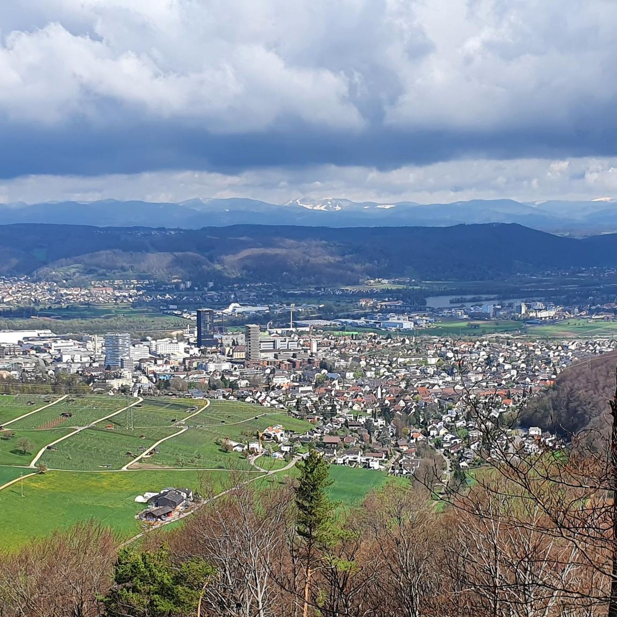
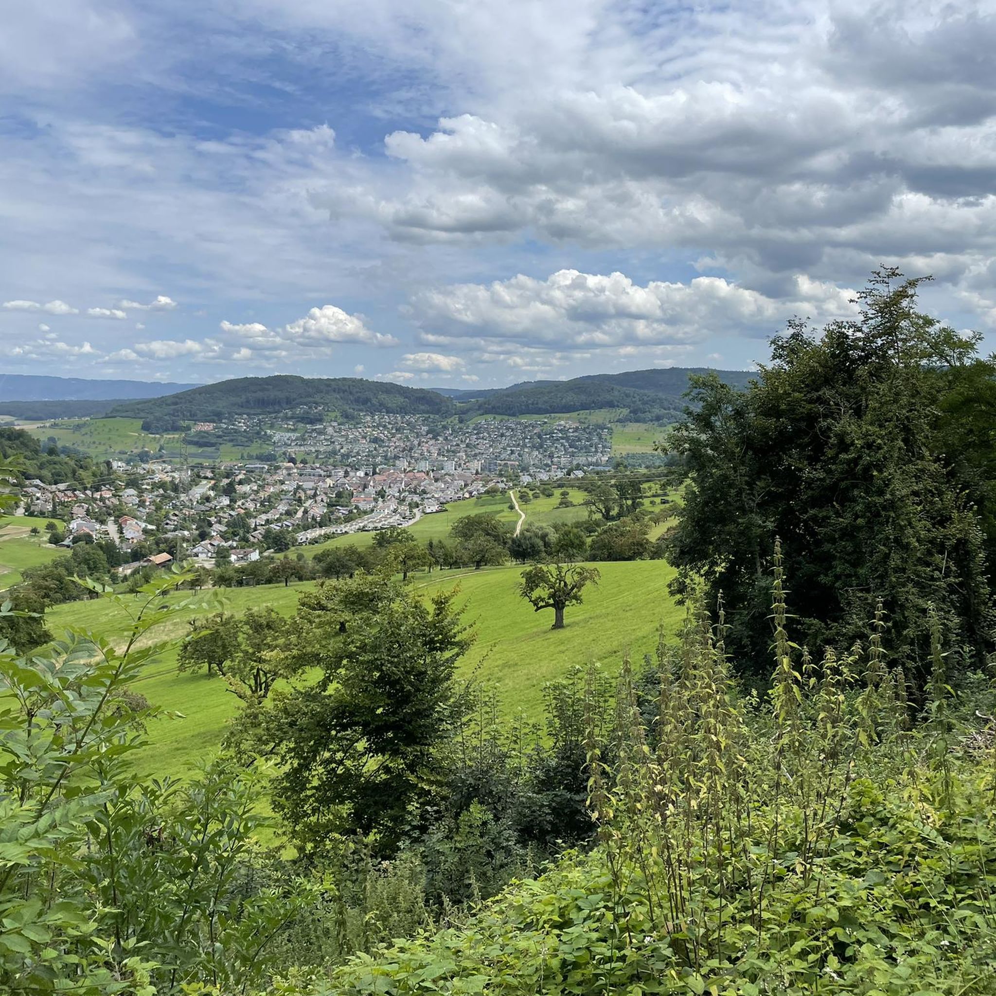

Other adventures around Frenkendorf

Tips from the Community

The observation tower on Schleifenberg is 30 meters high. Those who manage to climb to the top (after paying the entrance fee) enjoy a magnificent view of the Liestal valley and far beyond. At the foot of the tower lies the Turmwirtschaft (Tower Inn). Its hosts are around ten groups of innkeepers who bring the inn to life every Sunday and public holiday throughout the year. They cook and serve for their guests out of sheer joy in working together.
2
0

Just below the museum is an entry point for Rhine swimmers
4
1

The Museum Tinguely in Basel is an art museum
5
0

The customs regulations are conveniently posted in the gate.
3
1

A city gate was probably built here before 1398
3
1
The Schleifenberg Tower is an observation tower in the municipality of Liestal in the canton of Basel-Landschaft. The current steel framework tower was built in 1900 by the Liestal Transport and Beautification Association to replace the previous wooden tower (built in 1891). Renovation work was carried out on the tower in 1932, 1985 and 2007. Maintenance is ensured by the Liestal Tourism Association, which is also responsible for the tower restaurant. When a team of hosts opens the tower restaurant, this is traditionally signaled by the flag hoisted on the top of the tower; otherwise no flag is visible. Access is via a turnstile with cash payment by inserting coins. With an entrance fee of CHF 0.50, you can climb 150 steps to the observation platform at a height of 28.5 meters. https://de.m.wikipedia.org/wiki/Schleifenbergturm
7
1

Very beautiful good art directly in the Tinguely Museum on the Rhine
1
0

The Spalentor is the most magnificent and imposing of the three city gates that have survived from the great city fortifications of 1400. It is a former city gate of the city and corresponds to the former Spalenschwibbogen on the inner Basel city wall.
3
0
Frequently Asked Questions
What are the most prominent elevated points or viewpoints around Frenkendorf?
The Frenkendorf area, part of the Jura Mountains and Basel-Landschaft Tafeljura, features several notable elevated points and viewpoints. These include the historic Schauenburgflue rock face with the nearby Ruins of Alte Schauenburg, the scenic Schartenflue, and the Gempenturm Observation Tower. Other popular spots offering expansive views are the Eigenturm Observation Tower, the Schleifenberg Tower, and the View from Gempenfluh.
Are there historical sites to explore near the elevated points around Frenkendorf?
Yes, the region offers a blend of natural beauty and history. Near the Schauenburgflue, you can explore the historic Ruins of Alte Schauenburg, a castle ruin that adds a cultural dimension to your hike. While the ruins themselves are privately owned, the surrounding paths offer fantastic panoramas. Further afield, the Tinguely Museum in Basel and the historic Rheinfelden Railway Station also offer cultural insights.
What kind of hiking trails can I find around Frenkendorf's elevated points?
The area around Frenkendorf provides a variety of well-maintained hiking trails suitable for different fitness levels. You can find moderate loops like the "Schauenburgflue Rock Face – Ruins of Alte Schauenburg loop" (12.9 km, 430m elevation gain) or more challenging routes such as the "Ruins of Alte Schauenburg – View of Schauenburgflue loop" (10.6 km, 390m elevation gain). Many trails offer beautiful views towards St. Chrischona, the Upper Basel area, and even the Black Forest. For more options, explore the hiking guide for Frenkendorf.
Where can I get the best panoramic views in the Frenkendorf area?
For breathtaking panoramic views, consider visiting the Eigenturm Observation Tower, which offers a fantastic view over the Rhine plain between Rheinfelden and Basel, extending to the Swiss Jura on clear days. The Schleifenberg Tower provides a unique 3-country panoramic view. Additionally, the Gempenturm Observation Tower offers expansive vistas, including towards the Black Forest, and the View from Gempenfluh provides wonderful views from its limestone cliffs.
Are there family-friendly options for exploring the elevated points around Frenkendorf?
Yes, there are options suitable for families. While some trails require good fitness, many paths around the elevated points are well-maintained and can be enjoyed by families. For example, the "Zwärgämoos Forest Kindergarten – Hülftenschanz Monument loop" from Frenkendorf-Füllinsdorf is an easy 5.4 km route. When planning, look for trails with lower elevation gains and shorter distances, which are often more suitable for children.
What are some challenging hiking routes near Frenkendorf's peaks?
For those seeking a challenge, the "Ruins of Alte Schauenburg – View of Schauenburgflue loop" from Frenkendorf is rated as difficult, covering 10.6 km with 390m elevation gain. Another demanding option is the "Gempenturm Observation Tower – Ruins of Alte Schauenburg loop" from Frenkendorf-Füllinsdorf, which spans 16.3 km with 550m elevation gain. These routes offer extended exploration and rewarding views. You can find more challenging routes in the Frenkendorf hiking guide.
Can I bring my dog on hikes around Frenkendorf?
Generally, dogs are welcome on most hiking trails around Frenkendorf's elevated points. It's always advisable to keep your dog on a leash, especially in nature reserves, near livestock, or in busy areas, and to carry water for both yourself and your pet. Please ensure you clean up after your dog to maintain the natural beauty of the trails.
What is the best time of year to visit the elevated points around Frenkendorf?
The best time to visit the elevated points around Frenkendorf is typically from spring through autumn (April to October). During these months, the weather is generally mild, and the trails are clear of snow, offering pleasant hiking conditions and lush scenery. Autumn provides particularly beautiful foliage. While winter hiking is possible, some trails might be icy or require appropriate gear, and certain facilities may have reduced operating hours.
Are there options for mountain biking near Frenkendorf's elevated points?
Yes, the region offers excellent opportunities for mountain biking. You can find various MTB trails, including challenging routes like the "Gempenturm Observation Tower – View from Gempenfluh loop" from Frenkendorf-Füllinsdorf, which is 19.3 km long and rated difficult. Other routes like the "Augusta Raurica Roman Theatre – Rheinfelden Town Hall loop" offer longer rides. Explore more options in the MTB Trails around Frenkendorf guide.
Are there places to eat or drink near the hiking trails?
Yes, you can find places to refresh yourself near some of the elevated points. For instance, the Schleifenberg Tower has a restaurant, the Turmwirtschaft, which is open on Sundays and public holidays (look for the flag flying to confirm). The View from Gempenfluh also has a popular restaurant nearby. It's always a good idea to check opening hours in advance, especially outside peak season.
How can I access these elevated points, and is parking available?
Many of the elevated points and trailheads around Frenkendorf are accessible by car, with parking often available at or near the starting points of popular hiking routes. Public transport connections, particularly to Frenkendorf itself, are also good, allowing you to start hikes directly from the municipality. Specific parking availability can vary, so it's recommended to check local signage or online resources for your chosen trailhead.
What are some longer hiking routes that combine multiple elevated points?
For a more extensive exploration, you can find routes that connect several elevated points. The region research mentions scenic trails that lead over both Schauenburgflue and Schartenflue, showcasing the diverse scenery. The "Gempenturm Observation Tower – Ruins of Alte Schauenburg loop" (16.3 km) is another example of a longer route that combines significant landmarks. These longer loops are ideal for those looking to spend a full day immersed in the landscape.
Most popular routes around Frenkendorf
Most popular attractions around Frenkendorf

Get inspired with the komoot mobile app


Explore more
See even more amazing summits around Frenkendorf with these guides:
