Top 9 Natural Monuments around Martley
Best natural monuments around Martley are characterized by a diverse natural environment, shaped by varied geological structures. The area features extensive footpaths that provide access to its landscapes, including deciduous woodlands and flatter terrains. This geological diversity supports a rich tapestry of flora and fauna, making it suitable for nature exploration. Martley offers a comprehensive experience of rural England's natural heritage.
Best natural monuments around Martley
- The most popular natural monuments is Prior's Mill and Weir, a natural monument…
Last updated: June 29, 2026
Redstone Caves
Highlight • Natural Monument
Tip by

Earl Beauchamp's Fountain
Highlight • Monument
Tip by

Sign up now to discover places like this
Get recommendations on the best single tracks, peaks, & plenty of other exciting outdoor places.
Sign up for free
Waterfall with Snowdrops
Highlight • Natural Monument
Tip by

Prior's Mill and Weir
Highlight • Natural Monument
Tip by
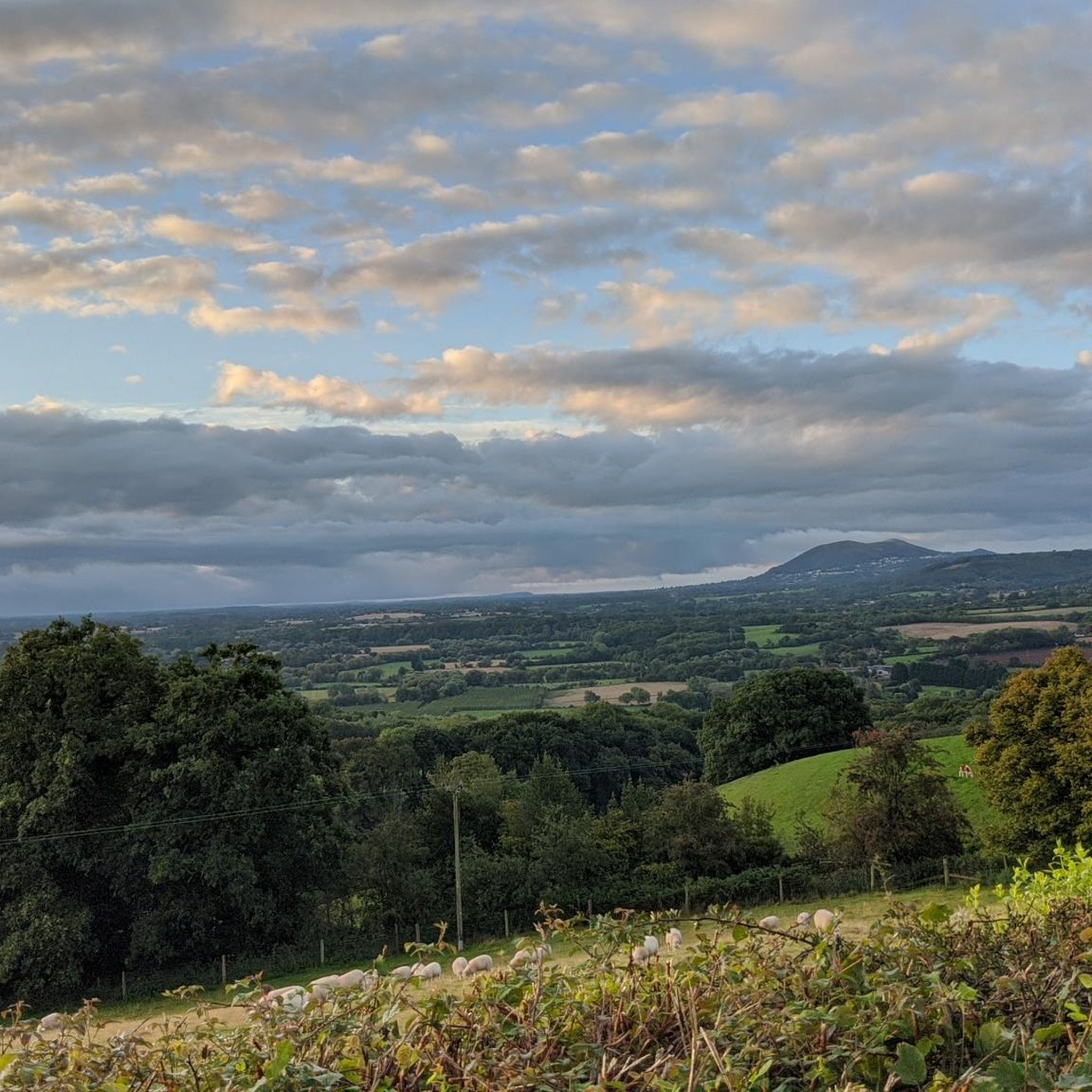
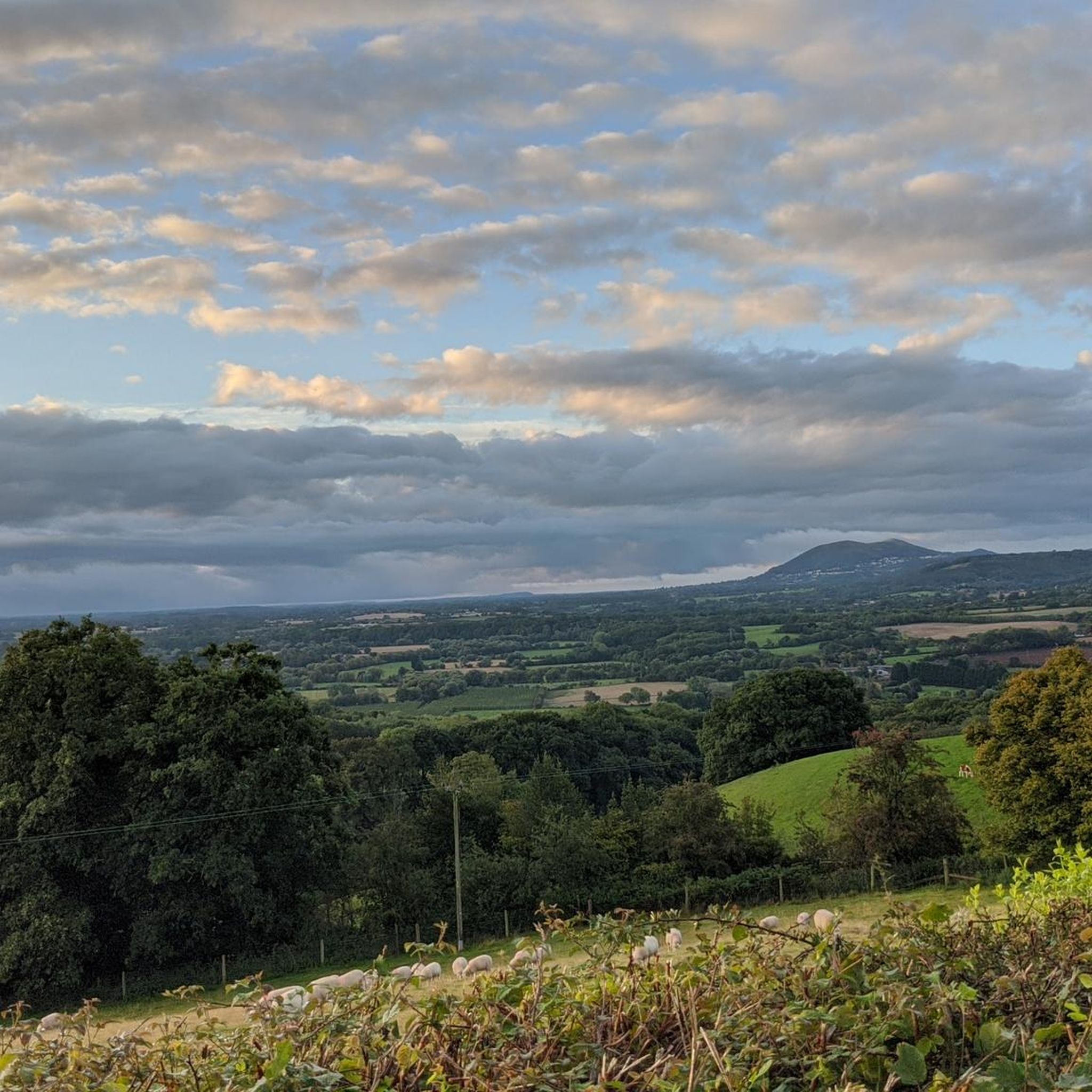
Ankerdine Hill
Highlight • Viewpoint
Tip by

Sign up for free to discover even more natural monuments around Martley.
Sign up for free
Already have an account?
Start today with a free account
Your next adventure awaits.
Login or Signup

Tips from the Community

This little man-made waterfall is the overflow from the big lake but is still quite realistic. Best visited in the winter for flow and less foliage to get in the way of the camera shot!|
0
0
A real picturesque old mill, and the Geopark Way affords a really good view of the weir and house from a number of angles.
0
0

This spout, formerly known as the Cowleigh Spout, is on the left as you leave Malvern on the Cowleigh Road, almost opposite the Worcestershire Way car park. The springs are in an adjacent field and their daily output is 10,000 gallons, with much running to waste. Unlike many of the other natural water sources of the Malverns, Cowleigh Spout maintained a healthy flow even during times of severe drought, such as that in 1921, and on many occasions was the sole supply over an extensive area. During the construction of the North Malvern Tank in the 1870s, when the supply from the Morris tank was cut off, the inhabitants walked the half mile from North Malvern to this spout for their household's water. This rural idyll was witness to the 'dirty' hordes of Birmingham hop-pickers who flocked to the countryside for their annual working holiday. "Cowleigh Spring was the resort of many hoppers on Sunday, the "crystal streams" being freely used for their ablutions. They borrowed a piece of soap and had a "wash and brush up, the pocket handkerchief doing service as a towel". The Madresfield Connection The original spout was replaced with this one by the 7th Earl Beauchamp. He was later immortalised as Lord Marchmain in Evelyn Waugh's Brideshead Revisited. The wording on the tiled surround reads: "This fountain was presented to the people of Cowleigh by William Earl Beauchamp 1905." The Earls Beauchamp lived at Madresfield Court, three miles away on the opposite side of the hills, and the cisterns behind the fountain originally supplied the Court, four farms and a dozen houses on the Madresfield estate. The spout fed a tank on Cowleigh Park Farm. In the 1870s, a three-inch iron main was laid to Madresfield via Dyson Perrins School, Tanhouse Lane and Newland and a 30,000-gallon reservoir/header tank at Lower Woodsfield Farm enabled the supply thereafter to be gravity fed. The laying of the supply is recorded in the local paper of 7 Dec.1872, titled `New water supply to Madresfield Court': "For some time past, the route between Madresfield Court...and the famous flow of water at the entrance to `Cowleigh Park', known as `Cowleigh Spout' has exhibited a line of excavation, in which mains have been deposited for the conveyance of the overflow of water at the spout for use at Madresfield Court. The work is now all but completed." The village was put on to the main public supply shortly after 1955 following concern about possible contamination. A sample analysed during the 1980s suggested a similar composition to the Schweppes Pewtriss Well. The tanks behind still overflow copiously and are maintained because they supply several local households with water. In 1995 water was reinstated at the public spout as a result of the efforts of local enthusiasts. Since then the area around the spout has been the subject of various initiatives to make the area more user friendly in recent years. There are now steps from the car park at the rear, which once housed the bottling works tank. Also the area in front of the spout has been restored and drainage improved. The Madresfield Estates Trust still owns about 50 acres of land behind the spout together with the nearby Cowleigh Wood, but at some time in the past the ownership of the spout changed. In 2007 the Area of Outstanding Natural Beauty managers when implementing the Heritage Lottery Fund enhancements unsuccessfully tried to trace the owners of this fountain. What they did discover was that the properties across the road from the fountain had a right to the water and in the case of The Byre it was a gift in perpetuity from the Beauchamp estate for bravery in the Great War. Source: malvernwaters.com
0
0
Prior's Mill is a former seventeenth century timber-framed water mill, with twentieth century alterations, and now used as a private residence. Next to it is a very high weir on the Dick Brook. There used to be several mills on this stream long ago.
0
0
Geological overview Just south of Stourport a magnificent river cliff of fine grained red sandstone is seen. Although mainly homogenous in terms of geology, there are white streaks and thin bands of coarse material running throughout the section. The soft sandstone of Redstone Rock is easily carved and there is evidence of human-made habitation in the cliff face since Stone Age times. The caves that can be seen today were mostly made in the 12th century, when a hermitage was established there, conveniently located for the hermits to be on hand to offer blessings and prayers for passers-by in return for alms. It was said to house up to 500 men, who may have also manned the ferry crossing, which was there due to the presence of a ford until the river was dredged. The caves were later used as domestic dwellings and were inhabited almost continuously until the mid twentieth century. Source: Geopark.org
0
0


Just south of Stourport-on-Severn, Redstone Caves are made from Triassic sandstone. Carved out in the 12th century and then home to a hermitage, it seems extraordinary today that once up to 500 men lived here. The Geopark Way, a long-distance footpath specialising in geological marvels in the area, runs unsurprisingly right past these caves.
1
0

Ankerdine Hill, at 489 feet (149 m), is part of the Abberley Hills ridge in the Abberley and Malvern Hills Geopark. The ridge was formed during the Silurian period and is of considerable geological significance. The River Teme loops around the hill, surrounding it on its western, southern and eastern side, giving it superb views of the Teme Valley. It is most commonly ascended from the village of Knightwick, where the award-winning Talbot pub is a good post-hike option.
0
0
Frequently Asked Questions
What are some unique geological features to explore around Martley?
Martley is renowned for its diverse geological structure, which has shaped its varied landscapes. You can explore sites like Sunken Lane, which cuts through Triassic-aged rocks deposited approximately 220 million years ago, showcasing siltstones, sandstones, and conglomerates. The Redstone Caves are another fascinating example, carved from Triassic sandstone and part of the Geopark Way. Additionally, Walsgrove Hill Summit View is part of the geologically significant Abberley and Malvern Hills Geopark, offering insights into 700 million years of natural history.
Where can I find the best views of the Martley landscape?
For expansive views of the Martley landscape, head to Walsgrove Hill Summit View. From its 869-foot summit, you can see towards Abberley Hill and its distinctive clock tower, offering a panoramic perspective of the surrounding area.
Are there any historical natural monuments in the Martley area?
Yes, Martley offers natural monuments with significant historical connections. The Redstone Caves, for instance, were carved in the 12th century and served as a hermitage, later housing up to 500 men and continuously inhabited until the mid-20th century. Prior's Mill and Weir features a former 17th-century timber-framed water mill. Also, Earl Beauchamp's Fountain, though a man-made monument, taps into natural springs and has a rich history tied to local water supply and the Madresfield estate.
What kind of wildlife can I expect to see in Martley?
Martley's diverse habitats support a rich array of wildlife. Its ancient woodlands are home to small-leaved lime trees, bluebells, and rare species like herb Paris. Limestone-rich areas boast various orchids, including common spotted, bee, and pyramidal orchids. Along the River Teme, you might spot aquatic plants like purple loosestrife. Birdlife is abundant, with all three species of woodpecker, nuthatch, tree creeper, and jays in the woodlands, and birds of prey like common buzzards and red kites overhead. The area is also rich in ferns, fungi, and diverse grasses.
Are there family-friendly natural monuments or walks suitable for children?
While many of Martley's natural areas are suitable for families, Earl Beauchamp's Fountain is specifically categorized as family-friendly. The extensive network of footpaths throughout Martley also provides many easy walking options, such as the 'Kingswood Common – River Teme Riverside Walk' loop, which is an easy 5.1 km hike, perfect for families to explore the natural beauty.
What are the best walking routes to experience Martley's natural beauty?
Martley boasts approximately 42 miles of footpaths, offering numerous opportunities to immerse yourself in its diverse landscapes. Popular hiking routes include the 'River Teme Riverside Walk – Kingswood Common loop from Martley' (9.8 km, moderate) and the 'View of Teme Valley – River Teme Riverside Walk loop from Martley' (11.5 km, moderate). You can find more detailed hiking routes and options on the Hiking around Martley guide.
When is the best time of year to visit Martley's natural monuments?
Martley offers natural beauty year-round, but the best time depends on your interests. Spring and summer are ideal for observing breeding birds like pied flycatchers and wood warblers, and for enjoying the vibrant wildflowers in meadows and woodlands, including bluebells and various orchids. Autumn brings an abundance of fungi and beautiful fall foliage. The extensive footpath network makes it accessible in most seasons, though winter walks might be muddy, especially on steeper sections like Walsgrove Hill.
Are there options for cycling or mountain biking near Martley's natural monuments?
Yes, Martley and its surroundings offer excellent opportunities for cycling and mountain biking. For touring cyclists, routes like 'Martley & Holt Heath loop from Worcester' (34.7 km, moderate) provide scenic rides. Mountain bikers can explore trails such as the 'Wyre Forest and Abberley Loop' (44.6 km, moderate) or the 'St Peter's Church, Martley – View of the Countryside loop from Martley' (29 km, easy). You can discover more routes in the Cycling around Martley and MTB Trails around Martley guides.
Where can I find ancient woodlands or diverse plant life in Martley?
Martley is rich in diverse flora. Its ancient woodlands are notable for small-leaved lime trees and a ground flora that includes bluebells, sanicle, and the rare herb Paris. Limestone-rich areas are home to various orchids and rock rose. Along the River Teme and in local ponds, you'll find aquatic plants like purple loosestrife and white water lilies. Meadows and roadside verges burst with wildflowers such as cowslips, moon daisies, and wild daffodils, making Martley a haven for plant enthusiasts.
What do visitors enjoy most about Martley's natural monuments?
Visitors particularly appreciate the diverse natural environment and the opportunities for exploration. The geological significance of sites like Redstone Caves and Sunken Lane is a major draw. The panoramic views from Walsgrove Hill Summit View are also highly rated. The overall appeal lies in the extensive network of footpaths that allow for immersive experiences in Martley's varied landscapes, from woodlands to riverbanks, supporting a rich tapestry of plant and animal life.
Are there any less-known natural monuments or 'hidden gems' in Martley?
While Martley doesn't have grand, widely publicized natural monuments, its charm lies in its accessible, diverse natural features. The Sunken Lane, with its ancient Triassic rock formations, offers a unique geological experience that feels like a hidden gorge. Similarly, the historical and geological significance of Redstone Caves, with its past as a hermitage, provides a fascinating, less-obvious natural monument to explore.
Most popular attractions around Martley

Get inspired with the komoot mobile app


Explore more
Extend your search for the best caves by checking out these guides of the top ones around Martley:
