Top 8 Natural Monuments around Garaguso
Best natural monuments near Garaguso are found in a hilly region characterized by diverse terrain and ancient geological formations. The landscape includes significant natural features and evidence of historical human interaction with the environment. This area offers a blend of natural beauty and geological interest, making it suitable for exploration. Visitors can discover limestone rock formations, picturesque valleys, and unique environmental characteristics.
Best natural monuments around Garaguso
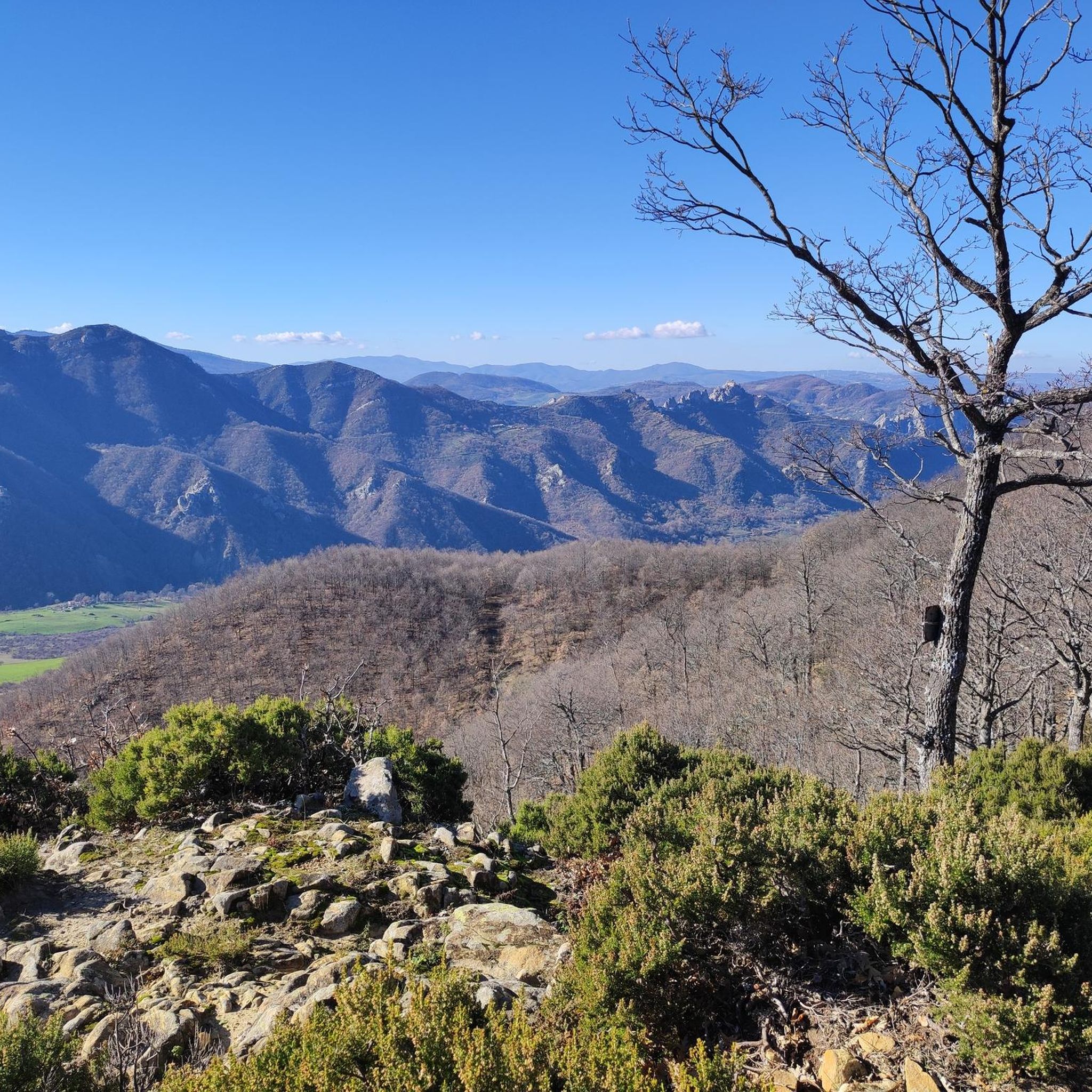
- The most popular natural monument is Viewpoint of Tomba 1 in Parco Regionale Gallipoli Cognato Piccole Dolomiti Lucane, a viewpoint located on a hill 1150 meters above sea level. It features an acropolis fortified with Greek construction techniques, including a double curtain wall.
- Another must-see spot is Petre de la Mola, a natural limestone rock formation within the Gallipoli Cognato Piccole Dolomiti Lucane Regional Park. It is believed to have been modified by humans in the Bronze Age to function as a stone calendar, indicating noon and the winter solstice sunset.
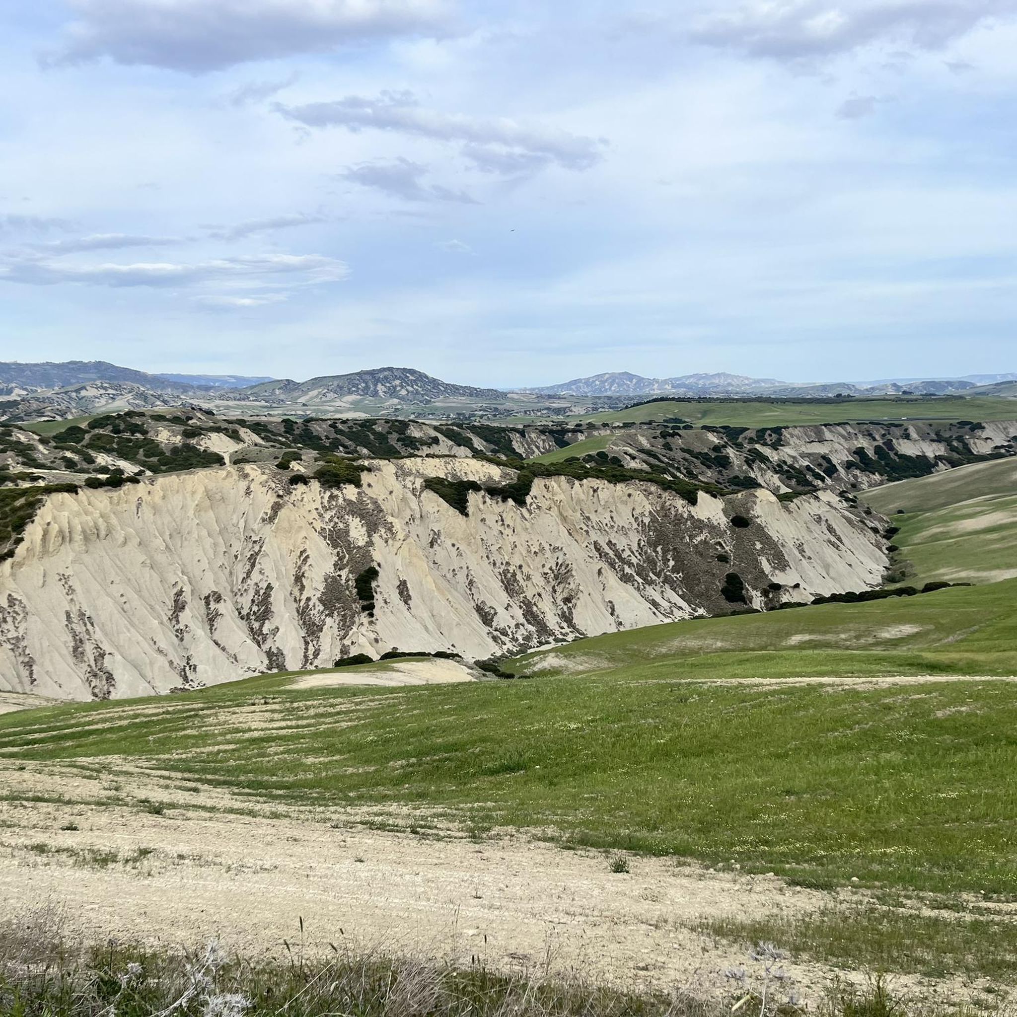
- Visitors also love Salandrella Valley, a splendid rocky valley carved by the Salandrella stream. This area is known for its pliopleistocenic fauna, with fossils found in the bluish clay along the stream.
- Garaguso is known for limestone formations, picturesque valleys, and monumental olive groves. The region offers a variety of natural monuments to see and explore, including dense woods and unique golden cliffs.
- The natural monuments around Garaguso are appreciated by the komoot community, with 11 upvotes and 25 photos shared by visitors.
Last updated: August 21, 2026
Petre de la Mola
Highlight • Natural Monument
The complex of rocks is believed to have been modified by man in the Bronze Age to be used as a "stone calendar" and, more precisely, to indicate both noon and the sunset of the winter solstice.
Translated by Google •
Tip by

Viewpoint of Tomba 1 in Parco Regionale Gallipoli Cognato Piccole Dolomiti Lucane
Highlight • Viewpoint
Translated by Google •
Tip by

Sign up now to discover places like this
Get recommendations on the best single tracks, peaks, & plenty of other exciting outdoor places.
Sign up for free
Salandrella Valley
Highlight (Segment) • Gorge
Translated by Google •
Tip by

Strada di Oliveto Lucano
Highlight (Segment) • Climb
Translated by Google •
Tip by

Rock Formations of the Piccole Dolomiti Lucane
Highlight • Natural Monument
Translated by Google •
Tip by
Sign up for free to discover even more natural monuments around Garaguso.
Sign up for free
Already have an account?
Start today with a free account
Your next adventure awaits.
Login or Signup
Tips from the Community

A mountain stretch of the Cavone river, the Salandrella stream has, over the centuries, carved out a splendid rocky valley in which it is wonderful to cycle. Near Oliveto Lucano and Garaguso, the road climbs lightly and steadily, providing a gentle Lucanian climbing experience.
0
0

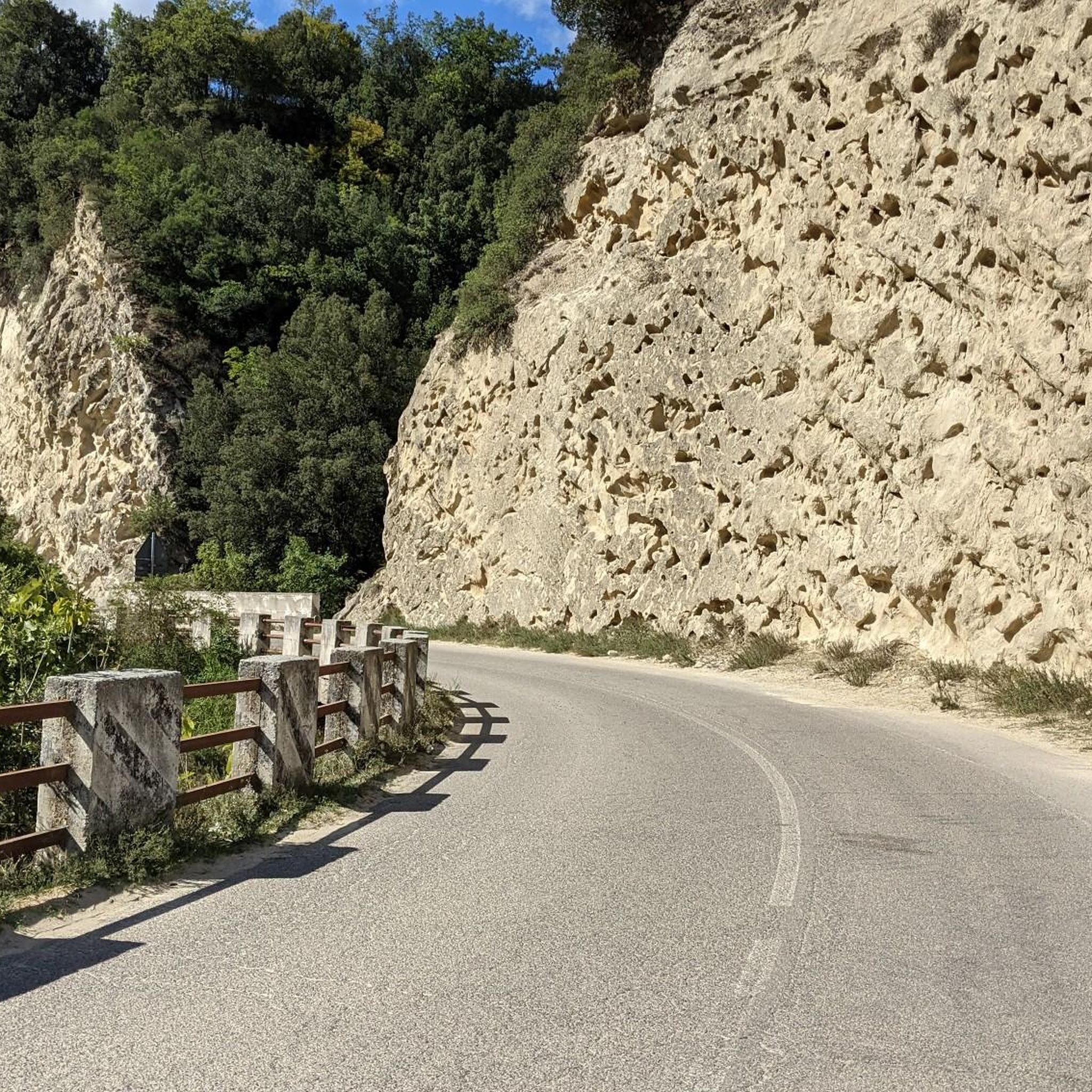
If taken uphill it is a rather demanding road, the gradients easily reach double figures. However, the climb is not very long, in short, doable.
1
0
Along the road one of the many rock formations like "cliffs" that emerge from the woods.
0
0

Narrowly cut with a small tunnel. Very idyllic!
0
0

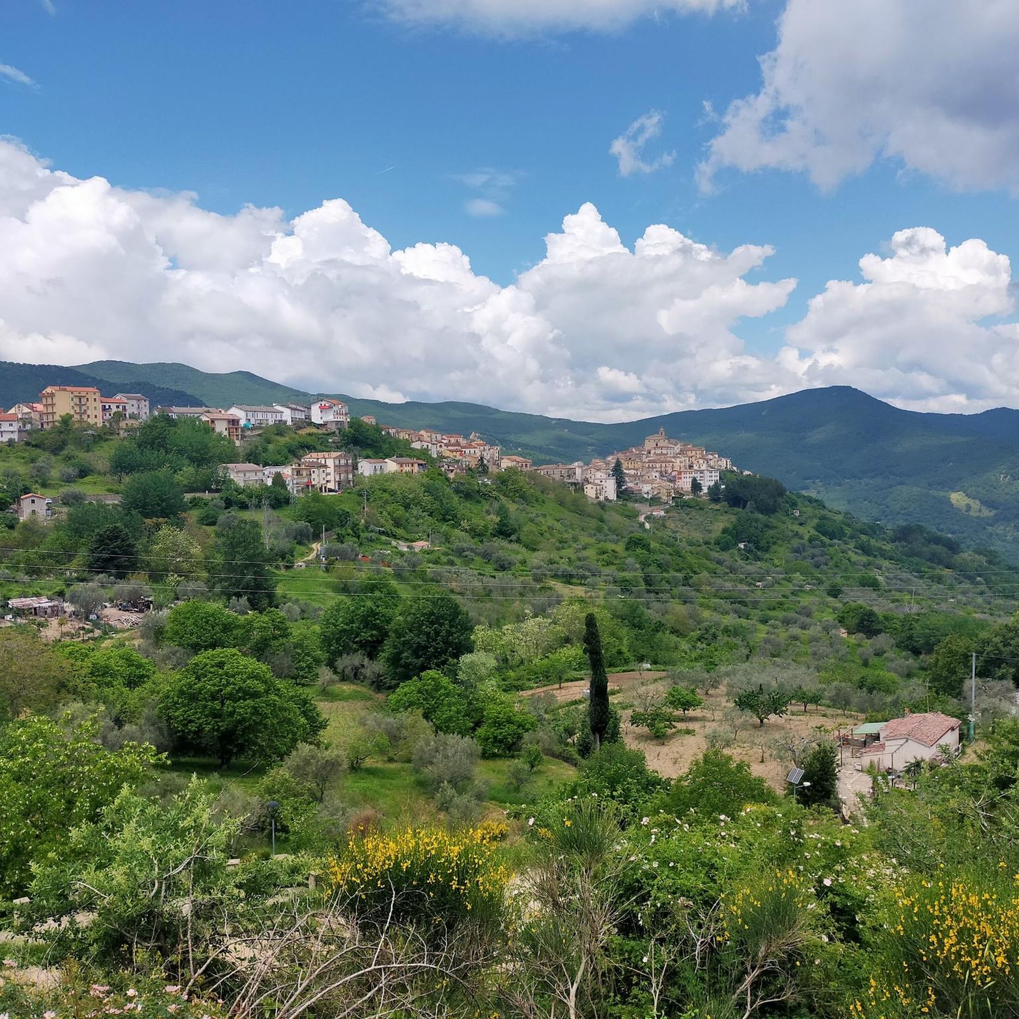
Our roads and the path that awaits you is purely fantastic, climbs, mountains, views, all enclosed in the fantastic scenery located in Basilicata !!!!!!
0
1
The settlement develops on a hill, 1150 meters above sea level, dominating the centers of Civita and Serra del Cedro di Tricarico, Accettura, Albano, lapped by important transversal routes connecting the high valleys of the Basento del Bradano and of the middle Agri valley. An area of about 6 hectares is enclosed by an imposing defensive system, consisting of 3 circuits of walls, of which the best preserved defends the acropolis of the town. The fortification of the acropolis, which surrounds an area of three hectares, is built according to Greek construction techniques. It is a double curtain with an external face made of regular blocks of sandstone, a filling of stones mixed with the ground and an internal wall made of hewn stones only on the face. The blocks bearing quarry signs in Greek letters are concentrated near the main door. The main door, of the courtyard type with an almost square compartment, open to vehicles, opens towards the east. Two small pedestrian gates are located on the northern side of the walls and two other posterns open towards the south.
1
0
Here you will find the viewpoint from where you can observe a breathtaking show !!!!!!!!
0
0
Here you will find the Acropolis, perfectly squared blocks positioned with maniacal precision !!
0
0
Frequently Asked Questions
What are the most notable natural monuments to visit near Garaguso?
Among the most notable natural monuments, you can explore Petre de la Mola, a unique limestone formation believed to be a Bronze Age stone calendar. Another significant site is the Viewpoint of Tomba 1 in Parco Regionale Gallipoli Cognato Piccole Dolomiti Lucane, offering historical insights and panoramic views from an ancient acropolis.
Are there any natural monuments around Garaguso with historical or archaeological significance?
Yes, Petre de la Mola is particularly significant. This natural limestone rock formation within the Gallipoli Cognato Piccole Dolomiti Lucane Regional Park is thought to have been modified by humans during the Bronze Age to function as a 'stone calendar,' marking noon and the winter solstice sunset. Additionally, the Viewpoint of Tomba 1 features an acropolis with Greek construction techniques, indicating ancient human settlement.
What kind of geological features can be found in the natural monuments near Garaguso?
The region is rich in geological interest. The Salandrella Valley, carved by the Salandrella stream, is known for its pliopleistocenic fauna, with fossils of shells like Ostea lamellose and Cassidria echinophora found in the bluish clay. You'll also find striking limestone formations, including the 'great golden cliff' known as Sabbioni di Garaguso along the stream, and the Rock Formations of the Piccole Dolomiti Lucane.
Are there hiking trails to reach these natural monuments?
Absolutely! The area offers various hiking opportunities. For instance, you can explore the 'Pietra della Mola - Parco Regionale Gallipoli Cognato Piccole Dolomiti Lucane' trail, which is a moderate hike. Another option is the 'Warrior's Tomb – Petre de la Mola loop'. You can find more hiking routes and details in the Hiking around Garaguso guide.
What other outdoor activities are available near the natural monuments of Garaguso?
Beyond hiking, the diverse terrain around Garaguso is excellent for cycling. There are numerous routes for both touring and road cycling, many of which pass through scenic natural areas and near monuments. For detailed routes, check out the Cycling around Garaguso and Road Cycling Routes around Garaguso guides.
What is the best time of year to visit the natural monuments around Garaguso?
The region experiences diverse weather. Spring and autumn generally offer pleasant temperatures for hiking and exploring. Summers can be warm, while winters can be cooler, especially at higher elevations like the Viewpoint of Tomba 1. Consider the specific activities you plan to do when choosing your visit time.
Are there any family-friendly natural attractions or activities in the Garaguso area?
The Salandrella Valley offers a picturesque landscape that can be enjoyed by families, with opportunities for gentle walks and fossil hunting along the stream. Exploring the ancient monumental olive groves and dense woods also provides a pleasant outdoor experience for all ages.
Can I find ancient olive groves or dense forests near Garaguso's natural monuments?
Yes, Garaguso is surrounded by ancient, monumental olive groves, particularly in the House of Revertera's groves. Additionally, dense woods overlook the banks of the Salandrella stream, providing beautiful natural areas for exploration and enjoying the tranquility of nature.
What do visitors appreciate most about the natural monuments around Garaguso?
Visitors frequently highlight the breathtaking views from spots like the Viewpoint of Tomba 1 and the unique historical aspect of Petre de la Mola. The diverse landscape, from rocky valleys to ancient forests, and the sense of discovery, especially regarding the geological formations and fossils in the Salandrella Valley, are also highly valued.
How can I access the natural monuments, and is parking available?
Many natural monuments, such as Petre de la Mola, are located within the Gallipoli Cognato Piccole Dolomiti Lucane Regional Park. Access typically involves driving to trailheads or specific points within the park. While specific parking details for each monument vary, designated parking areas are usually available near popular starting points for hikes and viewpoints within the regional park.
Are there any challenging climbs or trails for experienced hikers or cyclists?
Yes, for those seeking a challenge, the Strada di Oliveto Lucano is known for its demanding gradients, making it a challenging climb for cyclists. Many of the cycling routes in the area are also rated as difficult, offering significant elevation changes and requiring good fitness. Hiking trails like the 'Pietra della Mola' are moderate, but longer or more remote paths can offer greater challenges.
Most popular attractions around Garaguso

Get inspired with the komoot mobile app


Explore more
Extend your search for the best caves by checking out these guides of the top ones around Garaguso:
