Top 20 Natural Monuments around Þjóðgarðurinn á Þingvöllum
Best natural monuments around Þjóðgarðurinn á Þingvöllum are located within a UNESCO World Heritage Site. This region is situated on the Mid-Atlantic Ridge, where the North American and Eurasian tectonic plates are visibly pulling apart. The area features unique geological formations such as deep gorges, fissures, and a large lake, alongside sites of historical significance related to Iceland's ancient parliament.
Best natural monuments around Þjóðgarðurinn á Þingvöllum
- The most popular natural monuments is Öxarárfoss, a waterfall that cascades over…
Last updated: July 10, 2026
Öxarárfoss
Highlight • Waterfall
Translated by Google •
Tip by

Thingvellir National Park
Highlight • Natural Monument
Translated by Google •
Tip by

Sign up now to discover places like this
Get recommendations on the best single tracks, peaks, & plenty of other exciting outdoor places.
Sign up for free
Flosagjá Fissure
Highlight • Gorge
Translated by Google •
Tip by
Almannagjá Rift
Highlight (Segment) • Gorge
You will …
Translated by Google •
Tip by
Lögberg (Law Rock) — Þingvellir National Park
Highlight • Historical Site
Translated by Google •
Tip by
Sign up for free to discover even more natural monuments around Þjóðgarðurinn á Þingvöllum.
Sign up for free
Already have an account?
Start today with a free account
Your next adventure awaits.
Login or Signup
Popular around Þjóðgarðurinn á Þingvöllum
Tips from the Community

The National Museum has an interesting exhibition about the proclamation of the republic here in 1944—in pouring rain, but still with a significant portion of the population at that time. Anyone with time should definitely check it out to understand why this valley is still so deeply rooted in the country's cultural history.
1
0

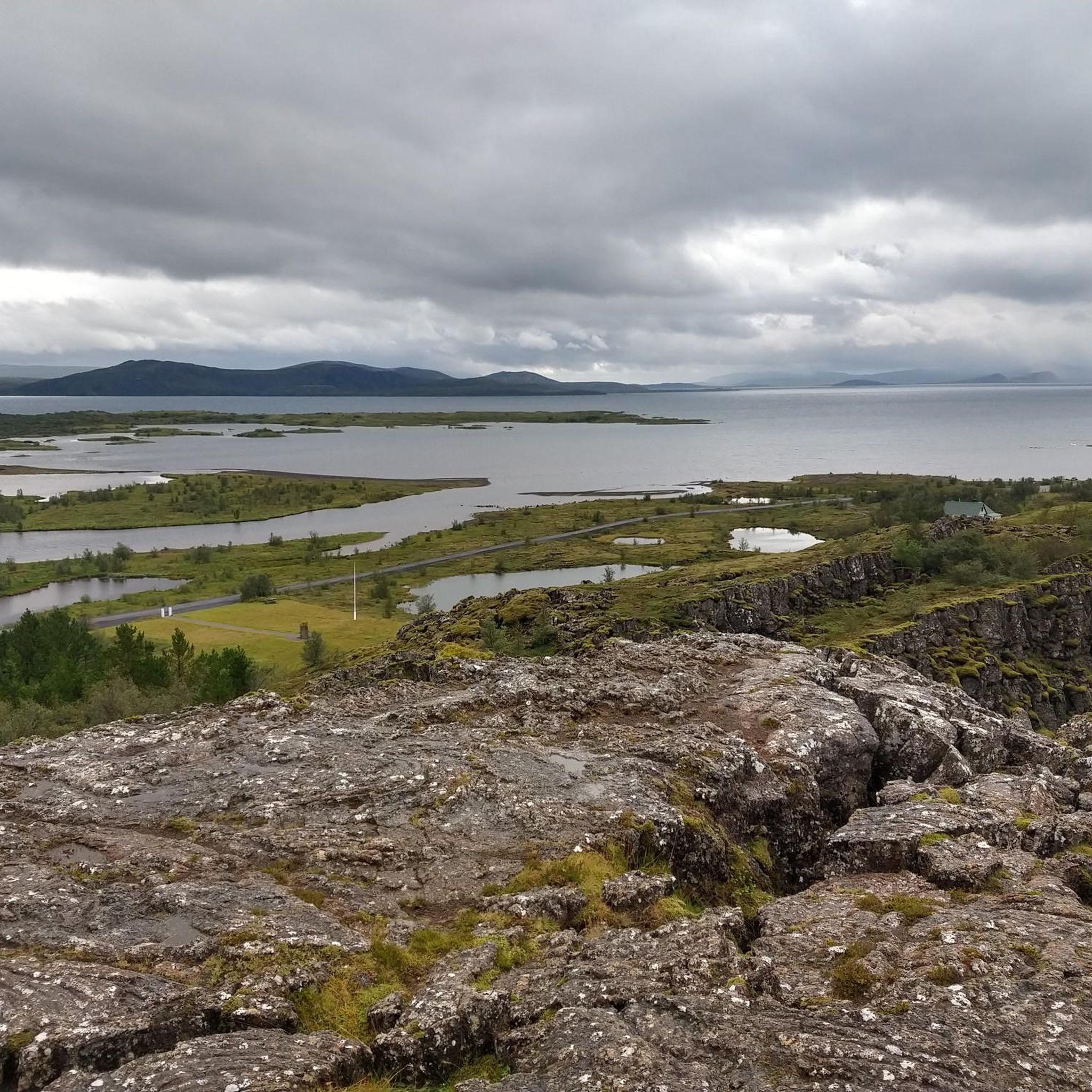
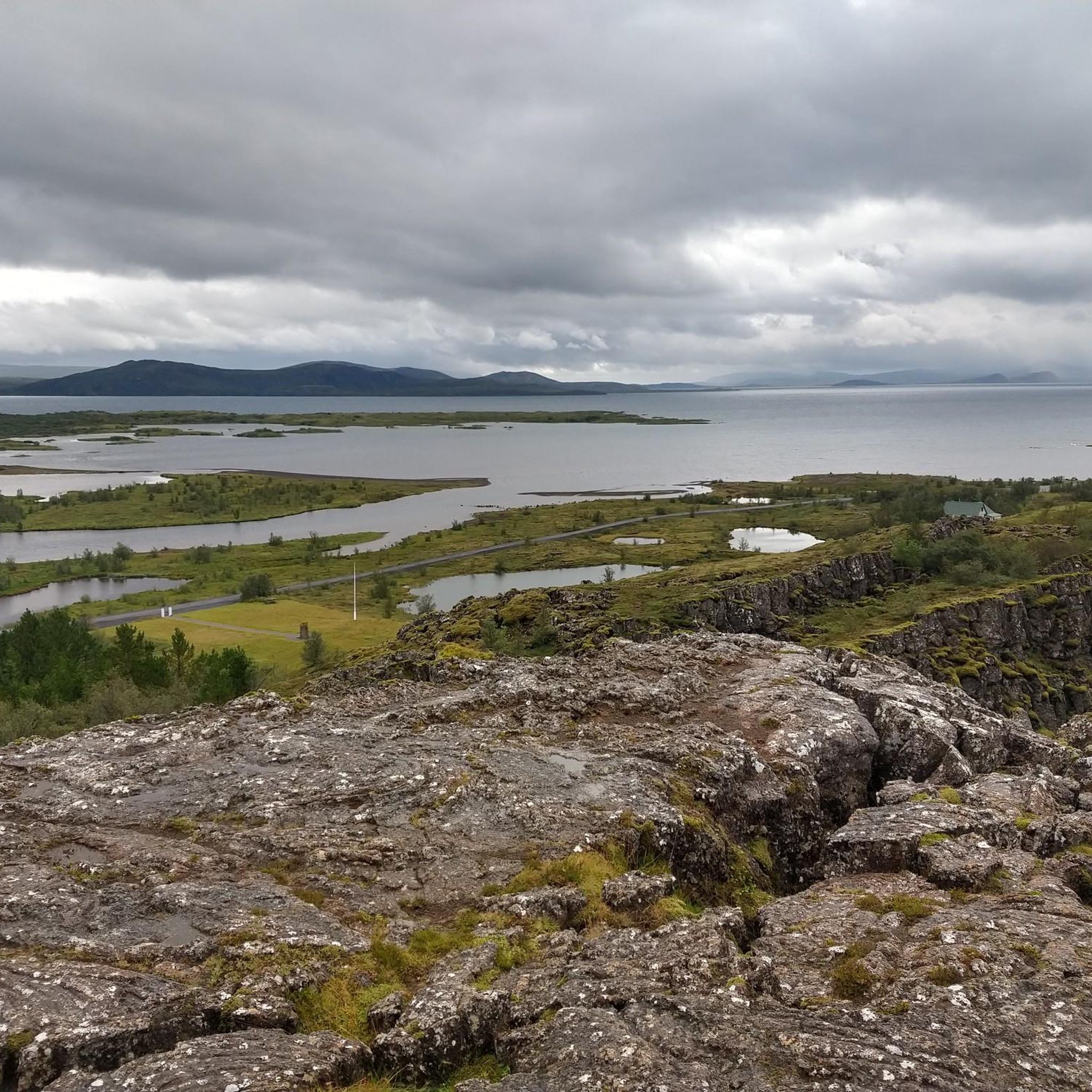
Þingvellir (or Thingvellir) National Park in Iceland is a unique geological location. It is the place where the North American and Eurasian tectonic plates move apart. This separation is very clearly visible in the park, making it one of the few places in the world where you can see this phenomenon so clearly. The park is located on the Mid-Atlantic Ridge and the plates here are drifting apart at a rate of about 2 to 2.5 centimeters per year. This results in spectacular geological features such as deep gorges filled with very cold and clear water, fissures, cracks, waterfalls, subsidence and fault surfaces.
14
1

Very nice place with lots of parking spaces and entrances. The P2 parking lot is generally very full, as most people intuitively use it due to its proximity to the waterfall. All the places you can visit there are therefore very well distributed. There are also good quality toilets there. Many tour operators offer day trips in small group buses.
5
0

It is unimaginable what forces must have been at work here when these continental plates formed. Why do people always think they are above everything? When nature uses its powers, people are insignificant 😉. I was very impressed by this short hike between the continental plates.
6
0
Lögberg, also known as the Whetstone, is a rocky outcropping in southwestern Iceland, on the site of the meeting of the country's Althing parliament. The original Althing was collected in Þingvellir, an area of dramatic landscapes easily accessible from the populated areas of the southwest. The exact location of Lögberg is unknown, due to the changing geography of the rift valley over 1,000 years. Two possible sites have been identified at Þingvellir, one a flat ridge at the top of a slope called Hallurinn (currently marked by a flagpole), the other in the Almannagjá fault against a rock face. The Lögberg was the place where the legislature (lögsögumaður) took his seat as the presiding officer of the assembly of the Althing. Speeches and announcements were made from this spot. Everyone present could make their argument from the Lögberg. The meetings were also called and dissolved from there. The Lögberg fulfilled its purpose from the founding of the parliament in 930. It ceased to be used in 1262, when Iceland swore allegiance to Norway.
9
1
Snorrabud is an important historical site, located in Þingvellir National Park. It is the founding location of Iceland as it was the site of the country's first parliament. The views from here are absolutely stunning. You can even go diving here if you're brave enough to brave the icy waters, where you can see the tectonic plates from a completely different perspective.
9
0
Located in the Þingvellir National Park, Flosagjá is an impressive gorge that is part of the Mid-Atlantic Ridge. This gorge, which contains crystal clear water that maintains a constant temperature of 3-4°C all year round, is a remarkable natural wonder. Flosagjá is about 730 meters long and reaches a depth of about 25 meters. It is named after Flosi Þórðarson, an important character in the Brennu-Njáls saga, who is said to have jumped the gorge to escape his enemies.
8
0
'Peningagjá' is a term from Icelandic and can be split into two parts: 'peninga' and 'gjá'. 'Peninga' means 'coin' and 'gjá' means 'crack' or 'gorge'. So, 'Peningagjá' can be translated as 'Cracked Coin'. This name comes from the tradition where visitors throw coins into the clear waters of the crevice in the hope of luck and fortune. It is important to note that authorities have now decided to stop this practice to preserve nature.
7
0
Frequently Asked Questions
What are the most popular natural monuments to visit in Þjóðgarðurinn á Þingvöllum?
Visitors frequently enjoy the dramatic landscapes of Öxarárfoss, a picturesque waterfall within the Almannagjá gorge. Another highly rated spot is the Flosagjá Fissure, known for its crystal-clear waters and unique geological setting. The Almannagjá Rift itself, where you can visibly see the continental plates pulling apart, is also a must-see.
Are there family-friendly natural monuments around Þjóðgarðurinn á Þingvöllum?
Yes, several natural monuments are suitable for families. The Öxarárfoss waterfall and the Almannagjá Rift are both accessible and offer engaging experiences for all ages. Additionally, the Thingvellir National Park area, including the historic Lögberg (Law Rock), provides easy paths and fascinating history for families to explore.
What unique geological features can I observe in Þjóðgarðurinn á Þingvöllum?
Þjóðgarðurinn á Þingvöllum is renowned for its exceptional geological features, being situated directly on the Mid-Atlantic Ridge. You can witness the visible boundary between the North American and Eurasian tectonic plates at the Almannagjá Rift. Other notable features include deep gorges like Flosagjá Fissure, and the stunning clarity of the water in fissures like Silfra, which is filled with glacial meltwater filtered through volcanic rock.
What historical sites are integrated with the natural monuments in this region?
The natural monuments in Þjóðgarðurinn á Þingvöllum are deeply intertwined with Iceland's history. The Almannagjá gorge was the central location for the Alþingi, the world's oldest parliament, established in 930 AD. Within the park, you can also find Lögberg (Law Rock), where laws were proclaimed. Even the Öxarárfoss waterfall is believed to have been man-made to supply water to the Alþingi.
Are there hiking trails near the natural monuments in Þjóðgarðurinn á Þingvöllum?
Yes, there are numerous hiking opportunities. You can find easy loops like the Öxarárfoss – Flosagjá Fissure loop or the Thingvellir National Park – Flosagjá Fissure loop. For more options, explore the Hiking around Þjóðgarðinn á Þingvöllum guide, which includes routes of varying difficulties, including easy and moderate trails.
What kind of outdoor activities can I do near these natural monuments?
Besides exploring the natural monuments themselves, the area offers excellent hiking. You can find trails that take you through the park's unique landscapes, including routes around Öxarárfoss and the Flosagjá Fissure. For detailed hiking routes, check out the Hiking around Þjóðgarðinn á Þingvöllum guide.
What do visitors enjoy most about the natural monuments in Þjóðgarðurinn á Þingvöllum?
Visitors are consistently amazed by the unique geological experience of walking between continents at the Almannagjá Rift. The breathtaking clarity of the water in fissures like Silfra and Flosagjá Fissure is also a highlight. Many appreciate the combination of natural beauty with the profound historical significance of sites like Lögberg and the ancient Alþingi.
Is it possible to dive or snorkel in any of the natural monuments?
Yes, the Silfra Fissure, a water-filled rift within the park, is world-renowned for its exceptional water clarity and offers a unique opportunity for snorkeling and diving directly between the North American and Eurasian tectonic plates. The water is glacial meltwater, naturally filtered, providing visibility often exceeding 100 meters.
What is Þingvallavatn and why is it significant?
Þingvallavatn is Iceland's largest natural lake, covering about 84 square kilometers. It is significant due to its pristine waters, with nearly 90% of its input coming from cold, subterranean spring-fed sources. This contributes to its exceptional clarity and supports a unique ecosystem, including several morphs of Arctic charr. It's a beautiful natural landmark within the park.
What is the historical significance of Drekkingarhylur?
Drekkingarhylur, also known as 'The Drowning Pool,' is a historically somber site within the Öxará River. While not a natural monument in the geological sense, it serves as a powerful and thought-provoking reminder of a darker chapter in Iceland's legal history, where women convicted of certain crimes were executed by drowning between the 16th and 18th centuries.
How long should I plan for a visit to the natural monuments in Þjóðgarðurinn á Þingvöllum?
To fully appreciate the main natural monuments like the Almannagjá Rift, Öxarárfoss, and Flosagjá Fissure, along with some of the historical sites, a half-day to a full day is recommended. This allows for leisurely walks, photo opportunities, and time to absorb the unique geological and historical context.
Is there parking available at the natural monuments?
Yes, there are designated parking areas within Þingvellir National Park, which provide access to the various natural monuments and historical sites. These are typically well-marked and often require a parking fee.
Most popular routes around Þjóðgarðurinn á Þingvöllum
Most popular attractions around Þjóðgarðurinn á Þingvöllum

Get inspired with the komoot mobile app


Explore more
Extend your search for the best caves by checking out these guides of the top ones around Þjóðgarðurinn á Þingvöllum:
