Top 20 Natural Monuments in Norðurþing
Natural monuments in Norðurþing are primarily shaped by glacial and volcanic activity. This municipality in northeast Iceland features dramatic landscapes, powerful waterfalls, and unique geological formations. The region is home to over 20 natural monuments, offering diverse outdoor exploration opportunities. These sites provide insights into Iceland's geological history and natural beauty.
Best natural monuments in Norðurþing
- The most popular natural monuments is Selfoss Waterfall, a waterfall that is approximately 13 meters high and 100 meters wide. Its waters flow…
Last updated: August 19, 2026
Dettifoss
Highlight • Waterfall
Translated by Google •
Tip by

Selfoss Waterfall
Highlight • Waterfall
Translated by Google •
Tip by

Sign up now to discover places like this
Get recommendations on the best single tracks, peaks, & plenty of other exciting outdoor places.
Sign up for free
Jökulsárgljúfur National Park
Highlight • Gorge
Translated by Google •
Tip by

Arctic Henge (Heimskautsgerðið) in Raufarhöfn
Highlight • Monument
Heimskautsgerðið in Raufarhöfn, the most remote and northernmost
Commune of Iceland, lies just below the Arctic Circle near the coast and
is under construction. The …
Translated by Google •
Tip by

Rauðhólar (Jökulsárgljúfur)
Highlight • Volcano
de.wikipedia.org/wiki/Rauðhólar_(Jökulsárgljúfur)
Translated by Google •
Tip by

View of Ásbyrgi Canyon
Highlight • Canyon
Translated by Google •
Tip by

Hljóðaklettar Basalt Rock Formations
Highlight • Natural Monument
Translated by Google •
Tip by

Jökulsá á Fjöllum
Highlight • River
Translated by Google •
Tip by
Jökulsárgljúfur Canyon Cliffs
Highlight • Canyon
Translated by Google •
Tip by
Bird Cliffs at Rauðinúpur
Highlight • Natural Monument
You can take great photos.
However, the breeding season has to be considered.
Translated by Google •
Tip by

Sign up for free to discover even more natural monuments in Norðurþing.
Sign up for free
Already have an account?
Start today with a free account
Your next adventure awaits.
Login or Signup
Popular around Norðurþing
Tips from the Community

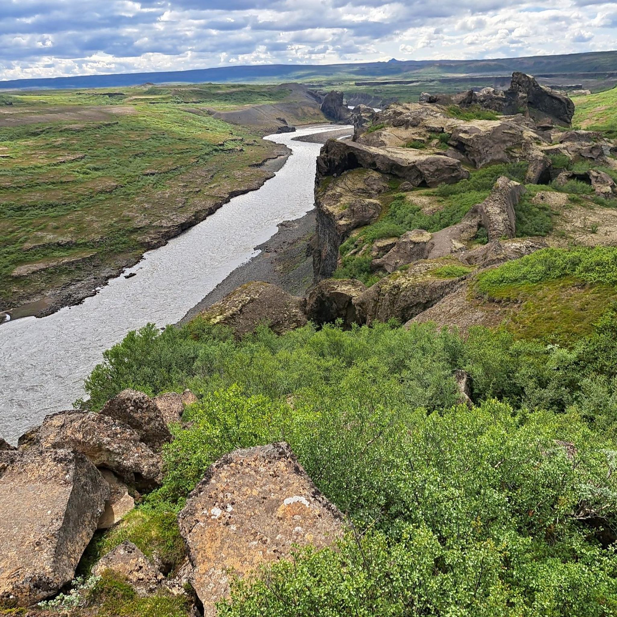
In Jökulsárgljúfur National Park, the Jökulsá á Fjöllum River has created Iceland's longest river canyon, stretching over 25 km. There are several beautiful hiking trails through the park, starting at the Vesturdalur campsite. One tour leads to the red mountain cones of the Rauðhólar crater series, which offer excellent views over the canyon. Those who want to hike the three waterfalls of Jökulsárgljúfur can take the hiking trail above the canyon and pass the Hafragilsfoss, Dettifoss, and Selfoss waterfalls one after the other. With the establishment of Vatnajökull National Park in 2008, Jökulsárgljúfur National Park was incorporated into the larger park.
0
0
The Selfoss Waterfall is characteristically wider than it is tall, with a height of approximately 11 meters (36 feet) and a width of around 100 meters (330 feet). This impressive width creates a majestic waterfall, particularly impressive from the surrounding cliffs. The powerful flow of water and the mist it creates give the waterfall an enchanting atmosphere. This combination of vastness and mist makes Selfoss a photographer's paradise, offering numerous opportunities for impressive shots in a variety of lighting conditions.
0
0

Unfortunately, it is currently difficult to reach for people with reduced mobility, but a "ramp" is already being built from the parking lot to the viewing platform (as of August 2024) to make the waterfall accessible to wheelchair users, otherwise the earlier you get there, the emptier it is 😉
0
0

This is a nice place for the chance to shoot a rainbow.
7
0
Jökulsá á Fjöllum, which means “glacier river in the mountains”, is the second longest river in Iceland with a length of approximately 206 km. The river's source is the Vatnajökull Glacier and it flows into the Greenland Sea. The river flows over the Selfoss, Dettifoss, Hafragilsfoss and Réttarfoss waterfalls, the second of which is the most powerful waterfall in Europe. The Jökulsá á Fjöllum basin is the largest in Iceland, covering an area of approximately 7,380 square kilometers.
8
0
Selfoss is a beautiful waterfall, located in the Jökulsá á Fjöllum river, upstream from the powerful Dettifoss. This waterfall is approximately 13 meters high and 100 meters wide. Selfoss is characterized by its many basalt columns and is surrounded by breathtaking scenery. The waters of Selfoss flow over a wide front, making it an impressive sight for visitors. From the parking lot at Dettifoss it is about a kilometer walk to Selfoss. The trail is well marked and offers beautiful views of both waterfalls.
8
1

A beautiful rock of red and black ash that offers breathtaking views of the gorge.
3
0
Frequently Asked Questions
What are the most prominent natural features to explore in Norðurþing?
Norðurþing is renowned for its dramatic landscapes shaped by glacial and volcanic activity. You'll find powerful waterfalls like Selfoss, unique geological formations such as the basalt columns at Hljóðaklettar Basalt Rock Formations, and impressive canyons like Ásbyrgi Canyon. The region is also home to the Jökulsá á Fjöllum River, Iceland's second-longest, which has carved much of this spectacular scenery.
Are there family-friendly natural monuments in Norðurþing?
Yes, several natural monuments in Norðurþing are suitable for families. For instance, the Arctic Henge (Heimskautsgerðið) in Raufarhöfn is listed as family-friendly. While many natural sites involve some walking, the accessibility of trails can vary. Always check specific trail conditions for younger children or those with limited mobility.
What kind of hiking trails can I find near the natural monuments in Norðurþing?
Norðurþing offers a variety of hiking trails. You can find routes ranging from easy to difficult. For example, there's an easy 3 km loop from Dettifoss to Selfoss Waterfall. More challenging options include a 9.6 km loop from Dettifoss to Selfoss. For a comprehensive overview of hiking opportunities, explore the Hiking in Norðurþing guide.
What is the best time to visit the natural monuments in Norðurþing?
The best time to visit Norðurþing's natural monuments is generally during the summer months (June to August) when the weather is milder, and trails are most accessible. During this period, you'll experience longer daylight hours, making it ideal for exploring the waterfalls and canyons. Winter visits can be challenging due to snow and ice, though they offer a unique, stark beauty.
Where can I find impressive viewpoints over the canyons and landscapes?
For breathtaking views, consider visiting Rauðhólar (Jökulsárgljúfur), a volcano offering fantastic panoramas over the Jökulsárgljúfur canyon. The View of Ásbyrgi Canyon also provides stunning perspectives of its horseshoe shape and towering cliffs. Many trails within the Jökulsárgljúfur area offer excellent vantage points.
Are there any unique geological formations besides waterfalls?
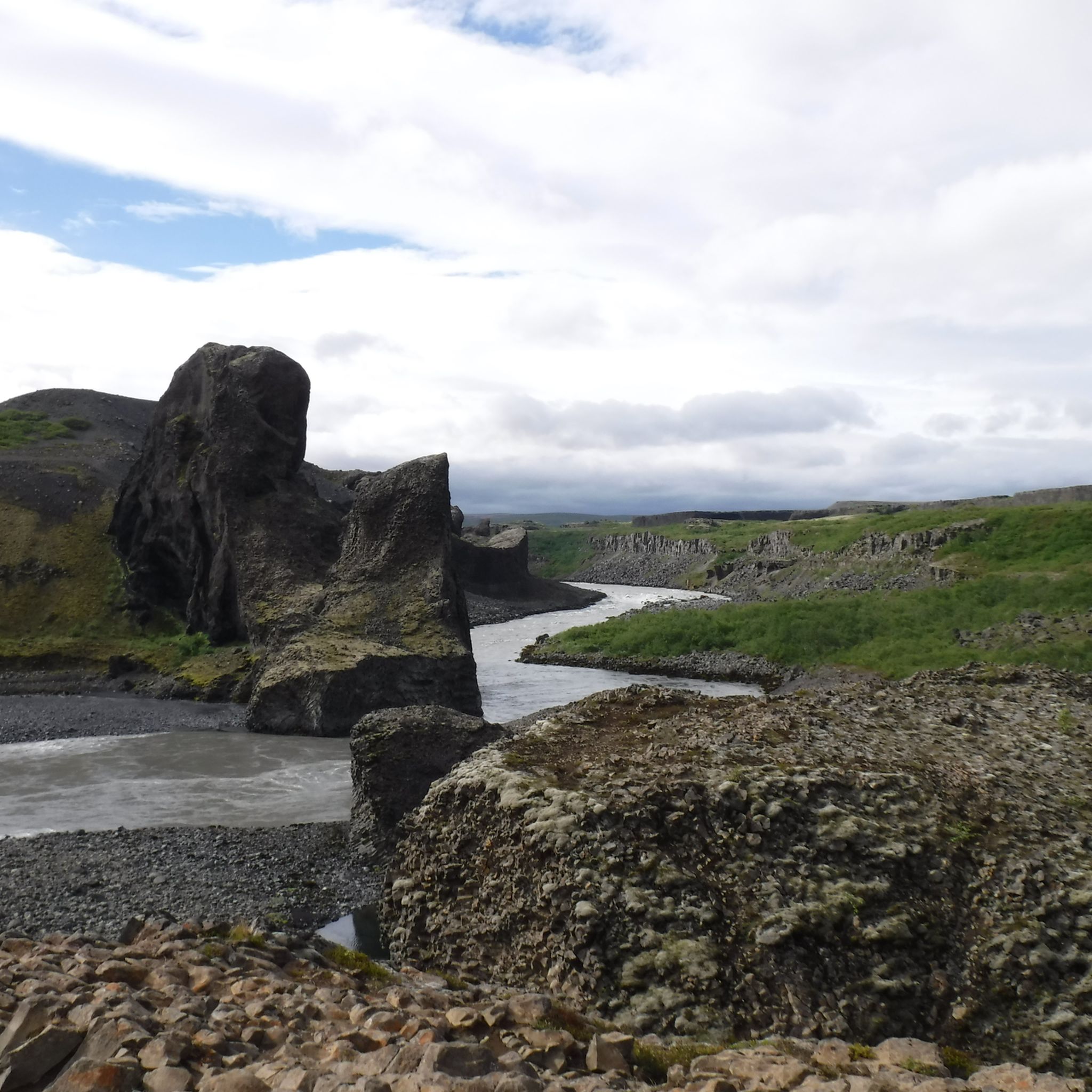
Absolutely. The Hljóðaklettar Basalt Rock Formations are a prime example, featuring jagged, twisted basalt rocks with mushroom-shaped columns and a raised layer resembling a church vault. These formations were created by the rapid cooling of lava under the influence of water, and visitors often report an echo phenomenon in the area.
What is the Jökulsárgljúfur National Park known for?
Jökulsárgljúfur National Park, now part of the larger Vatnajökull National Park, is famous for Iceland's longest river canyon, stretching over 25 kilometers. It's a region of dramatic landscapes carved by the Jökulsá á Fjöllum River, featuring several beautiful hiking trails, unique lava formations like Hljóðaklettar, and the iconic horseshoe-shaped canyon of Ásbyrgi.
What kind of activities can I do near the natural monuments in Norðurþing?
Beyond exploring the monuments themselves, Norðurþing offers various outdoor activities. Hiking is very popular, with routes like the Dettifoss Viewpoint – Selfoss Waterfall loop. You can also find running trails, such as those listed in the Running Trails in Norðurþing guide. The region's diverse terrain is ideal for experiencing Iceland's dramatic wilderness.
Are there any easy hiking options to see the natural monuments?
Yes, there are several easy hiking options. An easy 3 km loop connects the Dettifoss Viewpoint to Selfoss Waterfall. Another easy trail is the 2.8 km loop from Trölliđ to the Hljóðaklettar Rock Formations and Kirkjan Cave. For more easy routes, consult the Easy hikes in Norðurþing guide.
What do visitors enjoy most about the natural monuments in Norðurþing?
Visitors frequently praise the sheer scale and raw power of the waterfalls, particularly the immense volume of Dettifoss and the wide basalt-columned Selfoss. The unique geological formations, such as the twisted basalt rocks at Hljóðaklettar, and the stunning views from places like Rauðhólar, are also highly appreciated. The dramatic wilderness and opportunities for hiking are consistently highlighted as major draws.
Is there parking available at the main natural monuments?
Yes, parking is generally available at the main natural monuments. For instance, there is a parking lot at Dettifoss, from which a well-marked trail leads to Selfoss Waterfall. The road to the parking lot for Hljóðaklettar Basalt Rock Formations is now paved, making it easily accessible. Always check local signage for specific parking regulations and fees.
Can I see wildlife near the natural monuments in Norðurþing?
While Norðurþing's natural monuments are primarily geological, the region's wilderness does support various bird species. For example, the Bird Cliffs at Rauðinúpur are a notable spot for birdwatching. Keep an eye out for local fauna while exploring the trails and canyons.
Most popular attractions in Norðurþing

Get inspired with the komoot mobile app


Didn’t find what you were looking for?
Find even more amazing natural monuments in Norðurþing by checking out the top Highlights region by region:
Explore more
Extend your search for the best caves by checking out these guides of the top ones in Norðurþing:
