Top 11 Gorges in the Absaroka Range
Canyons in the Absaroka Range are a prominent feature of this rugged sub-range of the Rocky Mountains, spanning parts of Montana and Wyoming. The region's volcanic origins, dating back 53 to 43 million years, combined with extensive glacial carving, have created dramatic and deep canyon systems. These landscapes offer a remote wilderness experience within protected areas like the Absaroka-Beartooth Wilderness. Visitors can explore diverse ecosystems and observe abundant wildlife within these geologically significant formations.
Best canyons in the Absaroka Range
…Last updated: June 27, 2026
Upper Yellowstone Falls
Highlight • Waterfall
Tip by

Lower Yellowstone Falls
Highlight • Waterfall
The Lower Falls of the Yellowstone River are a majestic sight, plunging dramatically into the Grand Canyon of the …
Tip by

Sign up now to discover places like this
Get recommendations on the best single tracks, peaks, & plenty of other exciting outdoor places.
Sign up for free
View of Lower Falls from Artist Point
Highlight • Viewpoint
Tip by
South Rim Trail
Highlight (Segment) • Trail
Translated by Google •
Tip by

Calcite Springs Overlook
Highlight (Segment) • Viewpoint
Translated by Google •
Tip by

Buffalo Bill Dam
Highlight • Monument
Tip by

Harden Arch Bridge - Shoshone Canyon
Highlight • Bridge
Tip by

Seven Mile Hole Trail
Highlight (Segment) • Trail
Tip by
Shoshone Canyon Tunnels
Highlight • Structure
Tip by
Start today with a free account
Your next adventure awaits.
Login or Signup
Tips from the Community

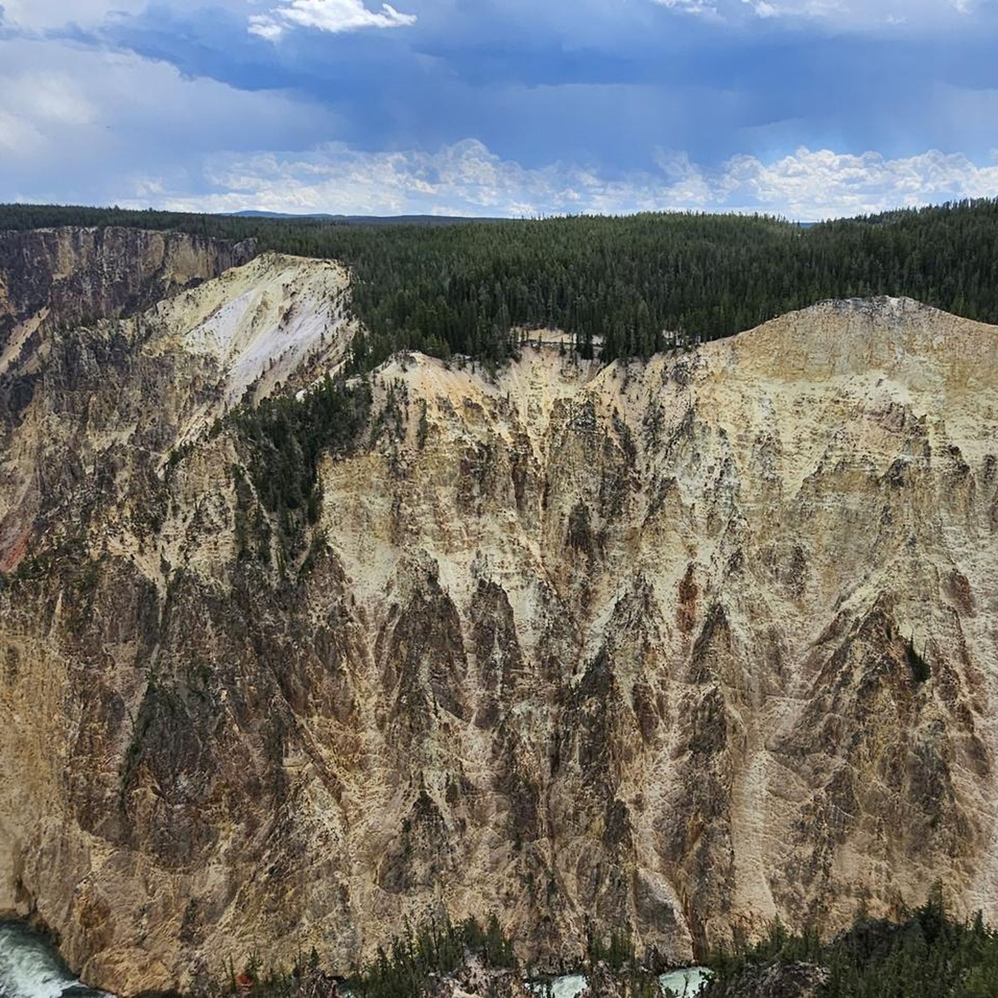
Lower Falls Of The Yellowstone River, Yellowstone National Park, United States 🇺🇸 The Grand Canyon of the Yellowstone stretches for roughly twenty miles and offers some of the most breathtaking vistas in the entire American West. Carved by the power of the Yellowstone River, the canyon walls display a stunning array of colors ranging from deep oranges and reds to brilliant yellows and whites, caused by the chemical weathering of iron compounds in the rhyolite rock. To get the best views of the Lower Falls, visitors should head to Artist Point or Lookout Point, which provide sweeping perspectives of the 308-foot waterfall as it plunges into the canyon below. Timing is essential when planning a visit to this iconic landmark, as the roar of the falls is most thunderous during the late spring and early summer when snowmelt increases the river's volume. It is highly recommended to arrive early in the morning to beat the large crowds and to witness the soft morning light illuminating the canyon walls. For those interested in a closer look, the Brink of the Lower Falls trail offers a steep but rewarding hike that leads directly to the edge of the precipice, allowing you to feel the mist and hear the deafening power of the water. Beyond the main overlooks, travelers should explore the various trails that line both the North and South Rims to find quieter spots for photography and wildlife viewing. The area is home to diverse fauna, including osprey that nest on the towering rock pinnacles and the occasional grizzly bear or elk wandering through the nearby forests. Always carry bear spray and stay on designated paths to protect the fragile geothermal environment. Because Yellowstone is a high-altitude park, it is wise to drink plenty of water and wear layers to accommodate the rapidly changing weather conditions common in the mountains. Faheem Hunarwar
0
0
Lower Falls of the Yellowstone, Yellowstone National Park, United States 🇺🇸 The Lower Falls of the Yellowstone River are a majestic sight, plunging dramatically into the Grand Canyon of the Yellowstone. This iconic waterfall, nearly twice the height of Niagara Falls, is a testament to the raw power of nature and the volcanic forces that shaped this unique landscape. Visitors can marvel at its grandeur from various viewpoints, each offering a distinct perspective on the cascading water and the vibrant hues of the canyon walls. The Grand Canyon of the Yellowstone itself is a geological wonder, carved by the mighty Yellowstone River over thousands of years. Its rhyolite rock, altered by hot water and steam, displays a dazzling array of colors, from fiery reds and oranges to soft yellows and browns. Hiking trails wind along the rim and descend into the canyon, providing opportunities for intimate encounters with this breathtaking natural artistry. Exploring this area offers incredible photographic opportunities and a chance to truly connect with the wild heart of Yellowstone. Remember to stay on marked trails for safety and to protect the delicate ecosystem. Early mornings or late afternoons often provide the best light for photography and fewer crowds, allowing for a more serene experience.
1
0

This 110-foot waterfall is only small in comparison to the lower falls, which are almost 330 feet high. Needless to say the upper falls are still magnificent, and the interesting colors in the canyon walls are the result of this region's constant hydrothermal activity.
0
0

The hiking trail along the rim from the Upper Falls to the Lower Falls is definitely worth it. It offers spectacular views that are less crowded.
0
0

On a serpentine path about 1.3 km long (there and back) you can go down to the river and, directly above the Lower Falls, get an impression of the masses of water that cascade down here day after day.
0
0
A small but particularly worthwhile viewpoint, where completely different but always exciting views can be seen within just a few meters. Firstly, of the Calcite Springs, small steaming springs on the bank, then of the exciting rock layers opposite, where rock columns (basalt?) are lined up at some distance from one another, and finally a spectacular view downstream through a deep gorge.
3
0
In May there can still be quite a lot of snow here, as this side is in the shade.
0
0

The Seven Mile Hole Trail begins on the canyon rim and slowly snakes its way almost 1,000 feet to the Yellowstone River below. Along the way it passes multiple campsites, all with amazing views of the gorge.
1
0
Frequently Asked Questions
What makes the canyons in the Absaroka Range unique?
The Absaroka Range canyons are unique due to their volcanic origins, dating back 53 to 43 million years, combined with extensive glacial carving. This geological history has created dramatic and deep canyon systems with impressive rock formations, steep walls, and diverse geological strata. Much of the range lies within protected wilderness areas, offering a remote experience with abundant wildlife.
Are there family-friendly viewpoints or activities in the Absaroka Range canyons?
Yes, several spots are suitable for families. You can visit the View of Lower Falls from Artist Point, which offers spectacular views of the Lower Falls and Yellowstone River. Another family-friendly option is Upper Yellowstone Falls, a magnificent waterfall with various viewing points. The Calcite Springs Overlook also provides accessible views of a gorge.
What kind of wildlife can I expect to see in the Absaroka Range canyons?
The Absaroka Range is a haven for diverse wildlife. The canyons provide crucial habitats and corridors for animals such as bighorn sheep, mountain goats, elk, deer, moose, black bears, wolves, and a substantial grizzly population. Opportunities for wildlife sightings are abundant, especially in the more remote wilderness areas.
What are some notable natural features besides waterfalls in the Absaroka Range canyons?
Beyond the impressive waterfalls, the canyons feature sparkling streams, hundreds of alpine lakes, and diverse ecosystems ranging from dense conifer forests to broad mountain meadows and high-altitude tundra plateaus. The volcanic and glacial influences have also created unique rock formations and U-shaped valleys.
What hiking opportunities are available near the Absaroka Range canyons?
The Absaroka Range offers extensive hiking opportunities. For instance, you can explore the hiking trails in the Absaroka Range, which include routes like the South Rim Trail, offering spectacular views of the Grand Canyon of the Yellowstone. There are also waterfall hikes like Passage Falls Trail and Crazy Creek Falls Trail.
What is the best time of year to visit the Absaroka Range canyons?
The best time to visit is generally during the warmer months, from late spring through early autumn. This period offers the most favorable weather for hiking, wildlife viewing, and accessing trails, as many areas can be snow-covered and challenging during winter. Early mornings or late afternoons often provide the best light for photography and fewer crowds.
Are there any historical or man-made landmarks within the canyons?
Yes, you can find man-made structures that are historically significant or offer unique perspectives. The Buffalo Bill Dam is a notable historical site and viewpoint within a gorge. Additionally, the Harden Arch Bridge - Shoshone Canyon provides impressive views of the river gorge and access to an old road.
What are the difficulty levels of trails in the Absaroka Range canyons?
Hiking trails in the Absaroka Range vary in difficulty. You can find easy routes like the easy hikes in the Absaroka Range, such as the South Rim Trail or Trout Lake Trail. Intermediate options include the South Rim Trail itself, while more challenging routes like the Seven Mile Hole Trail are available for experienced hikers.
How do the Absaroka Range canyons compare to those within Yellowstone National Park?
The Absaroka Range forms the eastern boundary of Yellowstone National Park, and its canyons share similar volcanic and glacial influences. While Yellowstone's Grand Canyon is widely recognized, the Absaroka Range itself offers a more remote and wild experience within protected wilderness areas. The canyons here are integral to the range's rugged character, providing unparalleled wilderness adventures and dramatic vistas that complement Yellowstone's more visited areas.
What other outdoor activities can I do near the Absaroka Range canyons?
Beyond hiking, the clear mountain lakes and streams within the canyons are renowned for fly fishing, with populations of cutthroat, brook, rainbow, and golden trout. The extensive wilderness areas also offer opportunities for backpacking and off-trail exploration for those seeking a truly remote experience.
Are there any accessible features for visitors with mobility considerations?
While much of the Absaroka Range offers rugged wilderness, some areas provide easier access. The Shoshone Canyon Tunnels are noted as wheelchair accessible, offering a way to experience the canyon environment. Many viewpoints, like Artist Point, are also designed to be easily reachable.
What geological features are prominent in the Absaroka Range canyons?
The canyons are characterized by their unique geology, primarily composed of volcanic breccia, granites, and gneisses. This results in impressive rock formations, steep canyon walls, and diverse geological strata. Glacial erosion has further shaped the landscape, creating U-shaped valleys and cirques, often with vibrant colors in the rock due to hydrothermal activity.
Most popular routes in the Absaroka Range
Most popular attractions in the Absaroka Range

Get inspired with the komoot mobile app


Explore more
Already discovered everything in this region? See additional gorges in the Absaroka Range for your next adventure:
