The 14 Most Amazing Peaks in Cape Verde
Best mountain peaks in Cape Verde are found across its volcanic islands, offering diverse landscapes for exploration. This archipelago in the central Atlantic Ocean features rugged coastlines, lush valleys, and active volcanoes. The islands' mountainous terrain provides a variety of natural features and viewpoints.
Best mountain peaks in Cape Verde
- The most popular mountain peaks is Pico do Fogo, a volcano that offers a spectacular climb up to its crater rim. The ascent provides fantastic views of the Caldeira.
- Another must-see spot is Trail to Monte Gordo Summit, a trail leading to a summit and viewpoint. Visitors can expect a path that transitions from paved to forest road, culminating in stairs to the summit.
- Visitors also love Pico Pequeno Crater, a challenging volcano and summit. This highlight offers a fascinating view into the "Hellmouth" of the huge crater.
- Cape Verde is known for its volcanic peaks, challenging summits, and scenic viewpoints. The islands offer a variety of mountain peaks to see and explore, from active volcanoes to trails leading to high summits.
- The mountain peaks in Cape Verde are appreciated by the komoot community, with 68 upvotes and 8 photos shared by visitors.
Last updated: July 9, 2026
Pico do Fogo
Highlight • Volcano
Translated by Google •
Tip by

Pico do Fogo
Highlight • Volcano
A massive eruption from the main crater of the Pico in 1680 gave the island, then called "São Filipe", the name Fogo (English: "fire"), which it still uses today. Further eruptions followed in 1785, 1799, 1847, 1852, 1857 and 1951.
During the eruption on April 2, 1995, the lava flow of which was limited to the interior of the Chã das Caldeiras, a small secondary volcano (Pico Pequeno 1950 m) was formed at the western foot of the Pico. After the eruption of Pico Pequeno, large parts of the cultural landscape in the Caldeira were destroyed, and the 2000 inhabitants were temporarily evacuated.
On the morning of November 23, 2014, there was another eruption with ash and lava ejection at the same location as the 1995 eruption. The ongoing eruption destroyed the southern and central part of Portela and about 70% of the neighboring municipality of Bangaeira by December 7, 2014. The eruption increased in intensity and covered most of the hamlet of Portela with a lava flow that destroyed all the inhabitants' belongings. On February 8, 2015, the volcano stopped erupting again after 77 days.
Living conditions are still not easy, there is no public water or electricity supply. Emerging tourism and small-scale viticulture are the main sources of income. Pico is part of a nature reserve. For the strenuous but not particularly difficult hike to the summit, it is not necessary to be accompanied by a mountain guide. The town of Chã das Caldeiras is connected to São Filipe, the main town on the island of Fogo, by a road via Salto and Monte Largo and can be reached by taxi, car and shared taxis ("aluguer", once a day). Coffee, beans, oranges, bananas and corn, among other crops, are grown on the northeast slopes of the island. The eastern slope of Pico is not accessible. A road runs along the coastline past the volcano to Mosteiros through a very barren landscape. The volcano is clearly visible almost the entire way.
Translated by Google •
Tip by

Sign up now to discover places like this
Get recommendations on the best single tracks, peaks, & plenty of other exciting outdoor places.
Sign up for free
Pico d'Antónia
Highlight • Summit
Translated by Google •
Tip by

Trail to Monte Gordo Summit
Highlight (Segment) • Trail
Translated by Google •
Tip by

Pico Pequeno Crater
Highlight (Segment) • Volcano
Translated by Google •
Tip by
Monte Curral
Highlight • Summit
Translated by Google •
Tip by

Pau Sec Summit
Highlight • Summit
Translated by Google •
Tip by

Pico do Fogo
Highlight • Volcano
Translated by Google •
Tip by
View from Pico da Cruz
Highlight • Viewpoint
Translated by Google •
Tip by

Ascent of Pico do Fogo
Highlight (Segment) • Volcano
We were with a guide but you can also do the climb without.
The fastest climb so far was 56 minutes by an athlete from the island. Our guide told us that some people have taken 6 hours to get to the top.
Translated by Google •
Tip by
Sign up for free to discover even more peaks in Cape Verde.
Sign up for free
Already have an account?
Start today with a free account
Your next adventure awaits.
Login or Signup
Popular around Cape Verde
Tips from the Community


The climb is definitely worth it. And in the crater, there's smoke and a sulphurous smell.
0
0

The short detour to the summit of Pico da Cruz is a must if you're in the area. We were there in the morning and gazed down at a stunning sea of clouds.
0
0

Wire rope installed by Mustafa (Casa Marisa) with really nice brackets (hand-twisted)
1
0

A great view to São Vicente! Directly below the peak, there is a small village where you can get a cold drink.
1
0
What begins as a paved path turns into a forest road after the closed info point on the mountain and after the turnoff towards Monte Gordo, it goes up the stairs to the summit
1
0
We walked up and down from Lombo Bronco to the top of Pau Sec (both alternatives). Beautiful tour through plantations with great views of the Paul Valley, the sea and towards Ribeira Grande. The paths are a bit overgrown in places but easy to find with gpx.
0
0

Highest point of the island. The last 300 meters are tricky. Advance with caution.
4
0
Frequently Asked Questions
Which mountain peaks in Cape Verde offer the most challenging climbs?
For a truly challenging experience, Pico do Fogo on Fogo Island stands out as the highest and an active stratovolcano. Its ascent is demanding, often involving a via ferrata near the summit, and guides are highly recommended. On Santiago Island, Pico d'Antónia also offers a strenuous climb, with the last 300 meters being particularly tricky, requiring a local guide. Santo Antão's highest peak, Tope de Coroa, presents a physically demanding hike through volcanic landscapes.
Are there any family-friendly mountain peaks or trails in Cape Verde?
While many peaks offer challenging terrain, some areas provide more accessible options. For instance, Monte Curral is listed as family-friendly. Additionally, the guide for Easy hikes in Cape Verde features routes like the 'View of Monte Soca loop' which could be suitable for families looking for less strenuous walks.
What unique natural features can I expect to see on Cape Verde's mountain peaks?
Cape Verde's mountain peaks are rich in unique natural features. On Fogo Island, you can explore the dramatic dark lava fields and the impressive crater of Pico do Fogo, including the fascinating 'Hellmouth' of the Pico Pequeno Crater. Santo Antão offers rugged volcanic landscapes contrasting with lush green valleys. São Nicolau's Monte Gordo Natural Park is home to a diverse ecosystem, including 32 endemic plant species like the rare Dragon Blood Tree, and cloud-forest pockets.
What is the best time of year to hike the mountain peaks in Cape Verde?
The best time to visit Cape Verde for hiking is generally during the dry season, from November to June, when temperatures are milder and rainfall is minimal. This period offers clearer skies for panoramic views and more comfortable hiking conditions. For active volcanoes like Pico do Fogo, early morning climbs are recommended to avoid the heat and experience starry nights.
What kind of views can I expect from the mountain summits?
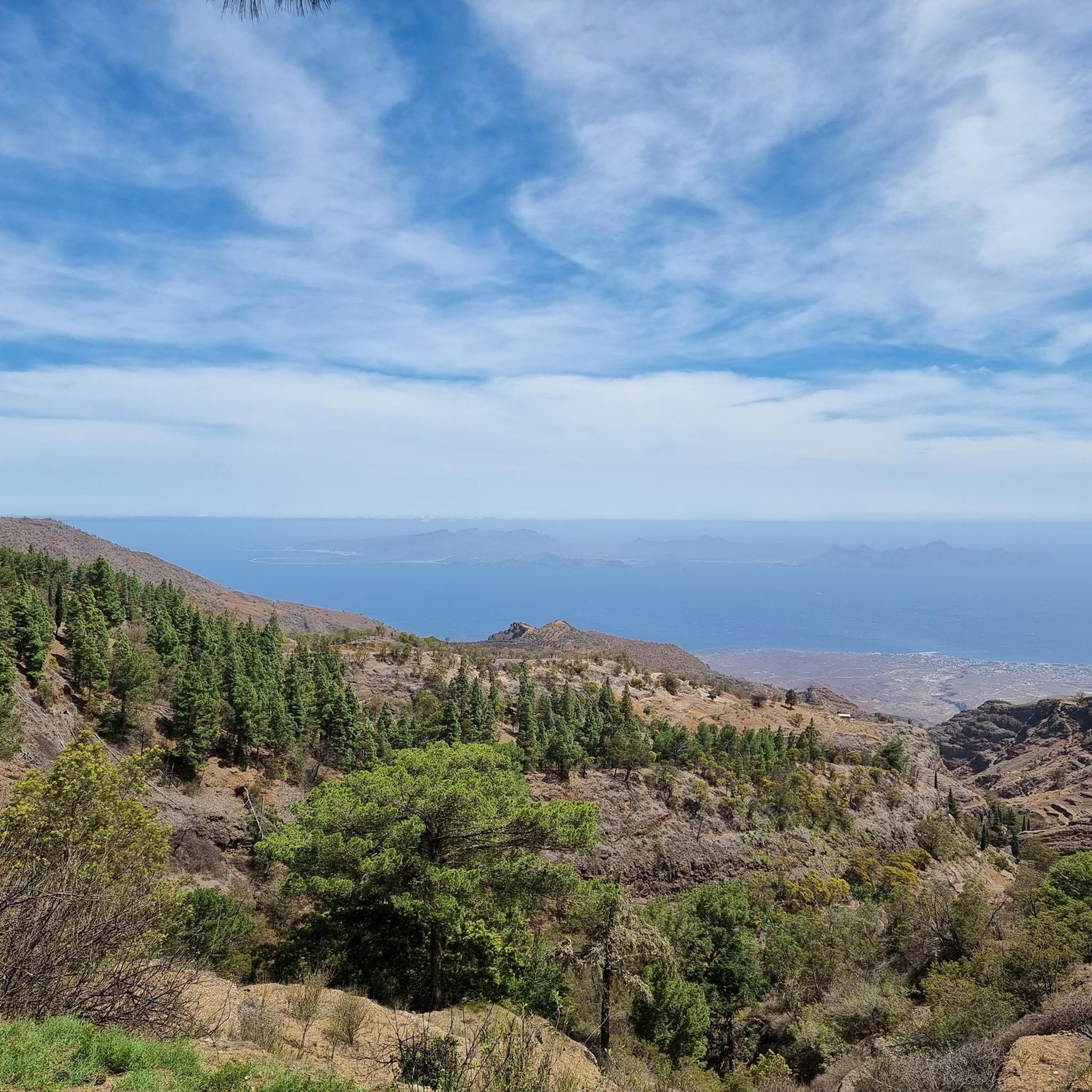
The mountain summits in Cape Verde offer breathtaking panoramic views. From Pico do Fogo, you get spectacular views of the Caldeira and, on clear days, surrounding islands. The View from Pico da Cruz on Santo Antão provides a fantastic panorama over the island and often a stunning sea of clouds. From Monte Gordo on São Nicolau, you can see São Vicente, Santo Antão, and Santa Luzia on clear days, while Monte Verde on São Vicente offers stunning views of Mindelo and the coastline.
Are there specific trails to reach the summit of Monte Gordo?
Yes, to reach the summit of Monte Gordo on São Nicolau, you can follow the Trail to Monte Gordo Summit. This path transitions from paved sections to a forest road, culminating in stairs leading to the summit. There is a park entrance fee, and visitors recommend good shoes due to some loose ground and small rocks near the top.
What outdoor activities can I do near the mountain peaks in Cape Verde?
Beyond hiking, Cape Verde offers a variety of outdoor activities. You can find MTB Trails in Cape Verde, with routes like the 'Salamansa Beach – Municipal Market of Praia loop'. For road cycling, explore Cycling in Cape Verde, which includes routes such as the 'Church of Nossa Senhora da Luz – Cesária Évora Mural loop'. Monte Gordo Natural Park also supports mountain biking and horseback riding.
What do visitors enjoy most about hiking Cape Verde's mountain peaks?
Visitors frequently praise the spectacular panoramic views from the summits, especially the unique volcanic landscapes. The descent from Pico do Fogo, often described as 'sliding down through ash like a 'moon walk'', is a highlight for many. The rich biodiversity, particularly in areas like Monte Gordo Natural Park, and the insights into local agricultural life found on trails in Santo Antão, also contribute to a rewarding experience.
What should I pack for trekking in Cape Verde's mountains?
For trekking in Cape Verde's mountains, it's essential to pack good hiking shoes, especially for trails with loose ground or slippery sections like the Trail to Monte Gordo Summit. Walking sticks can also be beneficial for stability. Given the varied climates and potential for heat, layers of clothing, sun protection, and plenty of water are advisable. For active volcanoes, consider protective gear for ash descents.
Are there any specific safety considerations for hiking active volcanoes like Pico do Fogo?
Yes, hiking active volcanoes like Pico do Fogo requires specific safety precautions. It is highly recommended to hire a local guide for safety and to navigate the challenging terrain, especially since the actual summit is considered brittle. Guides also provide valuable historical context about the Caldeira. The descent can involve unstable stones, so caution is advised.
Can I find accommodation or amenities near the mountain peaks?
While specific amenities vary by location, staying overnight in Chã das Caldeiras, a village within the volcanic crater of Pico do Fogo, is an option for early morning climbs. In more populated areas or near popular trailheads, you might find small villages offering basic amenities. For example, near Pico da Cruz, there's a small village where you can get a cold drink.
What makes Santo Antão a 'number 1 hiking island' for mountain enthusiasts?
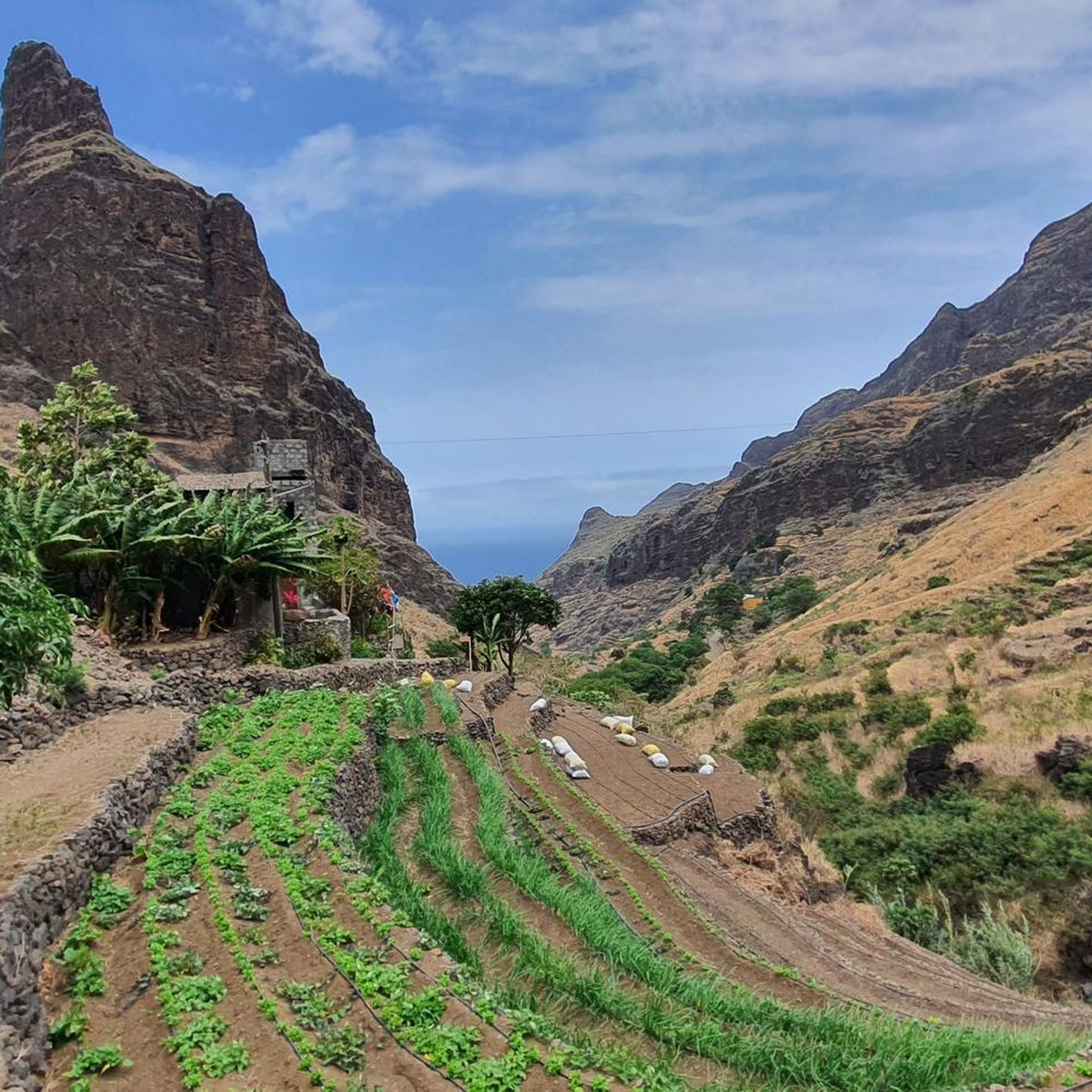
Santo Antão is renowned as a 'number 1 hiking island' due to its spectacular, rugged mountain landscapes, which alternate with tropical green valleys and impressive cliffs. Its trails, often old mule paths, wind through remote villages and offer insights into agricultural life. The island boasts unique features like cobblestone paths scaling seemingly vertical rock faces, connecting valleys with mountain communities, making it visually striking and ideal for adventure seekers.
Most popular attractions in Cape Verde

Get inspired with the komoot mobile app


Didn’t find what you were looking for?
Discover Cape Verde’s best peaks and summits by region:
Explore more
See even more amazing summits in Cape Verde with these guides:
