The 6 Most Amazing Peaks around Lower Harpton
Mountain peaks around Lower Harpton offer a diverse landscape for outdoor exploration, situated near the England-Wales border. This region features a collection of hills and summits, providing varied terrain for hikers. The area's geographical context includes features like the Radnor Forest and views extending to the Black Mountains. These natural features contribute to the appeal of trails near Lower Harpton.
Best mountain peaks around Lower Harpton
- The most popular mountain peak is Hergest Ridge Summit, a trail that runs…
Last updated: June 30, 2026
Hergest Ridge Summit
Highlight • Trail
Tip by

The Whimble
Highlight • Viewpoint
To the …
Tip by

Sign up now to discover places like this
Get recommendations on the best single tracks, peaks, & plenty of other exciting outdoor places.
Sign up for free
Wapley Hillfort
Highlight • Viewpoint
Tip by

Black Mixen Summit
Highlight • Structure
Tip by
Great Rhos (Rhos Fawr) — Summit Trig Point
Highlight • Summit
Tip by
Sign up for free to discover even more peaks around Lower Harpton.
Sign up for free
Already have an account?
Start today with a free account
Your next adventure awaits.
Login or Signup


Tips from the Community

You can just about make out the ramparts of Wapley Hillfort, but it is pretty overgrown.
0
0

Mike Oldfield created an album called ‘Hergest Ridge’ in 1974 and lived at ‘The Beacon’ the cottage with a first floor extension on Offas Dyke path from Kington which is now a guest house. The golf course encompasses Bradnor Hill and there are benches and wooden shelters at various points. Views across several counties are well worth the walk. If you’re a horse person or just a calm, quiet person around animals you will probably make some pony friends
0
0

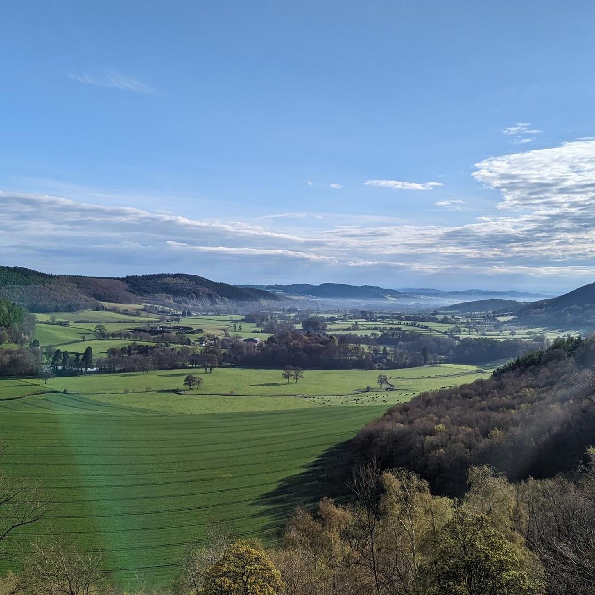
If you hike the Offa's Dyke Path, the passage over the Hergest Ridge is the highlight of the stage from Hay-on-Wye to Kington. Very beautiful views and distant vistas! The path itself does not lead directly over the summit, but you can of course incorporate that if you wish.
1
0

The Whimble has a striking conical shape. The summit is 599m and on a clear day offers great voews with the hill dropping away steeply on all sides. To the southeast, Hergest Ridge and the Black Mountains visible to the south. To the west and north the higher, flat-topped summits of the Radnor Range. To the northeast, Bache Hill.
3
0

Wapley Hill, at 1,079 feet (329 m), is a large and impressive Iron Age hillfort. It is not the finest example, as it is quite overgrown. It is also a UK listed Marilyn, so worth a bimble to tick it off.
1
0
Beautiful day out hiking two Marilyns in the Kington area. Kington is a gorgeous place to stay and the walk along the Hargest Ridge is a classic little gem.
1
0
Rhos Fawr or Great Rhos is a mountain summit in the Radnor Forest (Mid Wales), a rather isolated dome of hills to the north of the village of New Radnor. The local rocks are sedimentary shales and mudstones with some Silurian limestone. With a height of 660 metres (2,170 ft), it is the highest point in the Radnor Forest and the historic county top of Radnorshire. The summit is located on a broad heathery plateau, which is separated from Black Mixen: the eastern plateau summit, by the cwm of Harvey Dingle. To the west is Drygarn Fawr and Gorllwyn, to the northwest Plynlimon, to the north Beacon Hill and the Clun Forest (Shropshire), and to the south the Black Mountains. There is a prominent trig point at the summit, and a very useful landmark for walkers on the broad and featureless summit plateau.
3
0
Frequently Asked Questions
What are some of the most popular mountain peaks around Lower Harpton?
Among the most popular peaks is Hergest Ridge Summit, known for its panoramic views along the England-Wales border. Another highly regarded spot is The Whimble, an intermediate viewpoint with a striking conical shape offering extensive vistas. Wapley Hillfort is also a notable historical site and viewpoint.
Are there any historical sites among the mountain peaks in Lower Harpton?
Yes, Wapley Hillfort is a significant historical site. This impressive Iron Age hillfort stands at over 300 meters and is recognized as a UK listed Marilyn, offering both historical interest and a viewpoint.
What kind of views can I expect from the peaks in Lower Harpton?
The peaks around Lower Harpton offer diverse and extensive views. From Hergest Ridge Summit, you can see the hills of Shropshire, the Brecon Beacons, and the Malverns on clear days. The Whimble provides views of Hergest Ridge, the Black Mountains, and the Radnor Range. Even from Wapley Hillfort, you can enjoy the surrounding landscape, despite some areas being overgrown.
Are there family-friendly hiking options in the Lower Harpton area?
Yes, there are several easy hiking routes suitable for families. You can explore trails like the Hergest Ridge Summit – Monkey-puzzle trees and bench loop from Kington or the Highland – Wapley Hillfort loop from Staunton on Arrow. These routes offer manageable distances and gentle terrain for a pleasant family outing.
What are the highest points in the Lower Harpton region?
The highest point in the Radnor Forest, and the historic county top of Radnorshire, is Great Rhos (Rhos Fawr) — Summit Trig Point, reaching 660 meters (2,170 ft). Another significant peak is The Whimble, with its summit at 599 meters. Hergest Ridge Summit also reaches 426 meters (1,398 ft).
Can I find trails suitable for beginners around Lower Harpton?
Absolutely. The area offers a selection of easy hikes perfect for beginners. You can find routes such as the Monkey-puzzle trees and bench loop from Kington or the Lookout Bench – Nash Wood Viewpoint loop from Shire Hall, which are designed for easier exploration.
What other outdoor activities are available near the mountain peaks?
Beyond hiking, the Lower Harpton area is excellent for cycling. You can explore various road cycling routes, including loops from Kington, or try gravel biking trails that take you through diverse landscapes, such as the challenging Black Mixen Summit – View of the Valley loop from New Radnor.
What unique natural features can I see in the Lower Harpton mountains?
The region is characterized by its diverse natural features. You'll find the striking conical shape of The Whimble, and the broad heathery plateau of Great Rhos, which is part of the Radnor Forest. Black Mixen Summit is notable for its large peat bog plateau.
What is the geographical context of the mountain peaks around Lower Harpton?
The mountain peaks around Lower Harpton are situated near the England-Wales border, offering a diverse landscape of hills and summits. The area's geographical context includes features like the Radnor Forest, and on clear days, views extend to the Black Mountains, providing a rich backdrop for outdoor activities.
What do visitors enjoy most about the mountain peaks around Lower Harpton?
Visitors frequently highlight the breathtaking panoramic views, especially from spots like Hergest Ridge Summit. The diverse terrain, from open ridges to forested hills, and the combination of natural beauty with historical sites like Wapley Hillfort, are also highly appreciated. The komoot community has shared over 50 photos and given more than 40 upvotes, reflecting the area's appeal.
Are the trails around Lower Harpton dog-friendly?
While specific regulations for each trail can vary, many outdoor areas in the UK, including those with public footpaths and bridleways, are generally dog-friendly, especially if dogs are kept under control. It's always advisable to check local signage and ensure your dog is well-behaved around livestock and other walkers.
What amenities are available near the mountain peaks, such as cafes or pubs?
While direct amenities on the peaks themselves are limited, nearby towns like Kington, mentioned in several route descriptions, offer facilities such as cafes and pubs. These towns serve as good starting points or refreshment stops for your adventures in the Lower Harpton area.
Most popular attractions around Lower Harpton

Get inspired with the komoot mobile app


Explore more
See even more amazing summits around Lower Harpton with these guides:
