The 5 Most Amazing Peaks around All Saints
Best mountain peaks around All Saints offer diverse natural and historical attractions. The region features elevated natural monuments and viewpoints, providing opportunities for exploration. These peaks are often associated with ancient historical sites, adding a cultural dimension to outdoor activities. Visitors can find a variety of terrain, from forested areas to open summits, suitable for different levels of activity.
Best mountain peaks around All Saints
- The most popular mountain peaks is Pilsdon Pen Summit and Trig Point, a natural…
Last updated: June 28, 2026
Pilsdon Pen Summit and Trig Point
Highlight • Natural Monument
Tip by

Coney's Castle Hillfort and Bluebell Woods
Highlight • Forest
Tip by

Sign up now to discover places like this
Get recommendations on the best single tracks, peaks, & plenty of other exciting outdoor places.
Sign up for free
Lambert's Castle Hillfort
Highlight • Viewpoint
Tip by
View of Pilsdon Pen and Lewesdon Hill
Highlight • Viewpoint
Tip by

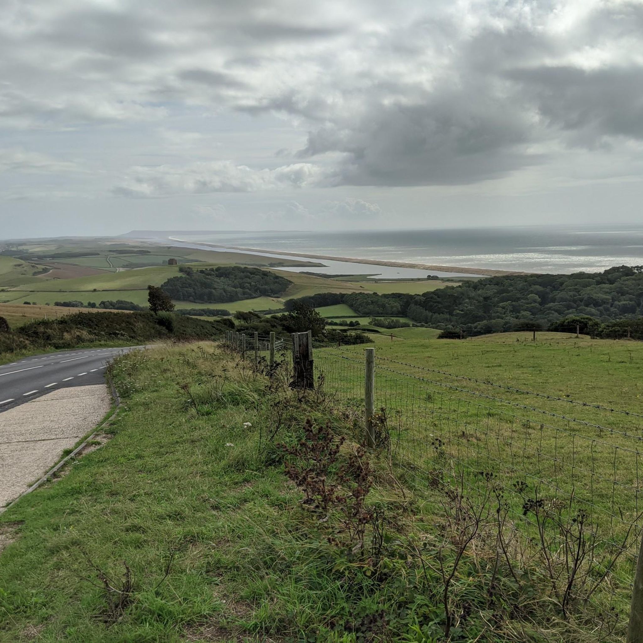
View of Golden Cap and Thorncombe Beacon
Highlight • Viewpoint
Tip by
Sign up for free to discover even more peaks around All Saints.
Sign up for free
Already have an account?
Start today with a free account
Your next adventure awaits.
Login or Signup

Tips from the Community

From the trig point at Pilsdon Pen summit, you get spectacular, wide-open views across Dorset. Looking south, the eye sweeps over the lush farmlands and rolling hills of the Marshwood Vale, extending all the way down to Bridport and the dramatic cliffs of the Jurassic Coast.
0
0
If you’ve hauled yourself up to the ramparts of Lambert’s Castle, congratulations! You are currently standing on an Iron Age "penthouse" with a view that makes most postcards look like blurry thumbprints. Looking south toward the coast, the landscape does a dramatic drop-and-roll toward the English Channel. Here is the lowdown on the two big celebrities you’re staring at: 1. Golden Cap: The Gilded Giant Dominating the horizon is Golden Cap, the highest point on the South Coast of England. The Look: It’s basically a massive, flat-topped wedge of rock that looks like nature tried to bake a giant loaf of bread and then gave it a glowing, golden crust. The Vibe: From Lambert’s Castle, you can see exactly why it got its name. When the sun hits that upper layer of Greensand, it glows like a pirate’s treasure chest. Fun Fact: At 191 meters (627 feet), if you were standing on top of it, you’d be higher than any other cliff-dweller in southern England. From up here on the hill, it looks like the ultimate finish line. 2. Thorncombe Beacon: The Dramatic Sidekick Just to the east of Golden Cap sits its slightly shorter, but equally moody sibling, Thorncombe Beacon. The Look: It’s got that classic "dinosaur spine" silhouette. It’s part of the same rollercoaster of cliffs that makes the Jurassic Coast look like it’s trying to jump into the sea. The Vibe: It feels a bit more "wild and windy." Historically, this was part of a chain of fire beacons used to warn everyone that the Spanish Armada was coming to ruin the weekend. The Perspective: From your vantage point, you can see the deep "V" of the Seatown valley tucked between the two peaks, looking like a perfect little green cradle.
0
0
From the summit of Lambert’s Castle Hill (258m), you are treated to one of the most celebrated panoramas in Dorset. Looking eastward across the sprawling Marshwood Vale, Pilsdon Pen and Lewesdon Hill stand out as the two most prominent landmarks on the horizon. The View of Pilsdon Pen Appearance: From Lambert's Castle, Pilsdon Pen (277m) is easily identified by its distinctive "flat-topped" profile. It is an Iron Age hillfort and was long thought to be the highest point in Dorset. Perspective: It sits approximately 4.7km (just under 3 miles) to the east-northeast. Because the Marshwood Vale drops away between the two hills, Pilsdon Pen appears as a massive, brooding green rampart rising sharply from the valley floor. Detail: On a clear day, you can clearly see the triple-dyked earthworks that ring its summit. The View of Lewesdon HillAppearance: Located just slightly south of Pilsdon Pen, Lewesdon Hill (279m) is the true "County Top" (the highest point in Dorset). Unlike the open, grassy summit of Pilsdon, Lewesdon is heavily wooded with ancient oak and beech trees.Perspective: From your vantage point at Lambert's Castle, Lewesdon appears as a dark, rounded, tree-covered dome. It lacks the sharp architectural lines of the hillforts but provides a lush, textured contrast to the surrounding fields.Context: Because it is so close to Pilsdon Pen (separated only by a small saddle), they are often referred to as "twin peaks" of the Marshwood Vale.
0
0

The summit of this hill represents the second highest point in Dorset, and from here, you'll have breathtaking panoramic views. At the top, there was an Iron Age hillfort, which was excavated in the mid-20th century.
0
0

Lewesdon Hill is the highest point in Dorset
0
0
#NT Golden Cap is the highest point on the South Coast
0
0

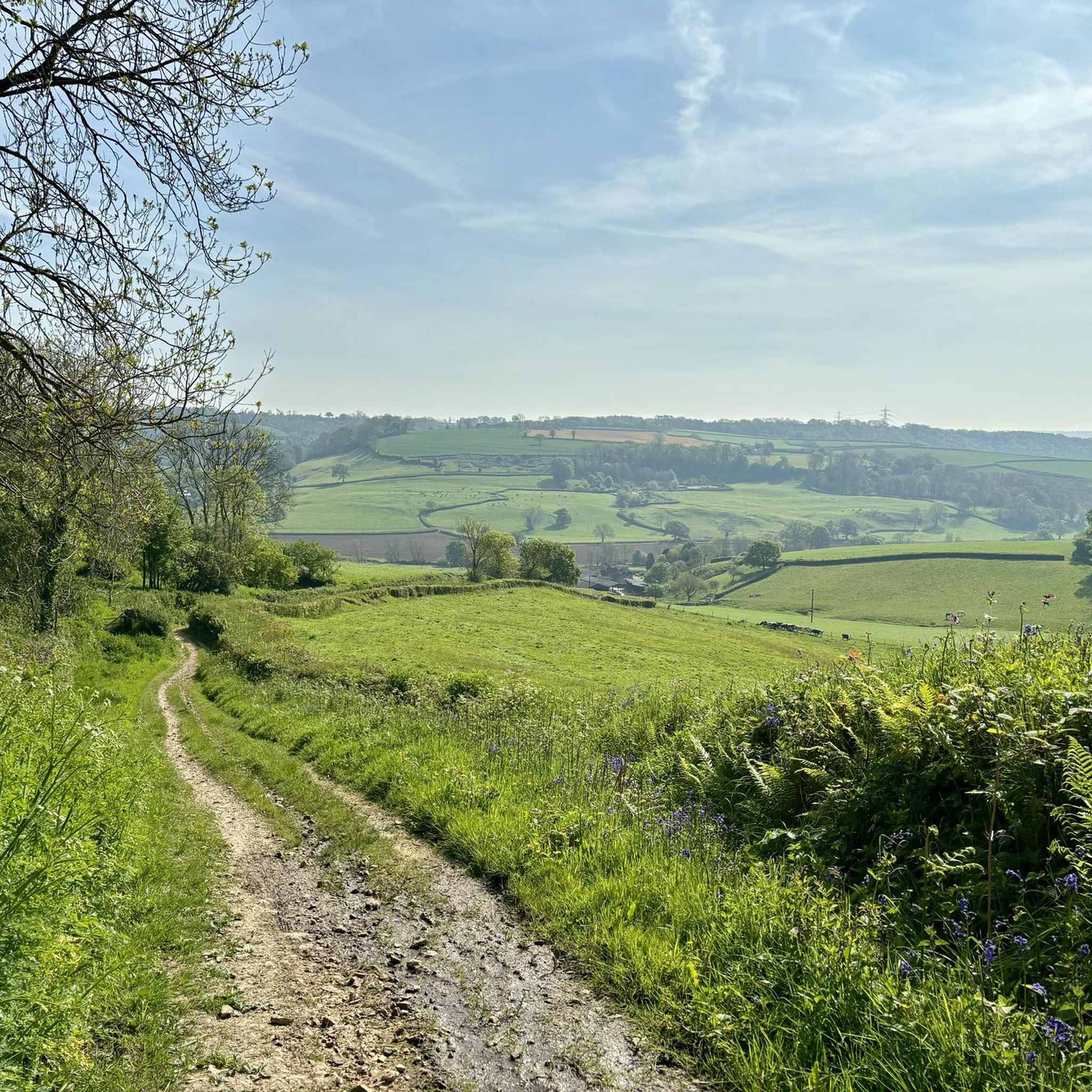
This Iron Age hillfort is the smaller cousin of Lambert’s Castle, a little to the north. With ancient woodland and a fantastic spring bluebell display, Coney’s Castle is a peaceful little summit and one of numerous such hillforts in the area. Check out the earthwork ramparts on the north, south and east sides. The western edge used the natural slope of the hill as a defense. Managed by the National Trust, this hillfort is free to roam around and served by a car park. Its only downside is that there’s a road right through the middle of it.
0
0
Around 2,500-years-old, this Iron Age hillfort sits at the north end of the appropriately-named Lambert’s Castle Hill. You’ll find evidence of earthworks here and lovely views of the surrounding landscapes, particularly if you explore the entire hill. There’s a trig point to the south of the hillfort, at 840 feet (256 m). Lambert’s Castle is managed by the National Trust and is free to enter. There’s a car park to the south west and the Liberty Trail hiking path runs right through the middle of the fort.
0
0
Frequently Asked Questions
What are the most prominent mountain peaks around All Saints, Antigua?
The region around All Saints, Antigua, is home to several notable peaks within the Shekerley Mountains. The highest is Boggy Peak (formerly Mount Obama) at 402 meters (1,319 feet), offering extensive island views. Other significant peaks include Signal Hill (370 meters), Sage Hill (349 meters), McNish Mountain (339 meters), and Sugar Loaf Hill (309 meters).
Are there challenging hikes available in the mountains near All Saints?
Yes, several peaks offer challenging hikes. The ascent to Sugar Loaf Hill is described as short, very steep, and challenging, with multiple routes. For more adventurous hikers, the trail to Cade Peak (153 meters) is moderately difficult with steep climbs and connects to a larger network within the Shekerley Mountain range, including Boggy Peak.
Which mountain peaks offer the best panoramic views of Antigua?
Boggy Peak, as the highest point, provides extensive views of the entire island. Sugar Loaf Hill offers expansive views over Falmouth Harbour, while the Cade Peak lookout also provides broad vistas of the island's landscape.
What kind of natural features can I expect to see when hiking these peaks?
Hikers can expect to explore diverse natural features, including lush rainforest ecosystems, particularly around Signal Hill within the Wallings Nature Reserve, and along the trail to Cade Peak. The peaks themselves are often remnants of volcanic activity, offering unique geological formations.
Is it recommended to use a tour guide for hiking in the All Saints mountain region?
For certain peaks, a tour guide is strongly recommended. This is particularly true for Sugar Loaf Hill due to its challenging routes, and for Cade Peak where trails can be shaded and potential for wrong turns exists, especially for less experienced hikers.
Are there any historical sites or landmarks on these mountain peaks?
While the region's peaks are primarily known for natural beauty and views, the broader area around All Saints has historical significance. The peaks themselves, like Boggy Peak, are natural landmarks. The Wallings Nature Reserve, which encompasses Signal Hill, is a protected area with historical context related to land use and conservation.
What is the second-highest peak in Antigua, and what does it offer?
Signal Hill is the second-highest peak in Antigua, reaching 370 meters (1,214 feet). It is situated within the 1680-acre Wallings Nature Reserve, which preserves rainforest in the Shekerley Mountain Protected Area. Visitors can hike to its summit, and a contribution fee to the park is required for entry.
What outdoor activities can I do near these mountain peaks?
Beyond hiking the peaks themselves, the region offers various outdoor activities. You can find options for running trails, mountain biking, and cycling routes in the broader area around All Saints, suitable for different skill levels.
Is there an entry fee for any of the mountain areas?
Yes, if you plan to hike to Signal Hill, which is located within the Wallings Nature Reserve, a contribution fee to the park is required for entry.
What is the highest point in Antigua and Barbuda?
The highest point in Antigua and Barbuda is Boggy Peak (formerly Mount Obama), standing at 402 meters (1,319 feet) in the Shekerley Mountains.
Are there any peaks suitable for a moderate hike with good views?
Cade Peak, at 153 meters, offers a moderately difficult trail through the rainforest leading to a lookout with expansive views. While it has steep climbs, it's a rewarding option for those seeking a good view without the extreme challenge of the highest peaks.
Where can I find more information about the mountains and hills of Antigua and Barbuda?
For a comprehensive list and additional details about the various mountains and hills across the islands, you can refer to resources like Wikipedia's list of mountains and hills of Antigua and Barbuda.
Most popular attractions around All Saints

Get inspired with the komoot mobile app


Explore more
See even more amazing summits around All Saints with these guides:
