The best walks and hikes around Königswartha
4.6
(1581)
5,956
hikers
68
hikes
Hiking around Königswartha offers diverse landscapes, from rolling hills and green meadows to dense forests. The region is characterized by the unique Oberlausitzer Heide- und Teichlandschaft Biosphere Reserve, featuring over a thousand artificial ponds. This area provides predominantly easy and flat terrain, while the nearby Lusatian Mountains offer more challenging routes.
Best hiking trails around Königswartha
- The most popular hiking route is Caminau Castle Ruins – Biotope Network Caminau loop from Königswartha - Rakecy, a 2.1 miles (3.4 km)…
Last updated: June 26, 2026
4.7
(33)
118
hikers
Easy hike. Great for any fitness level. Easily-accessible paths. Suitable for all skill levels.
5.0
(14)
48
hikers
Moderate hike. Good fitness required. Easily-accessible paths. Suitable for all skill levels.

Sign up for free
4.3
(6)
11
hikers
10.2km
02:36
30m
30m
Moderate hike. Good fitness required. Easily-accessible paths. Suitable for all skill levels.
5.0
(2)
11
hikers
Moderate hike. Good fitness required. Easily-accessible paths. Suitable for all skill levels.
5.0
(2)
10
hikers
Moderate hike. Good fitness required. Easily-accessible paths. Suitable for all skill levels.
Get access to more routes and recommendations from other explorers.
Sign up for free
Already have an account?
Our route recommendations are based on thousands of hikes, rides, and runs completed by other people on komoot.
Start today with a free account
Your next adventure awaits.
Login or Signup
Tips from the Community

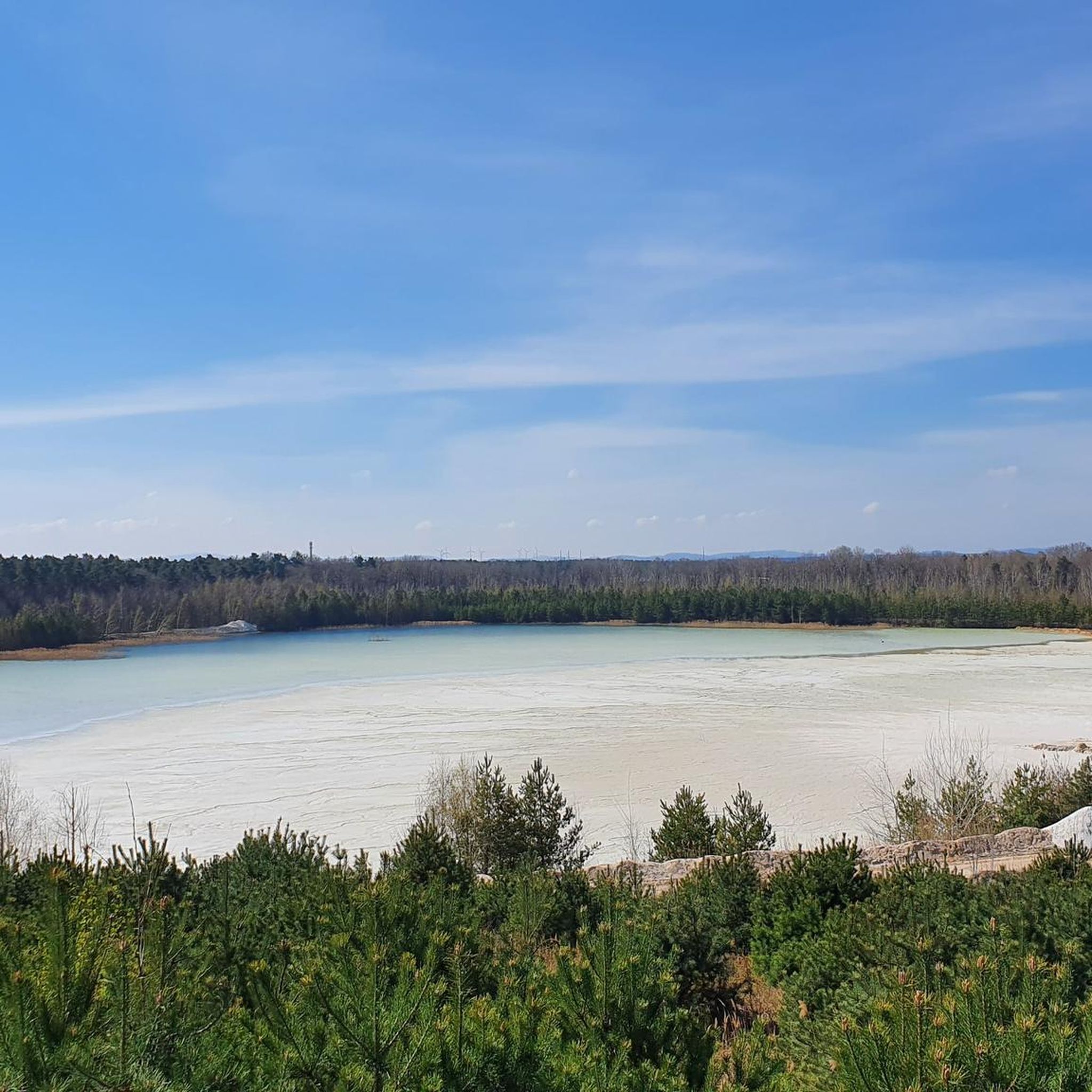
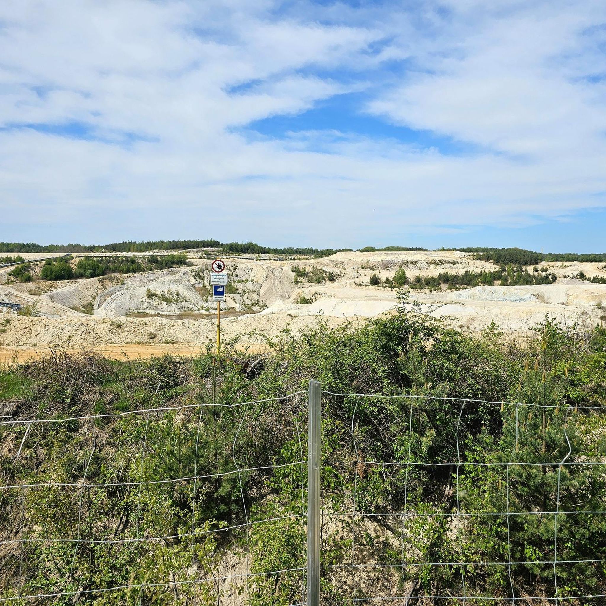
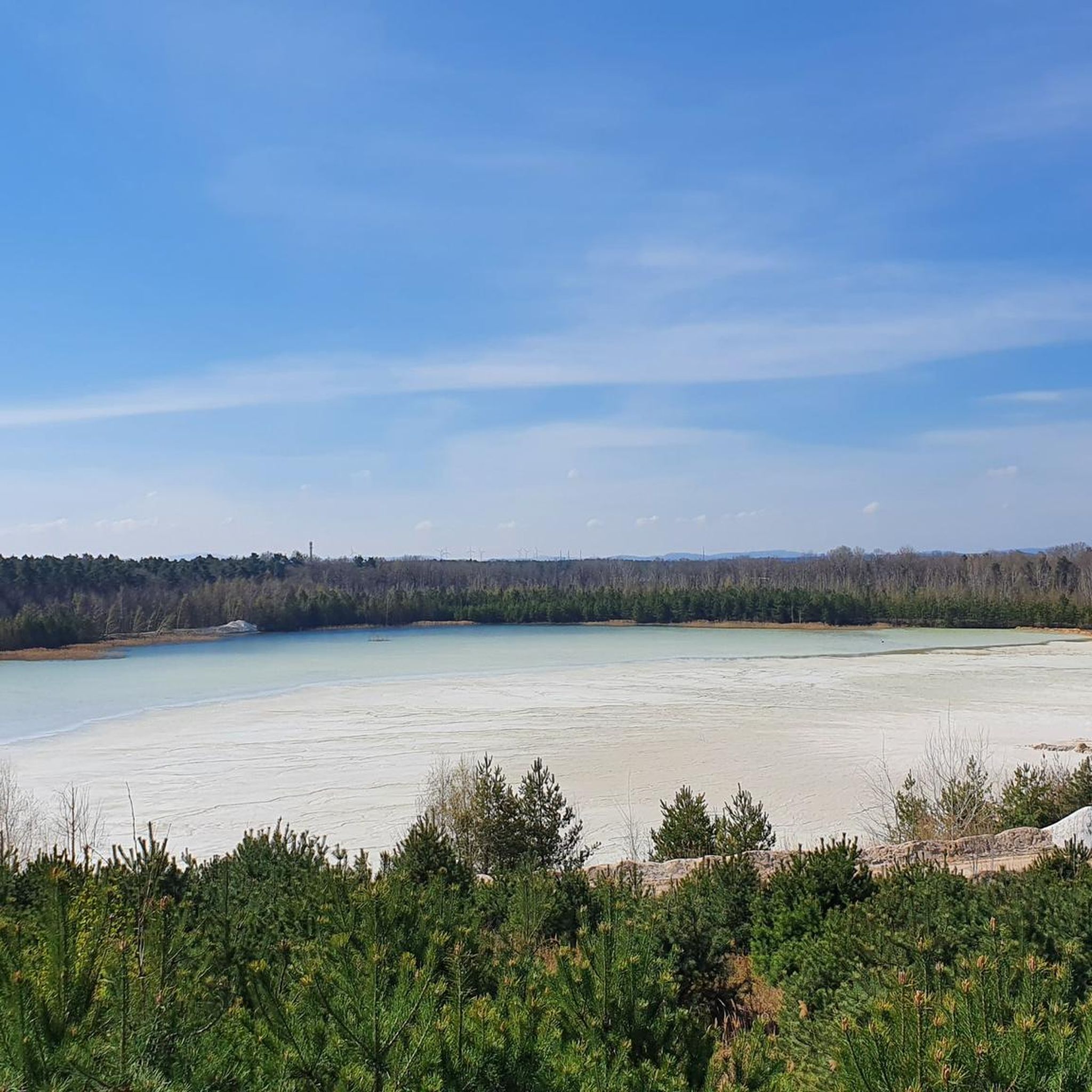
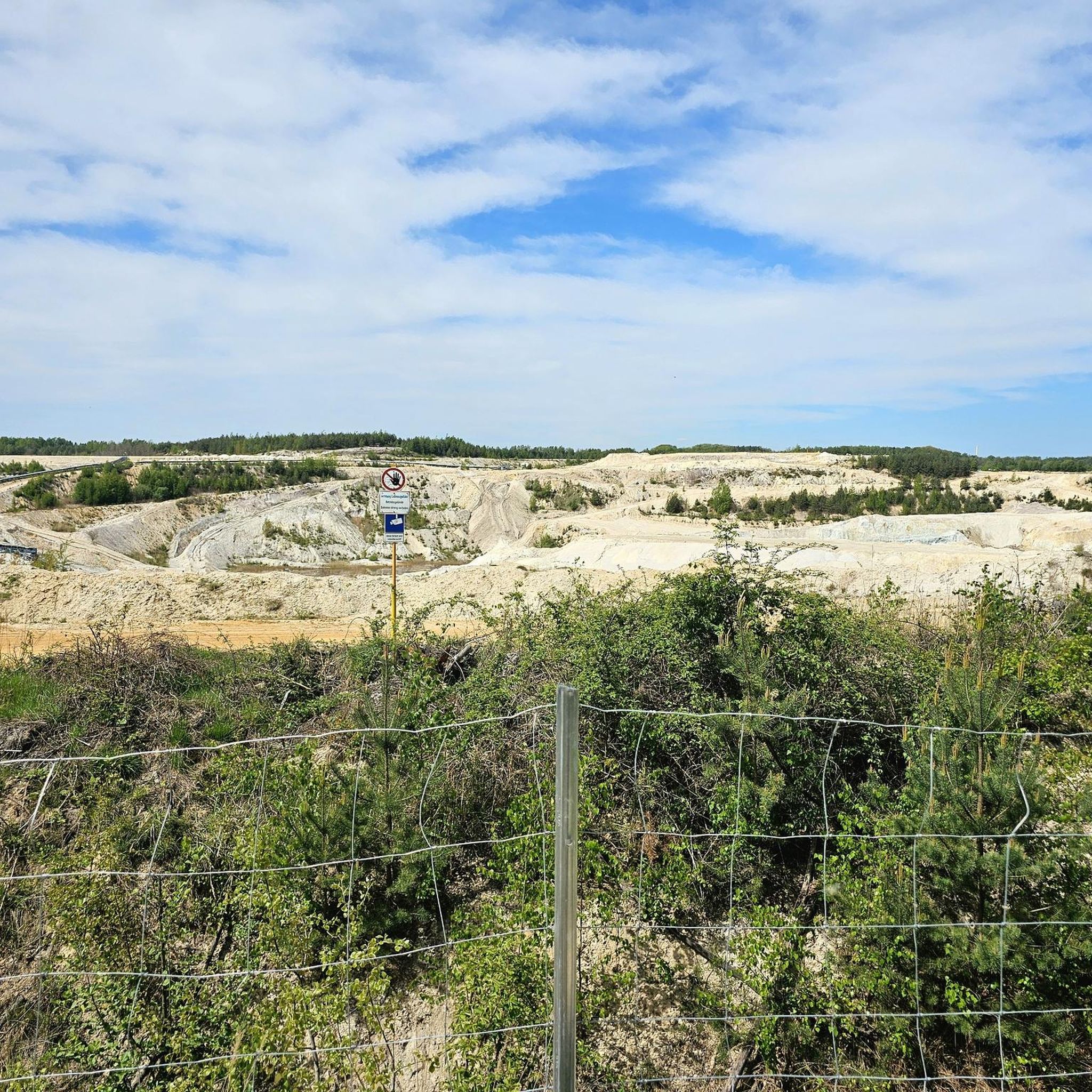
An adventure park for all ages has been created on the former open-cast mining site in Caminau. Those wishing to explore this adventure trail should pay close attention on the B 96 coming from Königswartha towards Hoyerswerda to avoid missing the small signpost behind the fish pond. In 2005, a 350,000-square-meter former open-cast mining area of the Caminau kaolin works was opened to the public. Gradually, a unique network of biotopes developed, attracting many visitors with its diverse offerings: These include a dendrological nature trail, showcasing a collection of native and non-native trees. There is also a plant collection from Asia, featuring a replica of a Japanese shrine as a symbol of good fortune.
0
0
A large, contiguous pond area consisting of two sub-areas, near-natural eutrophic standing waters with siltation zones and transitions to swamp and riparian forests, wet meadows and pastures.
0
0
The forest playground is beautifully designed; you can climb, slide and dig, there's even a forest school with a blackboard.
0
0
Only about 20 years ago, some attractions were built on the spoil heap of the kaolin mine. Excavation work is still taking place there today.
0
0
The wetland habitat contains many forests and fish ponds. Over decades, the post-mining landscape has been shaped and enhanced. However, unlike during the GDR era, this was not done by reforesting with pure stands of pine, but rather through a variety of attractions.
0
0
The amphitheater is also artificially created as an open-air stage; whether performances are ever actually held here is unknown to us.
0
0
The Caminau castle ruins, with their three round towers, are an artificial ruin built in the 21st century and opened to the public after 2012. They are the highlight of the Caminau biotope network, which was constructed as part of the remediation and recultivation of the former open-cast mining site of the Caminau calamine works.
0
0

Fantastically beautiful.
0
0
Frequently Asked Questions
How many hiking trails are available in Königswartha?
Königswartha offers a wide selection of hiking trails, with over 70 routes available. These include 33 easy trails, 35 moderate paths, and 4 more challenging options, ensuring there's something for every fitness level.
What kind of terrain can I expect on hikes around Königswartha?
The terrain around Königswartha is quite diverse. You'll find predominantly easy and flat paths winding through the unique pond landscapes of the Oberlausitzer Heide- und Teichlandschaft Biosphere Reserve, as well as rolling hills, green meadows, and dense forests. For more experienced hikers, the nearby Lusatian Mountains offer more demanding routes.
Are there any family-friendly hiking options in Königswartha?
Yes, many trails in Königswartha are suitable for families. The paths through the Oberlausitzer Heide- und Teichlandschaft Biosphere Reserve are often easy and flat, making them ideal for all fitness levels and children. Consider routes like the easy Caminau Castle Ruins – Biotope Network Caminau loop, which explores historic sites and natural areas.
Can I bring my dog on the hiking trails in Königswartha?
Königswartha is generally dog-friendly, with many trails suitable for walks with your canine companion. However, it's always recommended to keep your dog on a leash, especially within the Oberlausitzer Heide- und Teichlandschaft Biosphere Reserve, to protect wildlife and respect other hikers. Always carry waste bags and ensure your dog is well-behaved.
What are some notable natural features or landmarks to see while hiking?
While hiking in Königswartha, you can explore the unique pond landscapes of the Oberlausitzer Heide- und Teichlandschaft Biosphere Reserve, a vital habitat for migratory birds and even wolves. You might also encounter the Caminau Castle Ruins, or enjoy panoramic views from Wartheberg. The Neschwitz Baroque Palace and Park also offers romantic park landscapes and trails.
Are there any circular hiking routes in the Königswartha area?
Yes, many of the trails around Königswartha are circular, allowing you to start and end at the same point. Examples include the moderate Biotope Network Caminau – Caminau Castle Ruins loop or the Hiking loop from Wartha - Stróža. These routes are great for exploring the diverse landscapes without retracing your steps.
What is the best time of year to go hiking in Königswartha?
The best seasons for hiking in Königswartha are spring and autumn. Spring brings nature into full bloom, while autumn offers vibrant foliage, opportunities to witness bird migration, and local fish harvest events. These seasons generally provide pleasant temperatures and beautiful scenery for outdoor activities.
Where can I find parking for hiking trails in Königswartha?
While specific parking locations for every trailhead are not detailed, Königswartha and its surrounding villages typically offer designated parking areas for visitors. It's advisable to check local signage or use navigation apps for parking options near your chosen starting point, especially for popular areas like Wartheberg or Schlosspark Neschwitz.
Is public transport available to reach hiking trailheads?
Information on specific public transport connections to individual trailheads is limited. However, Königswartha is generally accessible by regional public transport. For detailed schedules and routes to specific starting points, it's recommended to consult local bus or train service providers in advance.
What makes the Oberlausitzer Heide- und Teichlandschaft Biosphere Reserve special for hikers?
The Oberlausitzer Heide- und Teichlandschaft Biosphere Reserve is a UNESCO-recognized area known for its unique pond landscapes, shaped by over a thousand artificial ponds used for fish farming for centuries. It's a vital habitat for migratory birds and offers numerous nature exploration paths that are predominantly easy and flat, making it perfect for serene walks and wildlife observation.
Are there any challenging hikes for experienced hikers near Königswartha?
While many trails in Königswartha are easy to moderate, experienced hikers seeking a challenge can find more demanding routes in the nearby Lusatian Mountains. These offer more significant elevation changes and rugged terrain compared to the flat pond landscapes closer to Königswartha.
What do other hikers say about the trails in Königswartha?
The hiking trails in Königswartha are highly rated by the komoot community, with an average score of 4.7 stars from over 100 reviews. Hikers often praise the diverse landscapes, the tranquility of the pond areas, and the well-maintained paths that cater to various skill levels.
Are there places to rest or find shelter along the trails?
Yes, you can find several shelters and rest areas along the trails. For instance, there's a Shelter between Schäfereiteich and Großer Strassenteich and a Shelter With Lake View at Großteich Milkel. These provide convenient spots for a break or protection from the elements.
Most popular routes around Königswartha
Most popular attractions around Königswartha

Get inspired with the komoot mobile app


Explore more
Browse the best Hikes in other regions.
