The best road cycling routes in Strážov
5.0
(2)
150
riders
6
rides
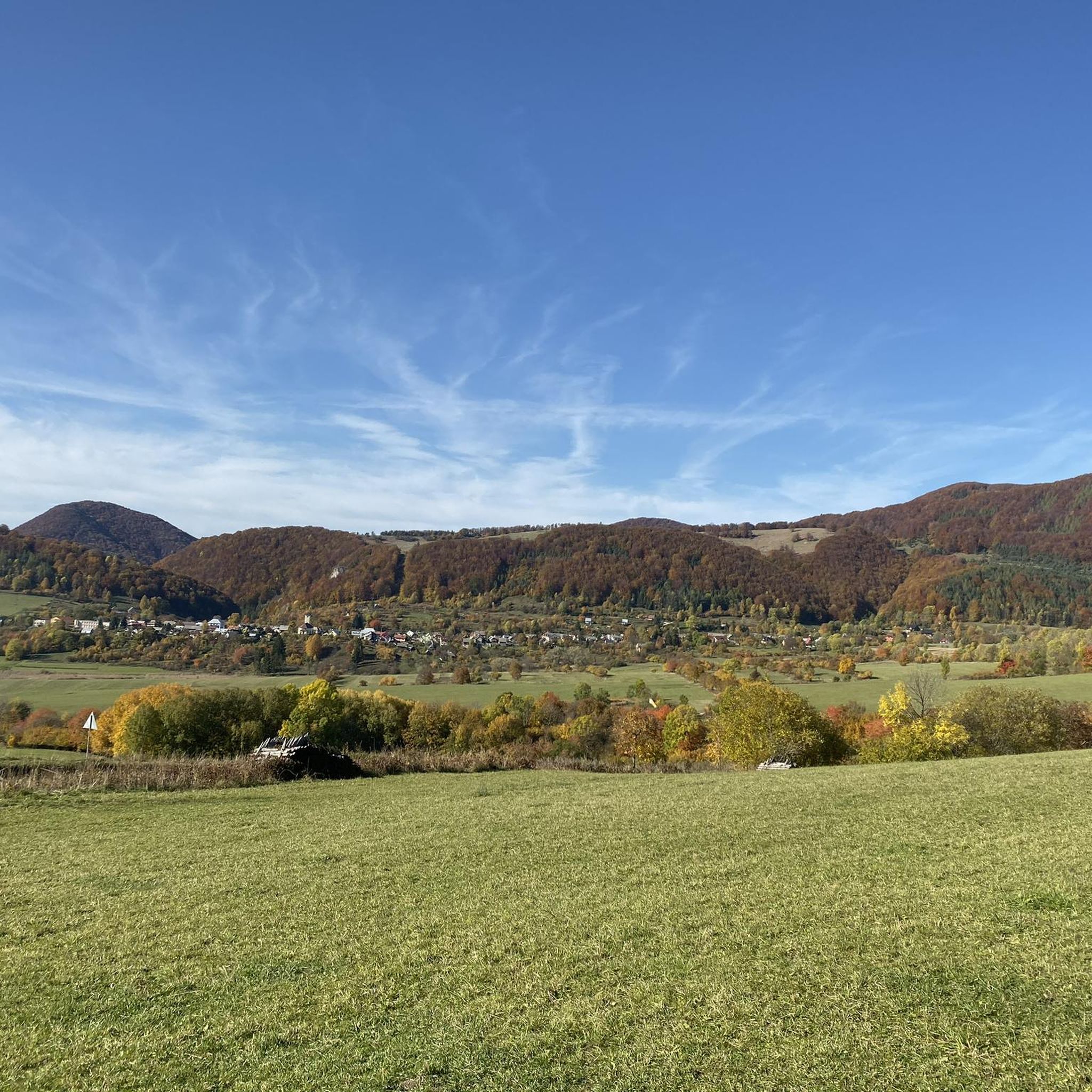
Road cycling in Strážov offers diverse landscapes and challenging terrain within the Strážov Hills, part of the Inner Western Carpathians. The region features rolling hills, lush forests, and hilly roads that provide opportunities for elevation gain. Cyclists encounter varied geological formations, including limestone and dolomite, within the Strážov Mountains Protected Landscape Area. The area provides smooth road routes and well-maintained cycle paths suitable for various skill levels.
Best road cycling routes in Strážov
- The most popular road cycling route is View of Strážov Hill loop from Čičmany, a 34.4 miles (55.4 km) trail that takes 2 hours 35 minutes to complete. This route offers views of Strážov Hill and passes through varied terrain.
- Another top favourite among local road cyclists is Sadocné–Pružina Road – View of Strážov Hill loop from Pružina, a moderate 55.1 miles (88.7 km) path. This route features significant elevation gain through the Strážov Hills.
- Local road cyclists also love the Sadocné–Pružina Road – Bar u Rasta loop from Pružina, a 36.6 miles (59.0 km) trail leading through rolling hills and forested areas, often completed in about 2 hours 25 minutes.
- Road cycling in Strážov is defined by rolling hills, dense forests, and varied geological formations. The network offers options for different ability levels, from moderate climbs to longer endurance rides.
- The routes in Strážov are highly rated by the komoot community with an average score of 5.0 stars from 2 reviews. More than 150 road cyclists have used komoot to explore Strážov's varied terrain.
Last updated: July 2, 2026
11
riders
55.4km
02:35
580m
570m
Moderate road ride. Good fitness required. Some segments of this route may be unpaved and difficult to ride.
45
riders
89.5km
04:00
870m
870m
Moderate road ride. Good fitness required. Some segments of this route may be unpaved and difficult to ride.

Sign up for free
5.0
(1)
40
riders
59.0km
02:25
370m
370m
Moderate road ride. Good fitness required. Mostly well-paved surfaces and easy to ride.
26
riders
107km
04:17
520m
520m
Moderate road ride. Good fitness required. Mostly well-paved surfaces and easy to ride.
19
riders
64.7km
02:32
270m
270m
Moderate road ride. Good fitness required. Mostly well-paved surfaces and easy to ride.
Our route recommendations are based on thousands of hikes, rides, and runs completed by other people on komoot.
Start today with a free account
Your next adventure awaits.
Login or Signup
Popular around Strážov
Tips from the Community

We were there at night around 1. It was cold, 5 degrees.
0
0

Directly under a car bridge, you could have found a more idyllic place ;-)
0
0

beautiful bike path in slovakia
0
0

In some places, it is overgrown with grass in the spring.
1
0
Crossing the lava bank of the canal - there to the cycle path
0
0

Hričov is a water reservoir on the river Váh, below its confluence with Kysuca and Rajčanka, near the village of Horný Hričov. It is part of the second part of the Vážská cascade and, together with the Žilina Waterworks, is its highest level. During the construction of the waterworks, part of the village of Strážov was flooded. Basic data Construction: 1958 – 1962 Tank volume: 8.467 million m³ Length of surface swelling: 6.0 km Flooded area: 2.53 km² At the time of higher water levels, a large amount of dirt gets into the reservoir through the waters of Kysuce and Rajčanka, which clog it. Currently, an estimated 2/3 of the reservoir's volume is clogged, which significantly reduces its storage capacity. https://sk.wikipedia.org/wiki/Hri%C4%8Dov_(vodn%C3%A1_n%C3%A1dr%C5%BE) https://www.youtube.com/watch?v=EXv_foPcXl0
2
0
Frequently Asked Questions
How many road cycling routes are available in Strážov?
There are currently 6 road cycling routes in Strážov listed on komoot, all rated as moderate difficulty. These routes offer diverse landscapes and challenging terrain within the Strážov Hills.
What is the best time of year for road cycling in Strážov?
The ideal time for road cycling in Strážov is during July and August. These months offer the most favorable weather conditions for exploring the region's natural beauty, including its rolling hills and lush forests.
Are there any family-friendly road cycling routes in Strážov?
While all listed routes are currently rated as moderate, the region offers smooth road routes and well-maintained cycle paths that can cater to various skill levels. For families, it's advisable to review the elevation gain and distance of specific routes to ensure they match your family's capabilities. For example, the Odhanka 1 loop from Pružina has a lower elevation gain compared to some others.
What kind of terrain can I expect on Strážov's road cycling routes?
Strážov is characterized by rolling hills, lush forests, and significant opportunities for elevation gain, making it ideal for cyclists seeking a demanding experience. The routes traverse varied geological formations, including limestone and dolomite, within the Strážov Mountains Protected Landscape Area.
What are some scenic points of interest along the road cycling routes?
The Strážov region offers numerous scenic points. You can expect impressive rock lookout points, especially from Strážov peak, providing expansive vistas of surrounding mountains. The area also features bizarre rock formations and dense forests. The charming mountain village of Čičmany, known for its distinctive wooden houses, is a cultural highlight and a starting point for some routes, such as the View of Strážov Hill loop from Čičmany.
Are there any long-distance road cycling routes in Strážov?
Yes, Strážov offers longer routes for endurance cyclists. For example, the Považská Teplá Post Office – New Cycle Path loop from Pružina is over 100 km long, providing a substantial challenge with moderate elevation gain. Another option is the Sadocné–Pružina Road – View of Strážov Hill loop from Pružina, which is nearly 90 km with significant elevation.
What do other road cyclists enjoy most about cycling in Strážov?
The road cycling routes in Strážov are highly rated by the komoot community, with an average score of 5.0 stars from 2 reviews. Cyclists often praise the diverse landscapes, challenging hilly roads, and the well-maintained cycle paths that cater to various skill levels.
Are there any circular road cycling routes in Strážov?
Many of the routes in Strážov are designed as loops, allowing you to start and end at the same point. Examples include the View of Strážov Hill loop from Čičmany and the Sadocné–Pružina Road – Bar u Rasta loop from Pružina, both offering convenient circular journeys through the region's scenery.
Can I find cafes or restaurants along the cycling routes in Strážov?
While specific cafes and restaurants are not detailed for each route, the region's charming villages, such as Čičmany, are likely to offer amenities for cyclists. It's recommended to plan your stops in advance, especially in more remote sections of the Strážov Mountains Protected Landscape Area.
Is public transport available to reach the cycling routes in Strážov?
The region is accessible, and while specific public transport links to every trailhead are not provided, major towns and villages like Čičmany and Pružina, which serve as starting points for routes, typically have public transport connections. It's advisable to check local bus or train schedules for the most up-to-date information on reaching your desired starting point.
Are there any specific permits required for road cycling in Strážov?
Generally, no special permits are required for road cycling on public roads and designated cycle paths within the Strážov region. However, as much of the area is within the Strážov Mountains Protected Landscape Area, always respect local regulations, stay on marked paths, and protect the natural environment.
What is the highest point I might encounter on a road cycling route in Strážov?
The highest point in the region is Strážov peak, standing at 1213 meters above sea level. While road cycling routes might not go directly to the very summit, they often involve significant climbs and offer views of this impressive peak and surrounding mountains like Kľak and Vápeč.
Are there any routes suitable for advanced road cyclists seeking a challenge?
Yes, advanced road cyclists will find the Strážov region challenging due to its abundance of hilly roads and opportunities for elevation gain. Routes like the Sadocné–Pružina Road – View of Strážov Hill loop from Pružina, with its 88.7 km distance and nearly 870 meters of elevation gain, provide a demanding experience.
Most popular routes in Strážov

Get inspired with the komoot mobile app


Explore more
Browse the best Road cycling routes in other regions.
