The best cycling routes around Godfrey
4.6
(25)
34
riders
4
rides
Touring cycling around Godfrey, Illinois, is characterized by its location along the Mississippi River, featuring limestone bluffs and varied natural landscapes. The region offers a mix of flat riverfront stretches and gentle, tree-lined hills, particularly along the Great River Road. Ecosystems include streams, prairie land, and restored forests, providing diverse scenery for cyclists. The topography includes 200-foot-high bluffs offering views of the Mississippi River.
Best touring cycling routes around Godfrey
- The most popular touring cycling route is Confluence Trail –…
Last updated: June 27, 2026
8
riders
44.6km
02:45
80m
80m
Moderate bike ride. Good fitness required. Mostly paved surfaces. Suitable for all skill levels.
4.7
(19)
7
riders
20.4km
01:13
40m
40m
Easy bike ride. Great for any fitness level. Mostly paved surfaces. Suitable for all skill levels.

Sign up for free
5
riders
36.6km
02:14
230m
230m
Moderate bike ride. Good fitness required. Mostly paved surfaces. Suitable for all skill levels.
6
riders
57.0km
03:19
150m
150m
Moderate bike ride. Good fitness required. Mostly paved surfaces. Suitable for all skill levels.
5.0
(1)
2
riders
Easy bike ride. Great for any fitness level. Mostly paved surfaces. Suitable for all skill levels.
Our route recommendations are based on thousands of hikes, rides, and runs completed by other people on komoot.
Start today with a free account
Your next adventure awaits.
Login or Signup
Popular around Godfrey

Tips from the Community

The Melvin Price Lock and dam is located on the MCT Confluence Trail near East Alton, Illinois. There is a Great Rivers Museum here and the National Great Rivers Research and Education Center. All of this is accessible directly off the trail with out having to cross any highways. They do have tours of the lock and dam. Check on line for availability. www.mtrf.org
0
0
This monument is located just adjacent to the MCT Confluence Trail near the Poag Road Intersection. The monument is completely accessible from the Trail without crossing any roads.
0
0
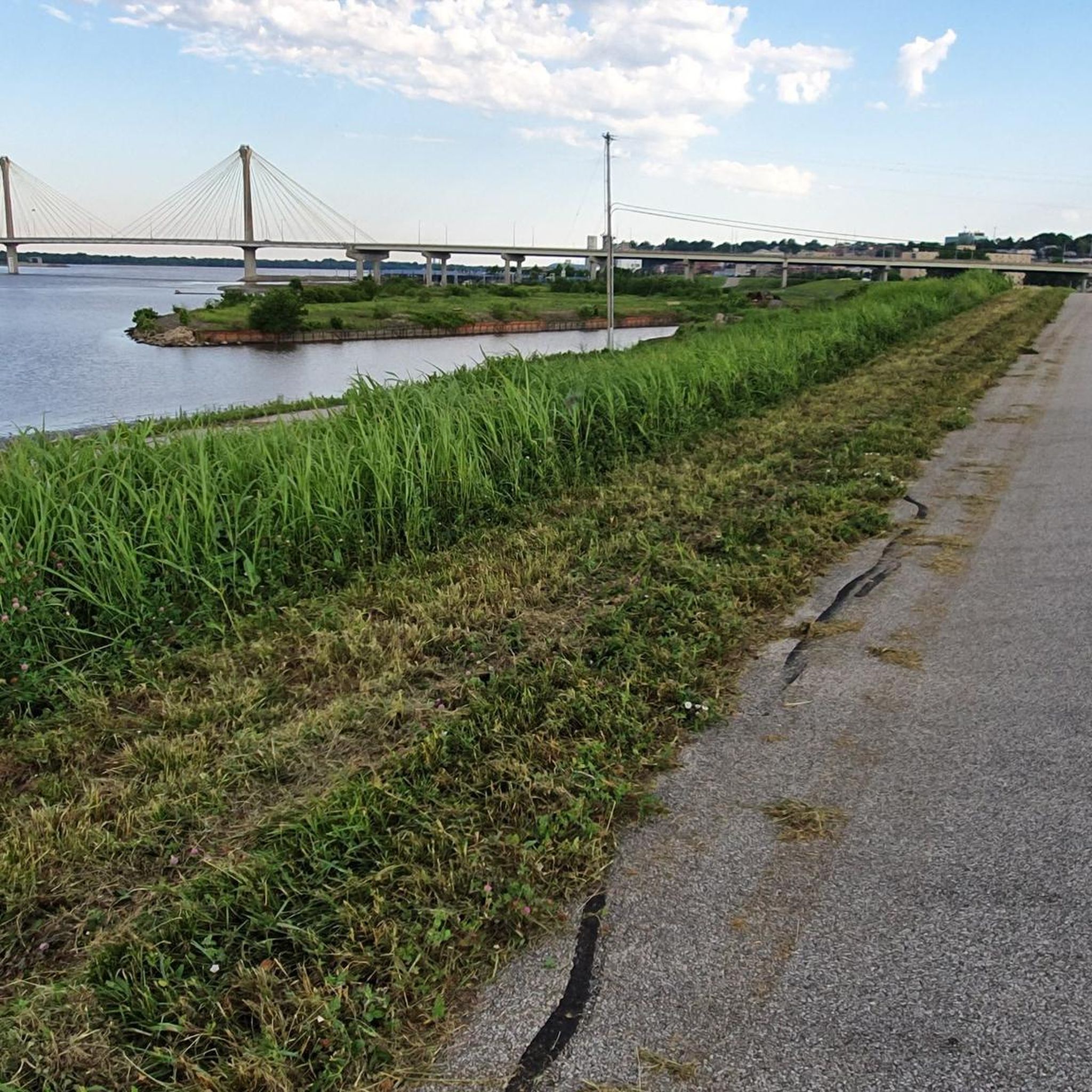
This bridge, I believe, is the longest in the Madison County Trail system which is comprised of over 138 miles of Class 1 bikeways. The 881 foot bridge parallels the Great River Road bridge. Just another unique and fun item on the Confluence Trail.
0
0
This is a monument to two famous American explorers, Lewis and Clark. They were credited with mapping the Missouri River and also finding a passage to the west coast of North America. It was from this point they launched their famous journey. This Monument is located on the Madison County Transit ( MCT ) Confluence trail which also carry's the Mississippi River Trail.
0
0

The MCT Confluence Trail is a beautiful 20.5 mile long trail. The trail mostly follows the Mississippi River. The trail is paved and mostly flat, so it is not a challenging trail. This section gives you great views of the river as you enter Alton.
1
0
Riverfront Park is a great park on the banks of the Mississippi River in Alton. There is a paved biking and hiking trail that runs through the park. The park also has a large amphitheater, picnic area and restrooms.
1
0
The Piasa Bird is a creature from Native American mythology that was painted on the cliffside above the Mississippi River. The original depiction of the Piasa Bird no longer exists, so this is a 20th century recreation that sits several hundred yards from where the original image was found.
1
0
The Sam Vadalabene Trail is a 20 mile paved trail from Grafton to Alton. The trail follows along the Mississippi and gives you great views of the river. The trail also connects several parks and you pass through several communities, so you have multiple choice for spots for a break.
1
0
Frequently Asked Questions
What kind of terrain can I expect on touring cycling routes around Godfrey?
Touring cycling routes in Godfrey offer a diverse landscape. You'll find a mix of flat riverfront stretches, particularly along the Great River Road, and gentle, tree-lined hills. The area is characterized by its location along the Mississippi River, featuring dramatic limestone bluffs up to 200 feet high, offering splendid vistas. Some routes, like the Confluence Trail – Levee Road (Gravel) loop from Wood River, include gravel sections, while others feature smooth pavement.
Are there routes suitable for beginner touring cyclists or families in Godfrey?
Yes, Godfrey offers several easy touring cycling routes perfect for beginners or families. For instance, the Melvin Price Locks and Dam – Riverfront Park loop from Wood River is an easy 12.7-mile trail that leads through pleasant riverfront areas. Another accessible option is the Confluence Trail – Confluence Trail – east of Alston loop from Alton, which is 16.3 miles and also rated easy.
Where can I find routes with significant elevation gain and scenic views?
For touring cyclists seeking more challenging routes with elevation gain and rewarding views, consider the Tucker Knob loop from Elsah. This moderate 22.8-mile path includes significant elevation gain, providing scenic views from the bluffs overlooking the Mississippi River.
What are some popular attractions or landmarks I can see along the cycling routes?
Many touring cycling routes in Godfrey offer access to notable attractions. You can cycle past the impressive Melvin Price Locks and Dam, or explore sections of the Confluence Trail. The region also boasts stunning views of the Mississippi River, especially from the bluffs, and during winter, areas like Captain Jake Ringering Park are excellent for spotting American bald eagles.
Are there any circular touring cycling routes available in the Godfrey area?
Yes, several touring cycling routes around Godfrey are designed as loops. Examples include the Confluence Trail – Levee Road (Gravel) loop from Wood River, the Melvin Price Locks and Dam – Riverfront Park loop from Wood River, and the Tucker Knob loop from Elsah. These circular routes allow you to start and end at the same point, making logistics easier.
What do other touring cyclists say about the routes in Godfrey?
The touring cycling routes in Godfrey are highly regarded by the komoot community, holding an average rating of 4.8 stars from over 20 reviews. Cyclists often praise the diverse scenery, from riverfront paths to bluff-top views, and the variety of routes suitable for different skill levels.
What is the best time of year to go touring cycling in Godfrey?
Godfrey offers beautiful cycling experiences throughout much of the year. The Great River Road, for instance, is bordered by towering oaks and maples that change colors seasonally, making autumn particularly scenic. During winter months, the region becomes a haven for American bald eagles, which can be observed from certain parks along the routes, adding a unique element to your ride.
Are there any specific trails like the Sam Vadalabene Bike Trail included in these routes?
Yes, the Sam Vadalabene Bike Trail is a significant asset for cyclists in the area. The Piasa Bird – Sam Vadalabene Trail loop from Alton is a moderate 35.4-mile route that incorporates sections of this popular trail. The Sam Vadalabene Bike Trail is accessible from Great Rivers Park and features rest stops like Captain Jake Ringering Park.
Are there any nature preserves or natural areas accessible by bike in Godfrey?
Godfrey is home to several nature preserves that offer diverse ecosystems. While direct cycling access within all preserves may vary, the region's routes often pass through or near areas with streams, prairie land, and restored forests. The Nature Institute, for example, manages preservation areas like the Olin Nature Preserve, which features miles of hiking trails where visitors can observe Illinois wildlife and diverse landscapes.
Where can I find parking or access points for the touring cycling routes?
Access points for touring cycling routes are available in various locations around Godfrey and nearby towns like Wood River and Alton. For example, the Sam Vadalabene Bike Trail is accessible from Great Rivers Park, which offers riverfront access. Many routes start from these towns, providing convenient parking options for cyclists.
Are there any routes that offer views of the confluence of the Mississippi and Missouri Rivers?
While not directly on all routes, the region's topography allows for views of the confluence of the Mississippi and Missouri Rivers from certain vantage points. LaVista Park, for instance, offers stunning views of the Mississippi River and is connected to the Great River Road, which many cycling routes utilize.
Most popular routes around Godfrey
Most popular attractions around Godfrey

Get inspired with the komoot mobile app


Explore more
Browse the best Cycling routes in other regions.
