The best walks and hikes around Slater-Marietta
3.7
(15)
39
hikers
6
hikes
Hiking around Slater-Marietta, South Carolina, features diverse landscapes within the foothills of the Blue Ridge Mountains. The region is characterized by forests, waterfalls, and varied terrain, including numerous state parks and heritage preserves. Hikers can experience mountain views, tranquil lakes, and dense woodlands, with the North Saluda River providing additional natural features.
Best hiking trails around Slater-Marietta
- The most popular hiking route is Furman University loop from Travelers Rest, a 7.2 miles (11.5 km) trail that takes 3 hours to complete. This moderate path leads through varied landscapes.
- Another top favourite among local hikers is Tall Pines Loop, an easy 2.6 miles (4.1 km) path. This route explores forested areas with gentle elevation changes.
- Local hikers also love the JFA Trail and Sassy's Pass, a 2.2 miles (3.5 km) trail leading through woodlands, often completed in about 57 minutes.
- Hiking around Slater-Marietta is defined by forested paths, scenic waterfalls, and mountain views. The network offers options for different ability levels.
- The routes in Slater-Marietta are highly rated by the komoot community with an average score of 3.7 stars from over 21 reviews. More than 34 hikers have used komoot to explore Slater-Marietta's varied terrain.
Last updated: July 10, 2026
3.0
(1)
3
hikers
2.20km
00:34
20m
20m
Easy hike. Great for any fitness level. Easily-accessible paths. Suitable for all skill levels.
4.0
(1)
2
hikers
4.14km
01:06
50m
50m
Easy hike. Great for any fitness level. Easily-accessible paths. Suitable for all skill levels.

Sign up for free
3.55km
00:57
60m
20m
Easy hike. Great for any fitness level. Easily-accessible paths. Suitable for all skill levels.
713m
00:12
20m
0m
Easy hike. Great for any fitness level. Easily-accessible paths. Suitable for all skill levels.
12
hikers
7.33km
01:56
70m
70m
Easy hike. Great for any fitness level. Easily-accessible paths. Suitable for all skill levels.
Our route recommendations are based on thousands of hikes, rides, and runs completed by other people on komoot.
Start today with a free account
Your next adventure awaits.
Login or Signup
Popular around Slater-Marietta

Tips from the Community


It's a lovely trail but at 9:00 a.m. on Saturday morning it starts getting crowded and by 11:00 there were lots of people. The most annoying part is the speed bicycle riders. They fly down the trail through crowds of pedestrians. I saw several near crashes. I would recommend this trail but only on weekday mornings when there's not as much humanity about.
0
0

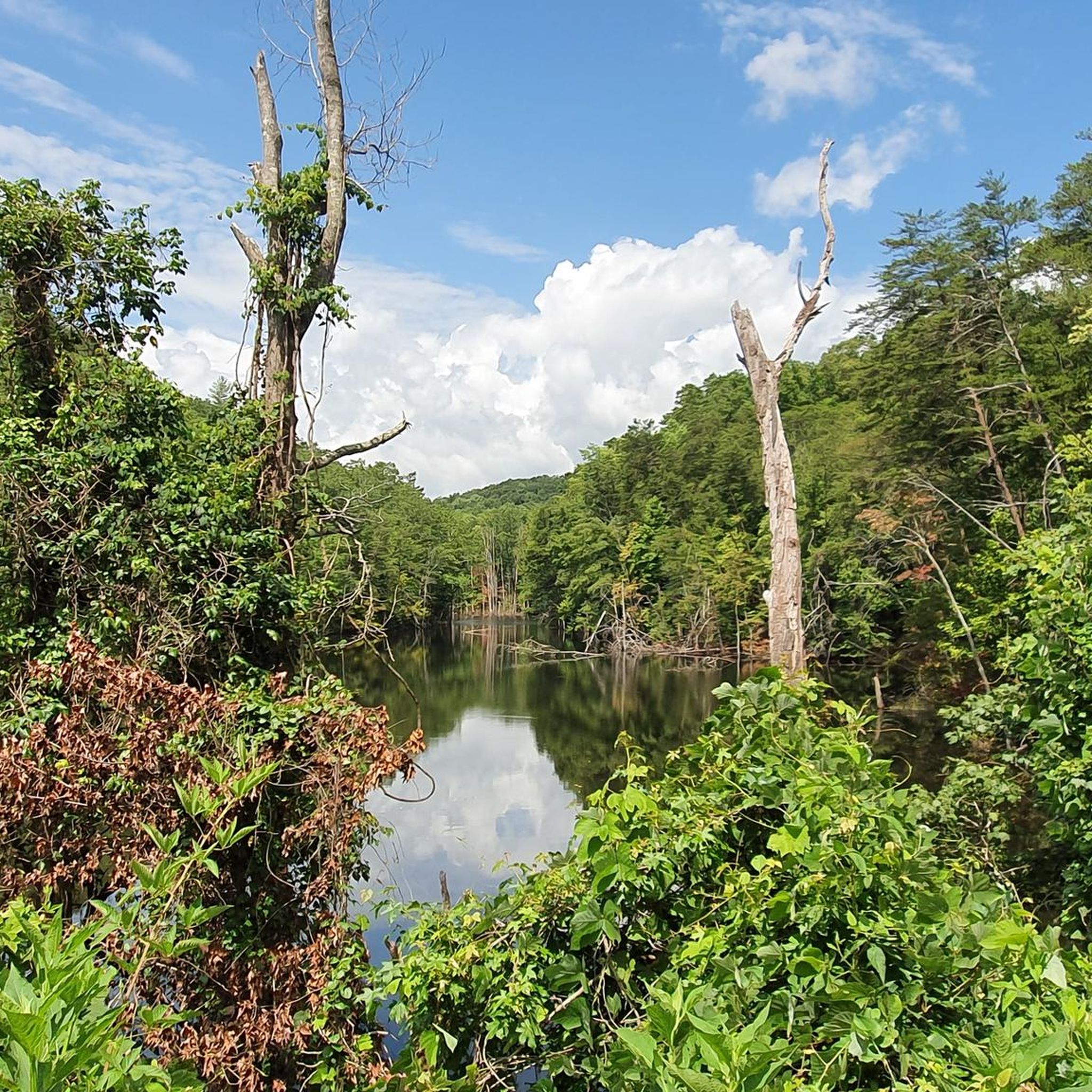
The Moody Bridge Road Parking area is your gateway to the four Tall Pines Lakes, each home to a thriving population of bass and bream fish. The main lake, distinguished by its lighthouse, is stocked year-round with rainbow trout, making it a favorite among anglers.
0
0

The Swamp Rabbit Trail, once a railroad, now a beloved biking route, winds through Upstate South Carolina. Rich in history, this converted rail corridor offers cyclists a scenic journey past woodlands, parks, and the Reedy River. Its transformation into a trail has revitalized communities, fostering recreation and cultural connections.
0
0
Frequently Asked Questions
What kind of natural features can I expect to see on hikes around Slater-Marietta?
The Slater-Marietta area is rich in natural beauty, featuring diverse landscapes with expansive forests, especially vibrant during autumn. You'll find numerous waterfalls, such as Lower Wildcat Falls, and impressive mountain views from overlooks like High Rock Overlook. The region also includes tranquil lakes, like Lake Wattacoo in Ashmore Heritage Preserve, offering a variety of scenic experiences.
Are there any family-friendly hiking options in the Slater-Marietta area?
Yes, the region offers several options suitable for families. Pleasant Ridge County Park features nature trails like the Leroy Smith Nature Trail, which is generally easy and provides access to Pleasant Ridge Falls. Paris Mountain State Park, nearby, also has easy trails such as the Lake Placid Trail. For a short, accessible walk, consider the Wildcat Wayside Nature Trail loop, which is an easy 2.0-mile path.
Where can I find trails with waterfalls near Slater-Marietta?
Waterfalls are a prominent feature in the Slater-Marietta area. You can find Pleasant Ridge Falls via a short hike in Pleasant Ridge County Park. Jones Gap State Park, a short drive away, is home to the impressive Rainbow Falls and another 50-foot waterfall. Additionally, Lower Wildcat Falls is another notable natural attraction in the vicinity.
What are the difficulty levels of hiking trails available?
Hiking trails around Slater-Marietta cater to various skill levels. You'll find easy, less strenuous options under 5 miles with minimal elevation gain, such as the Wildcat Wayside Nature Trail loop. There are also moderate paths like the High Rock Trail — Ashmore Heritage Preserve, and more challenging backcountry excursions in parks like Jones Gap State Park and Caesars Head State Park.
Are there any loop hikes in the Slater-Marietta area?
Yes, loop hikes are available for those who prefer not to retrace their steps. The Wildcat Wayside Nature Trail loop is an easy 2.0-mile option. Another popular choice is the Furman University loop from Travelers Rest, which is a longer 7.2-mile trail through varied landscapes.
What do other hikers enjoy most about hiking in Slater-Marietta?
The area is highly rated by the komoot community, with an average score of 3.9 stars from over 9 reviews. Hikers often praise the diverse landscapes, including forested paths, scenic waterfalls, and mountain views, which offer options for different ability levels. The variety of trails within state parks like Jones Gap and Caesars Head is also frequently highlighted.
Which state parks are good for hiking near Slater-Marietta?
Several state parks are within a short drive and offer excellent hiking. Pleasant Ridge County Park is a local favorite. Jones Gap State Park is known for its primitive and backcountry trails and impressive waterfalls. Caesars Head State Park provides breathtaking views and challenging hikes, while Table Rock State Park is recommended for its beautiful Pinnacle Mountain Trail. Paris Mountain State Park is also nearby with a variety of scenic hikes.
What is the best time of year to go hiking in Slater-Marietta?
The hiking experiences in Slater-Marietta are particularly stunning during autumn as the foliage changes colors. Trails like the Pinnacle Mountain Trail at Table Rock State Park are especially recommended during this season for their vibrant displays. Spring and milder days in late fall are also excellent for comfortable hiking conditions.
Are there any trails that offer panoramic views or overlooks?
Yes, the region boasts several spots with sweeping vistas. Caesars Head State Park is renowned for its dramatic viewpoints of the surrounding terrain. Additionally, High Rock Overlook provides another excellent vantage point for scenic views.
Is parking available at the trailheads?
Most state parks and heritage preserves in the Slater-Marietta area, such as Pleasant Ridge County Park, Jones Gap State Park, and Caesars Head State Park, offer designated parking facilities for hikers. Specific parking details can often be found on the respective park websites or within individual route descriptions.
Are there any trails that lead to lakes or offer water-based activities?
Yes, some trails provide access to lakes or are near water features. Pleasant Ridge County Park features a four-acre fishing lake, and the Leroy Smith Nature Trail leads to Pleasant Ridge Falls. For broader water-based activities like boating and kayaking, Lake Keowee at Keowee-Toxaway State Park is an option within a reasonable drive.
How many hiking trails are available in the Slater-Marietta area?
The Slater-Marietta area offers a variety of hiking opportunities. While specific numbers can vary, komoot currently features 5 distinct hiking routes in this guide, ranging from easy to moderate difficulty, with many more options available in the surrounding state parks and natural areas.
Most popular routes around Slater-Marietta
Most popular attractions around Slater-Marietta

Get inspired with the komoot mobile app


Explore more
Browse the best Hikes in other regions.
