The best cycling routes around West Alton
4.6
(23)
50
riders
10
rides
Touring cycling routes around West Alton, Missouri, are characterized by a unique riverine environment at the confluence of the Mississippi and Missouri Rivers. The landscape features forests, wetlands, and old fields, providing diverse natural settings for cycling. The area offers relatively flat terrain, making it suitable for various skill levels.
Best touring cycling routes around West Alton
- The most popular touring cycling route is Luther Ely Smith Square – Gateway Arch loop from Chouteau Island, a 28.8 miles (46.4…
Last updated: July 2, 2026
5.0
(2)
11
riders
40.4km
02:17
100m
100m
Moderate bike ride. Good fitness required. Mostly paved surfaces. Suitable for all skill levels.
8
riders
44.6km
02:45
80m
80m
Moderate bike ride. Good fitness required. Mostly paved surfaces. Suitable for all skill levels.

Sign up for free
4.0
(2)
6
riders
Moderate bike ride. Good fitness required. Mostly paved surfaces. Suitable for all skill levels.
7
riders
Easy bike ride. Great for any fitness level. Mostly paved surfaces. Suitable for all skill levels.
4.7
(19)
7
riders
20.4km
01:13
40m
40m
Easy bike ride. Great for any fitness level. Mostly paved surfaces. Suitable for all skill levels.
Get access to more routes and recommendations from other explorers.
Sign up for free
Already have an account?
Our route recommendations are based on thousands of hikes, rides, and runs completed by other people on komoot.
Start today with a free account
Your next adventure awaits.
Login or Signup
Popular around West Alton

Tips from the Community

Great Trail Surface. Watch out for dog walkers and joggers!
0
0

Great flat trail with access to the towns along the way.
0
0

The water intake towers are a great sight. Definitely worth the ride. Go there on one side and return on the other of the mighty Mississippi.
1
0
The Melvin Price Lock and dam is located on the MCT Confluence Trail near East Alton, Illinois. There is a Great Rivers Museum here and the National Great Rivers Research and Education Center. All of this is accessible directly off the trail with out having to cross any highways. They do have tours of the lock and dam. Check on line for availability. www.mtrf.org
0
0
This monument is located just adjacent to the MCT Confluence Trail near the Poag Road Intersection. The monument is completely accessible from the Trail without crossing any roads.
0
0
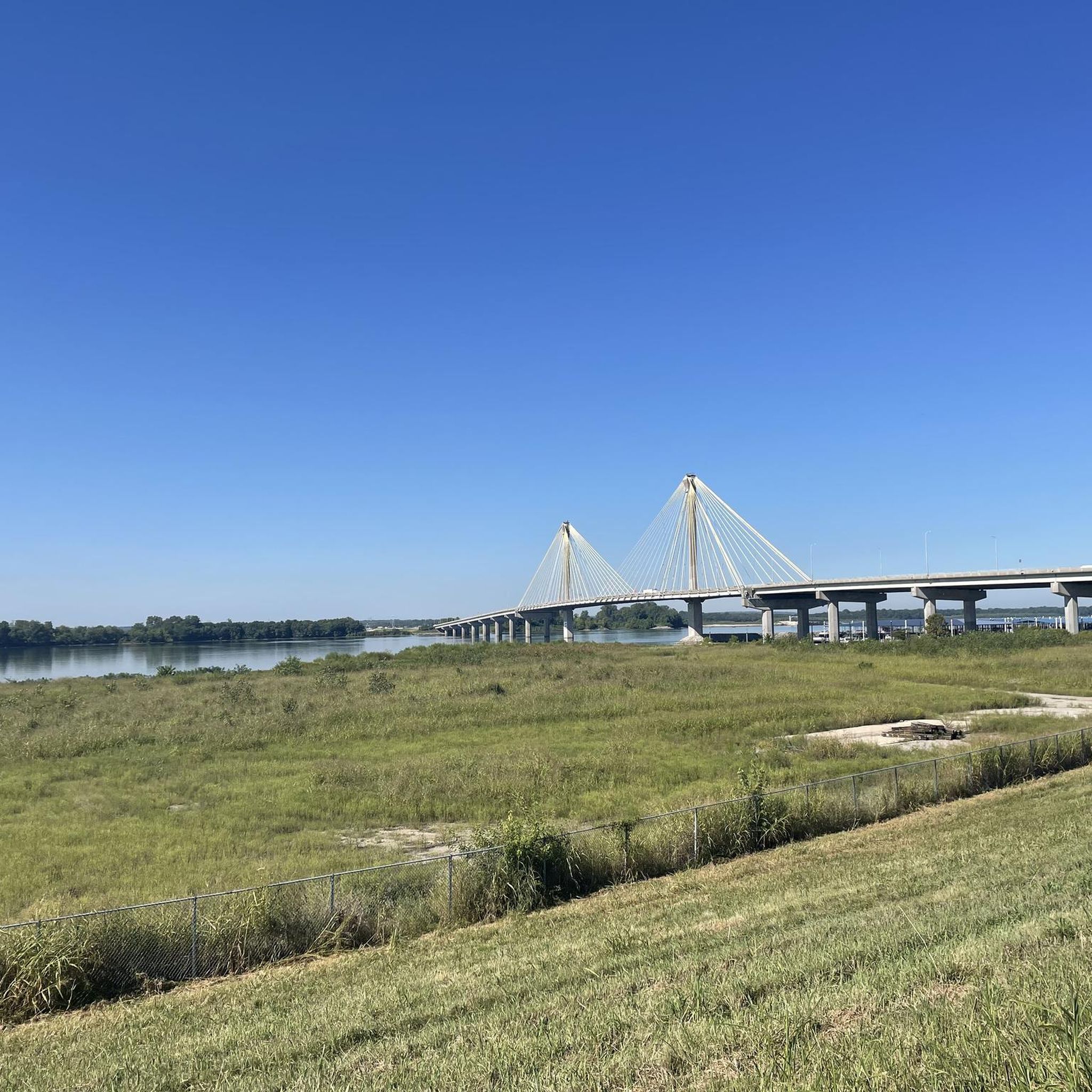
This bridge, I believe, is the longest in the Madison County Trail system which is comprised of over 138 miles of Class 1 bikeways. The 881 foot bridge parallels the Great River Road bridge. Just another unique and fun item on the Confluence Trail.
0
0
This is a monument to two famous American explorers, Lewis and Clark. They were credited with mapping the Missouri River and also finding a passage to the west coast of North America. It was from this point they launched their famous journey. This Monument is located on the Madison County Transit ( MCT ) Confluence trail which also carry's the Mississippi River Trail.
0
0

Some rough spots of pavement, so higher volume tires recommended
0
0
Frequently Asked Questions
How many touring cycling routes are available around West Alton?
There are 12 touring cycling routes around West Alton, offering a variety of experiences for cyclists. These routes are highly rated by the komoot community, with an average score of 4.6 stars.
What kind of terrain can I expect on touring cycling routes in West Alton?
The touring cycling routes around West Alton are generally characterized by a relatively flat riverine environment. You'll encounter landscapes featuring forests, wetlands, and old fields, particularly near the confluence of the Mississippi and Missouri Rivers. The routes are suitable for various skill levels, with 7 easy and 5 moderate options.
Are there any circular touring cycling routes in the West Alton area?
Yes, several routes offer a circular experience. For example, the Luther Ely Smith Square – Gateway Arch loop from Chouteau Island is a 28.8-mile loop, and the Bridge on MCT Goshen Trail – Troy Junction at Route 162 loop from Wanda covers 25.1 miles. Another option is the Confluence Trail – Levee Road (Gravel) loop from Wood River, which is 27.7 miles long.
What natural features or landmarks can I see while cycling near West Alton?
West Alton is rich in natural beauty and historical landmarks. You can witness the confluence of the Mississippi and Missouri Rivers at Edward (Ted) and Pat Jones-Confluence Point State Park. Along your rides, you might encounter the Old Chain of Rocks Bridge, the Confluence Tower and the Lewis & Clark Monument, and the Chouteau Island Country Road. The area is also known for bird watching, especially bald eagles in winter, near the Melvin Price Locks and Dam.
Are there any easy touring cycling routes suitable for families in West Alton?
Yes, there are 7 easy touring cycling routes around West Alton. A good option for a more relaxed ride is the Melvin Price Locks and Dam – MCT Confluence Trail loop from MCT Park and Ride, which is 14.8 miles long. The relatively flat terrain throughout the region makes many routes accessible for families.
Where can I find parking for touring cycling routes in West Alton?
Parking is available at various access points. The Lincoln-Shields Recreation Area, located at the Mississippi River near the William Clark Bridge, provides parking facilities. Additionally, many trailheads, such as the MCT Park and Ride, offer dedicated parking for cyclists.
What is the best time of year to go touring cycling in West Alton?
The riverine environment of West Alton offers pleasant cycling conditions during spring and fall, with milder temperatures and vibrant scenery. Winter can be a unique time for bird watching, particularly bald eagles, but be prepared for colder weather. Summers can be warm and humid, so early morning rides are recommended.
Are there places to eat or stay near the cycling routes in West Alton?
While West Alton itself is more focused on natural areas, the nearby town of Alton, Illinois, just a short drive across the Clark Bridge, offers numerous options for cafes, pubs, and accommodation. Within the immediate area, you might find the Luna Cafe (Route 66) as a point of interest. The Lincoln-Shields Recreation Area also has picnicking facilities.
Can I access the Katy Trail from West Alton?
While the Katy Trail is a prominent rail-trail in Missouri, it is largely located in St. Charles County. There are discussions about potentially extending it to Confluence Point State Park, which would significantly enhance direct access from West Alton. Currently, the Katy Trail East of St. Charles is a highlight you can explore.
What is the average duration for a touring cycling route in West Alton?
The duration of routes varies depending on their length and your pace. For instance, the Melvin Price Locks and Dam – Riverfront Park loop from Wood River, an easy 12.7-mile route, typically takes around 1 hour 12 minutes. Longer moderate routes, like the Luther Ely Smith Square – Gateway Arch loop from Chouteau Island (28.8 miles), can take approximately 2 hours 39 minutes.
What do other touring cyclists enjoy most about cycling in West Alton?
The area is highly rated by the komoot community, with an average score of 4.6 stars from over 20 reviews. Cyclists often praise the unique riverine environment, the relatively flat terrain suitable for various skill levels, and the opportunities to explore significant natural features like the confluence of the great rivers.
Most popular routes around West Alton
Most popular attractions around West Alton

Get inspired with the komoot mobile app


Explore more
Browse the best Cycling routes in other regions.
