The best walks and hikes around Tullymore
4.9
(7)
32
hikers
4
hikes
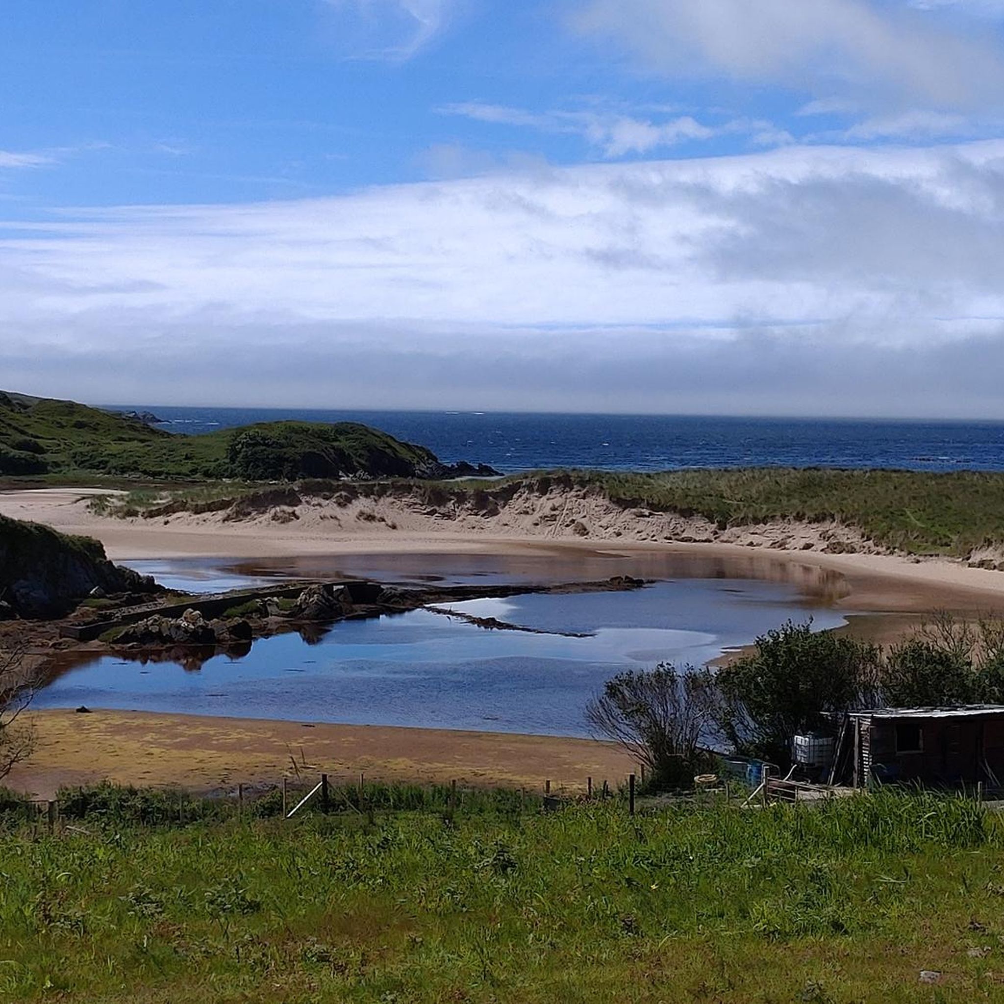
Hiking around Tullymore features a landscape characterized by diverse water features, including waterfalls, loughs, and reservoirs. The terrain offers a mix of riverside paths and routes around natural and man-made lakes. Elevation changes are generally gentle, making the area accessible for various hiking abilities. The region provides opportunities to explore natural beauty alongside tranquil waterscapes.
Best hiking trails around Tullymore
- The most popular hiking route is Fowley's Falls Trail from Lough Melvin, a 3.2 miles (5.1 km) trail that…
Last updated: October 7, 2026
4.9
(7)
21
hikers
5.13km
01:24
70m
70m
Easy hike. Great for any fitness level. Easily-accessible paths. Suitable for all skill levels.
8
hikers
2.50km
00:42
50m
50m
Easy hike. Great for any fitness level. Easily-accessible paths. Suitable for all skill levels.

1
hikers
8.63km
02:17
80m
90m
Moderate hike. Good fitness required. Easily-accessible paths. Suitable for all skill levels.
2
hikers
2.37km
00:38
30m
30m
Easy hike. Great for any fitness level. Easily-accessible paths. Suitable for all skill levels.
Our route recommendations are based on thousands of hikes, rides, and runs completed by other people on komoot.

Tips from the Community

In Ballyshannon, the oldest town in Ireland, you'll find two iconic tributes to blues-rock legend Rory Gallagher, who was born here in 1948. In the heart of the town, on The Diamond, stands the life-size 2010 bronze Rory Gallagher statue, capturing the guitarist in full flow with his battered Fender Stratocaster. This is an essential photo opportunity for fans wanting to soak up the atmosphere of the annual International Tribute Festival.
7
0

The Wee Bakery Coffee Shop Ballyshannon Address: Main St, Townparks, Ballyshannon, Co. Donegal, F94 HTW5 Lovely little cafe with friendly staff and tasty food. If you have the opportunity to stop here, do so.
1
0
Rory Gallagher (born 2nd March, 1948, Ballyshannon, Co. Donegal - died 14th June, 1995, London) was an Irish musician and songwriter. He is known for his virtuosic style of guitar playing, and is often referred to as "the greatest guitarist you've never heard of".[https://en.wikipedia.org/wiki/Rory_Gallagher]
2
0

This is a nice spot to have a bit of a rest and a bite to eat after your lovely walk. Very convenient being next to the road and with a couple of benches here as well.
0
0
As the Glenanniff River travels down from the mountains above, it has eroded the local blue limestone to form a deep river valley. Fowley’s Falls is not a single drop waterfall; instead, it cascades in a series of drops over the exposed bedrock to form a spectacular torrent of water rushing through the steep valley towards Lough Melvin.
0
0

Ballyshannon is said to be the oldest town in Ireland and archaeological investigations have indeed found evidence the town dates back as far as 4000 and 2500 BC. The town as it is today was formed by Royal Charter in 1613. There are numerous places to eat and drink in Ballyshannon with the option of sitting out on the water's edge. It makes a great place to start or finish a ride as well as being a cafe stop destination.
1
0

Ballyshannon is thought to be the oldest town in Ireland, created by Royal Charter in 1613. Archaeological sites sites discovered in the town date back as far as 4000 and 2500 BC with some of the earliest settlers in Ireland, the parthalonians settling on the nearby Inis Saimer Island. With the sea adjacent to the town and a number of eating and drinking options, the town makes a lovely stop for a break.
2
0
Frequently Asked Questions
What kind of hiking trails can I expect in Tullymore?
Tullymore offers a diverse landscape characterized by numerous water features, including waterfalls, loughs, and reservoirs. You'll find a mix of riverside paths and routes that loop around natural and man-made lakes. The elevation changes are generally gentle, making the area accessible for various hiking abilities.
Are there any easy hikes suitable for beginners in Tullymore?
Yes, Tullymore has several easy trails perfect for beginners. For instance, the Fowley's Falls Trail from Lough Melvin is an easy 3.2-mile (5.1 km) route that explores the area around Lough Melvin and Fowley's Falls. Another short and scenic option is the Fowley's Falls – Picnic Spot loop from Rossinver, which is 1.6 miles (2.5 km) long.
Are there any circular walks in Tullymore?
Yes, Tullymore features several enjoyable circular routes. A popular choice is the Lough Lareen – Assaroe Reservoir loop from Belleek, a moderate 5.4-mile (8.6 km) path offering scenic views. For a shorter option, consider the Fowley's Falls – Picnic Spot loop from Rossinver.
What are some notable natural attractions or landmarks to see while hiking in Tullymore?
The Tullymore area is rich in natural beauty, particularly its water features. You can explore Lough Melvin and the impressive Fowley's Falls. The River Erne also flows nearby, adding to the picturesque waterscapes. For historical interest, the Castle Caldwell Ruins are also within reach.
Are the hiking trails in Tullymore suitable for families?
Many of Tullymore's trails are well-suited for families, especially those with gentle elevation changes and shorter distances. The easy routes, such as the Fowley's Falls – Picnic Spot loop from Rossinver, are ideal for a family outing, offering scenic views without being too strenuous.
Can I bring my dog on the hiking trails in Tullymore?
While specific dog policies can vary by individual trail or land ownership, generally, many outdoor areas in Tullymore are dog-friendly. It's always best to keep your dog on a leash and ensure you clean up after them to preserve the natural environment for everyone.
What is the best time of year to hike in Tullymore?
Tullymore's trails can be enjoyed year-round. Spring brings fresh greenery and blooming wildflowers, while autumn offers vibrant foliage. Summer is popular for its warmer weather, and even winter can be beautiful, though paths might be muddier. Always check local weather conditions before heading out.
What do other hikers say about the trails in Tullymore?
The hiking routes in Tullymore are highly rated by the komoot community, with an average score of 4.8 stars from over 5 reviews. Hikers often praise the tranquil waterscapes, the accessibility of the trails, and the beautiful waterfall views.
Are there any waterfalls to see in Tullymore?
Yes, waterfalls are a prominent feature of the Tullymore area. Fowley's Falls is a significant natural attraction and is featured on popular routes like the Fowley's Falls Trail from Lough Melvin.
How many hiking trails are available in Tullymore?
There are at least 4 distinct hiking routes documented for the Tullymore area, ranging from easy strolls to moderate hikes, offering options for different abilities.
Is there parking available near the Tullymore hiking trails?
While specific parking details for each trailhead are best checked on individual route pages, hiking areas like Tullymore typically have designated parking facilities or roadside parking options near popular access points. It's advisable to plan your route and check for parking information beforehand.
Can I reach the Tullymore hiking areas using public transport?
Public transport options to specific trailheads in rural areas like Tullymore can be limited. It's recommended to research local bus services or consider driving to access the starting points of the hikes. Some larger towns nearby might offer better public transport connections.
Most popular routes around Tullymore
Most popular attractions around Tullymore

Get inspired with the komoot mobile app


Explore more
Browse the best Hikes in other regions.
