The best running trails in Pr Břidličná
5.0
(1)
270
runners
9
runs
Jogging in Pr Břidličná offers a challenging experience within the Jeseníky Mountains, characterized by unique geological formations such as stone streams and frost-riven cliffs. The terrain includes varied surfaces from asphalt and forest roads to footpaths, often featuring rocky sections and significant elevation changes. This natural reserve is home to subalpine and forest biotopes, with mountain peaks like Břidličná hora and Jelení hřbet providing a rugged backdrop for running routes. The area's diverse landscapes and challenging conditions make it suitable…
Last updated: July 6, 2026
12
runners
17.0km
02:12
530m
530m
Hard run. Very good fitness required. Mostly paved surfaces. Suitable for all skill levels.
4
runners
Hard run. Very good fitness required. Mostly paved surfaces. Suitable for all skill levels.

Sign up for free
23
runners
6.29km
00:43
180m
180m
Moderate run. Good fitness required. Mostly paved surfaces. Suitable for all skill levels.
9
runners
20.0km
02:38
730m
740m
Hard run. Very good fitness required. Mostly paved surfaces. Suitable for all skill levels.
3
runners
12.6km
01:23
220m
220m
Moderate run. Good fitness required. Mostly paved surfaces. Suitable for all skill levels.
Get access to more routes and recommendations from other explorers.
Sign up for free
Already have an account?
Our route recommendations are based on thousands of hikes, rides, and runs completed by other people on komoot.
Start today with a free account
Your next adventure awaits.
Login or Signup
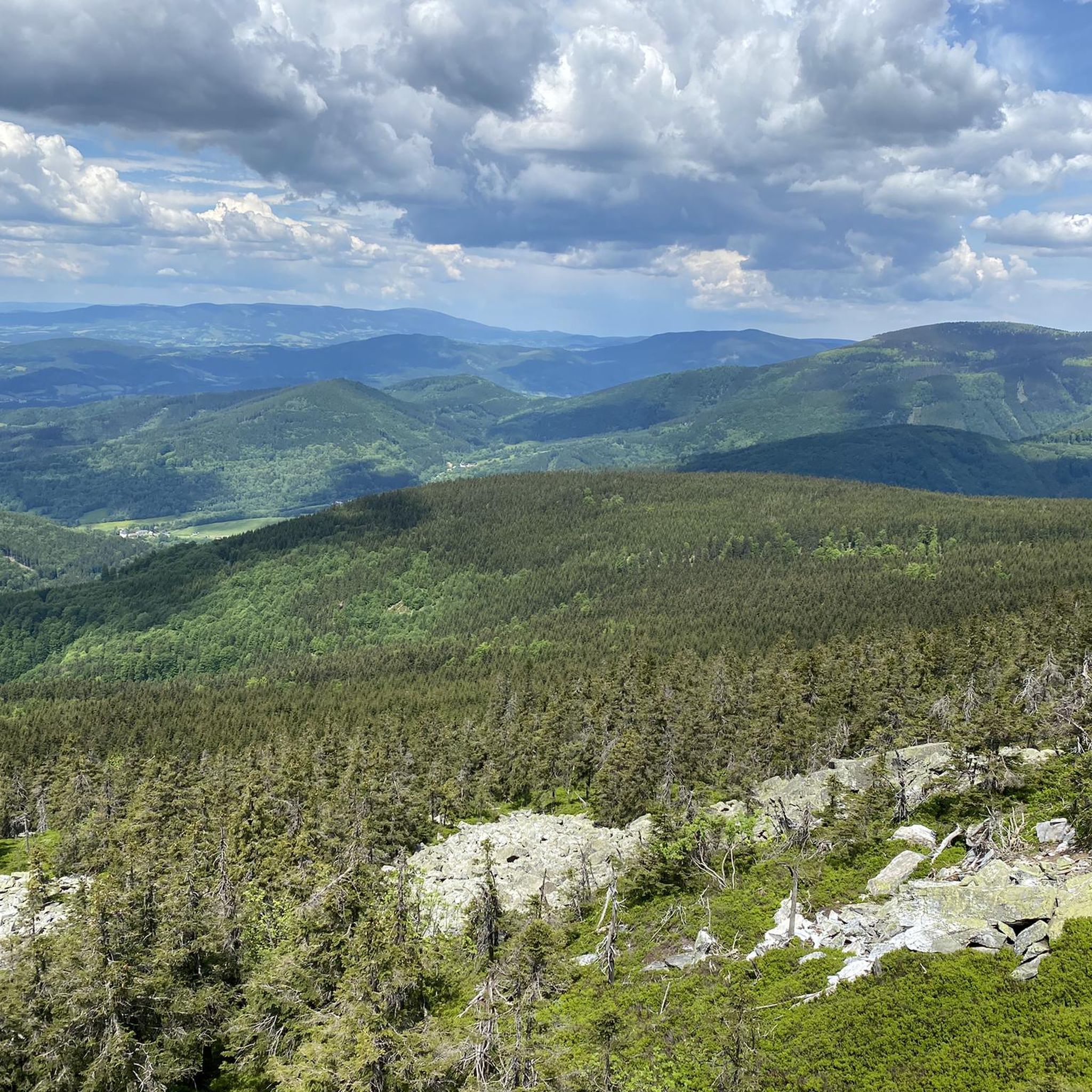
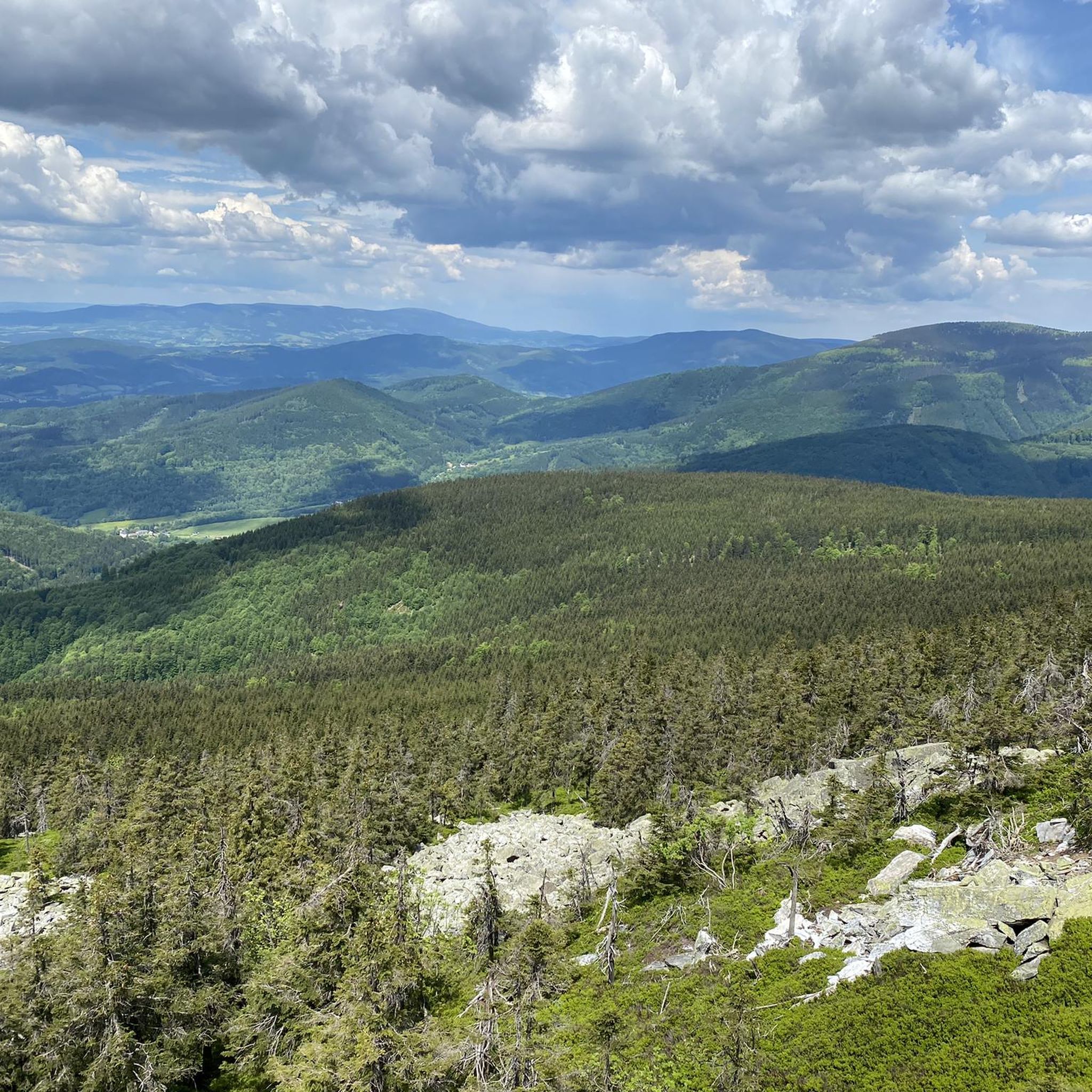
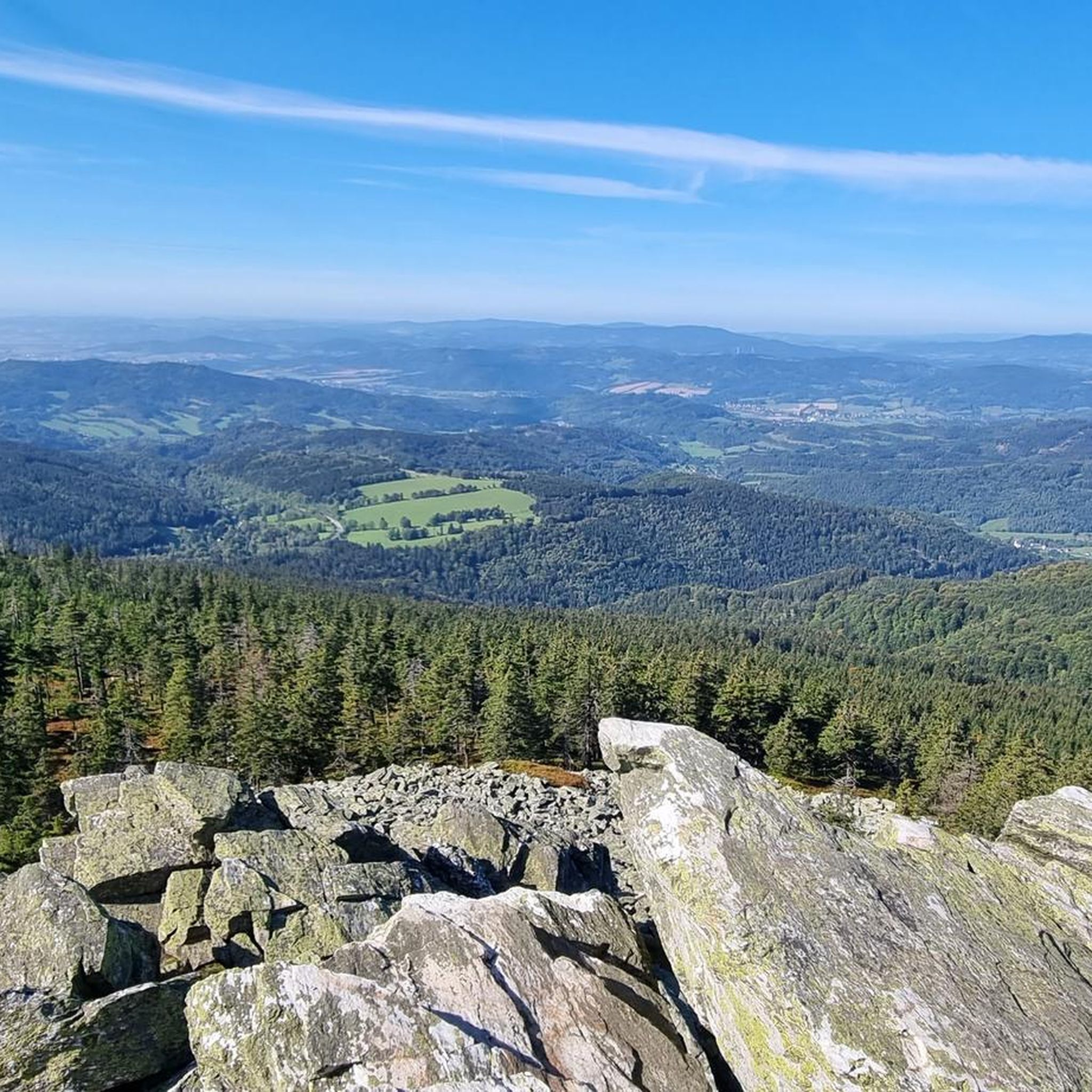
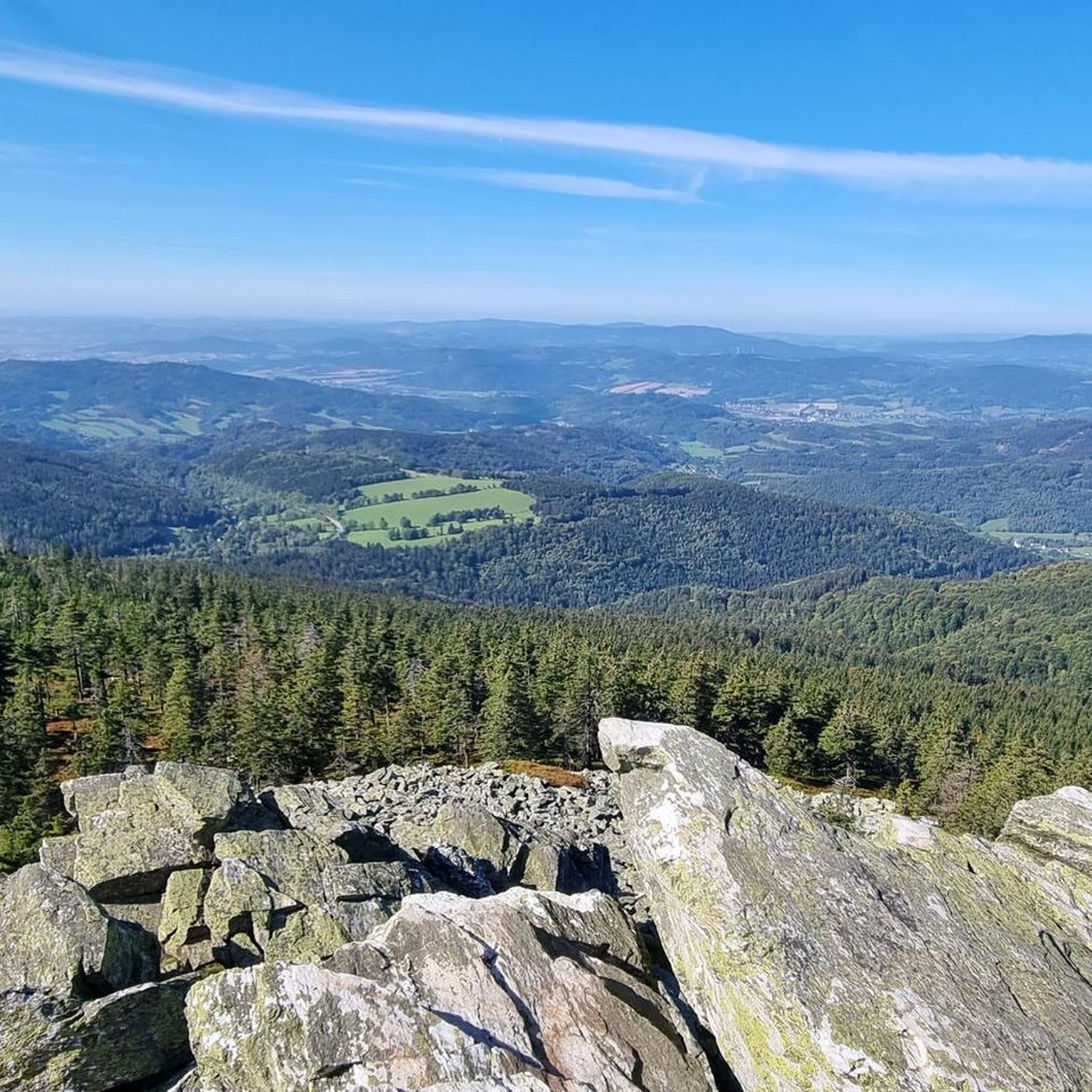

Tips from the Community

Nothing here is left to cyclists; people hike here, or maybe even the old man rides up here on his bike. 🤣🇨🇿👌😎🗼🌪
7
0

a mandatory point to walk or cycle through
1
0

A beautiful wooden shelter on the route Under the Lost Stones - Former Alfédka cottage. It will serve in any season and not only in bad weather for a short rest.
0
0

Three massive rocks rising on a bare hill near Praděd in Hrubé Jeseník have always attracted people's attention. In the past, they were most often looked upon with fear, and to find yourself near them meant almost certain accusations of witchcraft. In the 17th century, the cruel inquisitor Jindřich František Boblig from Edelstadt, known from the book Kladivo na charodějnice, designated it as the place of sabbath for all accused unfortunate women during inquisition trials.
5
0
Those who want to experience the Jeseníky Mountains in a different way have to get up early. Being on the ridges at four in the morning is almost too late for photography in the summer. But this applies to all mountains in the world
3
0
The construction of the transmitter with the observation tower began in 1969 according to Jan Liška's design, and it was completed only in 1980. The total height of the building is 146.5 meters, its tip is the highest (artificial) point in the Czech Republic. From the viewing platform, in addition to the Jesenice peaks, you can also see the Krkonoše Mountains with Sněžka, the Beskydy Mountains with Lysa Hora, and if the visibility is good, you can also see the High Tatras or Mala Fatra.
0
0
From Skrítek via Vysoka holi to Praděd there is an amazing ridge. It's worth stepping on.
2
0
Frequently Asked Questions
What is the typical difficulty level of running routes in Pr Břidličná?
Running routes in Pr Břidličná are generally challenging, with a significant number categorized as difficult due to the terrain and elevation changes. There are also several moderate routes available, but no easy routes are listed, making it more suitable for experienced trail runners.
What kind of terrain can I expect on the running trails in Pr Břidličná?
The terrain in Pr Břidličná is diverse and often demanding. You'll encounter unique geological features like stone streams and frost-riven cliffs, along with varied surfaces including asphalt, forest roads, and footpaths. Expect rocky sections and significant elevation changes, characteristic of the Jeseníky Mountains.
Are there any notable landmarks or natural features to see while running in Pr Břidličná?
Yes, Pr Břidličná is rich in natural beauty. You can expect to see unique geological formations such as stone streams (Kamenné proudy) and frost-riven cliffs (Mrazové sruby). The area also boasts diverse flora, including subalpine and forest biotopes, and offers stunning views, particularly from higher elevations like Břidličná hora, overlooking the Merta River valley and other mountain ranges. While the peak of Břidličná hora itself is protected, the surrounding trails provide ample opportunity to experience these features.
Are there many circular running routes available in Pr Břidličná?
Yes, many of the running routes in Pr Břidličná are designed as loops, allowing you to start and finish at the same point. For example, the Pod Ztracenými Kameny Shelter loop from NPR Rašeliniště Skřítek and the Petrovy Kameny – Vysoká Hole Summit loop from NPR Rašeliniště Skřítek are popular circular options.
When is the best time of year to go running in Pr Břidličná?
The Jeseníky Mountains, including Pr Břidličná, are generally best for running during the warmer months, from late spring through early autumn. This avoids the challenging conditions of winter snow and ice, which can make the already difficult terrain even more demanding. Always check local weather and trail conditions before heading out.
Can I bring my dog on the running trails in Pr Břidličná?
While specific regulations for dogs on trails within Pr Břidličná are not detailed, generally in natural reserves like this, dogs are permitted but must be kept on a leash to protect wildlife and ensure the safety of other visitors. It's always advisable to check local signage or park regulations upon arrival.
Are there options for longer distance running in the Pr Břidličná area?
Absolutely. Pr Břidličná offers several longer distance running options for those seeking an endurance challenge. Routes like the Petrovy Kameny – Vysoká Hole Summit loop from NPR Rašeliniště Skřítek cover over 13 miles (21 km) with significant elevation gain, providing a substantial workout amidst stunning mountain scenery.
What do other runners enjoy the most about jogging in Pr Břidličná?
The area is highly rated by the komoot community, with an average score of 4.5 stars. Runners often praise the unique geological features, the challenging yet rewarding terrain, and the breathtaking panoramic views from the ridge routes. The diverse landscapes and preserved forest communities also contribute to a highly engaging experience.
Which running routes offer the best views in Pr Břidličná?
For panoramic views, consider routes that ascend to higher elevations. The Petrovy Kameny – Vysoká Hole Summit loop from NPR Rašeliniště Skřítek is known for offering expansive vistas from its summit areas. From Břidličná hora, you can enjoy views to the west, encompassing the steep valley of the Merta River, the Rychlebské Hory, and Kralický Sněžník.
Are there any other notable running areas or attractions near Pr Břidličná?
Yes, the broader Jeseníky region offers many attractions. Nearby, you can explore Ztracené kameny, a prominent rock formation, or the picturesque Rešovské vodopády (Rešov Waterfalls). The Praděd statue loop from NPR Praděd is also a popular choice, leading through varied forest landscapes near the highest peak of the Jeseníky Mountains.
Is Pr Břidličná accessible by public transport for runners?
The region has marked tourist trails, including a red tourist mark that forms the main ridge route from Skřítek saddle. While specific public transport links directly to trailheads are not detailed, major access points to the Jeseníky Mountains often have bus connections. It's recommended to research local bus schedules to nearby villages like Vernířovice or Skřítek for the most up-to-date information.
Where can I park when visiting Pr Břidličná for a run?
Access points to the Pr Břidličná area, such as the Skřítek saddle (Skřítek pass), typically offer parking facilities for visitors. For routes starting from specific nature reserves like NPR Rašeliniště Skřítek or NPR Praděd, designated parking areas are usually available. Always check for official parking signs and any associated fees.
Are there any moderate running routes suitable for those building up their trail running experience?
While many routes are difficult, there are several moderate options available. For instance, the Praděd statue loop from NPR Praděd is a moderate 3.9-mile (6.3 km) trail that offers a less strenuous experience through varied forest landscapes, perfect for those looking for a balanced challenge.
Most popular routes in Pr Břidličná

Get inspired with the komoot mobile app


Explore more
Browse the best Running Trails & Routes in other regions.
