The best cycling routes around Chamartín
17
riders
4
rides
Touring cycling around Chamartín offers access to a diverse range of landscapes, from urban green spaces within the district to extensive natural areas in the wider Madrid region. The terrain varies, encompassing moderate urban loops, deep river valleys, ancient pine forests, and challenging mountain passes. This urban district serves as a strategic starting point for exploring both city routes and the natural features of the surrounding area.
Best touring cycling routes around Chamartín
- The most popular touring cycling route is…
Last updated: October 9, 2026
9
riders
45.1km
04:12
500m
500m
Hard bike ride. Very good fitness required. Mostly paved surfaces. Suitable for all skill levels.
2
riders
16.9km
01:19
70m
70m
Easy bike ride. Great for any fitness level. Mostly paved surfaces. Suitable for all skill levels.

3
riders
49.5km
04:28
690m
690m
Hard bike ride. Very good fitness required. You may need to push your bike for some segments of this route.
2
riders
23.5km
02:18
620m
610m
Hard bike ride. Very good fitness required. Mostly paved surfaces. Suitable for all skill levels.
1
riders
38.6km
03:19
510m
510m
Hard bike ride. Very good fitness required. Mostly paved surfaces. Suitable for all skill levels.
Our route recommendations are based on thousands of hikes, rides, and runs completed by other people on komoot.
Start today with a free account
Your next adventure awaits.
Popular around Chamartín

Tips from the Community

Aveinte, a name with historical roots, has a fascinating legend dating back to ancient times. Many centuries ago, at the dawn of the Middle Ages, there was a small town in what we know today as Aveinte. The inhabitants of this place were simple people, dedicated mainly to agriculture and livestock. They lived in harmony with nature and worshiped the gods of the earth and sky. One day, during a time of drought and scarcity, the locals gathered in the town square to pray for rain and good harvests. The wise old man of the place, known as Adventius, led the ceremony. With his wrinkled hands and deep voice, he spoke words of supplication to heaven. Legend has it that, at that crucial moment, a mysterious figure appeared among the clouds. He was a luminous being, dressed in white robes and silver hair. The villagers were amazed and knelt before this heavenly presence. The being addressed Adventius and spoke to him in an ancient language that only he understood. “For your devotion and the faith of your people, I will grant a blessing,” he said. “From now on, every twenty years, the waters of the river that runs through Aveinte will overflow, fertilizing the land and ensuring abundant harvests.” Thus the name Aveinte was born, which means “advent” or “arrival” in honor of the heavenly visit. Since then, every twenty years, the river overflows and renews the earth, fulfilling the promise of the luminous being. The inhabitants of Aveinte keep this tradition alive and celebrate “Aveinte” with joy and gratitude. The legend has been passed down from generation to generation, and the town's name remains a reminder of its connection to the divine and renewed hope. So, when you walk through the cobblestone streets of Aveinte, remember this story and the magic that surrounds its name. 🌟🏡
2
0

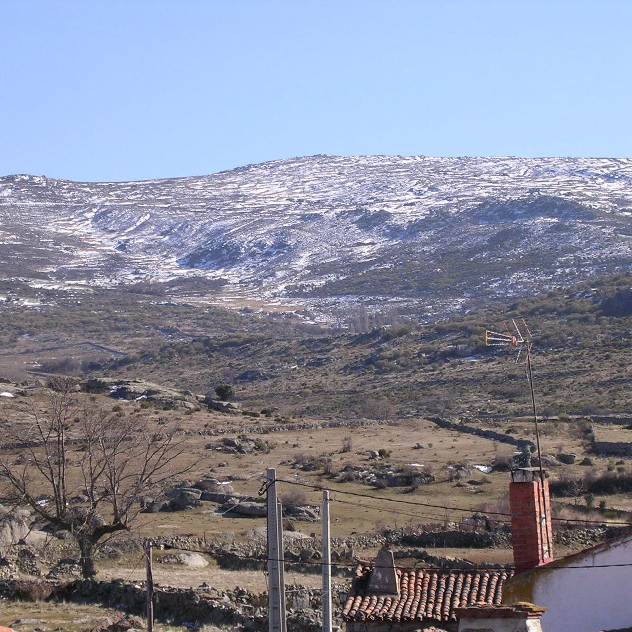
Rounded mountain range that is easily accessible from several towns. From the geodesic vertex there are impressive front-row views of the Sierra de la Paramera, La Serrota, the Amblés valley to the south and all of La Moraña to the north.
1
0
Small town located in a flat area between the cities between Ávila and Salamanca. Its church, that of Santo Tomas apostol, is one of the most important elements of the nucleus.
1
0

Good asphalt roads from blascojimeno and gravel roads from mancera
0
1
Small town located between Ávila and Salamanca, and located on a vast plain far from the south of the province which is much more mountainous.
0
1
Beautiful church located in the town of Mancera de Arriba. This one, made of stone from the area, has flagged the core since a long time ago.
0
0
Frequently Asked Questions
What kind of touring cycling routes can I find around Chamartín?
Chamartín offers a diverse range of touring cycling experiences. While the district itself is urban, it provides excellent access to both city green spaces and the wider Madrid region's natural landscapes. You can find routes that explore urban environments, as well as those leading to high mountain passes, deep river valleys, and ancient pine forests. Terrain varies from moderate urban loops to challenging mountain ascents.
Are there any easy touring cycling routes suitable for beginners or families?
Yes, there are routes suitable for beginners. For example, the Bike loop from San Pedro del Arroyo is an easy 10.9 km route with minimal elevation gain, perfect for a relaxed ride. Another easy option is the slightly longer Bike loop from San Pedro del Arroyo, covering 16.89 km.
What are some more challenging touring cycling routes in the area?
For experienced touring cyclists seeking a challenge, routes like the Sigeres loop from San Pedro del Arroyo offer a significant workout, spanning nearly 50 km with considerable elevation. Another demanding option is the Convento de Duruelo – Mancera de Arriba loop from Solana de Rioalmar, which is almost 39 km long with over 500 meters of ascent.
Are there any circular touring cycling routes available?
Many of the touring cycling routes around Chamartín are designed as loops, allowing you to start and finish at the same point. Examples include the easy Bike loop from San Pedro del Arroyo and the more challenging Cerro de Gorría loop from Narrillos del Rebollar.
What attractions or points of interest can I see along the touring cycling routes?
The routes around Chamartín can lead you to various interesting spots. You might pass through settlements like Aveinte or Sigeres. For scenic views, look out for places like Views of Valdecasa or the summit of Cerro de Gorría. Historical sites such as the Hermitage of Our Lady of Rihondo can also be found.
What is the best time of year for touring cycling in Chamartín?
The Madrid region, including areas accessible from Chamartín, generally offers good cycling conditions for much of the year. Spring and autumn are often ideal, with milder temperatures. Summer can be very hot, especially for longer rides, so early mornings or late afternoons are preferable. Winter cycling is possible, but be prepared for cooler temperatures, especially in higher elevations like the Sierra de Guadarrama.
Are there urban green spaces suitable for cycling within Chamartín itself?
Yes, within Chamartín, you can find urban green spaces perfect for leisurely rides.
Plaza de Castilla is a central hub with lush trees and open space. Parque de Berlín features ample greenery and dedicated paths, and notably houses three original pieces of the Berlin Wall, offering a unique point of interest during your ride.
How accessible are the cycling routes from Chamartín using public transport?
Chamartín is a well-connected district in Madrid, making it a strategic starting point. It has excellent public transport links, including a major train station (Chamartín) and several metro lines. This allows for convenient access to various starting points for routes both within the city and those extending into the wider Madrid region, such as the Anillo Verde Ciclista.
Can I find routes that connect to major natural parks from Chamartín?
Absolutely. Chamartín provides convenient access to significant natural areas just outside the city center. You can find routes leading to places like Casa de Campo and Monte de El Pardo, which offer extensive trails through forests and hills. For more challenging mountain biking, routes extend towards the Sierra de Guadarrama National Park, featuring rocky cliffs and dense pine forests.
What is the cycling community like in Chamartín?
Chamartín has a vibrant and active cycling community. Organizations like Club Ciclista Chamartín organize long-distance routes and cycling marathons, indicating a strong local interest in touring and other forms of cycling. This means you'll often find well-maintained routes and a supportive environment for cyclists.
Most popular routes around Chamartín
Most popular attractions around Chamartín

Get inspired with the komoot mobile app


Explore more
Browse the best Cycling routes in other regions.
