The best MTB trails around Agallas
4.3
(5)
94
riders
14
rides
Mountain biking around Agallas offers a diverse landscape characterized by rolling hills and mountain passes, providing varied terrain for cyclists. The region features numerous loop routes, indicating a network of trails that explore different elevations and natural settings. With significant elevation gains on many routes, the area is well-suited for mountain bikers seeking challenging climbs and rewarding descents.
Best mountain bike trails around Agallas
- The most popular mountain bike trail is Monastery of La Caridad – Alcázar Gate loop from…
Last updated: July 6, 2026
4.0
(2)
14
riders
39.2km
02:51
350m
350m
Moderate mountain bike ride. Good fitness required. Suitable for all skill levels.
5.0
(1)
14
riders
59.7km
05:03
820m
820m
Hard mountain bike ride. Very good fitness required. Suitable for all skill levels.

Sign up for free
10
riders
41.8km
04:09
950m
950m
Hard mountain bike ride. Very good fitness required. Suitable for all skill levels.
7
riders
61.2km
05:49
1,150m
1,150m
Hard mountain bike ride. Very good fitness required. Suitable for all skill levels.
6
riders
55.7km
04:46
1,010m
1,010m
Hard mountain bike ride. Very good fitness required. Suitable for all skill levels.
Get access to more routes and recommendations from other explorers.
Sign up for free
Already have an account?
Our route recommendations are based on thousands of hikes, rides, and runs completed by other people on komoot.
Start today with a free account
Your next adventure awaits.
Login or Signup
Tips from the Community

The Alcázar Gate in Ciudad Rodrigo is one of the historic entrances to the city walls and has great heritage and scenic value. It was opened in 1507 by Antonio del Águila, warden of the Alcázar, when he built the defensive barrier in that area. It is located next to the Castle of Henry II of Trastámara, in the section of the wall facing the Águeda River, known as the Battery, due to the cannons that were once installed there.
4
0
The Puerta del Alcázar is one of the ancient access gates to the walled enclosure of Ciudad Rodrigo. This gate, along with others such as the Puerta del Sol and the Puerta de Santiago, was part of the city's defensive system.
4
0

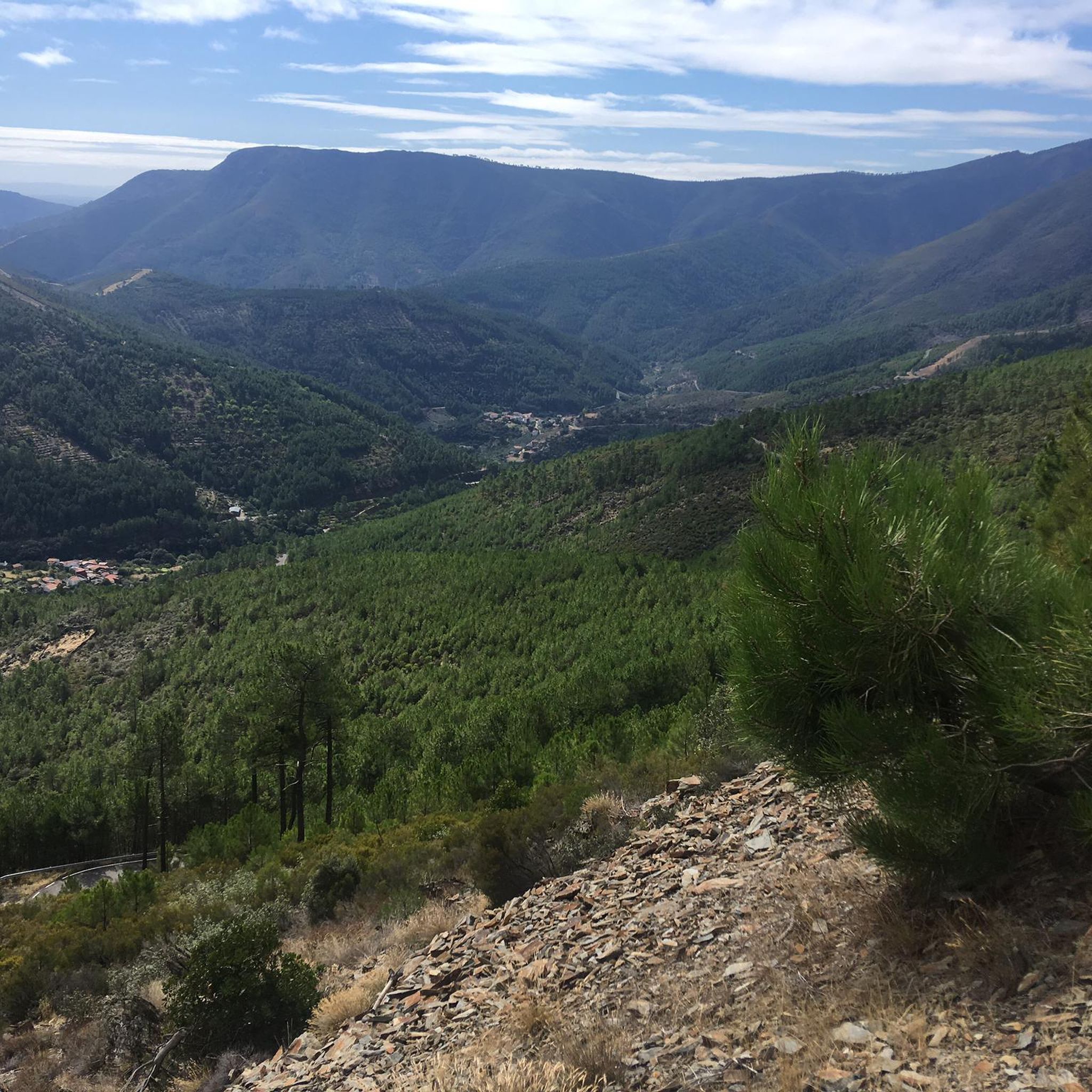
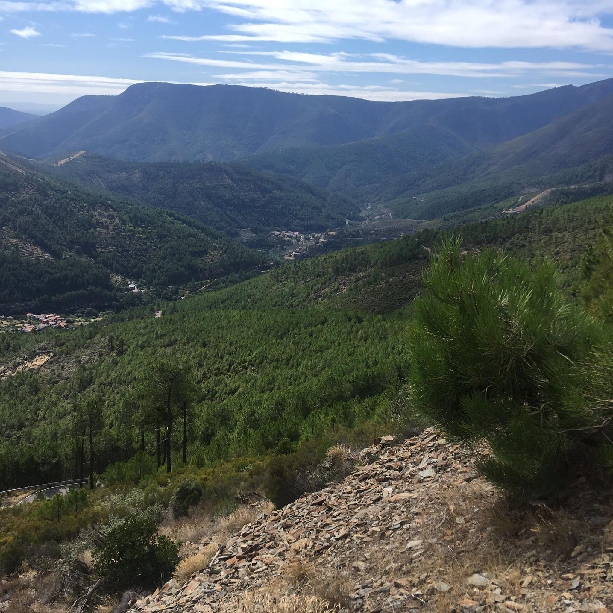
High point bordering the Hurdes and the Sierra de Francia. If you continue along the ridge you will reach the Puerto de Esperabán. At the top there is a forest hut and incredible views. Recommended for mountain bikes, a bit more difficult for gravel due to the stones, incline and broken ground, but it could be done with gravel. A very hard port from the Castile and Leon side.
0
0
The port starts in Descargamaría, on the bridge over the Arrago River, heading towards Robledillo de Gata. The road is in perfect condition up to this beautiful town, but from here on the road surface is quite deteriorated and the width of the road decreases, but, yes, we gain in beauty, since we enter a beautiful area, leaving Robledillo on the left we will be surrounded by chestnut trees, pines, oaks, olive trees, rockroses, etc. A delight for the senses to travel along this little road without hardly finding a car. As for difficulty, as we said before, it exceeds 100 coefficient, which is a lot, a lot, but the climb is bearable. We will find two very hard kilometers, which are the ones that will basically mark that coefficient, at the exit of Robledillo, a full kilometer above 8% and a couple of kilometers higher, another kilometer above 7%. From there, the difficulty level remains around 4 or 5 percent, but alternating with several downhill or flat sections, which lowers the percentage.
0
0
The Esperabán pass is a mountain pass in the interior of the Iberian Peninsula, located in the Central System. The route that crosses it connects the Spanish provinces of Cáceres and Salamanca. This pass, which divides the provinces of Cáceres and Salamanca, is located at an altitude of 1,295 m. Access to the pass is paved and in good condition. The pass runs along the road that connects the town of Pinofranqueado with the farmhouses located on the banks of the Esperabán River. The last 7 km, with an average gradient of 8%, run along a perfectly paved forest track that was once used for transporting wood. The end of the asphalt, at 1,285 m above sea level, is just a few meters from the summit that gives the pass its name. We can climb to the highest point with MTB or gravel without problems.
0
0

Views of the dam and the waters of the Águeda River. The river is the border between the municipalities of Zamarra (to the east) and Pastores (to the west).
1
0

This is a beautiful little town where life slows down. It is located at the foot of the Sierra de Gata. It has charming little streets and a way of life that hasn't changed in years.
1
0
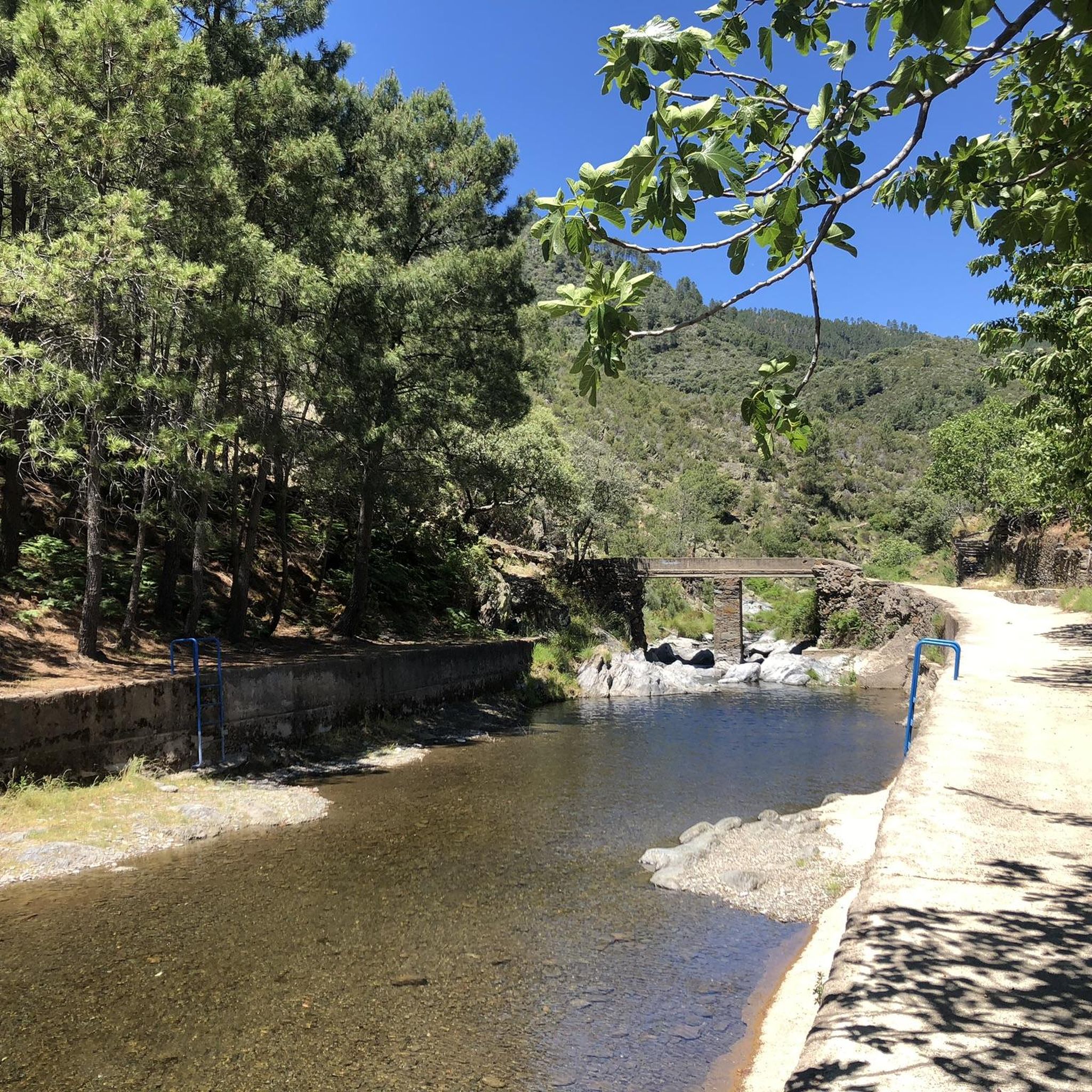
Natural pools on the side of the road for a quick dip. There is also a small park with a picnic area across the road.
1
0
Frequently Asked Questions
What is the general difficulty level of mountain bike trails in Agallas?
Mountain biking around Agallas primarily offers moderate to difficult trails. The region is characterized by rolling hills and mountain passes, featuring significant elevation gains that appeal to riders seeking a challenge. While there are 9 moderate routes, 3 are classified as difficult, with no easy options available.
Are there any easy mountain bike trails suitable for beginners in Agallas?
The mountain bike trails in Agallas are generally geared towards riders with some experience. There are no trails specifically classified as 'easy' in the area. Most routes are either moderate or difficult, involving varied elevations and mountain passes.
How long do mountain bike trails in Agallas typically take to complete?
The duration of mountain bike trails in Agallas varies significantly depending on the route and your pace. For example, the moderate Monastery of La Caridad – Alcázar Gate loop from La Encina is about 24.3 miles (39.2 km) and takes around 2 hours 51 minutes. More challenging routes like the difficult Puerto Espaban – Puerto de los Corrales loop from El Sahúgo, at 38 miles (61.2 km), can take over 5 hours 49 minutes.
Are there many circular mountain bike routes around Agallas?
Yes, the mountain biking network around Agallas is well-suited for circular routes. Many trails are designed as loops, allowing you to start and finish at the same point. This includes popular options like the Puerto Viejo loop from Martiago and the Puerto de los Corrales – Puerto Golosa loop from Agallas.
What kind of natural attractions or viewpoints can I find along the mountain bike trails in Agallas?
Agallas offers several natural attractions and scenic viewpoints. You can discover beautiful waterfalls such as Chorro de la Meancera and Chorrituelo Waterfall. For panoramic views, the Pregonera Viewpoint is a notable spot. The region is also known for its mountain passes like Robledo Pass and Esperabán Pass, which often provide stunning vistas.
Is parking available near the mountain bike trails in Agallas?
While specific parking information for each trailhead isn't always detailed, routes often start from towns or villages like La Encina or Martiago, where public parking facilities are typically available. It's advisable to check the starting point of your chosen route for local parking options.
Can I access mountain bike trails in Agallas by public transport?
Accessing mountain bike trails in Agallas primarily relies on personal transport due to the rural nature of the region and the dispersed trailheads. Public transport options might be limited, so planning your journey with a car or considering local taxi services to reach starting points is recommended.
Are the mountain bike trails in Agallas suitable for families?
Given that all mountain bike trails in Agallas are classified as moderate to difficult, they may not be suitable for young children or families seeking very easy, flat rides. The significant elevation gains and challenging terrain require a certain level of fitness and mountain biking experience. Families with older, experienced teenage riders might find some moderate routes enjoyable.
Can I bring my dog on the mountain bike trails in Agallas?
Generally, dogs are welcome on many outdoor trails in rural areas like Agallas, especially if kept on a leash. However, it's always best to check local regulations or specific trail guidelines, particularly in protected natural areas, to ensure dogs are permitted. Be mindful of livestock and other trail users.
What is the best time of year for mountain biking in Agallas?
The best time for mountain biking in Agallas is typically during spring and autumn when temperatures are milder and the natural landscape is vibrant. Summer can be hot, especially at midday, while winter might bring colder temperatures and potentially wet or icy conditions on higher passes, making some trails more challenging or inaccessible.
What do other mountain bikers say about the trails in Agallas?
The mountain bike trails in Agallas are highly rated by the komoot community, with an average score of 4.3 stars from over 4 reviews. Mountain bikers often praise the varied terrain, the challenging climbs through mountain passes, and the extensive loop routes that allow for diverse exploration of the region's natural beauty.
Are there any cafes or places to refuel near the mountain bike trails in Agallas?
Many mountain bike routes in Agallas start or pass through small towns and villages such as Martiago, La Encina, or Agallas itself. These locations often have local cafes, bars, or small shops where you can refuel and grab refreshments. It's always a good idea to carry sufficient water and snacks, especially on longer routes.
Most popular attractions around Agallas

Get inspired with the komoot mobile app


Explore more
Browse the best MTB trails in other regions.
