The best running trails around Fuentes Claras
97
runners
15
runs
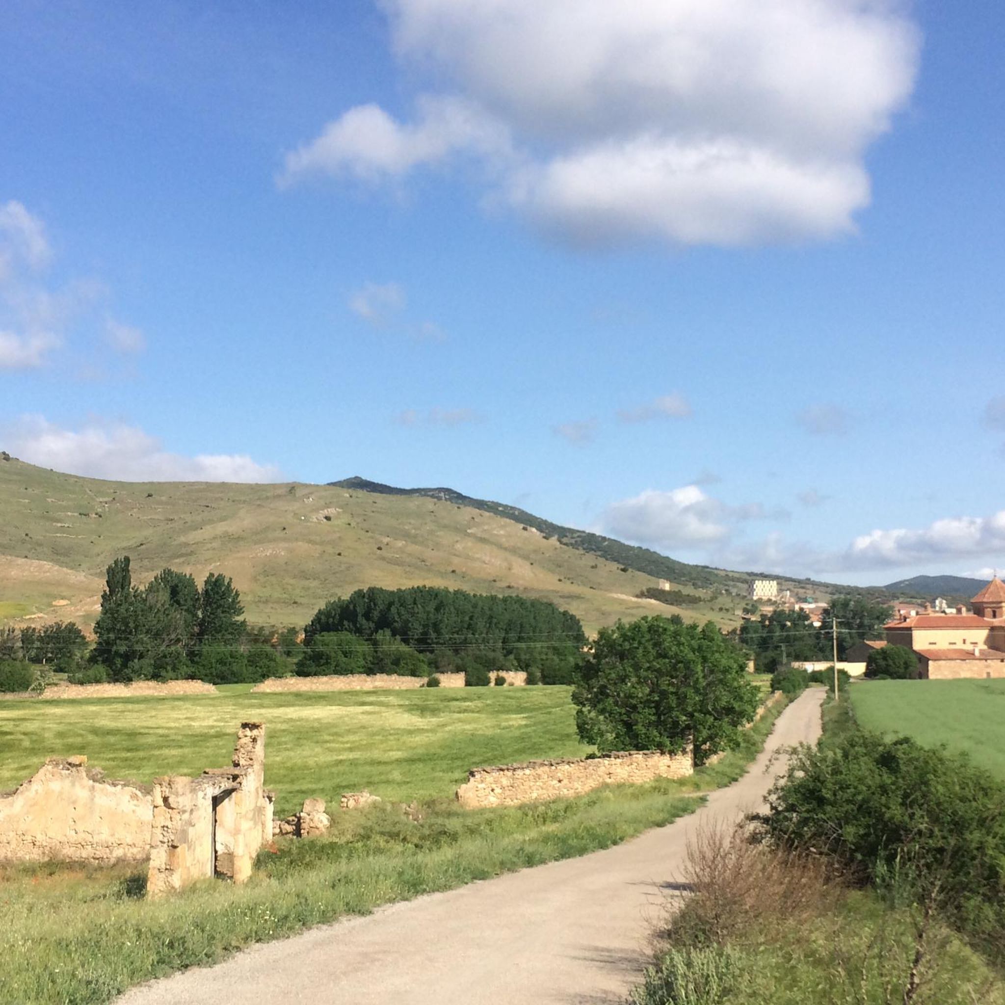
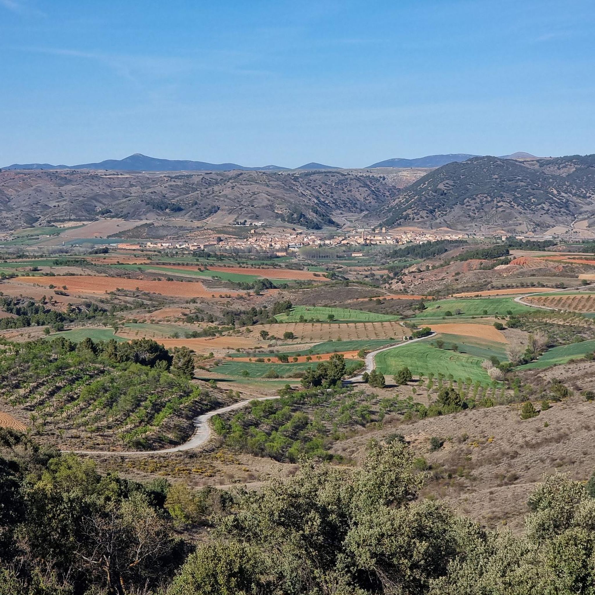
Jogging routes around Fuentes Claras offer a diverse landscape for runners, situated within the Jiloca Valley in Teruel, Spain. The region is characterized by the Jiloca River, providing fertile plains and cultivated fields for relatively flat running. Numerous natural springs, known as "ojos," create unique water features and small pools surrounded by vegetation, adding scenic elements to many running routes. Beyond the river valley, the terrain transitions to drylands, oak groves, and low mountains, offering varied elevation and more challenging running experiences.
Best jogging routes around Fuentes Claras
- The most popular jogging route is Valdellosa loop from Icona, a 7.6 miles (12.3 km) trail that takes 1 hour 39 minutes to complete. This route offers a challenging run through varied terrain with significant elevation gain.
- Another top favourite among local runners is Valdellosa – Cerro de San Esteban loop from El Poyo del Cid, a difficult 8.6 miles (13.8 km) path. This running route features substantial climbs and panoramic views over the surrounding landscape.
- Local runners also love the Monreal del Campo loop from Monreal del Campo, a 7.0 miles (11.2 km) trail leading through the Jiloca Valley, often completed in about 1 hour 16 minutes.
- Jogging around Fuentes Claras is defined by the Jiloca River valley, distinctive natural springs ("ojos"), and transitions into drylands and low hills. The network offers options for different ability levels, from moderate runs along the river to more difficult trails with significant elevation.
- The guide includes highly-rated routes that showcase the best of the region's landscape. More than 70 runners have used komoot to explore Fuentes Claras's varied terrain.
Last updated: October 9, 2026
17
runners
12.3km
01:39
410m
410m
Hard run. Very good fitness required. Mostly paved surfaces. Suitable for all skill levels.
20
runners
22.6km
03:02
660m
660m
Hard run. Very good fitness required. Mostly paved surfaces. Suitable for all skill levels.

18
runners
11.3km
01:17
80m
80m
Moderate run. Good fitness required. Mostly paved surfaces. Suitable for all skill levels.
2
runners
16.1km
01:44
50m
50m
Hard run. Very good fitness required. Mostly paved surfaces. Suitable for all skill levels.
5
runners
5.42km
00:34
30m
30m
Moderate run. Good fitness required. Mostly paved surfaces. Suitable for all skill levels.
Get access to more routes and recommendations from other explorers.
Already have an account?
Our route recommendations are based on thousands of hikes, rides, and runs completed by other people on komoot.
Start today with a free account
Your next adventure awaits.



Tips from the Community

Monreal del Campo is a fascinating place where you can learn all about the cultivation and harvesting of saffron. Located in the Plaza Mayor, the museum offers an interactive experience with traditional tools, historical photographs and workshops for the whole family.🌺
9
0

History can be found if you know the places...
1
0

From El Poyo del Cid you have an excellent view of the Jiloca valley. El Cid set up his camp here during his raids during the Reconquista, hence the name of the place. For this reason, there is a statue in his honor.
0
0

We are in the town of Monreal del Campo, located in the Jiloca region where we can visit the beautiful church, the Saffron Museum or near the town, the Ojos del Jiloca or Ojos de Monreal.
2
0

Population that is in the old middle of the Jiloca river, where it then descends towards the population of Teruel. The depression of the Jiloca river is a valley in the old middle of the Iberian System.
0
1

It is believed that Monreal del Campo was founded in the 12th century by order of King Alfonso I, after he had reconquered the territory after the Battle of Cutanda. Alfonso I ordered the construction of a castle, although today hardly any remains remain. In the town there is a saffron museum, as well as several restaurants and shops.
4
0

From El Poyo del Cid you have an excellent view over the Jiloca Valley. The Castilian knight El Cid had set up camp here during his forays during the Reconquista - hence the name of the place. A statue was erected in his honor at the end of the town.
1
0
Frequently Asked Questions
How many running routes are available around Fuentes Claras?
There are over 10 diverse running routes around Fuentes Claras, catering to various preferences and fitness levels. These routes explore the unique landscapes of the Jiloca Valley and its surroundings.
What kind of terrain can I expect on the running trails in Fuentes Claras?
Runners can expect a varied terrain. The routes often follow the fertile plains of the Jiloca River, offering relatively flat paths through cultivated fields. Beyond the river valley, the landscape transitions to drylands, oak groves, and low mountains, providing more challenging runs with varied elevation.
Are there running routes suitable for beginners or those looking for an easier run?
While many routes offer moderate to difficult challenges, the flatter sections along the Jiloca River valley are ideal for easier jogs. For example, the Monreal del Campo loop from Monreal del Campo is a moderate 7.0 miles (11.2 km) trail with less elevation, perfect for a steady run.
What natural features can I see while running in Fuentes Claras?
The region is rich in natural water features. You'll encounter the Jiloca River, numerous natural springs known as "ojos" (eyes) forming small pools, and irrigation channels. These features, along with oak groves and low mountains, create a picturesque and dynamic environment for runners.
Are there any circular running routes in the area?
Yes, many of the routes are circular, allowing you to start and end at the same point. For instance, the challenging Valdellosa loop from Icona is a popular circular route, as is the moderate Running loop from Torrijo del Campo.
What is the best time of year to go running in Fuentes Claras?
Fuentes Claras offers a unique landscape that can be enjoyed year-round, with different colors showcasing each season. Spring and autumn generally provide the most comfortable temperatures for running, while the distinctive "ojos" (springs) are a recommended landscape to visit in any season.
What interesting places can I explore near the running routes?
Beyond the natural beauty, you can explore several interesting settlements and landmarks. Nearby attractions include the towns of Calamocha and Monreal del Campo. You might also encounter historical sites like the Roman bridge of Luco de Jiloca or the settlement of El Poyo del Cid, which is part of the historic Camino del Cid.
Are the running routes in Fuentes Claras suitable for families?
The varied terrain means there are options for different activity levels. While some routes are challenging, the flatter paths along the Jiloca River and within local parks and gardens can be suitable for family walks or lighter jogs, offering accessible green spaces.
Can I bring my dog on the running trails?
Many outdoor trails in Spain are dog-friendly, especially in natural areas like the Jiloca Valley. However, it's always advisable to keep your dog on a leash, especially near cultivated fields or protected natural areas, and to respect local regulations regarding pets.
Is there parking available near the running trails?
As Fuentes Claras is a municipality with established routes, including those for walking and cycling, parking is generally available within or near the villages that serve as starting points for these trails. Specific parking information for individual routes can often be found on their respective komoot tour pages.
What do other runners enjoy most about jogging in Fuentes Claras?
Runners frequently praise the diverse landscape, from the tranquil Jiloca River plains with their unique "ojos" (springs) to the more challenging drylands and low mountains. The variety ensures a dynamic experience, and the well-defined paths, often part of regional walking and biking routes, are appreciated for their accessibility.
Are there any challenging running routes for experienced runners?
Absolutely. For experienced runners seeking a challenge, routes like the Valdellosa – Cerro de San Esteban loop from El Poyo del Cid offer significant climbs and panoramic views over the surrounding landscape, covering 8.6 miles (13.8 km) with substantial elevation gain.
Most popular routes around Fuentes Claras
Most popular attractions around Fuentes Claras

Get inspired with the komoot mobile app


Explore more
Browse the best Running Trails & Routes in other regions.
