The best walks and hikes in Cochrane
4.8
(83)
901
hikers
15
hikes
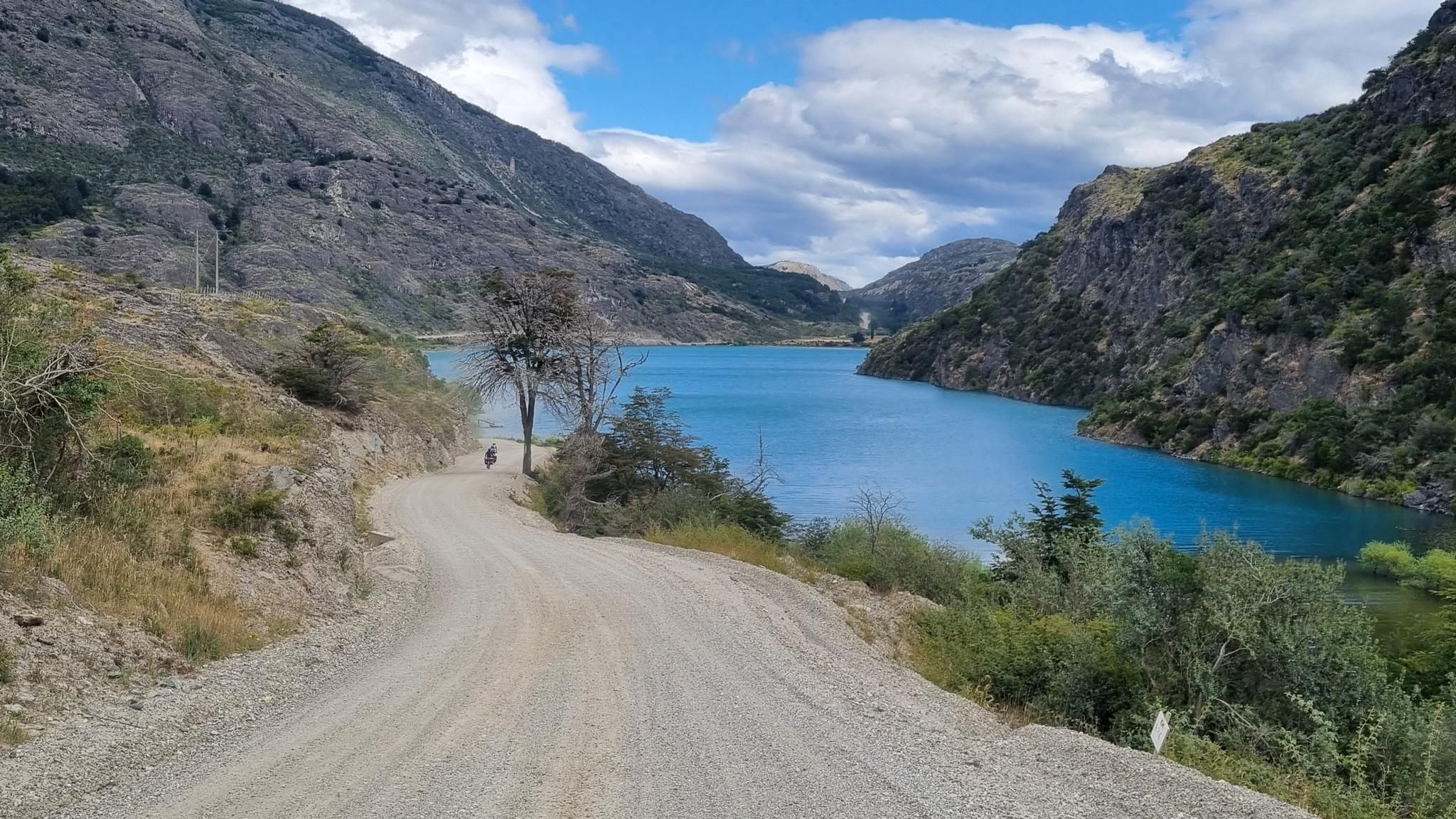
Hiking in Cochrane is characterized by its diverse landscapes, including high-altitude lagoons, river valleys, and views of Lake Cochrane. The region offers a mix of terrain, from challenging mountain paths to more accessible trails through valleys and near campgrounds. Hikers can explore areas around Valle Chacabuco and Reserva Nacional Tamango, experiencing the natural features of Aysén.
Best hiking trails in Cochrane
- The most popular hiking route is Lagunas Altas Trail – West Winds Campground loop from Westwind, a 13.1 miles (21.1 km) trail that takes 6 hours 49 minutes to complete. This difficult route features significant elevation gain through varied terrain.
- Another top favourite among local hikers is Avilés River Suspension Bridge loop from Cochrane, a moderate 10.1 miles (16.3 km) path. This trail follows the Avilés River, offering scenic views and takes approximately 4 hours 52 minutes.
- Local hikers also love the West Winds Campground loop from Westwind, a 3.5 miles (5.6 km) trail leading through campground areas, often completed in about 1 hour 29 minutes.
- Hiking in Cochrane is defined by high-altitude lagoons, river valleys, and views of Lake Cochrane. The network offers options for different ability levels, from easy loops to difficult multi-hour treks.
- The routes in Cochrane are highly rated by the komoot community with an average score of 4.86 stars from over 60 reviews. More than 700 hikers have used komoot to explore Cochrane's varied terrain.
Last updated: July 9, 2026
4.8
(27)
350
hikers
21.1km
06:49
880m
890m
Hard hike. Very good fitness required. Easily-accessible paths. Suitable for all skill levels.
4.9
(9)
119
hikers
9.70km
02:50
250m
250m
Moderate hike. Good fitness required. Easily-accessible paths. Suitable for all skill levels.

Sign up for free
4.9
(10)
75
hikers
16.3km
04:53
490m
490m
Moderate hike. Good fitness required. Easily-accessible paths. Suitable for all skill levels.
5.0
(5)
65
hikers
5.86km
01:33
60m
60m
Easy hike. Great for any fitness level. Easily-accessible paths. Suitable for all skill levels.
4.8
(5)
55
hikers
28.6km
09:02
810m
810m
Hard hike. Very good fitness required. Sure-footedness, sturdy shoes and alpine experience required.
4.0
(3)
34
hikers
9.36km
03:10
370m
380m
Hard hike. Good fitness required. Sure-footedness, sturdy shoes and alpine experience required.
4.5
(4)
24
hikers
26.3km
09:18
1,210m
1,210m
Hard hike. Very good fitness required. Sure-footedness, sturdy shoes and alpine experience required.
4.7
(3)
18
hikers
15.6km
04:26
350m
350m
Moderate hike. Good fitness required. Easily-accessible paths. Suitable for all skill levels.
5.0
(5)
36
hikers
Moderate hike. Good fitness required. Easily-accessible paths. Suitable for all skill levels.
5.0
(1)
18
hikers
11.9km
03:29
330m
330m
Moderate hike. Good fitness required. Easily-accessible paths. Suitable for all skill levels.
Get access to more routes and recommendations from other explorers.
Sign up for free
Already have an account?
Our route recommendations are based on thousands of hikes, rides, and runs completed by other people on komoot.
Start today with a free account
Your next adventure awaits.
Login or Signup
Popular around Cochrane
Other adventures in Cochrane

Tips from the Community

Beautiful wooden path located on the hiking trail
0
0

There was signal without problem
0
0

There are several places here with cell phone reception, which are marked by these signs. Easy to spot in case of an emergency.
0
0
You can take a tour boat from Cochrane here and/or back and hike the other way if you're paying a one-way ticket. Alternatively, you can rent kayaks.
1
0
Open 24 hours. There are also hot showers!
3
0
The overnight stay costs 8 euros per person. There are toilets and hot showers as well as garbage cans and huts for cooking, in which smaller tents can also be set up. Kayaks are available for rent for three hours. Kayaks for one person cost 15 euros, double kayaks 25 euros for three hours.
2
0
In the middle of the Tamango campsite. Next to it is a large trash can. Please put bottles in front of it.
2
0
Great view of the large lake Cochrane Lake / Pueyrredón Lake. Unimaginably beautiful blue water!
2
0
Frequently Asked Questions
What types of hiking trails can I expect in Cochrane?
Cochrane offers a diverse range of hiking experiences, from trails through high-altitude lagoons and river valleys to paths with views of Lake Cochrane. You'll find a mix of terrain, including challenging mountain paths and more accessible routes near campgrounds. The area is known for its varied landscapes, providing options for different ability levels.
Are there any easy or family-friendly hiking options in Cochrane?
Yes, Cochrane has several easy trails suitable for families. For instance, the West Winds Campground loop from Westwind is an easy 3.5-mile (5.6 km) trail that takes about 1 hour 29 minutes to complete. Another accessible option is The Lake House – West Winds Campground loop from Valle Chacabuco, which is 3.6 miles (5.8 km) and also considered easy.
What are some of the more challenging hikes available in Cochrane?
For experienced hikers seeking a challenge, Cochrane offers several difficult routes. The Lagunas Altas Trail – West Winds Campground loop from Westwind is a demanding 13.1-mile (21.1 km) trail with significant elevation gain, typically taking nearly 7 hours. Another difficult option is Parque Vicente Previske – View of Lake Cochrane loop from Cochrane, a long 17.8-mile (28.6 km) route.
Are there any circular hiking routes in Cochrane?
Many of Cochrane's trails are designed as loops, offering a complete experience without retracing your steps. Examples include the Avilés River Suspension Bridge loop from Cochrane, a moderate 10.1-mile (16.3 km) path, and the Fresh water at Camping Tamango – View of Lake Cochrane loop from Reserva Nacional Tamango, which is a moderate 5.4-mile (8.7 km) loop.
What kind of natural attractions can I see along the trails in Cochrane?
Hikers in Cochrane can enjoy stunning natural features. Many routes offer panoramic views of Lake Cochrane. You can also explore areas near the Río Baker and its confluence with the Río Nef, providing beautiful riverside scenery. Some trails also pass by high-altitude lagoons and through river valleys.
What do other hikers enjoy most about hiking in Cochrane?
The hiking trails in Cochrane are highly rated by the komoot community, with an average score of 4.86 stars from over 60 reviews. Hikers often praise the diverse terrain, the stunning views of Lake Cochrane, and the variety of routes available for different skill levels, from easy walks to challenging multi-hour treks.
Are there places to camp or find facilities near the hiking trails?
Yes, several trails are located near camping areas and facilities. For example, the Lagunas Altas Trail and the West Winds Campground loop both start from or pass through the West Winds Campground. Another option is the Camping Area Reserva Nacional Tamango, which is a starting point for routes like the Fresh water at Camping Tamango loop.
How many hiking routes are available in Cochrane?
There are over 15 hiking routes documented in Cochrane, offering a wide range of distances and difficulties. These include 4 easy routes, 7 moderate routes, and 4 difficult routes, ensuring options for every type of hiker.
Can I find trails that follow rivers in Cochrane?
Absolutely. The region is characterized by its river valleys. A notable option is the Avilés River Suspension Bridge loop from Cochrane, which follows the scenic Avilés River, offering beautiful views and a moderate challenge.
What is the longest hiking trail in Cochrane?
One of the longest routes available is the Parque Vicente Previske – View of Lake Cochrane loop from Cochrane, which spans 17.8 miles (28.6 km) and is classified as difficult, taking over 9 hours to complete.
Are there any trails that offer views of the surrounding landscape and lakes?
Many trails in Cochrane provide excellent viewpoints. The Fresh water at Camping Tamango – View of Lake Cochrane loop from Reserva Nacional Tamango specifically highlights a view of Lake Cochrane. Other routes through Valle Chacabuco and Reserva Nacional Tamango also offer expansive vistas of the region's natural beauty.
Most popular routes in Cochrane
Most popular attractions in Cochrane

Get inspired with the komoot mobile app


Explore more
Browse the best Hikes in other regions.
