The best cycling routes in Strynefjellet Landskapsvernområde
4.9
(27)
277
riders
4
rides
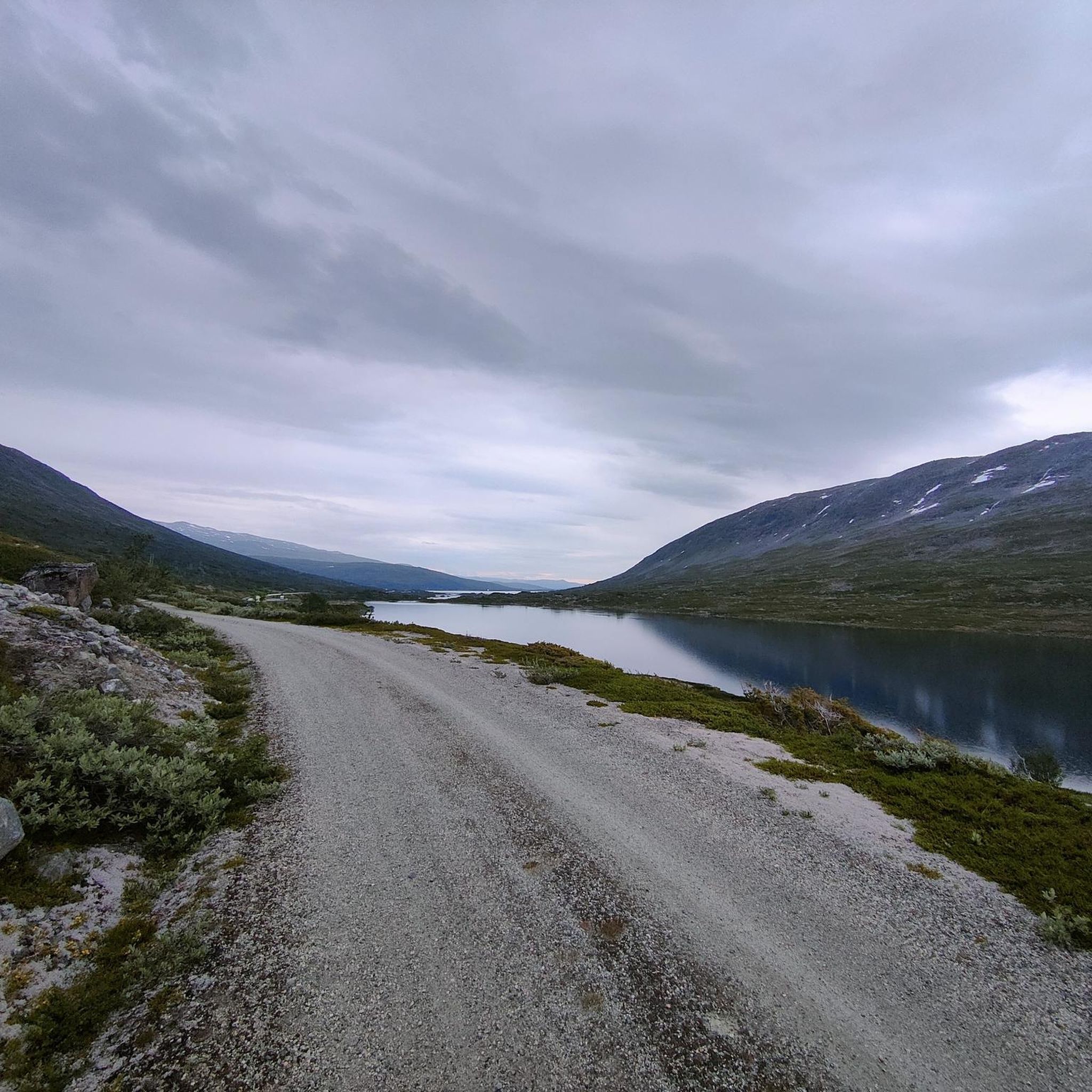
Touring cycling in Strynefjellet Landskapsvernområde offers routes through a dramatic landscape of high mountains, deep valleys, and glacial lakes. The region is characterized by its historic roads, such as the Gamle Strynefjellsvegen, which features old stone masonry and varying terrain from rounded eastern landscapes to precipitous western mountainsides. Cyclists will encounter emerald-green lakes, powerful rivers, and numerous waterfalls, providing a diverse backdrop for exploration. The area's elevation changes offer both challenging climbs and rewarding panoramic views.
Best touring cycling routes…
Last updated: July 2, 2026
5.0
(1)
28
riders
35.8km
03:14
360m
360m
Moderate bike ride. Good fitness required. Mostly paved surfaces. Suitable for all skill levels.
5.0
(2)
13
riders
51.1km
03:21
660m
660m
Hard bike ride. Very good fitness required. Mostly paved surfaces. Suitable for all skill levels.

Sign up for free
4.8
(20)
191
riders
54.6km
04:08
1,370m
1,370m
Hard bike ride. Very good fitness required. Mostly paved surfaces. Suitable for all skill levels.
5.0
(2)
37
riders
49.3km
04:30
840m
840m
Hard bike ride. Very good fitness required. Mostly paved surfaces. Suitable for all skill levels.
5.0
(2)
10
riders
28.0km
02:33
1,150m
1,150m
Hard bike ride. Very good fitness required. Mostly paved surfaces. Suitable for all skill levels.
Our route recommendations are based on thousands of hikes, rides, and runs completed by other people on komoot.
Start today with a free account
Your next adventure awaits.
Login or Signup
Popular around Strynefjellet Landskapsvernområde
Tips from the Community

Great view of the fjord and the ship. The effort is worth it.
3
0

Facts about the Geirangerfjord The fjord is 15 km long, 1.5 km wide at its widest point, and 700 m deep at its deepest point. The area, which has been declared a UNESCO World Heritage Site, covers 498 km² and includes the fjord and the surrounding areas in the Stranda and Norddal counties.
1
0
Numerous waterfalls and free-flowing rivers, deciduous and coniferous woodlands and forests, glacial lakes, glaciers, rugged mountains and a range of other natural attributes combine towards making Geirangerfjord and Nærøyfjord among the most scenically outstanding landscapes in the world.
1
0
What a magnificent view
1
0

Unfortunately, it is not possible to go off-road by bike. But the panorama makes up for it.
0
0
from sea level to just under 1.5k from Geiranger via the Trollstigen
0
0
There is a small rest area here with a nice view
0
0
There is a path and a viewing platform a little behind the Hotel Videseter
0
0
Frequently Asked Questions
How many touring cycling routes are available in Strynefjellet Landskapsvernområde?
There are several touring cycling routes in Strynefjellet Landskapsvernområde, with komoot featuring 4 distinct options. These routes offer a variety of experiences through the region's dramatic landscapes.
What are the typical difficulty levels for touring cycling routes in Strynefjellet?
The routes in Strynefjellet Landskapsvernområde range from moderate to difficult. For instance, the Lake Langvatnet – View of Stryn Valley loop from Grotli is considered moderate, while routes like the Djupvatnet Frozen Lake – Dalsnibba Mountain Road loop from Grotli and the View of Djupvatnet – Panoramic view of Geiranger loop from Geiranger present more challenging ascents and descents.
What kind of landscapes and natural features can I expect to see while cycling?
You'll encounter a diverse and breathtaking landscape, including high mountains, deep valleys, and emerald-green glacial lakes. Powerful rivers and numerous waterfalls, such as Videfossen and Øvstefossen, cascade down the mountainsides. The region also features dramatic contrasts, from rounded, ice-age-shaped eastern landscapes to precipitous western mountainsides.
Are there any historical routes or landmarks to explore by bike?
Absolutely. The most prominent historical route is the Gamle Strynefjellsvegen (The Old Strynefjell Road), a designated Norwegian Scenic Route. This historic road, built in the late 19th century, features old stone masonry and guard stones, offering a unique journey back in time. You can find more information about this route on Visit Norway.
When is the best time of year to go touring cycling in Strynefjellet?
The best time for touring cycling is typically from mid-June to late September. This is when the historic Gamle Strynefjellsvegen is usually open, and you might even encounter remarkable snow walls along the route, even in summer. Always check local conditions before planning your trip.
Are there any family-friendly touring cycling options in the area?
While many routes involve significant elevation changes, some sections or shorter loops might be suitable for families depending on their experience level. It's recommended to review the route profiles carefully on komoot to assess difficulty and distance, such as the moderate Lake Langvatnet – View of Stryn Valley loop from Grotli.
Can I bring my dog on the touring cycling routes?
Strynefjellet Landskapsvernområde is generally welcoming to dogs in outdoor areas, but specific rules may apply to certain trails or protected zones. It's always best to keep dogs on a leash and ensure they are well-behaved, especially in areas with livestock or wildlife. Check local regulations for any specific restrictions.
Are there circular touring cycling routes available?
Yes, several routes in the region are designed as loops, allowing you to start and end at the same point. Examples include the Rest Area with Valley View – View of Stryn Valley loop from Hjelle and the Rest Area with Valley View – View of Stryn Valley loop from Skåre snuplass, which offer varied distances and challenges.
What do other touring cyclists enjoy most about cycling in Strynefjellet?
The area is highly rated by the komoot community, with an average score of 4.9 stars from over 22 reviews. Cyclists often praise the dramatic scenery, the historical significance of routes like Gamle Strynefjellsvegen, and the rewarding panoramic views after challenging climbs.
Are there any unique attractions or points of interest along the cycling routes?
Beyond the stunning natural beauty, you might encounter unique attractions like Stryn Sommerski (Summer Ski Resort) along the Old Strynefjell Road, offering the unusual experience of summer skiing. The charming village of Hjelle, situated on Lake Strynsvatnet, also makes for an idyllic stop.
What are the options for parking when cycling in Strynefjellet Landskapsvernområde?
Parking is generally available at common starting points for routes, such as Grotli or Geiranger, and in villages like Hjelle. Specific parking information for each route can often be found in the route descriptions on komoot, or by checking local signage upon arrival.
Is public transport accessible for cyclists in the region?
Public transport options in this mountainous region can be limited, especially for carrying bicycles. While some bus services might operate between larger towns, it's advisable to check specific routes and their bicycle carriage policies in advance. Planning your route to start and end points accessible by car is often the most straightforward option.
Most popular routes in Strynefjellet Landskapsvernområde

Get inspired with the komoot mobile app


Explore more
Browse the best Cycling routes in other regions.
