The best walks and hikes in Cape Scott Provincial Park
5.0
(18)
219
hikers
5
hikes
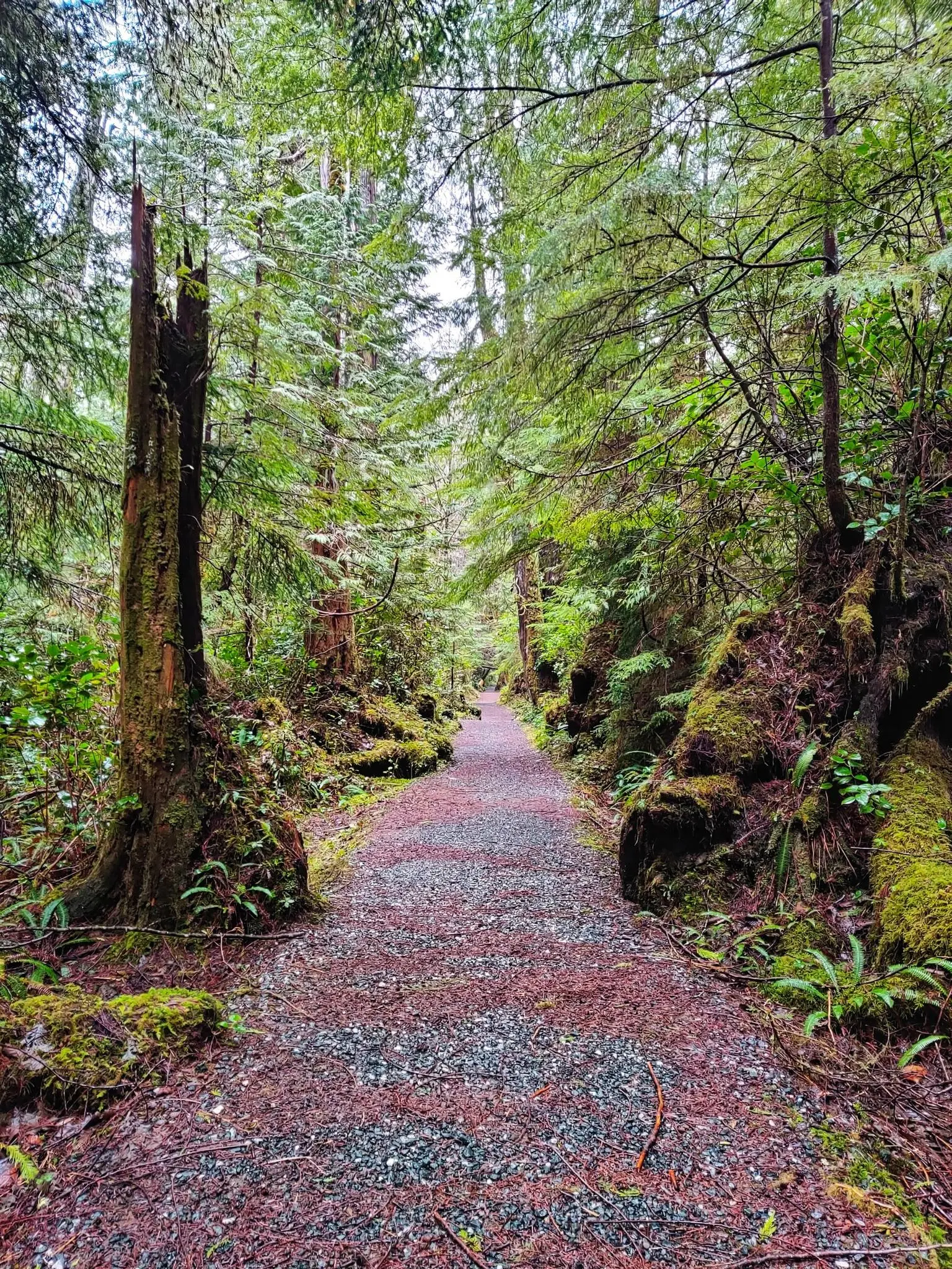
Hiking in Cape Scott Provincial Park offers a rugged coastal wilderness experience at the northwestern tip of Vancouver Island. The region is characterized by over 115 kilometers of ocean frontage, including expansive white-sand beaches and dramatic rocky promontories. Hikers traverse ancient rainforests dominated by old-growth Sitka spruce and Western Red Cedar, alongside lowland bogs and muskeg. Mount St. Patrick, rising over 400 meters, provides panoramic views of the unspoiled wilderness.
Best hiking trails in Cape Scott Provincial Park
- The most…
Last updated: August 25, 2026
5.0
(1)
11
hikers
14.6km
05:26
560m
560m
Hard hike. Very good fitness required. Sure-footedness, sturdy shoes and alpine experience required.
5.0
(15)
156
hikers
7.07km
01:55
100m
100m
Easy hike. Great for any fitness level. Easily-accessible paths. Suitable for all skill levels.

Sign up for free
5.0
(2)
29
hikers
13.4km
04:38
250m
250m
Moderate hike. Good fitness required. Mostly accessible paths. Sure-footedness required.
12
hikers
25.5km
08:47
380m
380m
Hard hike. Very good fitness required. Sure-footedness, sturdy shoes and alpine experience required.
11
hikers
Easy hike. Great for any fitness level. Easily-accessible paths. Suitable for all skill levels.
Our route recommendations are based on thousands of hikes, rides, and runs completed by other people on komoot.
Start today with a free account
Your next adventure awaits.
Login or Signup
Popular around Cape Scott Provincial Park
Other adventures in Cape Scott Provincial Park

Tips from the Community

This parking area provides convenient access to the Cape Scott and North Coast trails. However, reaching the parking area isn't all that convenient. For those beginning their hikes there is a long 60+ kilometer drive on rough logging roads to get here, and those arriving on foot from the North Coast Trail will have just completed a rough and rugged trek across Vancouver Island. That being said, the parking area can get busy in summer and the road conditions vary throughout the year so be sure to look up the current conditions before you head out.
0
0
From here you can take the Cape Scott Trail westward to Hansen Lagoon, multiple beachside campsites, and eventually, the Cape Scott Lighthouse. Those who head north will reach Nissen Bight and the North Coast Trail, and anyone heading south will eventually arrive at the Cape Scott parking area.
0
0

Mount St. Patrick Trail begins at the end of the San Josef Bay Trail. The climb to the peak is steep, but it's worth it for the rewarding views from the top. It rises 422 meters above sea level, with an open ridgeline at the top, treeless and offering 360-degree views. The weather here can change quickly, so be ready for anything. Trails can be muddy or slick after rain.
0
0
San Josef Bay is a long sandy beach with powerful Pacific waves and a rugged, windswept coastline. It can be reached via the Cape Scott or North Coast Trail. Visitors can see sea stacks, rocky headlands, and driftwood-lined shores backed by coastal rainforest. It’s a popular stop for day hikers or a base camp for multi-day hikers, as they can pitch a tent at several backcountry sites. Low tide shows off tide pools along the shore. Summer or early fall is the best time to visit, with long daylight hours and warm weather.
1
0

Being able to walk among the rocks and trees on this dreamlike beach at low tide is a real highlight.
0
0

A huge red cedar tree. Currently cordoned off, but very impressive even from a distance.
0
0
A 1.5-hour drive on a gravel road to Cape Scott, followed by a roughly 3 km walk to the beach. Absolutely worth seeing and well worth the trip.
0
0

What a gem of a place. If you have the time, it is well worth a visit. The nature feels still sooo good here. Gateway to a large back country hiking area as well.
2
0
Frequently Asked Questions
What kind of terrain can I expect when hiking in Cape Scott Provincial Park?
Hikers in Cape Scott Provincial Park will encounter a diverse and often challenging terrain. Expect to traverse ancient rainforests with old-growth Sitka spruce and Western Red Cedar, rugged coastlines featuring rocky promontories and sea stacks, expansive white-sand beaches, and lowland bogs and muskeg. Trails can be muddy and rooty, requiring navigation over fallen trees and sometimes using fixed ropes.
Are there any easy hiking trails suitable for beginners in Cape Scott Provincial Park?
Yes, Cape Scott Provincial Park offers some easier options. For instance, the Giant Red Cedar – San Josef Bay loop from Cape Scott Trailhead is rated easy, covering 4.4 miles (7.1 km) and typically taking under 2 hours. Another easy option is the Wolf Country Warning Sign – Wooden Boardwalk Trail loop from Raft Cove Provincial Park, which is 3.3 km long.
What are some notable natural features or landmarks to see along the trails?
The park is rich in natural beauty and historical landmarks. You can explore expansive white-sand beaches like Nels Bight and San Josef Bay, marvel at ancient old-growth forests with massive Sitka spruce trees, and witness dramatic rocky coastlines. The historic Cape Scott Lighthouse is a significant landmark, and Mount St. Patrick offers panoramic views. You might also encounter remnants of early Danish settlements and First Nation archaeological sites.
What is the best time of year to hike in Cape Scott Provincial Park?
Cape Scott Provincial Park can be visited year-round, but conditions vary significantly. While profound solitude can be found during winter, hikers must be prepared for adverse weather, including torrential rains and strong winds. The summer months generally offer more stable weather, making it a popular time for longer backpacking trips, though trails can still be muddy. Always check current weather and trail conditions before heading out.
Can I bring my dog on the hiking trails in Cape Scott Provincial Park?
Information regarding dogs in Cape Scott Provincial Park is not explicitly provided in the guide data. Generally, in BC Parks, dogs are permitted on leash in most campgrounds and on many trails, but restrictions may apply in sensitive wildlife areas or specific trails. It's always best to check the official BC Parks website for the most current regulations regarding pets in Cape Scott Provincial Park before your visit.
Are there any multi-day hiking opportunities in the park?
Yes, Cape Scott Provincial Park is renowned for its multi-day backpacking adventures. The main Cape Scott Trail, approximately 24 km one-way to the Cape Scott Lighthouse, and the 43.1 km North Coast Trail extension offer premier coastal backpacking experiences. Wilderness camping is a core part of the experience, with popular spots at Nels Bight, San Josef Bay, Nissen Bight, and Guise Bay, often with limited facilities like food caches and pit toilets.
What kind of wildlife might I encounter while hiking?
The park is home to a rich array of wildlife. In the forested and open uplands, hikers frequently encounter coastal black-tailed deer, Roosevelt elk, black bears, cougars, and wolves. The coastal areas are frequented by gulls and other seabirds, and the waters offshore are home to seals, sea lions, orcas, and whales. Always be wildlife aware and carry bear spray.
Do I need permits or reservations to hike or camp in Cape Scott Provincial Park?
Yes, permits are generally required for backcountry camping in Cape Scott Provincial Park. While the guide data does not specify the exact booking process, it is crucial to secure your permits in advance, especially for popular multi-day routes and designated camping areas. For detailed information on permits and reservations, please consult the official BC Parks website.
What do other hikers say about their experience in Cape Scott Provincial Park?
The hiking experiences in Cape Scott Provincial Park are highly rated by the komoot community, with an average score of 5.0 stars from more than 10 reviews. Hikers often praise the profound solitude, the stunning coastal scenery, the challenge of the rugged trails, and the unique wilderness experience offered by the park's ancient forests and expansive beaches.
Are there any circular hiking routes available in Cape Scott Provincial Park?
Yes, there are circular routes available. For example, the Cape Scott Lighthouse loop from Nels Bight Campsite is a moderate 8.3-mile (13.4 km) path that takes you to the historic lighthouse and back. Another option is the Giant Red Cedar – San Josef Bay loop from Cape Scott Trailhead, an easy 4.4-mile (7.1 km) loop through old-growth forests.
What is the highest point I can reach on a hike in the park?
The highest point in Cape Scott Provincial Park is Mount St. Patrick, which rises 422 meters (or 415 meters) above sea level. You can reach its summit via the Mount St. Patrick Trail — Cape Scott Provincial Park, a challenging 9.1-mile (14.6 km) route that offers spectacular panoramic views of San Josef Bay and the unspoiled wilderness.
Is public transport available to reach the trailheads in Cape Scott Provincial Park?
Access to Cape Scott Provincial Park is primarily by vehicle, as it is located at the remote northwestern tip of Vancouver Island. Public transport options directly to the trailheads are generally not available. Visitors typically drive to the park's access points, such as the Cape Scott Trailhead, which requires navigating gravel roads. Planning for private vehicle access is essential.
Most popular attractions in Cape Scott Provincial Park

Get inspired with the komoot mobile app


Explore more
Browse the best Hikes in other regions.
