The best running trails in Grøvelsjøen Naturreservat
41
runners
7
runs
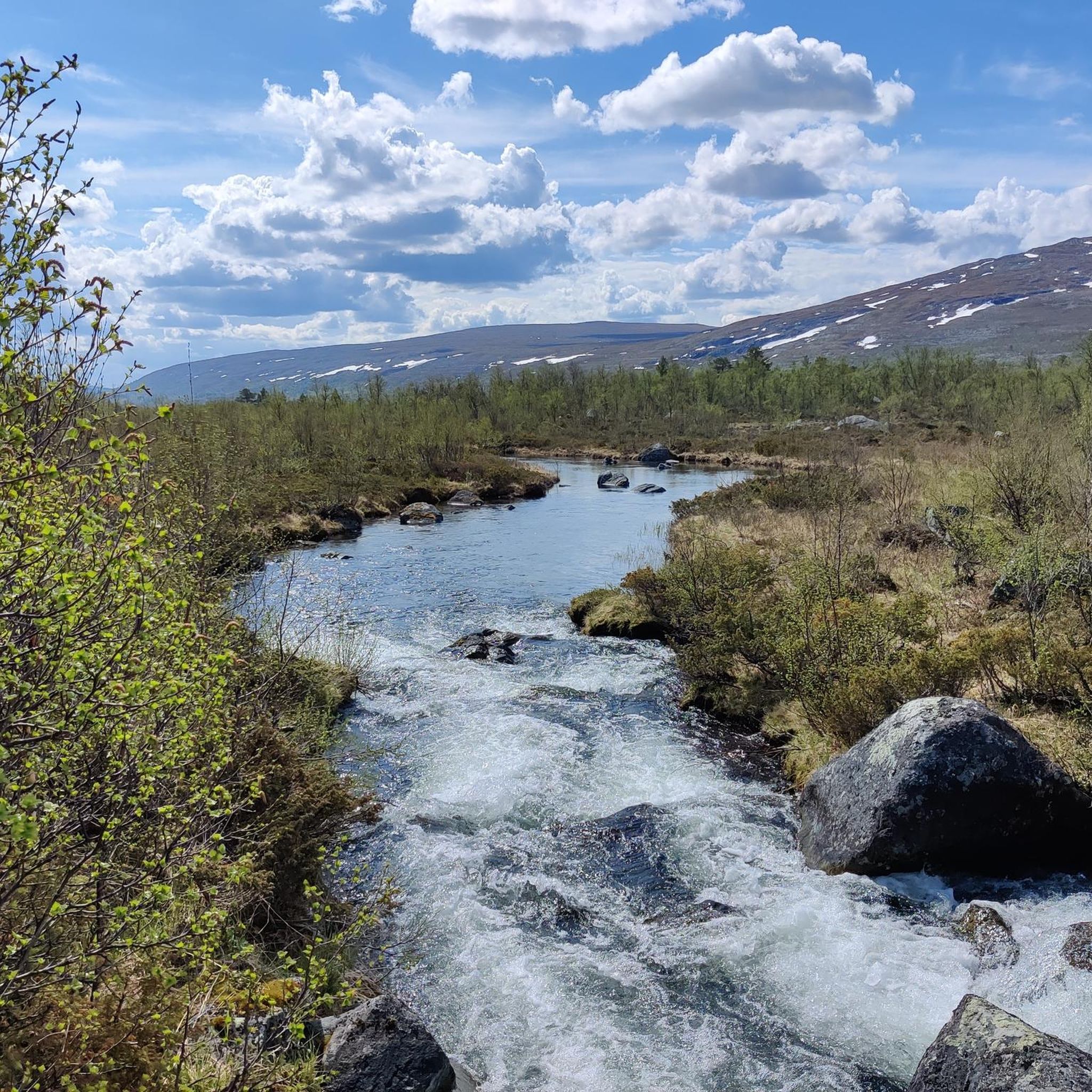
Jogging routes in Grøvelsjøen Naturreservat traverse a landscape characterized by ancient glacial features, including "striped" mountain slopes and meltwater channels. The region features rounded mountain formations, with elevations reaching up to 1400 meters, and a mix of mountain birch forests, sparse coniferous areas, and open plateaus. This diverse terrain offers varied running experiences across its extensive trail network.
Best jogging routes in Grøvelsjøen Naturreservat
- The most popular jogging route is Grövelsjön Mountain Station (STF Grövelsjön Fjällstation) – Storvätteshågna Summit loop…
Last updated: July 4, 2026
1
runners
Hard run. Very good fitness required. Sure-footedness, sturdy shoes and alpine experience required.
18
runners
Hard run. Very good fitness required. Mostly paved surfaces. Suitable for all skill levels.

Sign up for free
7
runners
Hard run. Good fitness required. Sure-footedness, sturdy shoes and alpine experience required.
6
runners
Hard run. Good fitness required. Sure-footedness, sturdy shoes and alpine experience required.
4
runners
Hard run. Very good fitness required. Sure-footedness, sturdy shoes and alpine experience required.
Get access to more routes and recommendations from other explorers.
Sign up for free
Already have an account?
Our route recommendations are based on thousands of hikes, rides, and runs completed by other people on komoot.
Start today with a free account
Your next adventure awaits.
Login or Signup
Popular around Grøvelsjøen Naturreservat
Tips from the Community

Beautiful 360 view over the northern part of Dalarna, Storvetteshågna with it's 1204 meters is the highest point in the south of Sweden.
0
0

Beginning and end point of the Grönna Bandet
2
0

Mini waterfall with bathing area in the beautiful mountains.
3
0

the cabin is small, barely room for two if they're not too big. Fire pit, dry toilet - the usual. And a nice bench close by.
0
0

Here the Southern Kungsleden has halftime. A large modern mountain station with food and equipment sales. Very good bus connections even to Stockholm in summer.
19
1

Good starting point for trekking tours
3
0

From here we started our 2-day hiking tour in the national park. On site you can find out more about the tour and buy/rent groceries or camping items. After the tour you can take a shower and relax.
5
1
Well signposted starting point for day and multi-day tours
4
0
Frequently Asked Questions
How many running routes are available in Grøvelsjøen Naturreservat?
There are 7 dedicated running routes in Grøvelsjøen Naturreservat listed on komoot. These routes offer a variety of experiences within the region's unique mountain landscape.
What kind of terrain can I expect on the jogging trails in Grøvelsjøen Naturreservat?
The jogging trails in Grøvelsjøen Naturreservat traverse a diverse landscape. You'll encounter ancient glacial features, including 'striped' mountain slopes and meltwater channels, rounded mountain formations, and a mix of mountain birch forests, sparse coniferous areas, and open plateaus. The region is known for its 'magnificent mountain world' and 'ordinary mountains with extraordinary shapes'.
Are there any family-friendly running options in Grøvelsjøen Naturreservat?
While the komoot guide currently lists routes primarily rated as 'difficult', the broader Grøvelsjøen Naturreservat area is known for having 'easily-accessible paths' suitable for various fitness levels. For families, it's advisable to look for shorter, less strenuous sections of trails or consult local visitor centers for routes specifically marked as easy.
Can I bring my dog on the running routes in Grøvelsjøen Naturreservat?
Grøvelsjøen Naturreservat is generally dog-friendly, but specific regulations may apply, especially concerning leash requirements and protected areas. It's always best to check local signage or official park information regarding dog regulations before heading out on a run.
What are some notable natural features or landmarks I might see while running?
The reserve is rich in natural beauty. You might encounter the unique 'striped' mountain slopes, lush mountain birch forests, and the alpine landscape characteristic of the Gränslandet area. Other features include Lake Grövelsjön, graying pine trees adorned with wolf lichen, and numerous mountain lakes. The Grövelsjön Mountain Station – Jakobshöjden loop, for instance, leads to Jakobshöjden, offering expansive views.
Are there any circular running routes in the area?
Yes, many of the running routes in Grøvelsjøen Naturreservat are circular. For example, the challenging Grövelsjön Mountain Station – Storvätteshågna Summit loop and the Grövelsjön Suspension Bridge – View of Grövelsjön loop are both circular paths, allowing you to start and end at the same point.
What is the best time of year for running in Grøvelsjøen Naturreservat?
The best time for running generally depends on your preference for conditions. Summer and early autumn offer pleasant temperatures and accessible trails. During winter, the landscape transforms, and some trails may be suitable for winter running or snowshoeing, but conditions can be challenging. Always check local weather and trail conditions before planning your run.
Where can I find parking or access points for the running trails?
Many routes, such as the Grövelsjön Mountain Station – Storvätteshågna Summit loop, start from Grövelsjöns Fjällstation, which typically offers parking and serves as a central access point for many trails in the area. Other trailheads may be available, and it's advisable to check specific route details for parking information.
What is the difficulty level of the running routes in Grøvelsjøen Naturreservat?
The running routes listed in this guide for Grøvelsjøen Naturreservat are all rated as 'difficult'. They often feature significant elevation gain and varied mountain terrain, making them suitable for experienced runners seeking a challenge. For example, the Grövelsjön Mountain Station – Grövelsjön Suspension Bridge loop covers over 26 km with substantial elevation changes.
Are there any long-distance running options available?
Yes, Grøvelsjøen Naturreservat offers several longer running routes. The Grövelsjön Mountain Station – Grövelsjön Suspension Bridge loop is a challenging 26.7 km route, and the Grövelsjön Mountain Station – Storvätteshågna Summit loop is another substantial option at 17.6 km, both providing extensive running experiences.
What do other runners say about jogging in Grøvelsjøen Naturreservat?
Over 40 runners have used komoot to explore Grøvelsjøen Naturreservat's varied terrain. While specific ratings are not available, the community frequently highlights the unique nature experiences, the 'magnificent mountain world', and the challenging yet rewarding mountain trails that define the region.

Get inspired with the komoot mobile app


Explore more
Browse the best Running Trails & Routes in other regions.
