The best walks and hikes around Mattapoisett Center
5.0
(2)
12
hikers
9
hikes
Hiking around Mattapoisett Center offers diverse outdoor experiences across its varied natural landscapes. The region is characterized by expansive forests, freshwater wetlands, and historic cranberry bogs. Hikers can explore trails that wind through former cranberry bogs, along swamps, and into tall pine forests, providing a rich habitat for wildlife. Coastal features and scenic rail trails also contribute to the varied terrain.
Best hiking trails around Mattapoisett Center
- The most popular hiking route is Phoenix Rail Trail, a 3.2 miles…
Last updated: October 10, 2026
5.0
(1)
1
hikers
2.56km
00:39
10m
10m
Easy hike. Great for any fitness level. Easily-accessible paths. Suitable for all skill levels.
8.90km
02:15
10m
20m
Moderate hike. Good fitness required. Easily-accessible paths. Suitable for all skill levels.

5.11km
01:18
10m
30m
Easy hike. Great for any fitness level. Easily-accessible paths. Suitable for all skill levels.
2.76km
00:42
0m
20m
Easy hike. Great for any fitness level. Easily-accessible paths. Suitable for all skill levels.
1.76km
00:27
0m
0m
Easy hike. Great for any fitness level. Easily-accessible paths. Suitable for all skill levels.
Get access to more routes and recommendations from other explorers.
Already have an account?
Our route recommendations are based on thousands of hikes, rides, and runs completed by other people on komoot.
Start today with a free account
Your next adventure awaits.
Popular around Mattapoisett Center

Tips from the Community

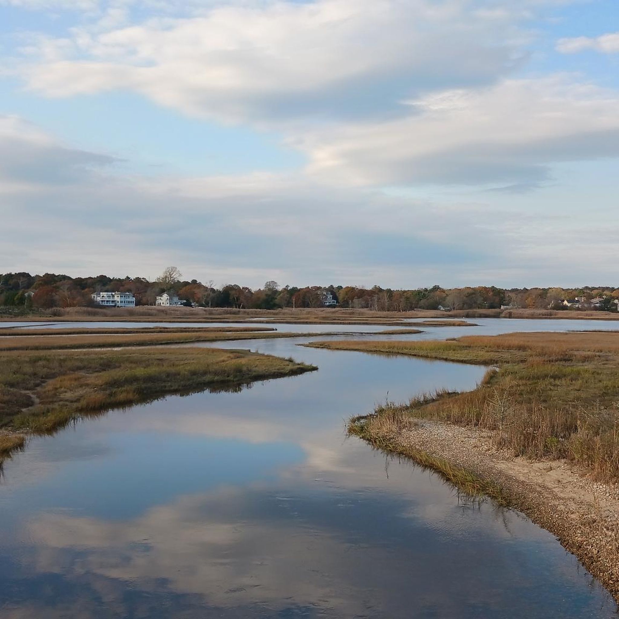
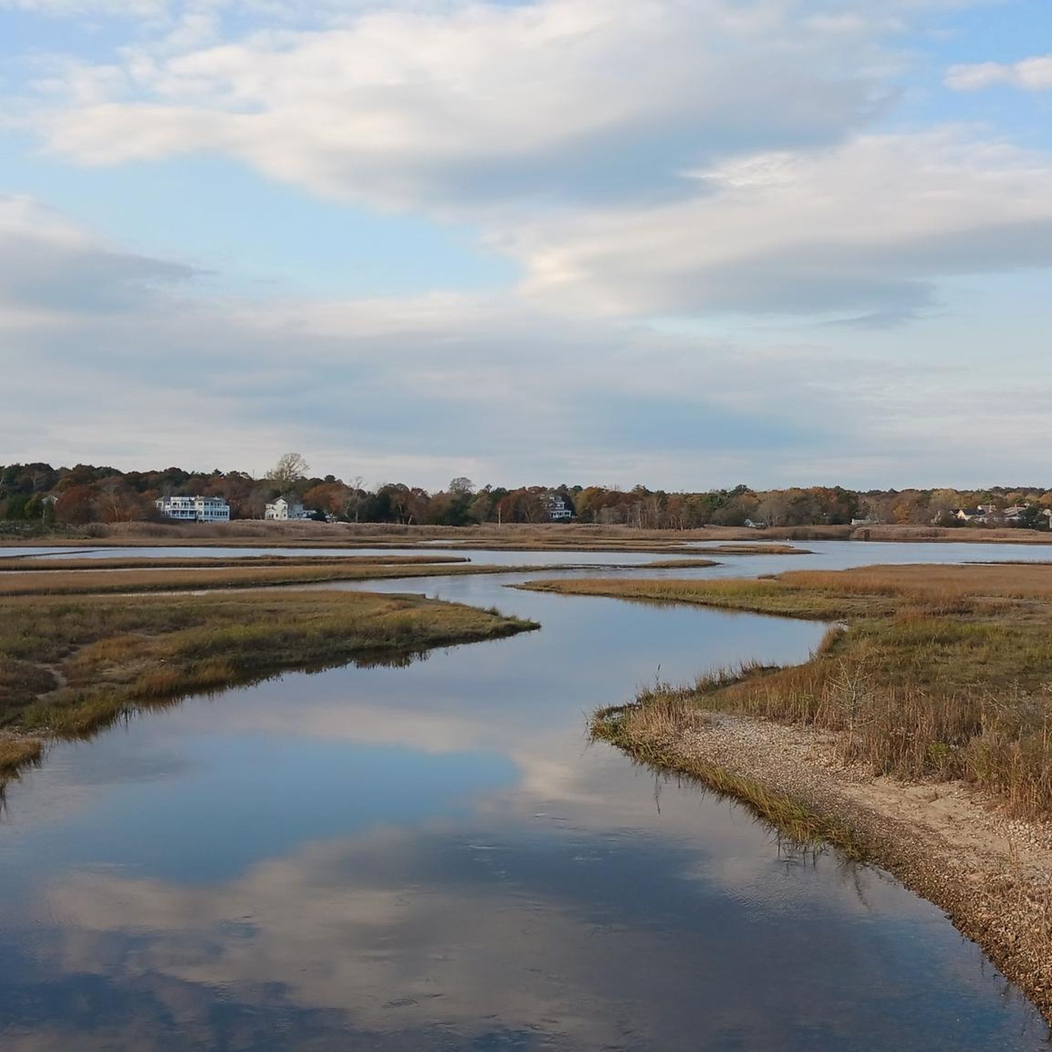
Great view of the Nasketucket Creek from the Phoenix Rail Trail. The creek leads out to Buzzard's Bay and has beautiful wetlands surrounding it.
0
0

As you traverse the East Coast Greenway, the view of Nasketucket Creek unfolds like a tranquil painting. Lush greenery lines the creek's banks, framing its gentle flow. Wildlife may be spotted amidst the serene waters, offering a peaceful retreat for cyclists along this scenic route.
0
0
Frequently Asked Questions
What types of landscapes can I expect to see while hiking around Mattapoisett Center?
Mattapoisett Center offers a diverse range of natural landscapes. You'll find extensive wetlands, dense forests, and riverine environments, including former cranberry bogs now reverting to wetlands. The area also features scenic coastal marshes and beaches, particularly along the rail trails.
Are there any easy hiking trails suitable for beginners or casual walkers?
Yes, Mattapoisett Center has several easy options. For instance, the Fort Taber Park loop — New Bedford is an easy 2.0-mile path offering coastal views. Another easy option is the Buttonwood Park Pond loop from New Bedford, which is 3.0 miles through parkland.
Can I bring my dog on the hiking trails in Mattapoisett Center?
Many trails in Mattapoisett Center, including sections of the Mattapoisett Rail Trail and areas within the Mattapoisett River Reserve, are generally dog-friendly. Always ensure your dog is on a leash and that you clean up after them to preserve the natural environment for everyone.
Are there any family-friendly hiking options in the area?
Absolutely. The Mattapoisett Rail Trail is an excellent choice for families, offering a flat, paved path through forests and over coastal marshes. Its gentle terrain makes it suitable for all ages. The Mattapoisett River Reserve also has accessible trails that are great for family outings.
Where can I find parking for hiking trails in Mattapoisett Center?
Parking is available at various access points for popular trails. For the Mattapoisett Rail Trail, there are designated parking areas. For the Mattapoisett River Reserve, specific parking lots are provided, though it's always good to check local signage for any permit requirements or restrictions.
What interesting landmarks or natural features can I see along the trails?
Hikers can discover several notable features. Along the Phoenix Rail Trail, you'll cross the scenic Mattapoisett River Bridge. The Mattapoisett River Reserve features former cranberry bogs, freshwater swamps, and Tripps Mill Brook. You might also spot Nasketucket Creek with its tranquil views and lush greenery.
Are there any loop trails available for hiking?
Yes, there are several loop options. The Fort Taber Park loop — New Bedford is a popular easy loop. Another is the Buttonwood Park Pond loop from New Bedford. Within the Mattapoisett River Reserve, areas like The Bogs offer trails that can be combined for circular walks.
What is the best time of year to go hiking in Mattapoisett Center?
Spring, summer, and fall all offer unique experiences. Spring brings colorful wildflowers and active wildlife. Summer is ideal for longer days and enjoying the coastal breezes. Fall provides stunning foliage. Winter hiking is also possible, but trails may be icy or muddy, so appropriate gear is recommended.
What kind of wildlife might I encounter on the trails?
The diverse ecosystems of Mattapoisett Center support a variety of wildlife. In the Mattapoisett River Reserve, you might spot turtles, various birds including osprey and great blue heron, deer, wild turkeys, and even black racer snakes. The wetlands are particularly rich in birdlife.
Are there any trails that offer coastal views or access to the water?
Yes, the Mattapoisett Rail Trail provides excellent coastal views, with elevated bridges over sensitive coastal marshes and beaches. A footpath from the paved section leads directly to the shores of the Mattapoisett River. Additionally, Fort Taber Park loop — New Bedford offers direct coastal views.
What do other hikers enjoy most about hiking in Mattapoisett Center?
The area is highly rated by the komoot community, with an average score of 5.0 stars. Reviewers often praise the region's varied terrain, from tranquil riverine paths and dense forests to scenic coastal routes, offering a peaceful escape into nature.
Is public transport available to reach hiking trailheads in Mattapoisett Center?
While Mattapoisett Center is primarily accessed by car, some regional bus services may operate nearby. However, direct public transport links to specific trailheads are limited. It's advisable to check local transit schedules for the most up-to-date information if you plan to rely on public transport.
Most popular routes around Mattapoisett Center
Most popular attractions around Mattapoisett Center

Get inspired with the komoot mobile app


Explore more
Browse the best Hikes in other regions.
