Easy hikes and walks in Sierras De Abdalajis Y La Encantada Sur
4.4
(2225)
20,053
hikers
126
hikes
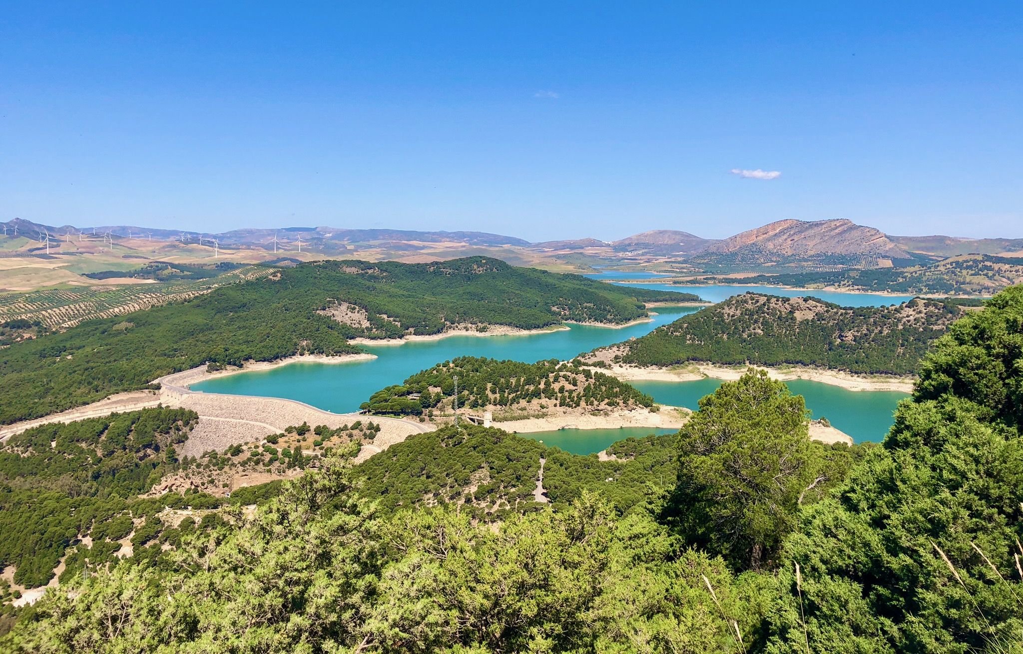
Easy hiking trails in Sierras De Abdalajis Y La Encantada Sur traverse a region characterized by rugged, mountainous terrain and striking limestone formations. This area features abundant karst elements such as deep cracks, gorges, and impressive rock faces, alongside unique "Mesas" de Villaverde in its southern parts. Prominent peaks, though not exceptionally high, create significant elevation changes and dramatic relief. The Mediterranean climate supports a lush environment, particularly after seasonal rains, making it suitable for year-round exploration.
Best easy hiking…
Last updated: July 14, 2026
83
hikers
2.30km
00:47
120m
120m
Easy hike. Great for any fitness level. Easily-accessible paths. Suitable for all skill levels.
4.7
(9)
25
hikers
Easy hike. Great for any fitness level. Easily-accessible paths. Suitable for all skill levels.

Sign up for free
4.8
(4)
111
hikers
Easy hike. Great for any fitness level. Easily-accessible paths. Suitable for all skill levels.
3.3
(3)
26
hikers
3.87km
01:12
150m
150m
Easy hike. Great for any fitness level. Easily-accessible paths. Suitable for all skill levels.
3.3
(3)
18
hikers
Easy hike. Great for any fitness level. Easily-accessible paths. Suitable for all skill levels.
Get access to more routes and recommendations from other explorers.
Sign up for free
Already have an account?
Our route recommendations are based on thousands of hikes, rides, and runs completed by other people on komoot.
Start today with a free account
Your next adventure awaits.
Login or Signup
Popular around Sierras De Abdalajis Y La Encantada Sur

Other adventures in Sierras De Abdalajis Y La Encantada Sur

Tips from the Community

The Caminito del Rey crosses the drawbridge at this point, before it says: end of the interesting part... and continue running until the helmet is returned. Those who have taken a guided tour will already be asked here to return the radio receiver.
2
0
The last 300m are challenging again: the path is secured on smooth rock, very impressive. Unfortunately, the exciting part of the hike is also over here.
2
0
El Kiosko is one of the few restaurants at the beginning of the Caminito del Rey. However, it's always very busy, as buses bring new visitors every 15 minutes. They offer tapas and simple traditional dishes from Malaga with a sea view.
3
0
Well-lit tunnel as a shortcut to the start of the Caminito del Rey. A bit low for people 1.90m and taller, otherwise another highlight around the Caminito del Rey. The tunnel is approx. 500m long and you can see the end of the tunnel right from the beginning.
4
0

At the end, there are a few steep wooden stairs leading to the exit.
4
0

Very nice sheet pile wall, you can't walk through it
0
0

It is the beginning of the gorge
0
0
Frequently Asked Questions
How many easy hiking trails are available in Sierras De Abdalajis Y La Encantada Sur?
There are 34 easy hiking trails in Sierras De Abdalajis Y La Encantada Sur. In total, the region offers 112 hiking routes across various difficulty levels.
What kind of landscapes can I expect on easy hikes in this region?
Easy hikes in Sierras De Abdalajis Y La Encantada Sur traverse rugged, mountainous terrain characterized by striking limestone formations and abundant karst features like deep cracks, gorges, and impressive rock faces. You'll also encounter unique 'Mesas' de Villaverde in the southern parts, offering diverse and dramatic scenery.
Are there any family-friendly easy hikes in Sierras De Abdalajis Y La Encantada Sur?
Yes, several easy routes are suitable for families. For instance, the View of Puente de la Josefona – El Chorro loop from Bobastro is a shorter, manageable trail that leads through the scenic El Chorro area, perfect for a family outing.
What are some notable landmarks or points of interest I can see on easy trails?
You can explore several interesting points. Near Bobastro, you'll find the Geological Point of Interest: Bobastro, the Entrance to the Mozarabic Ruins of Bobastro, and the Mozarabic Rock-Cut Church of Bobastro. The Las Mesas de Villaverde Viewpoint also offers panoramic views.
Are there any easy circular walks in the area?
Yes, many easy trails are designed as loops. A popular option is the View of Puente de la Josefona – View of El Chorro loop from El Chorro-Caminito del Rey, which is 3.9 km long and offers views near the El Chorro area. Another is the El Chorro – Pared del Huma loop from El Chorro-Caminito del Rey, exploring the landscape around El Chorro and the foothills of La Huma.
What is the best time of year to go hiking on easy trails in Sierras De Abdalajis Y La Encantada Sur?
The Mediterranean climate with warm summers and mild winters makes the region suitable for year-round exploration. However, spring and autumn, after seasonal rains, are particularly appealing as the environment becomes lush and temperatures are very pleasant for hiking.
What do other hikers say about the easy trails in Sierras De Abdalajis Y La Encantada Sur?
The trails in Sierras De Abdalajis Y La Encantada Sur are highly rated by the komoot community, with an average score of 4.3 stars from over 1600 reviews. Hikers often praise the dramatic scenery, unique geological formations, and the accessibility of routes for various skill levels.
Are there any easy trails that offer views of the reservoirs?
Yes, the Viewpoint of the Three Reservoirs – Three Reservoirs Viewpoint loop from Río Turón is an easy 6.6 km trail that provides excellent views of the surrounding reservoirs, offering a different perspective of the region's natural beauty.
Can I find trails that are relatively flat or have minimal elevation gain?
While the region is mountainous, many easy trails are designed to have manageable elevation changes. For example, the View of Puente de la Josefona – Tajo de la Encantada Dam loop from Bobastro has a modest elevation gain of around 40 meters, making it a relatively flat option for a pleasant walk.
What kind of wildlife might I encounter while hiking in the Sierras De Abdalajis Y La Encantada Sur?
The area is a habitat for diverse wildlife. While on easy trails, you might spot various bird species, including eagles, vultures, and eagle owls. Mammals such as ibex and wildcats also inhabit the region, though they are more elusive.
Are there any specific easy trails that lead to the El Chorro area?
Yes, several easy trails provide access to or explore the El Chorro area. The View of Puente de la Josefona – View of El Chorro loop from El Chorro-Caminito del Rey and the View of Puente de la Josefona – El Chorro loop from Bobastro are both excellent choices for experiencing this scenic part of the region.
Most popular routes in Sierras De Abdalajis Y La Encantada Sur
Most popular attractions in Sierras De Abdalajis Y La Encantada Sur

Get inspired with the komoot mobile app


Explore more
Browse the best Hikes in other regions.
