Easy hikes and walks around Lütjensee
4.6
(4408)
17,781
hikers
841
hikes
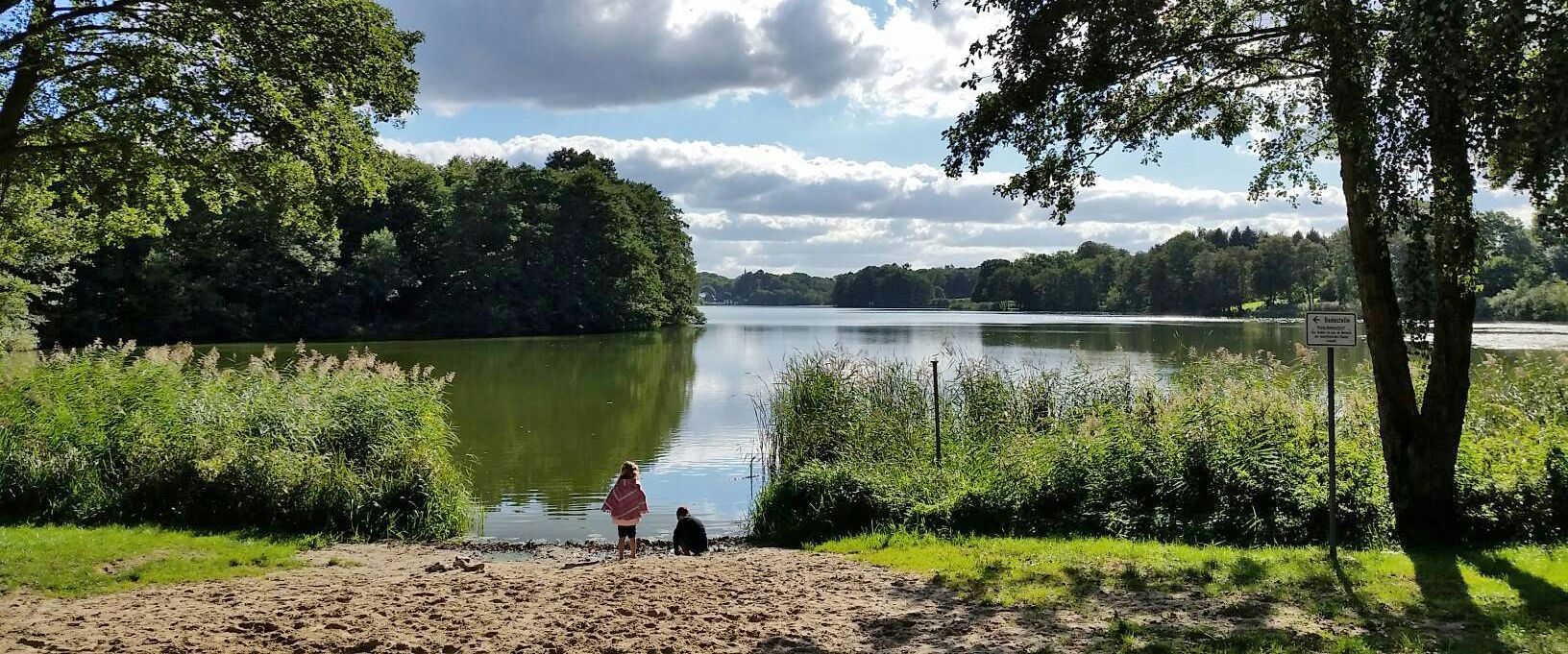
Easy hiking trails around Lütjensee traverse a landscape characterized by a three-lake region, encompassing Lütjensee, Großensee, and Mönchsteich. The area features enchanting moorlands, such as the Kranika Moorland Nature Reserve, and dense deciduous forests that provide shaded paths. Gently rolling hills define the terrain, offering dynamic views and accessible walking opportunities.
Best easy hiking trails around Lütjensee
- The most popular easy hiking route is Lake Lütjensee – Kranika Moorland loop from Lütjensee, a 4.4 miles (7.1 km) trail that takes 1 hour 49 minutes to complete, offering views of the lake and diverse moorland scenery.
- Another top favourite among local hikers is Lake Lütjensee – View of Lütjensee loop from Lütjensee, an easy 2.4 miles (3.9 km) path. This route provides consistent lakeside views on gentle terrain.
- Local hikers also love the Marshy Meadow – Lake Lütjensee loop from Lütjensee, a 2.5 miles (4.0 km) trail leading through marshy meadows and along the lake, often completed in about 1 hour 2 minutes.
- Hiking around Lütjensee is defined by its three-lake region, tranquil moorlands, and surrounding deciduous forests. The network offers options for various ability levels, with a focus on easy hiking trails.
- The routes in Lütjensee are highly rated by the komoot community with an average score of 4.6 stars from more than 4,000 reviews. More than 18,000 hikers have used komoot to explore Lütjensee's varied terrain.
Last updated: June 30, 2026
4.8
(8)
55
hikers
6.11km
01:35
40m
40m
Easy hike. Great for any fitness level. Easily-accessible paths. Suitable for all skill levels.
4.6
(7)
32
hikers
7.08km
01:50
40m
40m
Easy hike. Great for any fitness level. Easily-accessible paths. Suitable for all skill levels.

Sign up for free
5.0
(3)
24
hikers
3.88km
01:00
20m
20m
Easy hike. Great for any fitness level. Easily-accessible paths. Suitable for all skill levels.
5.0
(2)
21
hikers
2.55km
00:40
10m
10m
Easy hike. Great for any fitness level. Easily-accessible paths. Suitable for all skill levels.
4.5
(11)
83
hikers
4.06km
01:03
20m
20m
Easy hike. Great for any fitness level. Easily-accessible paths. Suitable for all skill levels.
Get access to more routes and recommendations from other explorers.
Sign up for free
Already have an account?
Our route recommendations are based on thousands of hikes, rides, and runs completed by other people on komoot.
Start today with a free account
Your next adventure awaits.
Login or Signup
Popular around Lütjensee
Other adventures around Lütjensee

Tips from the Community

The large, free parking lot on the southern shore of Lütjensee is a good starting point for a tour around the lake and other tours in the surrounding area.
1
0
A narrow path leads through this interesting, marshy area... I recommend sturdy, waterproof shoes, especially after prolonged periods of rain.
2
0

Good starting point for hiking
0
0

Narrow path, waterproof footwear required!
0
0
Nearby there is a worthwhile restaurant for a stop
0
0

The Lütjensee in the Stormarn district is around 33 hectares in size and is a popular destination for day trippers who want to leave the hustle and bustle of the city behind them for a while. From the riverside paths you can enjoy a wide view over the water, which glows in different colors depending on the time of day. The sunsets from this side of the lake are truly spectacular.
0
0
The Kranika moorland is located very close to the Lütjensee. It is 96 hectares in size and has been a nature reserve since 1993. Part of the area used to be covered by water, but later moors and wet meadows developed. Today, rare plants such as sundew and orchid grow here. Many animals, including frogs, grass snakes and various bird species, also call this area home. A number of beautiful hiking trails lead along the edges and information boards provide exciting insights.
2
0
Beautiful wetland not far from the protected Kranika moorland. Once a large peat mining area, the landscape is now becoming more and more peaceful. Rare amphibians and native snake species find their habitat here.
2
0
Frequently Asked Questions
How many easy hiking trails are available around Lütjensee?
The Lütjensee area offers a wide selection of easy hiking trails, with over 600 routes specifically categorized as easy. This makes it an ideal destination for relaxed walks and gentle explorations.
What natural features can I expect to see on easy hikes around Lütjensee?
Easy hikes around Lütjensee primarily feature a captivating three-lake landscape, including Lütjensee, Großensee, and Mönchsteich. You'll also encounter enchanting moorlands, such as the Kranika Moor Nature Reserve, and dense deciduous forests providing shaded paths. The terrain is characterized by gently rolling hills, offering dynamic views without strenuous climbs.
What do other hikers enjoy most about the trails in Lütjensee?
The trails in Lütjensee are highly rated by the komoot community, with an average score of 4.6 stars from over 4,000 reviews. Hikers frequently praise the tranquil moorlands, the consistent lakeside views, and the well-maintained paths that make for enjoyable and accessible walks.
Are there any easy circular routes around Lütjensee?
Yes, many of the easy trails around Lütjensee are circular routes. For example, the Lake Lütjensee – Kranika Moorland loop from Lütjensee is a popular 7.1 km option, and the Kranika Moorland – Kranika Moor Nature Reserve loop from Lütjensee offers a shorter 3.2 km walk through the moorland.
Are the easy hiking trails around Lütjensee suitable for families with children?
Yes, the easy trails around Lütjensee are generally very suitable for families. The gentle terrain, shaded forest paths, and numerous lakeside spots like the Nordstrand Bathing Area, Lütjensee provide pleasant environments for all ages. Many routes are short enough for younger children to enjoy.
Can I bring my dog on the easy hiking trails in Lütjensee?
Most easy hiking trails in Lütjensee are dog-friendly, allowing you to enjoy the natural beauty with your canine companion. It is generally recommended to keep dogs on a leash, especially in nature reserves like the Kranika Moorland, to protect local wildlife.
Are there places to stop for a rest or a meal along the easy routes?
Yes, the Lütjensee area offers several inviting rest stops and restaurants. The village of Lütjensee itself has a local bakery and café. Many routes lead past these establishments, providing convenient opportunities for a break or a meal during your hike.
What are some interesting points of interest or attractions near the easy hiking trails?
Beyond the scenic lakes and moorlands, you can find points of interest such as the Nordstrand Bathing Area, Lütjensee, perfect for a summer dip. There's also a Fallow Deer Enclosure at Seehof am Lütjensee, which can be an interesting stop for families.
Is there public transport available to access the hiking trails in Lütjensee?
While Lütjensee is well-connected by road, public transport options are available to reach the area. For detailed schedules and connections, it's best to check local bus services that serve the Stormarn district, which includes Lütjensee.
Where can I find parking for easy hikes around Lütjensee?
Parking is generally available at various points around Lütjensee, especially near popular trailheads and recreational areas. Look for designated parking lots in the village or near the larger lakes to start your easy hike conveniently.
What is the best time of year to go easy hiking in Lütjensee?
Lütjensee is beautiful year-round for easy hiking. Spring brings blooming nature, summer offers pleasant lakeside activities, and autumn showcases vibrant foliage. Even in winter, the gentle terrain allows for enjoyable walks, though some paths might be muddy or icy.
Are there any easy trails that offer consistent views of Lake Lütjensee?
Absolutely. The Lake Lütjensee – View of Lütjensee loop from Lütjensee is an excellent choice, providing consistent lakeside views on gentle terrain. Another option is the View of Lütjensee – Lake Lütjensee loop from Lütjensee, a shorter route also offering great lake vistas.
Most popular routes around Lütjensee
Most popular attractions around Lütjensee

Get inspired with the komoot mobile app


Explore more
Browse the best Hikes in other regions.
