Easy hikes and walks in Sint Pietersberg & Jekerdal
4.4
(19527)
92,179
hikers
43
hikes
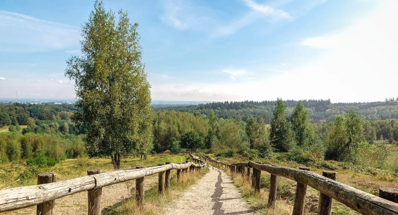
Easy hiking trails in Sint Pietersberg & Jekerdal offer a diverse landscape shaped by limestone hills, river valleys, and historical features. The region is characterized by the meandering Jeker river, chalk grasslands, and the imposing Sint Pietersberg hill. Hikers can explore a blend of natural beauty, including unique biodiversity on the hill's slopes and picturesque riverine scenery in the valley. This area provides varied terrain suitable for easy walks, with gentle elevation changes and well-maintained paths.
Best easy hiking trails…
Last updated: October 17, 2026
4.8
(160)
1,355
hikers
7.03km
01:55
110m
110m
Easy hike. Great for any fitness level. Easily-accessible paths. Suitable for all skill levels.
4.7
(36)
302
hikers
7.13km
01:55
90m
90m
Easy hike. Great for any fitness level. Easily-accessible paths. Suitable for all skill levels.

4.6
(26)
162
hikers
Easy hike. Great for any fitness level. Easily-accessible paths. Suitable for all skill levels.
4.7
(14)
138
hikers
6.05km
01:40
100m
100m
Easy hike. Great for any fitness level. Easily-accessible paths. Suitable for all skill levels.
4.6
(8)
45
hikers
6.84km
01:53
110m
110m
Easy hike. Great for any fitness level. Easily-accessible paths. Suitable for all skill levels.
Get access to more routes and recommendations from other explorers.
Already have an account?
Our route recommendations are based on thousands of hikes, rides, and runs completed by other people on komoot.
Start today with a free account
Your next adventure awaits.
Popular around Sint Pietersberg & Jekerdal
Other adventures in Sint Pietersberg & Jekerdal


Tips from the Community


Along the entire Belgian-Dutch border (458 km), boundary stones were placed in accordance with the Treaty of Maastricht of 8 August 1843. The demarcation of the border begins with boundary stone number 1 at the Drielandenpunt in Vaals and ends with boundary stone number 365 in the Zwin, west of Retranchement in Dutch Flanders. The cast-iron posts are provided with black-painted coats of arms of Belgium and the Netherlands in relief, the year 1843, and the post number. Between the cast-iron posts, 356 bluestone auxiliary stones or intermediate stones were also placed. These boundary stones are smaller than the cast-iron posts and are located at places where a country road crosses the border or at equal distances between widely spaced boundary posts, or where the border makes a turn at a very short distance from each other. Boundary post 365 was the last post until 1869. Further on towards the North Sea, the border was formed by the sea arm, the Zwin. After the area was diked, boundary posts 366 to 369 were placed. They bear the year 1869.
2
0
Along the entire Belgian-Dutch border (458 km), border posts were placed pursuant to the treaty of Maastricht of 8 August 1843. The demarcation of the border begins with border post number 1 at the Drielandenpunt in Vaals and ends with border post number 365 in the Zwin, west of Retranchement in Zeelandic Flanders. The cast-iron posts are provided with black-painted coats of arms of Belgium and the Netherlands in relief, the year 1843 and the post number. Between the cast-iron posts, 356 bluestone auxiliary stones or intermediate stones were also placed. These boundary stones are smaller than the cast-iron posts and are located at places where a country road crosses the border or at equal distance between widely spaced border posts, or where the border makes a corner at a very short distance from each other. Border post 365 was the last post until 1869. Further on towards the North Sea, the border was formed by the Zwin estuary. After the area was diked, border posts 366 to 369 were placed. They bear the year 1869.
3
0

You can still see the deposition layers in the marl. You are looking at millions of years here. Strange idea.
0
1

Beautiful small path along the Maas!
0
0

Beautiful spot for a short coffee stop at Chalet Observant. With a view of the marl quarry.
0
1

A beautiful place. A visit is recommended
1
0

Frequently Asked Questions
How many easy hiking trails are available in Sint Pietersberg & Jekerdal?
Sint Pietersberg & Jekerdal offers a wide selection of easy hiking trails, with over 30 routes specifically categorized as easy. In total, there are nearly 40 hiking routes to explore in the region.
What kind of terrain can I expect on easy hikes in Sint Pietersberg & Jekerdal?
Easy hikes in Sint Pietersberg & Jekerdal feature a diverse landscape. You'll encounter gentle elevation changes across limestone hills, picturesque river valleys along the Jeker, and serene chalk grasslands. The paths are generally well-maintained, making them suitable for relaxed walks.
Are there any viewpoints or landmarks to see on easy trails?
Yes, many easy trails offer access to stunning viewpoints and historical landmarks. You can enjoy panoramic vistas from the ENCI Quarry Viewpoint, overlooking the re-naturalized quarry. The historic Fort Sint Pieter is also accessible on several easy routes, such as the ENCI Quarry Viewpoint – Fort Sint Pieter loop from Maastricht.
Can I find circular easy walks in the region?
Absolutely. Many of the easy trails in Sint Pietersberg & Jekerdal are designed as circular routes, allowing you to start and end at the same point. For example, the Little ENCI Lake – ENCI Quarry Viewpoint loop from Kanne is a popular circular option.
What natural features can I discover while hiking?
The region is rich in natural beauty. You'll find unique biodiversity on Sint Pietersberg's southern slopes, including rare plants and butterflies. The Jekerdal features the meandering Jeker River, chalk grasslands, and old vineyards. Keep an eye out for the Kiekoet Viewpoint – Oehoe Valley, known for birdwatching, including the eagle owl.
Are the easy hiking trails suitable for families?
Yes, the easy hiking trails in Sint Pietersberg & Jekerdal are generally very family-friendly. Their gentle gradients, well-maintained paths, and moderate distances make them ideal for walks with children. Many routes also pass by interesting historical sites or offer scenic views that can engage younger hikers.
Is there parking available near the easy trailheads?
Yes, parking is generally available near popular trailheads, especially in areas like Kanne or on the outskirts of Maastricht, which serve as starting points for many routes. It's advisable to check specific route details for the most convenient parking options.
What do other hikers enjoy most about hiking in Sint Pietersberg & Jekerdal?
The area is highly rated by the komoot community, with an average score of 4.7 stars from over 660 reviews. Hikers often praise the diverse landscapes, the blend of natural beauty with historical sites like Fort Sint Pieter, and the well-maintained, accessible paths suitable for easy walks.
Are there any historical sites or castles to visit along the trails?
Beyond Fort Sint Pieter, you can also find Château Neercanne, the only terraced castle in the Netherlands, located in the Jekerdal. The Sint Pietersberg caves, formed by marlstone extraction, also offer a unique historical insight, with guided tours available.
What is the best time of year to hike the easy trails in Sint Pietersberg & Jekerdal?
The region is beautiful year-round, but spring and autumn are particularly pleasant for easy hikes. In spring, the chalk grasslands burst with wildflowers, and in autumn, the foliage offers vibrant colors. Summer is also enjoyable, with the river valleys providing cooler spots, while winter can offer crisp, scenic walks, though some paths might be muddy.
Are dogs allowed on the easy hiking trails?
Many trails in Sint Pietersberg & Jekerdal are dog-friendly, allowing you to enjoy the easy walks with your canine companion. However, it's always recommended to keep dogs on a leash, especially in nature reserves or areas with livestock, and to check specific trail regulations before you go.
Can I reach the easy hiking trails using public transport?
Yes, the region is accessible by public transport, particularly from Maastricht. Buses can take you to various points near the trailheads in Sint Pietersberg and Jekerdal, making it convenient to start your easy hike without a car.
Most popular routes in Sint Pietersberg & Jekerdal
Most popular attractions in Sint Pietersberg & Jekerdal

Get inspired with the komoot mobile app


Explore more
Browse the best Hikes in other regions.
