Easy hikes and walks in Saaledurchbruch Bei Rothenburg
4.6
(651)
2,160
hikers
211
hikes
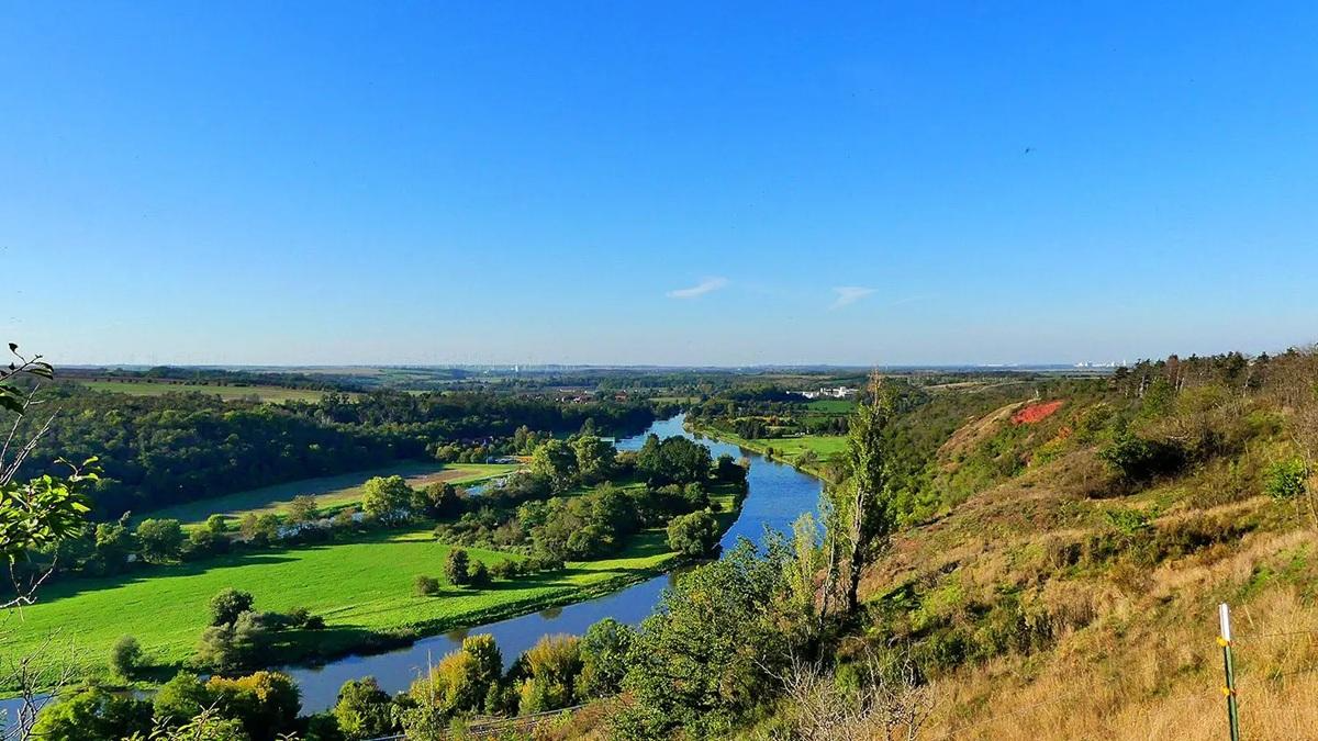
Easy hiking trails in Saaledurchbruch Bei Rothenburg traverse a landscape shaped by the Saale River's breakthrough through the Halle-Hettstedt mountain range. This region features steep slopes, varied rock formations, and extensive dry grasslands. The terrain includes the Saale floodplain with oxbow lakes and riparian forests, alongside diverse forest communities and charming side valleys.
Best easy hiking trails in Saaledurchbruch Bei Rothenburg
- The most popular easy hiking route is Hike along the "historical Sputinesburg educational trail", a 0.5 mile (0.8…
Last updated: October 17, 2026
5.0
(1)
1
hikers
Easy hike. Great for any fitness level. Easily-accessible paths. Suitable for all skill levels.
4.5
(4)
15
hikers
Easy hike. Great for any fitness level. Easily-accessible paths. Suitable for all skill levels.

4.3
(3)
9
hikers
7.05km
01:54
90m
90m
Easy hike. Great for any fitness level. Easily-accessible paths. Suitable for all skill levels.
5.0
(2)
10
hikers
4.71km
01:19
80m
90m
Easy hike. Great for any fitness level. Easily-accessible paths. Suitable for all skill levels.
4.5
(2)
6
hikers
4.74km
01:15
40m
40m
Easy hike. Great for any fitness level. Easily-accessible paths. Suitable for all skill levels.
Get access to more routes and recommendations from other explorers.
Already have an account?
Our route recommendations are based on thousands of hikes, rides, and runs completed by other people on komoot.
Start today with a free account
Your next adventure awaits.
Popular around Saaledurchbruch Bei Rothenburg


Tips from the Community


Came here completely unexpectedly for me
1
0

Definitely worth seeing
0
0

Heavily weathered, reason and date of construction unknown.
0
0
The nave features a horseshoe gallery. The carved pulpit on the north side of the choir and the stone baptismal font date from the time of construction. The altar table with a crucifix is located in the center of the choir. Of note is the large-scale grave monument from 1579 for Joachim von Pentz (1514–1579), leaseholder of the Friedeburg office from 1561, on the south side of the choir, which originates from the previous building. It is a three-part, two-story stone wall structure with caryatids. The central relief depicts the Resurrection of Jesus Christ, and above it is a relief of the Last Judgment. The almost life-size, fully executed figure of the praying deceased, kneeling to the right in front of the epitaph, is part of the ensemble. On the north east wall of the nave is a high-quality painting, probably created at the end of the 16th century, depicting the Fall of Man, Moses, and Golgotha in a Mannerist landscape. A wooden memorial plaque for the fallen of the First World War is attached to the south side of the nave. In the rectory garden, five sandstone gravestones from the second half of the 16th century are located; one features a relief figure of a noblewoman in period costume, another depicting two children. Source: https://de.wikipedia.org/wiki/St._Bonifatius_(Friedeburg)
3
0
The church, dedicated to St. Boniface, was rebuilt in neo-Gothic style between 1882 and 1886 to replace a previous building that had been demolished in the 1870s. It is a hall church built of red sandstone with a recessed five-sided choir, to which a small sacristy extension is attached to the east. The west tower, crowned with a pointed spire, is also flanked by extensions. The main portal is located on the west side of the tower. Restorations and repairs took place in 1970 and from 1991 to 1996. In 2015, the church tower clock from 1885 was renovated and converted from manual winding to electric operation.[2] A stone memorial plaque for the Friedeburg residents who fell in World War II is attached to the sacristy extension to the east. Source https://de.wikipedia.org/wiki/St._Bonifatius_(Friedeburg)
3
0
St. Bonifatius is the Protestant church of Friedeburg (Saale), a town in the Mansfeld-Südharz district of Saxony-Anhalt, Germany. The church belongs to the Gerbstedt parish in the Eisleben-Sömmerda church district of the Evangelical Church in Central Germany. The church is listed as a historic monument in the local register of monuments under registration number 094 65752.[1] Source: https://de.wikipedia.org/wiki/St._Bonifatius_(Friedeburg)
4
0

The first ski jump was built in Nussgrund in 1973. Since then, the sports facility has been continually expanded and improved. Children from ages 4 to men's ski jumps train on various ski jumps in all weather conditions. There's the Zwergenschanze (dwarf ski jump) from 1996, the Andreas Wank ski jump from 1973, and the Peter Ott ski jump from 1977. Further information can be found at: https://www.sfv-rothenburg.de/index.php
3
0
Frequently Asked Questions
How many easy hiking trails are available in Saaledurchbruch Bei Rothenburg?
There are over 100 easy hiking trails in Saaledurchbruch Bei Rothenburg, offering a wide variety of options for all fitness levels. In total, the region features more than 200 hiking routes.
What kind of landscapes can I expect on easy hikes in Saaledurchbruch Bei Rothenburg?
Easy hikes in this region will take you through diverse landscapes shaped by the Saale River. You'll encounter steep, sometimes rocky slopes, extensive dry grasslands with unique flora, and the Saale floodplain with its oxbow lakes and riparian forests. Diverse forest communities and charming side valleys also characterize the area.
Are there easy circular hiking routes in Saaledurchbruch Bei Rothenburg?
Yes, the region offers several easy circular routes. For example, the Eichberg – Falkenstein Castle loop from Saaledurchbruch bei Rothenburg is an easy 3.2-mile (5.2 km) path with varied terrain and views of the Saale river gorge. Another option is the Nußgrund – Red Wall at the Ski Jump loop from Rothenburg, which is about 3 miles (4.7 km) long.
Are the easy hiking trails in Saaledurchbruch Bei Rothenburg suitable for families with children?
Many easy trails in Saaledurchbruch Bei Rothenburg are suitable for families. Shorter routes like the Hike along the "historical Sputinesburg educational trail" (0.5 miles / 0.8 km) are perfect for an introduction to the area's history and nature without being too strenuous for younger hikers.
Can I bring my dog on the easy trails in Saaledurchbruch Bei Rothenburg?
Generally, dogs are welcome on the hiking trails in Saaledurchbruch Bei Rothenburg. However, it's always recommended to keep them on a leash, especially in nature reserve areas or near wildlife, and to be mindful of other hikers and local regulations.
What interesting sights or landmarks can I see along the easy hiking trails?
Along the easy trails, you can discover several interesting sights. You might encounter the Rothenburg–Brucke Ferry (Saale), the Schifffahrtssäule Rothenburg, or the Church in Schlenze Village. Some routes, like the Ruins of the Former Prayer Room – The Saale loop from Dößel, even incorporate historical elements.
What do other hikers enjoy most about the easy trails in Saaledurchbruch Bei Rothenburg?
The easy trails in Saaledurchbruch Bei Rothenburg are highly rated by the komoot community, with an average score of 4.6 stars from over 500 reviews. Hikers often praise the dramatic riverine landscapes, the diverse ecosystems, and the well-maintained paths that offer grand panoramic views into the Saale valley.
Are there any viewpoints on the easy hiking trails?
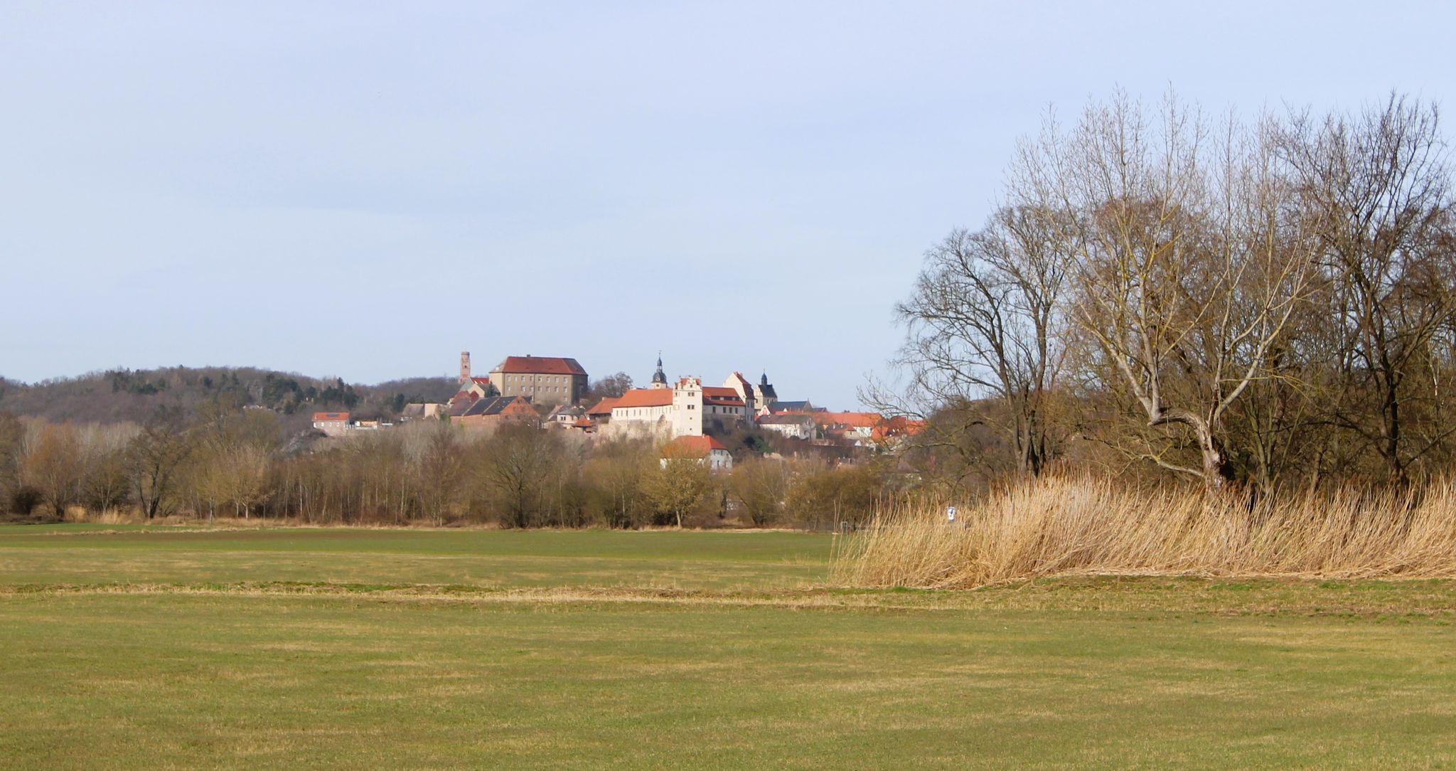
Yes, many easy trails offer grand panoramic views into the Saale valley and of Rothenburg from designated viewpoints. These spots often have benches and information boards, allowing you to enjoy the unique geological formations and the river's breakthrough through the Halle-Hettstedt mountain range.
What is the best time of year for easy hikes in Saaledurchbruch Bei Rothenburg?
The dry grasslands and diverse flora are particularly beautiful in spring and early summer. Autumn offers stunning foliage, while the riverine landscapes are accessible year-round. Always check local weather conditions before heading out.
Are there options for parking near the easy hiking trailheads?
Parking is generally available near popular trailheads and villages within the Saaledurchbruch Bei Rothenburg region. Specific parking information can often be found on individual route descriptions or local tourist information sites.
Can I reach the easy hiking trails using public transport?
While some areas might be accessible by local bus services, public transport options can be limited in this nature-focused region. It's advisable to check local bus schedules for specific starting points or consider driving to trailheads.
Are there any cafes or places to eat near the easy hiking trails?
You can find cafes and pubs in the villages surrounding the Saaledurchbruch Bei Rothenburg area, such as Rothenburg or Friedeburg. These establishments offer opportunities for refreshments and meals before or after your hike.
Most popular routes in Saaledurchbruch Bei Rothenburg
Most popular attractions in Saaledurchbruch Bei Rothenburg

Get inspired with the komoot mobile app


Explore more
Browse the best Hikes in other regions.
