Easy hikes and walks in National Forests In Alabama
4.9
(20)
236
hikers
51
hikes
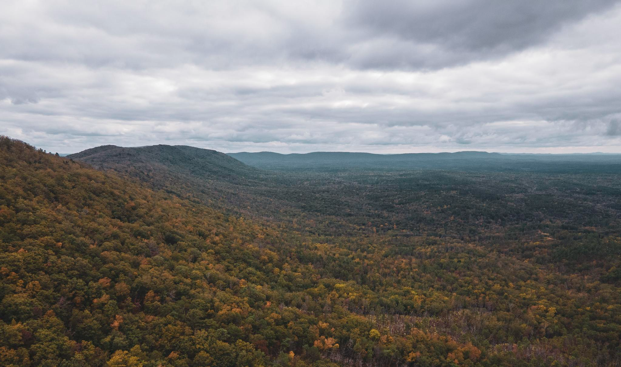
Easy hiking trails in National Forests In Alabama traverse a diverse landscape, ranging from the Southern Appalachian Mountains to the Coastal Plain. These forests, spanning over 673,000 acres, feature varied terrain including deep canyons, extensive pine forests, and mountainous areas. Hikers can explore regions known for numerous waterfalls, lush wilderness areas, and winding ridgelines. The network of trails provides access to a rich array of natural features across the state's national forests.
Best easy hiking trails in National Forests In Alabama
- The most popular easy hiking route is Hernandez Peak and McDill Point via Pinhoti Trail, a 2.2 miles (3.5 km) trail that takes 1 hour 3 minutes to complete. This route offers views of Hernandez Peak and McDill Point along the Pinhoti Trail.
- Another top favourite among local hikers is Chinnabee Silent Trail, an easy 1.1 miles (1.7 km) path. This trail features minimal elevation gain, providing a gentle walk through natural surroundings.
- Local hikers also love the Pinhoti Trail: Morgan Lake to Little Hillabee Falls, a 2.2 miles (3.6 km) trail leading through forested areas, often completed in about 1 hour.
- Hiking in National Forests In Alabama is defined by diverse landscapes including waterfalls, deep canyons, and pine forests. The extensive trail network offers options for various ability levels, focusing on easy hiking trails for accessible outdoor experiences.
- The routes in National Forests In Alabama are highly rated by the komoot community with an average score of 4.9 stars from over 20 reviews. More than 200 hikers have used komoot to explore National Forests In Alabama's varied terrain.
Last updated: October 11, 2026
13
hikers
3.51km
01:03
130m
90m
Embark on an easy hike along the Hernandez Peak and McDill Point via Pinhoti Trail, a rewarding route that covers 2.2 miles (3.5 km) with an elevation gain of 413 feet (126 metres). You can expect to complete this journey in about 1 hour and 2 minutes, making it perfect for a quick escape. As you traverse the path, you will encounter rocky and root-filled sections, leading you to expansive vistas from both Hernandez Peak and McDill Point, offering sweeping views of the Talladega Mountains. Keep an eye out for the distinctive plane wreckage, a unique and somber landmark along the way, adding a layer of intrigue to your adventure.
For a comfortable and safe experience on the trail, sturdy footwear is highly recommended due to the varied terrain. While the path is generally well-maintained and marked with blue blazes for straightforward navigation, be aware that overgrowth can occur, especially during warmer months. Consider starting your hike earlier in the day to enjoy cooler temperatures and clearer paths. This trail is an excellent choice if you are looking for an accessible outdoor activity that still delivers impressive scenery without requiring extensive time or effort.
This trail is nestled within Cheaha State Park, providing a fantastic opportunity to explore the natural beauty of the Talladega Mountains. The Pinhoti Trail, a significant long-distance route, forms part of your journey, connecting you to a broader network of Alabama's wilderness. The presence of the plane wreckage offers a unique historical element, prompting reflection amidst the natural surroundings. This route stands out for its combination of ease, scenic rewards, and intriguing points of interest, making it a notable option for anyone visiting the area.
2
hikers
1.70km
00:27
0m
30m
Hike the easy 1.1-mile Chinnabee Silent Trail to Cheaha Falls in Talladega National Forest, gaining 3 feet in 26 minutes.

1
hikers
3.61km
01:00
80m
30m
Embark on an easy 2.2-mile (3.6 km) hike along the Pinhoti Trail, gaining 264 feet (81 metres) in about 59 minutes. This route takes you through rolling hillsides and dense forests, offering a genuine Southern Appalachian wilderness experience. You will pass the tranquil Morgan Lake, a 14-acre lake nestled in a narrow valley. Further along, you can enjoy the charming Little Hillabee Waterfall, which is particularly impressive after a good rain. The trail meanders through native ecosystems, providing a scenic journey.
Accessing this section of the Pinhoti Trail is straightforward, with general parking available right at the Morgan Lake trailhead. As you plan your hike, be aware that the route includes a required crossing of Hillabee Creek. For this reason, it is advisable to bring water shoes, as your feet will likely get wet. This ensures you can comfortably navigate the creek and continue your journey.
This segment of the Pinhoti Trail is nestled within the expansive Talladega National Forest, offering a true taste of the Southern Appalachian wilderness. The trail provides an opportunity to immerse yourself in a natural environment rich with diverse flora and fauna. It is a popular choice for those seeking a quick, accessible outdoor adventure within this significant regional forest.
1
hikers
5.48km
01:28
40m
110m
Hike the easy 3.4-mile Scott's Lake via Pinhoti Trail through pine forests to the new bridge at Jogloma-Scott Lake in Talladega National For
6.95km
01:48
20m
80m
Embark on an easy hike through the lush Sipsey Wilderness, a journey spanning 4.3 miles (6.9 km) with a gentle 80 feet (24 metres) of elevation gain. This route typically takes around 1 hour and 48 minutes to complete, offering a relaxed pace to explore. You will wander through a verdant forest, where deep canyons and impressive rock formations create a unique landscape. The highlight is undoubtedly the towering Yellow Poplar, known as the Big Tree, which stands as the largest in Alabama. Listen for the soothing sounds of flowing water as you make your way along the path.
While the Sipsey Big Tree route is easy, be aware that other trails in the wider Sipsey Wilderness can be more demanding. Conditions can change, especially after rainfall, when paths might become muddy and slippery. It is always wise to check local conditions before you head out, as you might encounter elevated water crossings. If you plan to venture beyond this specific path, ensure you have good fitness and sure-footedness. Consider visiting during drier periods for the most comfortable experience.
This area is often referred to as "The Land of 1,000 Waterfalls," hinting at the numerous cascades you might discover. Beyond the main attraction, you will also pass Bee Branch Falls, which is particularly striking after a good rain. The trail provides a wonderful opportunity to experience Alabama's natural beauty without a strenuous climb, making it a perfect choice for a shorter outing. It offers a glimpse into a rich ecosystem, characterized by its unique geological features and diverse flora.
Get access to more routes and recommendations from other explorers.
Already have an account?
Our route recommendations are based on thousands of hikes, rides, and runs completed by other people on komoot.
Start today with a free account
Your next adventure awaits.
Popular around National Forests In Alabama
Other adventures in National Forests In Alabama

Tips from the Community

Cheaha Creek is a constant companion for much of the Chinnabee Silent Trail. The trail itself has an interesting story that, no doubt, is relevant to its name: It was constructed in 1977 by a Boy Scout troop from the Alabama Institute for the Deaf and Blind.
1
0

Past Hernandez Peak, McDill point offers some of the most impressive, sprawling views in the area.
1
0
This is one of the highest peaks in Alabama and offers some great views over the Checha Wilderness.
1
0

Scenic waterfall off of the cliffs near the Bees Creek Canyon Trail. There is also an iconic Giant Tulip Popular Tree here known as the "Big Tree.
0
0
Frequently Asked Questions
How many easy hiking trails are available in the National Forests in Alabama?
There are over 50 hiking routes in the National Forests in Alabama, with 18 specifically categorized as easy. These trails offer accessible outdoor experiences across diverse landscapes.
What makes the easy trails in National Forests in Alabama suitable for families?
The easy trails in the National Forests in Alabama are generally characterized by minimal elevation gain and shorter distances, making them ideal for families. For example, the Chinnabee Silent Trail is only 1.1 miles long with very little elevation change, providing a gentle walk through natural surroundings.
Are there any easy trails with waterfalls in the National Forests in Alabama?
Yes, Bankhead National Forest, often called the 'land of a thousand waterfalls,' offers several easy trails with scenic cascades. You can find beautiful waterfalls like Caney Creek Falls and Thompson Creek Waterfall in the Sipsey Wilderness area.
What are the best times of year to hike the easy trails in National Forests in Alabama?
Spring and fall are generally the best times to hike in the National Forests in Alabama. The weather is milder, and the natural scenery is vibrant, with blooming wildflowers in spring and colorful foliage in autumn. Summer can be hot and humid, while winter offers cooler temperatures but fewer crowds.
Are dogs allowed on the easy hiking trails?
Most trails in the National Forests in Alabama are dog-friendly, but it's always best to check specific regulations for each trail or wilderness area. Generally, dogs should be kept on a leash to protect wildlife and ensure a pleasant experience for all hikers.
Where can I find parking for easy trails in the National Forests in Alabama?
Many easy trails have designated parking areas at their trailheads. For instance, the Wooden Bridge Trailhead in William B. Bankhead National Forest provides convenient access to trails in that area. It's advisable to check the specific route details on komoot for parking information before you go.
Are there any circular easy walks available?
While many trails are out-and-back, some sections of longer trails or specific routes can be combined to form circular walks. The National Forests offer diverse trail networks, and exploring the map on komoot can help you identify loops or shorter sections of trails like the Pinhoti Trail that can be enjoyed as circular routes.
What kind of scenery can I expect on easy hikes in the National Forests in Alabama?
The scenery varies greatly across the National Forests. In Bankhead National Forest, you'll find deep canyons, lush forests, and numerous waterfalls. Talladega National Forest offers mountainous terrain with scenic overlooks and hardwood forests, while Conecuh National Forest features extensive pine forests. You can expect a rich array of flora and fauna throughout.
What do other hikers say about the easy trails in National Forests in Alabama?
The easy trails in the National Forests in Alabama are highly rated by the komoot community, with an average score of 4.9 stars from over 20 reviews. Hikers often praise the quiet woodlands, well-maintained paths, and the opportunity to experience diverse natural beauty, from waterfalls to scenic viewpoints.
Are there any scenic viewpoints accessible via easy trails?
Yes, Talladega National Forest, located at the southern edge of the Appalachian Mountains, offers scenic overlooks. While some viewpoints require more challenging hikes, areas like Bald Rock Summit can be accessed via trails that offer spectacular views from Cheaha Mountain, Alabama's highest point.
Can I find short duration easy hikes in the National Forests in Alabama?
Absolutely. Many easy trails are designed for shorter durations. For example, the Chinnabee Silent Trail is only 1.1 miles and takes about 25-30 minutes to complete, while Hernandez Peak and McDill Point via Pinhoti Trail is 2.2 miles and typically takes just over an hour.
Are there any specific easy trails in Talladega National Forest?
Talladega National Forest features sections of the Pinhoti Trail that are suitable for easy hikes. Routes like Pinhoti Trail: Morgan Lake to Little Hillabee Falls offer gentle walks through forested areas, providing a taste of the region's mountainous beauty without significant challenge.
What kind of natural features can I explore on easy trails in Bankhead National Forest?
Bankhead National Forest is renowned for its deep canyons, lush wilderness, and abundant waterfalls. Easy trails here often lead you through mossy landscapes to stunning natural features like Caney Creek Falls, offering a truly immersive experience in nature.
Most popular routes in National Forests In Alabama
Most popular attractions in National Forests In Alabama

Get inspired with the komoot mobile app


Explore more
Browse the best Hikes in other regions.
