Easy hikes and walks in Mineral County
4.8
(10)
215
hikers
27
hikes
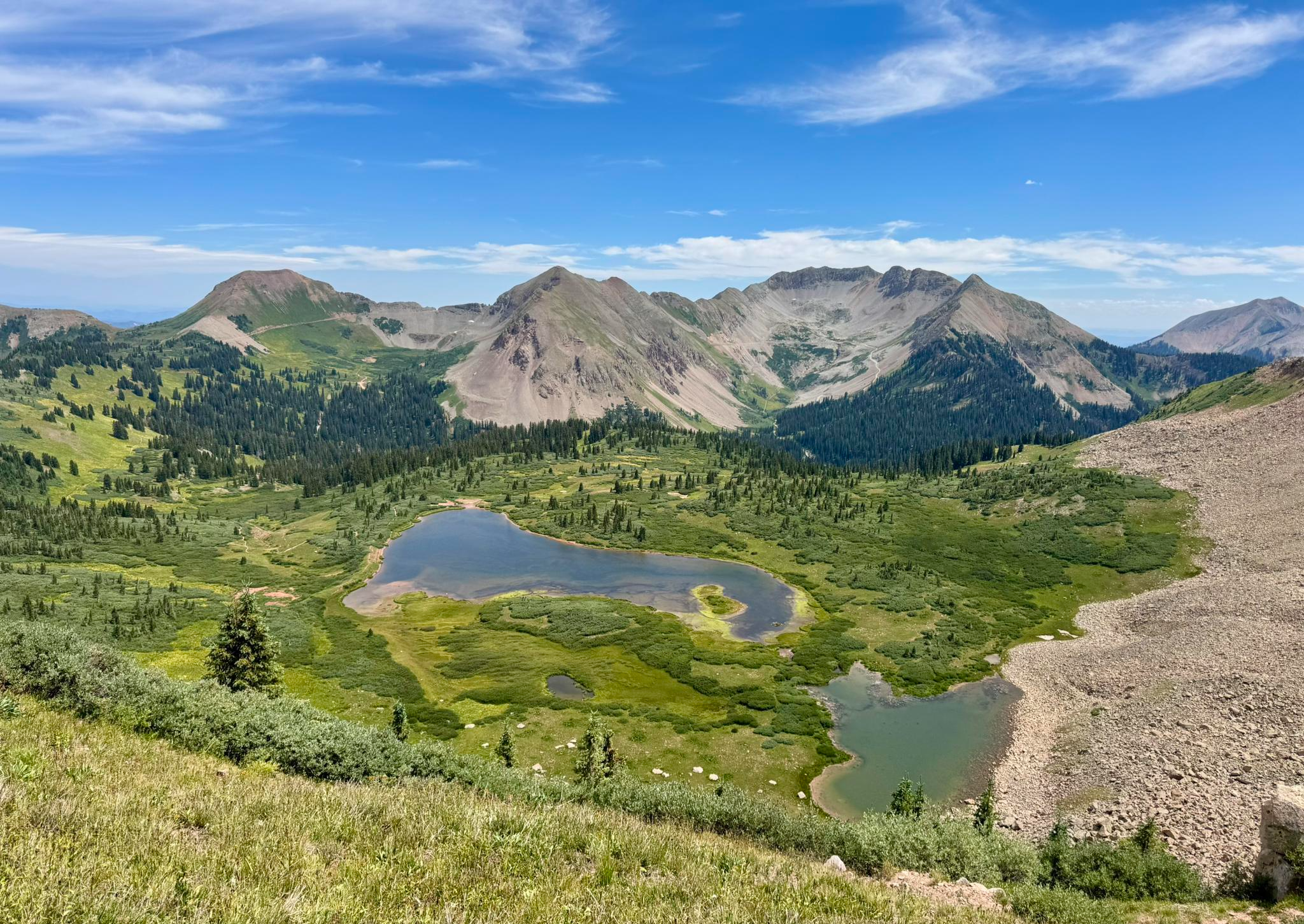
Easy hiking trails in Mineral County traverse high-altitude landscapes within Colorado's Rocky Mountains, encompassing parts of the Rio Grande National Forest. The terrain features mountain valleys, alpine lakes, and the headwaters of the Rio Grande River. This region is characterized by extensive public lands and offers a network of trails suitable for various skill levels.
Best easy hiking trails in Mineral County
- The most popular easy hiking route is Up and Over Trail, a 2.1 miles (3.4 km) trail that takes 1 hour 9 minutes to complete. This route features a steady ascent with views of the surrounding high-altitude environment.
- Another top favourite among local hikers is Alberta Peak via Continental Divide National Scenic Trail, an easy 2.8 miles (4.5 km) path. This trail offers an accessible section of the Continental Divide, leading towards Alberta Peak.
- Local hikers also love the Lobo Overlook and Continental Divide Trail, a 2.4 miles (3.9 km) trail leading through mountain terrain, often completed in about 1 hour 9 minutes.
- Hiking in Mineral County is defined by mountain valleys, alpine lakes, and sections of the Continental Divide National Scenic Trail. The trail network offers options for various ability levels, including many easy hikes.
- The routes in Mineral County are highly rated by the komoot community with an average score of 4.9 stars from more than 10 reviews. More than 200 hikers have used komoot to explore Mineral County's varied terrain.
Last updated: October 11, 2026
2
hikers
3.38km
01:09
190m
130m
Embark on the Up and Over Trail, an easy hike that guides you through varied landscapes. You will begin with an uphill climb across a barren hillside before entering a refreshing forested area. The route offers scenic views across the valley and the town of Creede, especially from a wonderful lookout point. This 2.1-mile (3.4 km) journey involves gaining 609 feet (186 metres) in elevation. Expect to complete the hike in about 1 hour and 8 minutes, enjoying the natural beauty of the San Juan Mountains as you descend towards East Willow Creek.
The Up and Over Trail is a popular choice if you are looking for an afternoon hike. Accessing the trailhead and finding parking are generally straightforward, making it easy to begin your adventure. This route offers a unique perspective of the valley and Creede. Consider starting in the afternoon to enjoy the changing light over the landscape. It is a great option for a quick outdoor escape.
Located within the vast Rio Grande National Forest, this trail provides a rewarding experience for casual hikers. It stands out as an accessible way to appreciate the natural beauty of the region without requiring extensive time or effort. The path's design allows you to experience both open hillsides and dense forest, showcasing the diverse ecosystems of the San Juan Mountains. It is a perfect introduction to the area's scenic offerings.
1
hikers
4.48km
01:25
280m
40m
Embark on an easy hiking adventure along the Alberta Peak via Continental Divide National Scenic Trail, covering 2.8 miles (4.5 km) with an elevation gain of 932 feet (284 metres). This route typically takes about 1 hour and 25 minutes to complete. You will experience diverse terrain, moving through peaceful meadows and dense conifer forests before reaching a unique rocky talus slope known as "the Rock Garden." As you ascend, the trees give way to expansive views of the stunning San Juan Mountains and the Continental Divide, culminating in panoramic vistas from Alberta Peak, overlooking the Wolf Creek Ski Area and Alberta Reservoir.
To plan your visit, access the trail from Wolf Creek Pass, a well-known starting point. While the initial segment is easy, be aware that reaching the very top of Alberta Peak involves a more challenging rock scramble. Always check the weather forecast before you head out, as mountain conditions can change rapidly, and wearing sturdy shoes is highly recommended for your comfort and safety on the varied terrain.
This trail offers a fantastic opportunity to experience a segment of the iconic Continental Divide National Scenic Trail within the beautiful San Juan National Forest. It provides a quick yet rewarding outdoor experience, allowing you to immerse yourself in the natural environment and enjoy significant mountain views without committing to a full-day trek. The route's position along the Continental Divide makes it a notable feature in the region, connecting you to a much larger network of trails and natural wonders.

2.83km
00:59
240m
0m
Hike the 1.8-mile Alder Bench Trail in South Fork, Colorado, an easy route with 797 feet of gain and challenging, rocky terrain.
4.93km
01:22
140m
10m
Hike the easy 3.1-mile Seepage Creek Trail near Creede, Colorado, featuring meadows, aspen groves, and the beautiful Ghost Lake.
3.94km
01:09
50m
210m
Embark on an easy hike along the Lobo Overlook and Continental Divide Trail, a 2.5-mile (3.9 km) route that takes about 1 hour and 8 minutes to complete. You'll gain 163 feet (50 metres) in elevation as you explore a section of the iconic Continental Divide Trail. The path offers expansive views of the San Juan Mountains, stretching westward towards Pagosa Springs. From Lobo Overlook, perched high above Wolf Creek Pass, you can enjoy a remarkable vantage point. During summer, the alpine environment bursts with vibrant wildflowers, adding to the scenic beauty of your journey.
When planning your visit, be aware of the high-altitude conditions in this area. Weather can change quickly, so prepare for potential thunderstorms and hail, particularly if you hike during the summer months. Access to Lobo Overlook involves navigating a challenging one-lane gravel road with switchbacks and steep grades. This road can sometimes be closed by snow, even well into the summer season. Always check local conditions before heading out to ensure a smooth trip.
This trail is located within the vast Rio Grande National Forest, offering you a direct experience with its unique high-altitude environment. You will be walking a segment of the renowned Continental Divide Trail, which traverses North America. It provides an excellent opportunity to experience the distinct alpine character of this famous long-distance route. This hike serves as a great introduction to the challenges and rewards of high-altitude trekking.
879m
00:17
70m
0m
Embark on an easy 0.5-mile (0.9 km) hike along the Piedra Ice Fissures Trail, a short adventure that typically takes around 17 minutes. You will gain 213 feet (65 metres) as you explore remarkable deep fissures carved into the sandstone, some so narrow they resemble slot canyons. The route leads you through a conifer forest before reaching a rocky ridgeline, offering expansive views of the Piedra River Valley and the distant San Juan Mountains from Sally Overlook.
Plan your visit to the Piedra Ice Fissures Trail between June and November, as snow typically makes the route inaccessible outside of these months. While the trail is easy, if you decide to venture into the deeper fissures, it is wise to bring a flashlight and hike with a companion for safety. This ensures you are prepared for the unique conditions within these natural formations.
This trail stands out for its distinctive geological formations, offering a rare chance to walk through ancient ice fissures. Located within the vast San Juan National Forest, the route provides a glimpse into the natural processes that have shaped this rugged landscape over millennia. It is a unique natural wonder that highlights the power of erosion and time.
3.37km
01:04
230m
0m
Embark on the Anderson Trail for an easy hike through the Weminuche Wilderness, covering 2.1 miles (3.4 km) with a manageable 748 feet (228 metres) of elevation gain. You can expect to complete this route in about 1 hour and 3 minutes, making it a perfect choice for a quick outdoor escape. As you hike, you will discover picturesque alpine lakes and vibrant wildflower meadows, especially during the right season. Keep an eye out for impressive views of peaks like Pagosa Peak, which provides a dramatic backdrop to your adventure.
Before you head out, always check local conditions, as seasonal changes can affect trail access or conditions. Parking is typically available near trailheads within the Weminuche Wilderness, but it is always wise to arrive early, especially during peak times, to secure a spot. This preparation ensures a smooth start to your hiking experience. Knowing what to expect regarding trail conditions will help you plan your visit effectively.
The Anderson Trail offers a wonderful opportunity to immerse yourself in the diverse landscape of the Weminuche Wilderness. This area is known for its natural beauty and provides a serene setting for your hike. The route's accessibility and relatively short duration make it a notable option for those looking to experience the wilderness without committing to a full-day excursion. It stands out as an easy entry point into the region's vast outdoor offerings.
4.3
(3)
54
hikers
Easy hike. Great for any fitness level. Easily-accessible paths. Suitable for all skill levels.
5.0
(3)
28
hikers
Easy hike. Great for any fitness level. Easily-accessible paths. Suitable for all skill levels.
17
hikers
Easy hike. Great for any fitness level. Easily-accessible paths. Suitable for all skill levels.
Get access to more routes and recommendations from other explorers.
Already have an account?
Our route recommendations are based on thousands of hikes, rides, and runs completed by other people on komoot.
Start today with a free account
Your next adventure awaits.
Popular around Mineral County
Other adventures in Mineral County

Tips from the Community

At Wolf Creek Pass, the Continental Divide Trail crosses Highway 160. It is a good spot to get on or off the trail or for hitching into South Fork (to the north) or Pagosa Springs (to the south). Be careful when crossing the highway as it is quite busy.
2
0

Treasure Falls plummets down toward the trail from a high rocky outcropping over 100 feet high. The trail to the falls is short and easy, and there are many little overlooks with insightful signposts describing your trek through geological time.
0
0
This is a great little trail from which you get an epic view up the Piedra River valley off the dramatic ledge dropoff. Be sure to check out the ice caves at the top, either before or after your run.
0
0
From here you can take the stock drive trail south across the mountains or follow the much flatter Little Sand Trail up Weminuche Creek.
0
0
The Big Meadows Reservoir is a great spot for recreational activities such as hiking and fishing. There is a large parking lot, a pit toilet, a campground at the east shore and a hiking trail to circle around the lake. If you want to extend your adventure, you can take the Archuleta Trail to get into the mountains.
3
0
Starting at Big Meadows Reservoir, the Archuleta Trail is roughly 6.5 miles long to where it connects with the Continental Divide Trail and to the beautiful Archuleta Lake. It will take you along creeks, through forest, open meadows and through Aspen forests.
3
0
At this sign you can extend your hike around Big Meadows Reservoir into the Weminuche Wilderness by following the Archuleta Trail that take you to Archuleta Lake. There is a trail register that you should use for your protection in case you get lost.
3
0
The Archuleta Trailhead is located at the south shore of Big Meadows Reservoir. There is a large parking lot and a pit toilet. You can walk around the lake combining a section of the Archuleta Lake with the Big Meadows Loop Trail. The Archuleta Trail leads up to Archuleta Lake in the Weminuche Wilderness and connects with the Continental Divide Trail.
4
0
Frequently Asked Questions
How many easy hiking trails are available in Mineral County?
Mineral County offers 12 easy hiking trails, providing accessible options for exploring its high-altitude landscapes. In total, there are 28 hiking routes across various difficulty levels.
What kind of terrain can I expect on easy hikes in Mineral County?
Easy hikes in Mineral County, particularly in the Colorado region, traverse mountain valleys, lead past alpine lakes, and follow sections of the Rio Grande River's headwaters. You'll experience extensive public lands, including parts of the Rio Grande National Forest, with trails suitable for various skill levels.
Are there any easy trails with waterfalls in Mineral County?
Yes, you can find an easy trail that features a waterfall. The Bridge over Fall Creek – Treasure Falls loop is a short, easy route near the impressive Treasure Falls.
Are the easy trails in Mineral County suitable for families?
Yes, many easy trails in Mineral County are suitable for families. They offer manageable distances and elevation changes, allowing for enjoyable outdoor experiences. Routes like the Piedra Ice Fissures Trail are short and offer unique natural features, perfect for a family outing.
Can I bring my dog on easy hikes in Mineral County?
Generally, dogs are permitted on trails within the Rio Grande National Forest, which covers much of Mineral County, Colorado. However, it's always best to check specific trail regulations or signage for any restrictions, especially regarding leash requirements or protected wilderness areas. Always practice Leave No Trace principles when hiking with pets.
What natural features can I see on easy hikes in Mineral County?
On easy hikes, you can discover a variety of natural features. Expect to see mountain valleys, pristine alpine lakes like Spotted Lake, and the headwaters of the Rio Grande River. Some trails also offer views of the Continental Divide National Scenic Trail, such as the Alberta Peak via Continental Divide National Scenic Trail.
Are there any specific viewpoints on easy trails in Mineral County?
Yes, several easy trails offer rewarding viewpoints. The Lobo Overlook and Continental Divide Trail provides scenic vistas. Additionally, the Snow Mesa highlight is known for its expansive views.
Is parking available at the trailheads for easy hikes in Mineral County?
Parking is generally available at designated trailheads throughout Mineral County, especially for popular routes within the Rio Grande National Forest. For example, the Archuleta Trailhead at Big Meadows Reservoir offers access to trails like the Big Meadows Reservoir – Archuleta Trail loop.
Do I need permits for easy hiking trails in Mineral County?
For most day hikes on easy trails within the Rio Grande National Forest in Mineral County, permits are generally not required. However, if you plan to enter designated wilderness areas or engage in specific activities like overnight camping, you may need a permit. Always check with the local Forest Service office for the most current regulations.
What is the best time of year for easy hiking in Mineral County?
The best time for easy hiking in Mineral County, Colorado, is typically from late spring through early fall (June to September). During this period, trails are usually clear of snow, and the alpine meadows are vibrant with wildflowers. The weather is generally mild, making for pleasant hiking conditions.
What do other hikers say about the easy trails in Mineral County?
The easy trails in Mineral County are highly rated by the komoot community, with an average score of 4.9 stars from over 10 reviews. Hikers often praise the stunning high-altitude environment, the accessibility of routes like the Up and Over Trail, and the well-maintained paths that offer beautiful views without extreme difficulty.
Are there any easy loop trails in Mineral County?
Yes, Mineral County offers several easy loop trails. The Bridge over Fall Creek – Treasure Falls loop and the Big Meadows Reservoir – Archuleta Trail loop are excellent options for a circular walk, allowing you to experience diverse scenery without retracing your steps.
Most popular attractions in Mineral County

Get inspired with the komoot mobile app


Explore more
Browse the best Hikes in other regions.
