The best waterfall hikes and walks around Monte Brione
4.5
(21712)
127,188
hikers
32
hikes
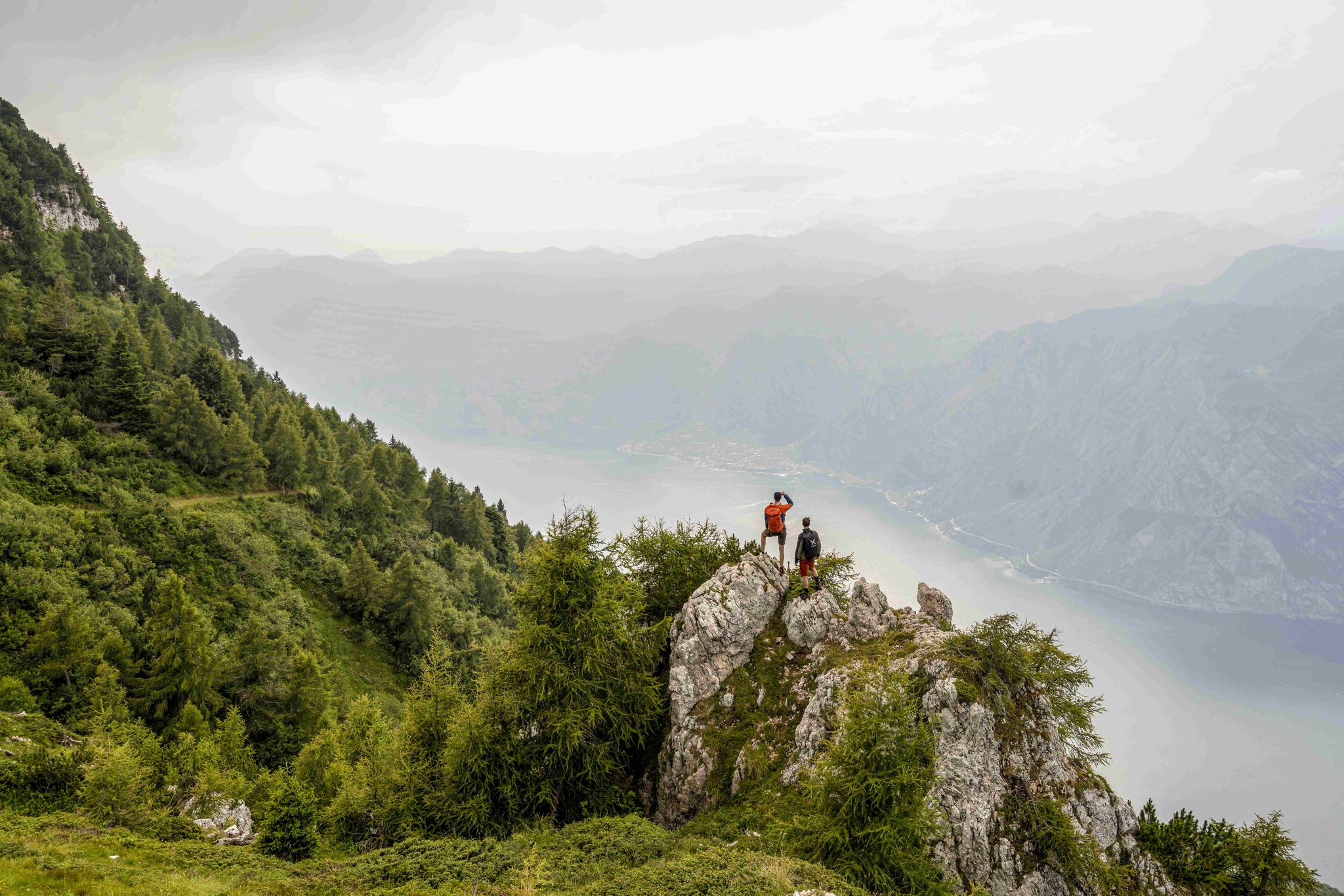
Hiking around Monte Brione offers a unique combination of landscapes and natural features, situated between Riva del Garda and Torbole on the northern shore of Lake Garda. This distinctive rocky formation provides panoramic views of Lake Garda, the Sarca plain, and surrounding mountains. Trails traverse extensive olive groves and shaded forests, within a protected nature reserve known for its rich biodiversity, including a variety of rare plant species. The area's unique location blends sub-Mediterranean and alpine environments, supporting diverse flora and fauna.
Best waterfall hiking trails around Monte Brione
- The most popular waterfall hiking route is View of Northern Lake Garda – Ponale Trail loop from Riva del Garda, a 7.6 miles (12.2 km) trail that takes 3 hours 56 minutes to complete. This route offers expansive views of Lake Garda and the surrounding landscape.
- Another top favourite among local hikers is View of Northern Lake Garda – The Bastion of Riva del Garda loop from Linfano, a moderate 8.3 miles (13.4 km) path. This trail provides further panoramic vistas and passes historical fortifications.
- Local hikers also love the Torrente Albola – Val di Brasa Waterfall loop from San Giorgio, a 9.6 miles (15.5 km) trail leading through the Val di Brasa, often completed in about 5 hours 20 minutes.
- Hiking around Monte Brione is defined by panoramic lake views, ancient olive groves, and historical forts. The network offers options for different ability levels, from easy paths to more challenging ascents.
- The routes in Monte Brione are highly rated by the komoot community with an average score of 4.5 stars from over 19,000 reviews. More than 114,000 hikers have used komoot to explore Monte Brione's varied terrain.
Last updated: July 9, 2026
4.3
(14)
74
hikers
Moderate hike. Good fitness required. Mostly accessible paths. Sure-footedness required.
4.6
(28)
172
hikers
14.6km
03:57
180m
180m
Moderate hike. Good fitness required. Easily-accessible paths. Suitable for all skill levels.

Sign up for free
5.0
(2)
3
hikers
8.27km
02:24
200m
200m
Moderate hike. Good fitness required. Easily-accessible paths. Suitable for all skill levels.
4.8
(466)
2,808
hikers
15.1km
05:18
800m
800m
Hard hike. Very good fitness required. Mostly accessible paths. Sure-footedness required.
4.7
(460)
2,286
hikers
Hard hike. Very good fitness required. Mostly accessible paths. Sure-footedness required.
Get access to more routes and recommendations from other explorers.
Sign up for free
Already have an account?
Our route recommendations are based on thousands of hikes, rides, and runs completed by other people on komoot.
Start today with a free account
Your next adventure awaits.
Login or Signup
Popular around Monte Brione
Other adventures around Monte Brione

Tips from the Community

Very beautiful cycle path with a great panorama into the mountains and across Lake Garda.
0
0
Very beautiful cycle path with a great panorama into the mountains and over Lake Garda.
0
0

Beautiful view of the lake and the surrounding mountains
0
0
Beautiful stretch of beach where you can swim for free and where a lawn for sunbathing is also available.
0
0
Beautiful view of Riva, the lake and the Monte Brione behind
0
0

The view is truly dramatic. The lake and the rugged mountains. Very impressive.
1
0

Great track to drive there but watch out for the brakes
1
0

Frequently Asked Questions
Are there actual waterfalls on Monte Brione hiking trails?
Yes, while Monte Brione is primarily known for its panoramic lake views and historical forts, there are trails that lead to beautiful waterfalls. For instance, the Torrente Albola – Val di Brasa Waterfall loop from San Giorgio is a popular route specifically highlighting a waterfall experience.
What are some recommended waterfall hikes around Monte Brione?
For a dedicated waterfall experience, consider the Torrente Albola – Val di Brasa Waterfall loop from San Giorgio. This challenging 9.6-mile (15.5 km) trail takes you through the scenic Val di Brasa and typically takes about 5 hours 20 minutes to complete.
Are there easy waterfall hikes suitable for beginners or families?
While many trails around Monte Brione offer varying difficulty, the specific waterfall routes tend to be more moderate to difficult. However, the region offers 7 easy hiking tours in total. For a generally easier experience with beautiful views, you might explore parts of the trails that are less steep, though they might not lead directly to a major waterfall. Always check the route details for elevation and terrain before setting out with beginners or children.
How long do waterfall hikes around Monte Brione typically take?
The duration of waterfall hikes varies depending on the specific route and your pace. For example, the Torrente Albola – Val di Brasa Waterfall loop from San Giorgio is a longer, more challenging trail that typically takes around 5 hours 20 minutes to complete.
What kind of natural features can I expect to see on these trails?
Monte Brione is a protected nature reserve with incredible biodiversity. You'll hike through extensive olive groves and shaded forests, encountering a rich variety of wild flora, including many rare species and over 20 types of orchids. The unique sub-Mediterranean climate meeting the alpine environment creates a diverse habitat for rare Mediterranean birds and wildlife. Of course, stunning panoramic views of Lake Garda are a constant companion.
Are there historical sites or landmarks along the waterfall hiking routes?
Yes, Monte Brione is rich in history. As you hike, you can explore well-preserved Austro-Hungarian forts from World War I, such as Forte San Nicolò, Forte Garda, Forte Batteria di Mezzo, and Forte Sant'Alessandro. Remains of tunnels, observation posts, and trenches are also visible. Forte Garda is often open for free visits during certain seasons. You can find more details about these historical points of interest, such as Forte di Mezzo, in our highlights section.
What is the best time of year to visit Monte Brione for waterfall hikes?
The sub-Mediterranean climate of Monte Brione makes it enjoyable for hiking for much of the year. Spring (April-May) is ideal for seeing the diverse flora in bloom, including the many orchids, and waterfalls are often at their fullest due to snowmelt. Autumn (September-October) offers pleasant temperatures and beautiful foliage. Summer can be warm, so early morning or late afternoon hikes are recommended. Winters are generally mild, but some higher sections might be cooler.
Can I bring my dog on the waterfall trails around Monte Brione?
Many trails around Monte Brione are dog-friendly, but it's always best to check specific route details on komoot for any restrictions or recommendations. Given the area's rich biodiversity and protected status, keeping dogs on a leash is generally advised to protect wildlife and ensure a pleasant experience for all hikers. Be prepared to carry water for your dog, especially on longer routes.
Are there circular waterfall walks available?
Yes, many of the hiking routes around Monte Brione are designed as loops, allowing you to start and end at the same point. The Torrente Albola – Val di Brasa Waterfall loop from San Giorgio is an example of a circular route that includes a waterfall, offering a complete hiking experience without retracing your steps.
What do other hikers enjoy most about hiking in Monte Brione?
The area is highly rated by the komoot community, with an average score of 4.5 stars from over 19,000 reviews. Hikers frequently praise the unparalleled panoramic views of Lake Garda, the serene olive groves, and the fascinating historical forts. The diverse flora and fauna, especially the unique orchids, also receive high acclaim, making it a favorite for nature lovers and history enthusiasts alike.
Is public transport available to access the Monte Brione waterfall trails?
Monte Brione is situated between Riva del Garda and Torbole, both of which are well-connected by public transport, including local buses and ferries on Lake Garda. You can often reach trailheads from these towns. It's advisable to check local bus schedules to find the most convenient stop for your chosen waterfall hike, as specific trail access points may vary.
Where can I park when visiting Monte Brione for waterfall hikes?
Parking is generally available in the towns surrounding Monte Brione, such as Riva del Garda and Torbole. From these points, you can access various trailheads. Some specific trail starting points may also have designated parking areas. It's recommended to check the komoot route details for your chosen hike, as they often provide information on nearby parking facilities.
Most popular routes around Monte Brione
Most popular attractions around Monte Brione

Get inspired with the komoot mobile app


Explore more
Browse the best Hikes in other regions.
