The best running trails around Challerange
3.8
(5)
150
runners
22
runs
Jogging around Challerange offers routes through a landscape characterized by gently rolling terrain and rural pathways. The region features moderate elevation changes, making it suitable for various running abilities. Many routes are circular, often passing through or near small villages and open countryside. The area provides a tranquil setting for outdoor activity.
Best jogging routes around Challerange
- The most popular jogging route is Vouziers loop from Vouziers, a 7.0 miles (11.2 km) trail that takes 1 hour 11 minutes…
Last updated: July 5, 2026
9
runners
11.6km
01:13
80m
80m
Moderate run. Good fitness required. Mostly paved surfaces. Suitable for all skill levels.
3.0
(1)
5
runners
13.9km
01:32
150m
150m
Moderate run. Good fitness required. Mostly paved surfaces. Suitable for all skill levels.

Sign up for free
4
runners
9.46km
00:59
50m
50m
Moderate run. Good fitness required. Mostly paved surfaces. Suitable for all skill levels.
7
runners
9.09km
00:57
60m
60m
Moderate run. Good fitness required. Mostly paved surfaces. Suitable for all skill levels.
3
runners
12.0km
01:15
80m
80m
Moderate run. Good fitness required. Mostly paved surfaces. Suitable for all skill levels.
Get access to more routes and recommendations from other explorers.
Sign up for free
Already have an account?
Our route recommendations are based on thousands of hikes, rides, and runs completed by other people on komoot.
Start today with a free account
Your next adventure awaits.
Login or Signup



Tips from the Community


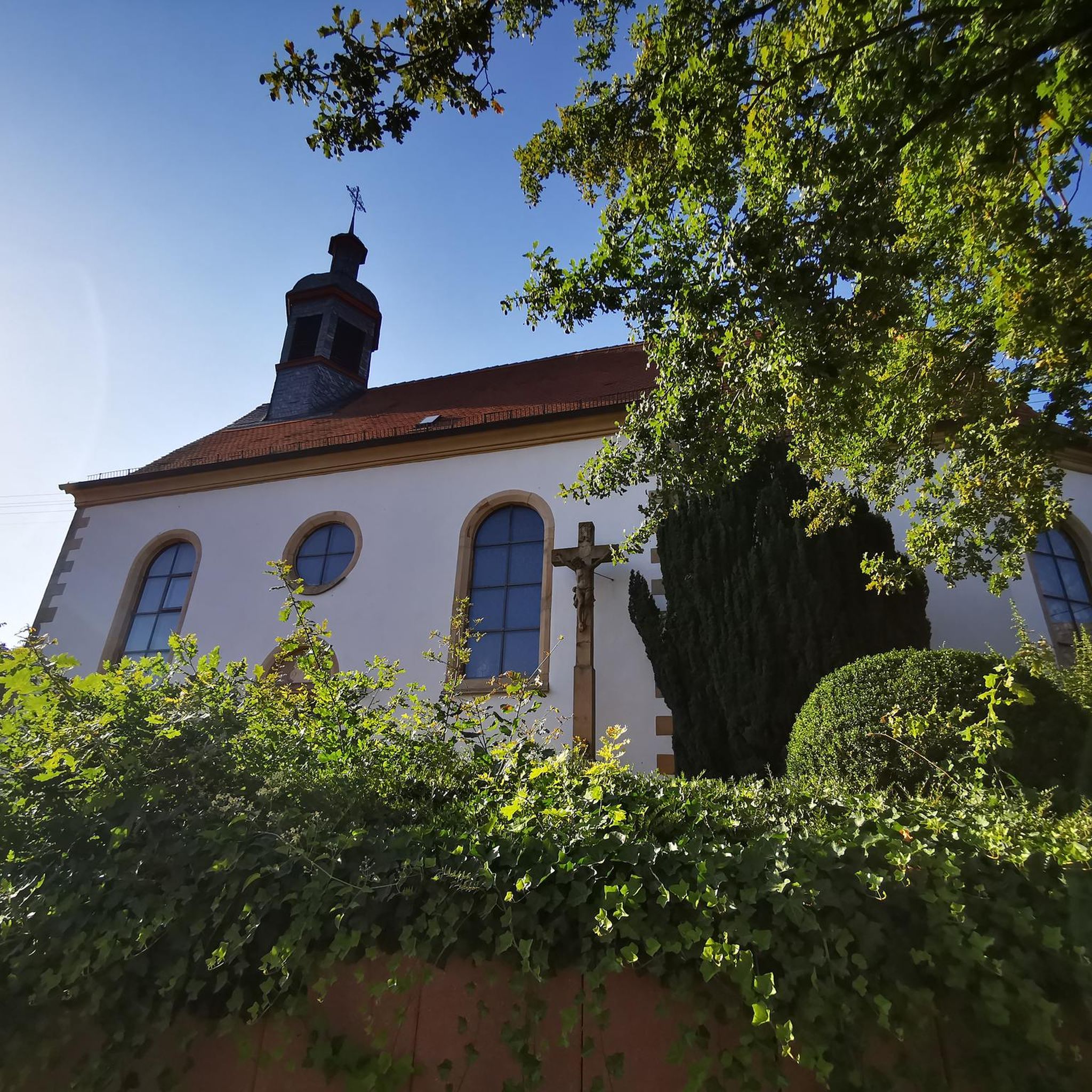
The Grand church is worth a stop. It offers a curious contrast between the massive tower of its facade and its delicate bell tower.
1
0

As a memorial to the many dead, such a “MONUMENT AUX MORTS” (usually called a “cenotaph” or “war memorial” in German-speaking countries) is still very important today. "Now you, O Lord, let your servant depart in peace, as you said..." says the so-called "Song of Simeon" (Gospel of Luke chapter 2, verse 29). However, the people who are remembered here did not die in peace, but rather became victims of war and tyranny. Many places and monuments that you encounter along the way are a testament to the horror of war and tyranny - which is still significant and relevant today. They all have, and this is new for each generation, two essential functions: -1- Commemorate and remember the victims -2- Call for the preservation of peace
2
0

The Castle of Grandpré is located in Grandpré, in the Ardennes, France. It was built by the Joyeuse, Counts of Grandpré, at the end of the 16th century and the beginning of the 17th century. For a long time, the place has been strategically located on the northern slope of the Aire valley, controlling one of the rare passages that cross the Argonne forest. This is the Grandpré passage.
7
0

The old castle of the place, unfortunately closed.
2
0
The old church in town, worth seeing.
3
0
Frequently Asked Questions
How many running routes are available around Challerange?
There are over 20 running routes in the Challerange area, offering a variety of options for different abilities. The landscape features gently rolling terrain and rural pathways, providing a tranquil setting for your run.
Are there any easy or beginner-friendly jogging routes in Challerange?
While most routes are classified as moderate, the gently rolling terrain around Challerange makes many paths accessible for beginners. Routes like the Running loop from Falaise, at 5.0 miles (8.1 km) with moderate elevation, offer a good starting point for those new to running in the area.
What are the typical distances and durations for running trails in Challerange?
Running routes in Challerange vary in length, with many popular options ranging from 5 to 9 miles (8 to 14 km). For example, the Vouziers loop from Vouziers is 7.0 miles (11.2 km) and typically takes around 1 hour 11 minutes, while the Grandpré Church – Château de Grandpré loop from Grandpré is 8.6 miles (13.9 km) and takes about 1 hour 32 minutes.
Are there any circular running routes in the Challerange region?
Yes, many of the running routes around Challerange are circular, allowing you to start and finish at the same point. Examples include the Vouziers loop from Vouziers and the Running loop from Saint-Morel, which is 5.9 miles (9.5 km) long.
What kind of scenery can I expect on the jogging paths around Challerange?
The running paths in Challerange are characterized by rural pathways, open fields, and gentle hills. You'll experience a tranquil countryside setting, often passing through or near small villages. Some routes, like the Grandpré Church – Château de Grandpré loop from Grandpré, also include historical landmarks.
Are there any interesting landmarks or attractions to see along the running routes?
Yes, several routes pass by notable points of interest. For instance, the Grandpré Church – Château de Grandpré loop from Grandpré takes you past the historic Château de Grandpré. Other highlights in the broader area include the village of Grandpré and the Chestres Military Cemetery.
What do other runners say about the trails in Challerange?
The running routes in Challerange are highly rated by the komoot community, with an average score of 3.0 stars from over 2 reviews. More than 130 runners have explored the varied terrain, often praising the tranquil setting and the mix of rural pathways and open countryside.
Are there any less crowded running trails in Challerange?
Challerange generally offers a tranquil setting, and many routes provide a peaceful experience away from large crowds. To find quieter paths, consider exploring routes that venture further into the open countryside, such as the Running loop from Savigny-sur-Aisne, which is 5.6 miles (9.1 km) long.
Is Challerange suitable for winter running?
The gently rolling terrain and rural pathways of Challerange can be suitable for winter running, though conditions will depend on recent weather. Paths may be muddy or icy after rain or snow, so appropriate footwear is essential. Always check local weather conditions before heading out.
Are there options for parking near the running routes in Challerange?
Many running routes in Challerange start from villages or accessible points where parking is typically available. For specific parking information, it's best to check the individual route details on komoot, as starting points often have designated parking areas nearby.
Can I find running routes that pass by cafes or places for refreshments?
While the Challerange area is largely rural, some routes may pass through or near small villages where local cafes or shops might be available. For example, routes starting or passing through larger villages like Vouziers or Grandpré might offer more options for refreshments. It's advisable to carry water and snacks, especially on longer runs.
Most popular attractions around Challerange

Get inspired with the komoot mobile app


Explore more
Browse the best Running Trails & Routes in other regions.
