The best road cycling routes around Chippewa Falls
4.0
(1)
51
riders
6
rides
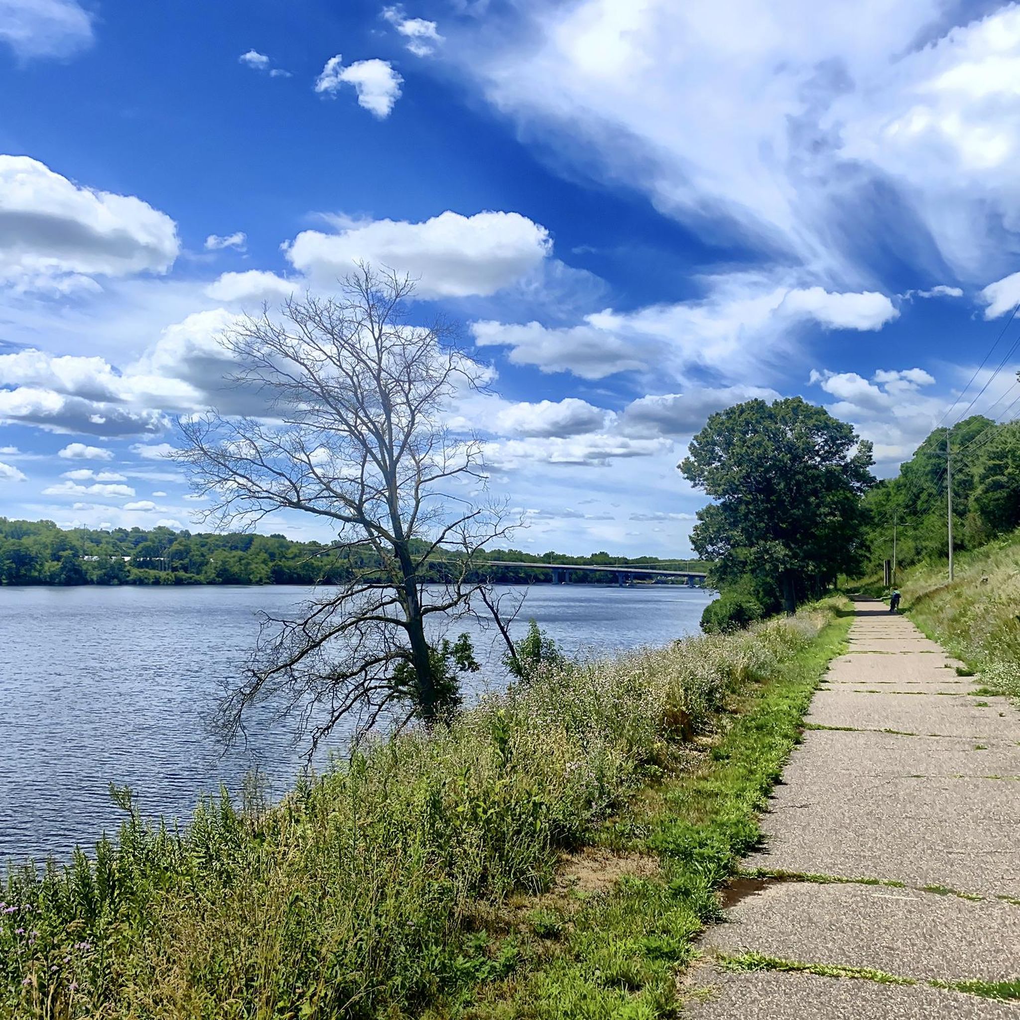
Road cycling routes around Chippewa Falls traverse a landscape characterized by extensive paved trails, rivers, lakes, forests, and agricultural lands. The area features an interconnected trail system, including the Old Abe State Trail and the Duncan Creek Trail, which offer diverse scenery. The terrain is generally flat, making it accessible for various fitness levels. This region provides a mix of natural beauty and developed pathways suitable for road cyclists.
Best road cycling routes around Chippewa Falls
- The most popular road…
Last updated: October 11, 2026
16
riders
Moderate road ride. Good fitness required. Mostly well-paved surfaces and easy to ride.
4.0
(1)
2
riders
45.2km
02:07
180m
180m
Moderate road ride. Good fitness required. Mostly well-paved surfaces and easy to ride.

6
riders
33.3km
01:37
150m
150m
Easy road ride. Great for any fitness level. Mostly well-paved surfaces and easy to ride.
5
riders
22.5km
01:04
110m
110m
Easy road ride. Great for any fitness level. Mostly well-paved surfaces and easy to ride.
2
riders
25.5km
01:15
120m
110m
Easy road ride. Great for any fitness level. Mostly well-paved surfaces and easy to ride.
Our route recommendations are based on thousands of hikes, rides, and runs completed by other people on komoot.
Start today with a free account
Your next adventure awaits.
Popular around Chippewa Falls

Tips from the Community

The Chippewa River Bridge is a pedestrian bridge that take you over the Chippewa River. It is part of the Chippewa River State Trail.
0
0
The Lakeshore Trail is a paved trail that runs alongside Half Moon Lake. The trail has no elevation gain, so it is an easy path to ride.
0
0

Phoenix Park Bridge is the starting point of Chippewa River State Trail and crosses the river of the same name. The bridge's special feature is, that it can be illuminated in the color of your choice for a fee. A very special way to convey your message.
0
0
One of several bridges across the Eau Claire River. There are good views of the river from the bridge.
0
0

This bridge located along the Old Abe Trail offers unobstructed views of Lake Wissota. The bridge is separate from the road, so you don't have to worry about car traffic if you stop for pictures.
0
0
Horseshoe-shaped Half Moon Lake, is a lake in the western part of the city of Eau Claire. It surrounds Carson Park and got its name from the 'half moon' it forms around the peninsula. The lake has a size of 135 acres and is a popular area for boating, fishing and swimming next to the beach in the northern lake's section.
0
0
Frequently Asked Questions
What is the typical terrain like for road cycling in Chippewa Falls?
The road cycling terrain in Chippewa Falls is generally flat and accessible for various fitness levels. Routes often traverse paved trails, agricultural lands, and forested sections, with many offering scenic views along the Chippewa River and Lake Wissota. The Old Abe State Trail, for instance, is a paved rail-trail known for its gentle grades.
Are there challenging road cycling routes in the area, or are they mostly easy?
Chippewa Falls offers a mix of road cycling routes. While many are easy to moderate, such as the Chippewa River Bridge – Owen Park loop from Practice Green, which is an easy 17.9-mile ride, the region's overall network provides options for different ability levels. The longer routes, like the Phoenix Park Bridge – Bridge across Eau Claire River loop from Chippewa Falls Senior High School, offer moderate distances and slight elevation changes, providing a good workout without being overly strenuous.
What natural features or landmarks can I expect to see while road cycling here?
Road cycling routes in Chippewa Falls are rich with natural beauty. You'll often encounter picturesque views of the Chippewa River and Lake Wissota, pass through charming farmlands, and wind through diverse forests, prairies, and wetlands. The Old Abe State Trail connects to Lake Wissota State Park and Brunet Island State Park, offering access to stunning natural environments. While not directly on the main cycling trails, nearby attractions like Big Falls County Park offer scenic waterfalls.
Are there specific scenic routes with notable views?
Yes, many routes offer notable scenic views. The Phoenix Park Bridge – Bridge across Eau Claire River loop from Chippewa Falls Senior High School provides views of the Eau Claire River. The Chippewa River Bridge – Owen Park loop from Practice Green follows areas alongside the Chippewa River. Generally, routes along the Old Abe State Trail offer undeveloped shoreline views of the Chippewa River and Lake Wissota, as well as diverse landscapes from farmland to forests.
Where can I find parking for road cycling trails in Chippewa Falls?
Parking is available at various trailheads throughout the area. For the Old Abe State Trail, designated parking areas can be found in Chippewa Falls and along its 19.5-mile stretch towards Cornell. The Duncan Creek Trail, which connects to the Old Abe State Trail, also has accessible parking within Chippewa Falls. It's advisable to check specific trail websites for detailed parking information.
Are the road cycling trails in Chippewa Falls suitable for families?
Absolutely. Many road cycling trails in Chippewa Falls are family-friendly, particularly the paved rail-trails like the Old Abe State Trail and the Duncan Creek Trail. These trails are generally flat and multi-use, making them suitable for cyclists of various ages and skill levels. The Bridge across Eau Claire River – Domer Park River Bluff loop from North High School is an easy 7.4-mile option perfect for a shorter family outing.
Can I bring my dog on the road cycling trails?
Many multi-use trails in the Chippewa Falls area, such as the Old Abe State Trail and the Duncan Creek Trail, generally allow dogs. However, dogs must typically be kept on a leash and owners are responsible for cleaning up after their pets. It's always best to check specific trail regulations or state park rules before heading out, as policies can vary.
Are there places to eat or stay along the road cycling routes?
Yes, there are options for refreshments and accommodation. Towns like Jim Falls, located along the Old Abe State Trail, offer food options. Additionally, Lake Wissota State Park and Brunet Island State Park, accessible from the Old Abe State Trail, provide camping facilities for those looking for multi-day outdoor trips. The historic downtown of Chippewa Falls also offers various dining and lodging choices.
When is the best time of year for road cycling in Chippewa Falls?
The best time for road cycling in Chippewa Falls is typically from spring through fall. During these seasons, the weather is generally pleasant, and the natural scenery is vibrant, with lush greenery in spring and summer, and beautiful fall foliage. It's always a good idea to check local weather forecasts and trail conditions before planning your ride.
How many road cycling routes are available in the Chippewa Falls area?
There are several road cycling routes available in the Chippewa Falls area, with komoot alone featuring over 4 routes. These routes vary in length and difficulty, ensuring options for different preferences and skill levels.
What do other cyclists say about road cycling in Chippewa Falls?
The road cycling routes in Chippewa Falls are highly rated by the komoot community, with an average score of 4.0 stars from over 1 review. Cyclists often praise the varied terrain, scenic river views, and the well-maintained paved trails that make for an enjoyable riding experience.
Are there options for longer, point-to-point road cycling adventures?
Yes, the interconnected trail system in Chippewa Falls provides opportunities for longer point-to-point rides. The Old Abe State Trail, for example, is a 19.5-mile trail connecting Chippewa Falls to Cornell. This trail is part of a larger 76-mile system that includes the Chippewa River State Trail and Duncan Creek Parkway Trail, offering extensive riding opportunities for those seeking longer adventures.
Where can I find information on current trail conditions for state trails?
For the most up-to-date information on trail conditions for state trails like the Old Abe State Trail and the Chippewa River State Trail, it is best to consult the official Wisconsin DNR website or the Chippewa County Parks and Trails department. These sources provide current alerts and maintenance updates.
Most popular routes around Chippewa Falls
Most popular attractions around Chippewa Falls

Get inspired with the komoot mobile app


Explore more
Browse the best Road cycling routes in other regions.
