The best running trails around Durnholzer Lake - Lake di Valdurna
5.0
(4)
147
runners
13
runs
Jogging around Durnholzer Lake - Lake di Valdurna offers routes through an alpine landscape characterized by forested slopes and the clear waters of the lake. The region features varied terrain, including paths along the lake shore and ascents into the surrounding hills. Runners can expect a mix of natural surfaces and scenic views. The area provides opportunities for both challenging runs and more moderate paths.
Best jogging routes around Durnholzer Lake - Lake di Valdurna
- The most popular jogging route…
Last updated: July 15, 2026
34
runners
4.59km
00:29
50m
50m
Easy run. Great for any fitness level. Mostly paved surfaces. Suitable for all skill levels.
25
runners
13.6km
01:53
680m
680m
Hard run. Very good fitness required. Mostly paved surfaces. Suitable for all skill levels.

Sign up for free
17
runners
12.0km
02:07
900m
900m
Hard run. Very good fitness required. Sure-footedness, sturdy shoes and alpine experience required.
9
runners
Hard run. Very good fitness required. Mostly paved surfaces. Suitable for all skill levels.
3
runners
7.39km
01:18
570m
570m
Hard run. Very good fitness required. Mostly paved surfaces. Suitable for all skill levels.
Get access to more routes and recommendations from other explorers.
Sign up for free
Already have an account?
Our route recommendations are based on thousands of hikes, rides, and runs completed by other people on komoot.
Start today with a free account
Your next adventure awaits.
Login or Signup
Popular around Durnholzer Lake - Lake di Valdurna
Tips from the Community

The small village of Durnholz, located on the lake, is car-free. There is a parking lot in front of the village.
0
0


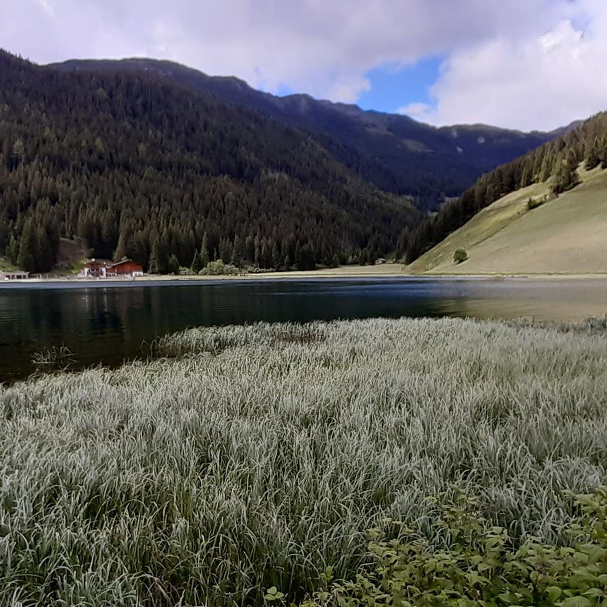
In the middle of nature lies the idyllic Durnholzer Lake
0
0

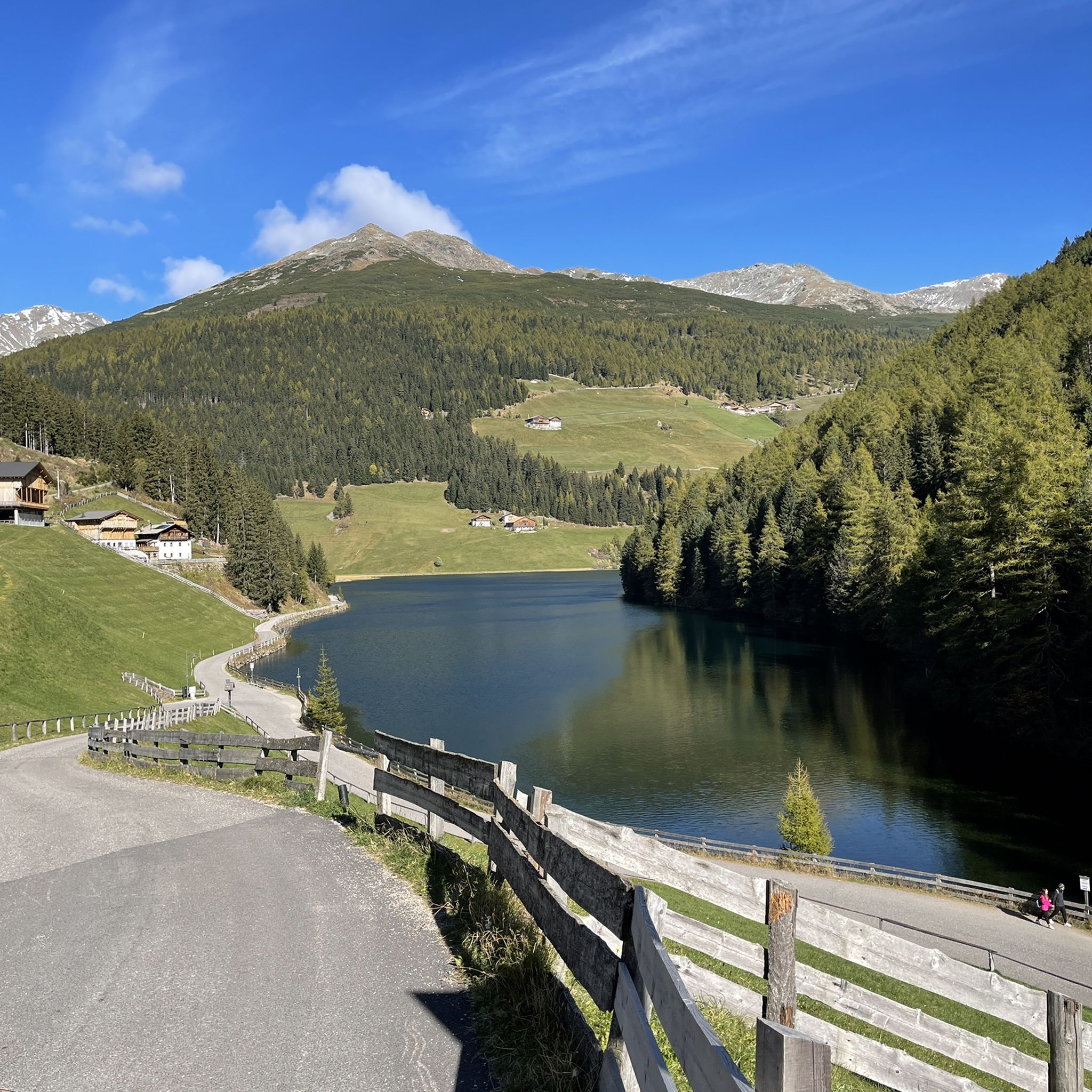
Lake Valdurna (Durnholzer See in German) is a small Alpine lake located at 1,545 meters above sea level in the Sarentino Valley, surrounded by thick forests and pastures. On its shores, you can see small typical settlements and stop at the local mountain huts, which offer an immersion in the traditions and flavors of South Tyrol. The area around the lake offers a variety of trails suitable for different levels of difficulty, which wind through forests and Alpine meadows. The dirt roads that surround the lake and the surrounding valleys allow you to explore the territory with panoramic views of the mountains. The area is also an excellent starting point for longer excursions, such as the tour of the lakes, which connect Lake Valdurna to other lakes in the area.
1
0

A left tributary of the Valdurna stream, the Ghetrun stream can be followed here on a lovely mountain path. At this point you are in the municipality of Sarentino, a place to discover in Alto Adige.
0
0

Excellent cuisine, splendid view towards the Getrumspitze, if you are on a mountain bike, an unmissable track for the descent towards Reinswald (Urlesteig) starts here
2
0

Children's climbing path for climbing, playground, horses, sandals and good food. Perfect for a family outing. From the gondola it is about 45 minutes with easy ups and downs on well-developed and not exposed paths.
1
0

Very nice view of the Sarntal and the surrounding mountains.
0
0
Frequently Asked Questions
How many running routes are available around Durnholzer Lake - Lake di Valdurna?
The komoot guide features 3 distinct running routes around Durnholzer Lake - Lake di Valdurna. These routes offer varied terrain, from lake shore paths to alpine ascents.
What is the best time of year for jogging around Durnholzer Lake?
The Durnholzer Lake region, being an alpine area, is generally best for running from late spring through early autumn (May to October). During these months, trails are typically clear of snow, and the weather is more favorable for outdoor activities. Winter jogging might be possible on cleared paths, but conditions can be challenging due to snow and ice.
Are there any family-friendly running paths near Durnholzer Lake?
The routes highlighted in this guide are rated as 'difficult' or 'moderate', featuring significant elevation changes. For families with younger children or those seeking very easy, flat paths, these specific routes might be challenging. However, the general area around the lake often provides flatter sections suitable for a leisurely jog or walk.
Can I bring my dog on the running trails around Lake di Valdurna?
Generally, dogs are welcome on trails in the Durnholzer Lake region, but it's always advisable to keep them on a leash, especially in areas with livestock or wildlife. Please ensure you clean up after your pet to maintain the natural beauty of the area.
Are there circular running routes available?
Yes, all the routes featured in this guide are circular. For example, you can explore the Running loop from Reinswald - San Martino, which is a 7.0-mile (11.3 km) difficult trail, or the Running loop from Kasereck, a 4.4-mile (7.2 km) moderate option.
Where can I park when visiting the running trails?
Parking availability varies by starting point. For routes like the Lago dei Morti loop from Reinswald - San Martino, you would typically look for parking in or near the Reinswald - San Martino area. It's recommended to check local signage or online maps for specific parking facilities at your chosen trailhead.
What kind of scenic views can I expect on these running routes?
The running routes around Durnholzer Lake offer stunning alpine scenery. You can expect views of the clear lake waters, forested slopes, and the surrounding mountainous terrain. Highlights in the area include Durnholzer Lake itself and various scenic points along the trails, such as Along the lake S0 🚵♂️💝👀.
Are there any cafes or restaurants near Durnholzer Lake for after a run?
The Durnholzer Lake area, while natural and serene, does have some local establishments. You can often find traditional mountain huts or guesthouses in nearby villages that offer refreshments and meals, perfect for refueling after your run. Specific options would depend on your exact location around the lake.
What are the difficulty levels of the running routes in this area?
The running routes around Durnholzer Lake are generally considered challenging. The guide features 3 difficult routes, including options with significant elevation gain through mountainous terrain. There are no easy or moderate routes listed in this specific guide.
What do other runners enjoy most about jogging in Durnholzer Lake - Lake di Valdurna?
Runners using komoot often praise the varied terrain and the beautiful alpine landscape of Durnholzer Lake. The mix of lake shore paths and ascents into forested hills provides both a good workout and rewarding scenic views, making it a popular choice for those seeking a challenging and picturesque running experience.
Are there any alternatives to the main running loops if I want a different experience?
While the guide focuses on specific loops, the broader Durnholzer Lake area offers numerous paths and trails. You can explore different sections of the lake shore or venture into the surrounding valleys for alternative running experiences. Komoot's map allows you to discover and plan your own routes based on your preferences.
Most popular routes around Durnholzer Lake - Lake di Valdurna
Most popular attractions around Durnholzer Lake - Lake di Valdurna

Get inspired with the komoot mobile app


Explore more
Browse the best Running Trails & Routes in other regions.
