The best walks and hikes around Kings, Subd. D
4.3
(5)
18
hikers
6
hikes
Hiking around Kings, Subd. D offers access to diverse natural features within Kings County, Nova Scotia. The region is characterized by its dramatic Bay of Fundy coastline, featuring high cliffs and unique sea stacks shaped by the world's highest tides. Inland, hikers can explore lush hardwood and coastal conifer forests, alongside rolling hills and scenic river valleys, including the Annapolis Valley. This varied terrain provides a range of environments for outdoor exploration.
Best hiking trails around Kings, Subd. D
- The…
Last updated: October 16, 2026
6
hikers
2.48km
00:39
10m
20m
Easy hike. Great for any fitness level. Easily-accessible paths. Suitable for all skill levels.
1
hikers
5.85km
01:29
10m
10m
Easy hike. Great for any fitness level. Easily-accessible paths. Suitable for all skill levels.

4.5
(2)
5
hikers
Moderate hike. Good fitness required. Easily-accessible paths. Suitable for all skill levels.
4.0
(3)
5
hikers
Easy hike. Great for any fitness level. Easily-accessible paths. Suitable for all skill levels.
4
hikers
3.03km
00:49
40m
40m
Easy hike. Great for any fitness level. Easily-accessible paths. Suitable for all skill levels.
Our route recommendations are based on thousands of hikes, rides, and runs completed by other people on komoot.
Start today with a free account
Your next adventure awaits.
Popular around Kings, Subd. D
Tips from the Community

Little River Falls drops into a wooded gorge near Sunken Lake, and you’ll mainly see it from the lookout above rather than right beside the water. The falls are roughly 6 metres high, with the creek dropping steeply into a pool below. The view through the trees is especially nice when there’s plenty of water flowing, but be careful around the edge of the gorge where the ground gets much steeper.
0
0
The walk to Little River Falls starts out along an old logging road before turning onto a narrower trail through the woods. It’s fairly straightforward for most of the way, although expect plenty of roots, rocks and muddy patches underfoot. The final section brings you to a lookout above the gorge, where you can see the falls below. Keep an eye out for the small trail markers and flagging along the way.
0
0

The Avon Causeway walking and bike path follows the northern shore of Lake Pisiquid, along the gap between the lake and the Highway 101 and the Avon River beyond.
0
0
This mini park squeezed between the main roads and Lake Pisiquid is a great place to blow off some steam. There is play equipment for kids and exercise stations for adults. Nice views and easy access.
0
0

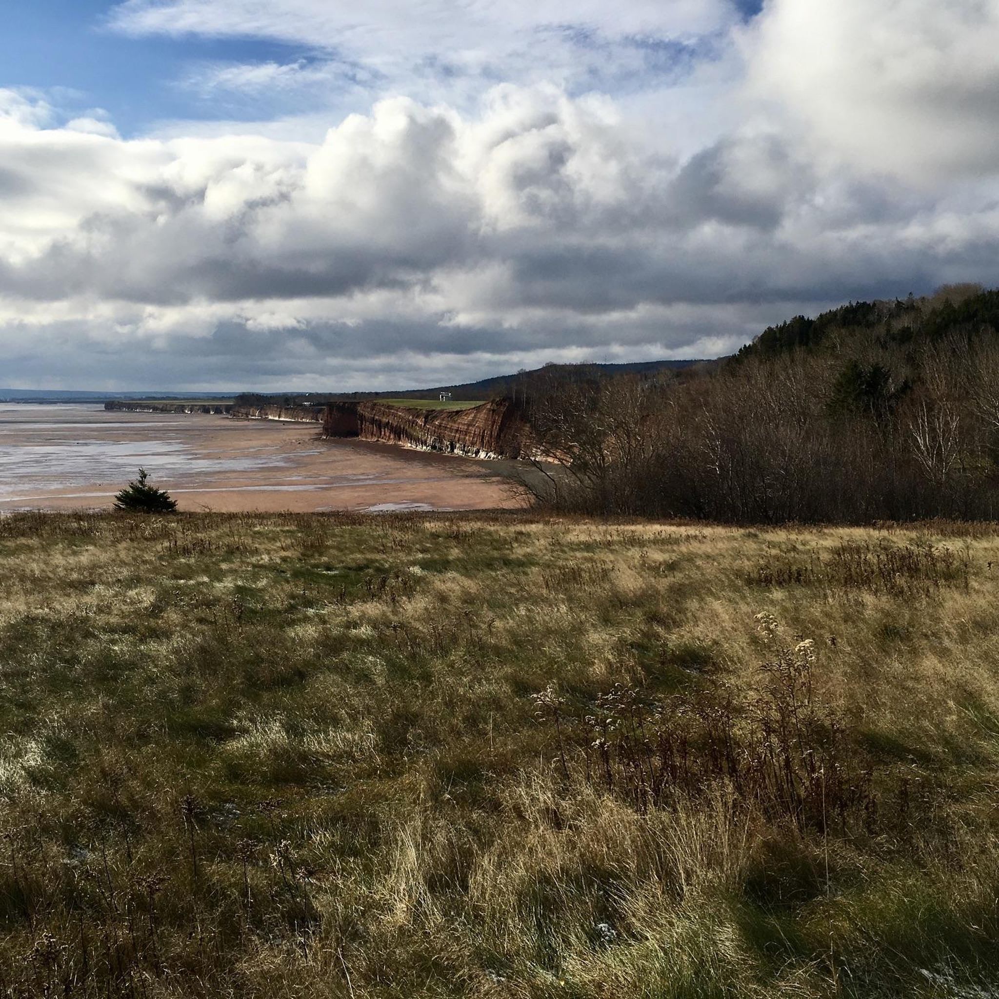
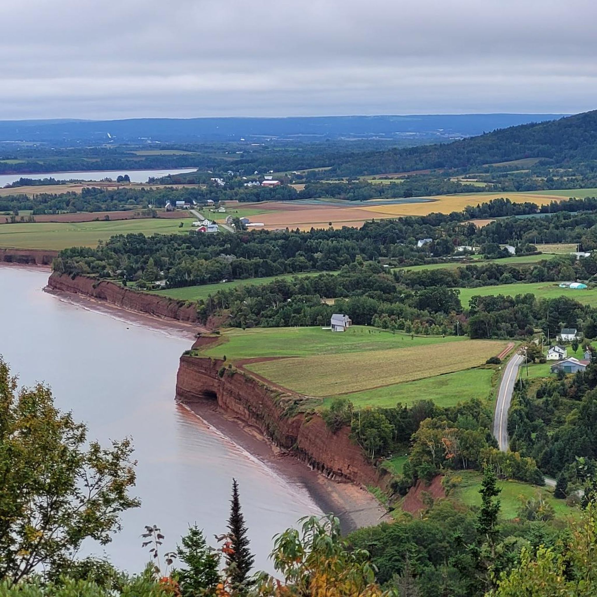
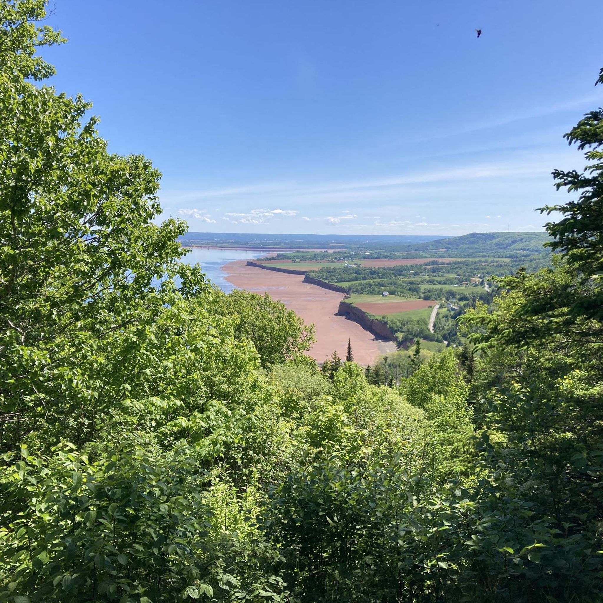
Minas Basin is the wide inner reaches of the Bay of Fundy, with a daily tidal range of 15 to 16 metres, among the highest in the world. The water takes on a unique reddish-brown colour from the large amounts of suspended silt churned continuously by the tidal currents, giving the basin a picturesque, ever-shifting character that changes with the tide. The area was designated a Hemispheric Shorebird Reserve in 1988, and the mudflats and shoreline attract hundreds of thousands of migrating shorebirds in season, making it as rewarding to stop and watch as it is to walk beside.
0
0
Avonport trail is an easy out-and-back that follows a dirt road along the shoreline of Minas Basin. The path is relatively straightforward and easy to follow, with the open water never far from your view and a lovely breeze off the basin. It’s a quiet trail that sees little foot traffic, making it an ideal route for enjoying some solitude. Just be sure to check tide times before you head out.
0
0
This trailhead, situated at the end of Avonport Road in the small community of Avonport, is your entry point to the Avonport shoreline trail overlooking Minas Basin. There is plenty of free parking in the cul-de-sac, and the trail is unlikely to be busy. From here, an easy dirt road takes you out along the coast, with beautiful views of the basin opening up ahead.
0
0
Frequently Asked Questions
What kind of natural features can I expect to see while hiking in Kings, Subd. D?
Kings, Subd. D, located within Kings County, offers diverse natural features. You'll encounter the dramatic Bay of Fundy coastline with its high cliffs and unique sea stacks, shaped by the world's highest tides. Inland, there are lush hardwood and coastal conifer forests, rolling hills, and scenic river valleys, including the Annapolis Valley.
Are there any easy hiking trails suitable for beginners or a relaxed walk?
Yes, there are several easy options. For a shorter, pleasant walk, consider the Gaspereau Mountain Reservoir loop from Wolfville Watershed Nature Preserve, which is an easy 4.1 km path. Another accessible choice is the Wolfville Reservoir loop from Town of Wolfville, a 6.6 km trail through wooded areas.
What are some longer or more challenging hiking options in the area?
While the immediate Kings, Subd. D area features mostly easy to moderate routes, the broader Kings County offers more challenging options. For instance, Cape Split Provincial Park, a major draw for hikers, features a moderately challenging backcountry hike of approximately 13.2 to 16 km round trip, leading to stunning coastal views 60 meters above the Bay of Fundy.
Are there any circular hiking routes available?
Yes, all the routes highlighted in the guide are circular. You can enjoy the Elderkin Pond – Cornwallis River Viewpoint loop from Town of Wolfville, the Gaspereau Mountain Reservoir loop from Wolfville Watershed Nature Preserve, and the Wolfville Reservoir loop from Town of Wolfville, all designed as loops.
What can I see or do near the hiking trails in Kings, Subd. D?
Beyond the trails, you can explore several local attractions. Consider visiting the Wolfville Sign, relaxing at Kingsport Beach, or enjoying the views from The Guzzle Lookoff. For local refreshments, Luckett Vineyards and Horton Ridge Malt & Grain Brewery are also nearby.
What is the best time of year to go hiking in Kings, Subd. D?
Kings County, including Kings, Subd. D, offers beautiful hiking experiences across multiple seasons. Spring brings lush greenery, while summer provides warm weather for coastal and forest trails. Autumn is particularly stunning with vibrant fall foliage in the hardwood forests. Hikers should be mindful of the powerful Bay of Fundy tides and coastal weather conditions year-round.
Are there any trails that offer views of the Bay of Fundy or other significant waterways?
Yes, the region is renowned for its coastal scenery. While the routes directly in Kings, Subd. D focus more on river and reservoir views, the broader Kings County, especially areas like Cape Split Provincial Park and Blomidon Provincial Park, offer dramatic panoramic views of the Bay of Fundy and the Minas Basin, where you can witness the world's highest tides.
What do other hikers say about the trails in Kings, Subd. D?
The hiking routes in Kings, Subd. D are highly rated by the komoot community, with an average score of 4.5 stars from several reviews. Hikers often praise the varied terrain, from river viewpoints to natural woodlands, and appreciate the options available for different ability levels.
Are there any long-distance trails in the wider Kings County area?
Yes, the Harvest Moon Trailway is a significant long-distance option in Kings County. This 110-kilometer trail utilizes a former railbed, stretching across the Annapolis Valley from the UNESCO World Heritage Site of Grand Pré to Annapolis Royal. It's suitable for walking, cycling, and exploring scenic towns along the way.
What kind of wildlife might I encounter on the trails?
The diverse forests and natural environments of Kings, Subd. D and the wider Kings County are home to a variety of flora and fauna. While specific sightings can vary, you might encounter various bird species, small mammals, and observe the rich ecosystem of the lush hardwood and coastal conifer forests.
How long do hikes typically take in Kings, Subd. D?
The duration of hikes varies depending on the route and your pace. For example, the Elderkin Pond – Cornwallis River Viewpoint loop from Town of Wolfville typically takes around 2 hours 47 minutes. Shorter options like the Wolfville Reservoir loop from Town of Wolfville can be completed in about 1 hour 46 minutes.
Are there any trails that pass through unique geological formations?
The Bay of Fundy coastline, which borders Kings County, is famous for its unique geological formations. The powerful tides have carved out impressive 60-meter high cliffs and distinctive sea stacks, offering a constantly changing and dramatic landscape. While not directly on the listed Kings, Subd. D routes, these features are a highlight of the broader region.
Most popular attractions around Kings, Subd. D

Get inspired with the komoot mobile app


Explore more
Browse the best Hikes in other regions.
